Skip to search
Skip to main content
Skip to first result
Search
You Searched For
Date
1800 - 1849
"Massachusetts"
Extent of Digitization
Completely digitized
Resource Type
Maps, Atlases & Globes
Date Created
1800 to 1849
New Search
Search Results
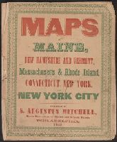
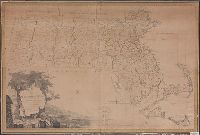
Published / Created:
1846
Call Number:
76 1846A
Container / Volume:
BRBL_00445
Image Count:
7
Resource Type:
Maps, Atlases & Globes
Publisher:
Augustus Mitchell,
Subject (Geographic):
New England--Maps
Found in:
Beinecke Rare Book and Manuscript Library > Maps of Maine, New Hampshire and Vermont, Massachusetts & Rhode Island, Connecticut, New York and New York City.
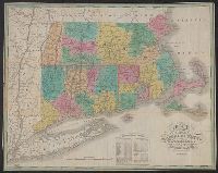
Published / Created:
1825
Call Number:
76 1825A
Container / Volume:
BRBL_00444
Image Count:
1
Resource Type:
Maps, Atlases & Globes
Abstract:
Massachusetts , Connecticut and Rhode Island, divided
Alternative Title:
Massachusetts Connecticut & Rhode
Description:
Cover title: Massachusetts Connecticut
Publisher:
Published by A. Finley Philada,
Subject (Geographic):
Massachusetts --Maps.
Subject (Name):
Batchelder, Abbie L.--Autograph., Vance, D. H. (David H.), ill, and Young, J. H. (James Hamilton)
Found in:
Beinecke Rare Book and Manuscript Library > Map of Massachusetts Connecticut and Rhode Island [cartographic material] : constructed from the latest authorities. 1825. / Drawn by D.H. Vance. Engraved by J.H. Young.
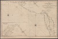
Published / Created:
[1815].
Call Number:
755cea 1815
Container / Volume:
BRBL_00442
Image Count:
1
Resource Type:
Maps, Atlases & Globes
Description:
Inset: Delaware Bay 1:360,000.
Publisher:
Cushing & Appleton,
Subject (Geographic):
East (U.S.)--Maps
Found in:
Beinecke Rare Book and Manuscript Library > A new chart of the coast of Connecticut. New York, New Jersey and the Delaware ... by Samuel Lambert, Salem. Wightman Sculpsit.
Creator:
Published / Created:
1830
Call Number:
764 An23 1830
Image Count:
1
Resource Type:
Maps, Atlases & Globes
Description:
portion of the City of Lawrence, Massachusetts .
Publisher:
Pendleton's Lithogy.,
Subject (Geographic):
Andover (Mass. : Town)--Buildings, structures, etc.--Maps., Andover (Mass. : Town)--Maps., Lawrence (Mass.)--Maps., and North Andover (Mass. : Town)--Maps.
Subject (Name):
Pendleton's Lithography.
Subject (Topic):
Landowners--Massachusetts --Andover
Found in:
Beinecke Rare Book and Manuscript Library > A plan of Andover taken for the town / by Moses Dorman, Jr.
Creator:
Published / Created:
[1814]
Call Number:
764 B65 1814A
Container / Volume:
BRBL_00455
Image Count:
2
Resource Type:
Maps, Atlases & Globes
Description:
Removed from Massachusetts House
Publisher:
Benjamin Dearborn,
Subject (Geographic):
Boston (Mass.)--Maps
Subject (Name):
Boston and Roxbury Mill Corporation
Subject (Topic):
Drainage--Massachusetts --Boston
Found in:
Beinecke Rare Book and Manuscript Library > A plan of those parts of Boston and the towns in its vicinity : with the waters and flats adjacent which are immediately or remotely connected with the contemplated design of erecting perpetual tide-mills.
Published / Created:
[1833?]
Call Number:
764CA 1833
Container / Volume:
BRBL_00460
Image Count:
1
Resource Type:
Maps, Atlases & Globes
Publisher:
Pendleton's Lithography,
Subject (Geographic):
Massachusetts --Maps
Found in:
Beinecke Rare Book and Manuscript Library > Geological map of Massachusetts By Edw. D. Hitchcock 1833 ...
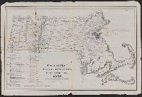
Published / Created:
1801
Call Number:
764FB 1801
Container / Volume:
BRBL_00462
Image Count:
1
Resource Type:
Maps, Atlases & Globes
Description:
Engraved by Joseph Callender and Samuel Hill.
Subject (Geographic):
Massachusetts --Maps
Found in:
Beinecke Rare Book and Manuscript Library > Map of Massachusetts proper compiled from actual surveys made by Order of the General Court. And under the inspection of Agents of their Appointment. By Osgood Carleton.
Published / Created:
1837
Call Number:
764gme 1837
Container / Volume:
BRBL_00462
Image Count:
2
Resource Type:
Maps, Atlases & Globes
Description:
[Sheet 1] "East of Connecticut River". and Preliminary record.
Publisher:
T. Moore's Lith.,
Subject (Geographic):
Massachusetts --Maps
Found in:
Beinecke Rare Book and Manuscript Library > Route of the Western Rail Road ... Enlarged from the Map of the State.
Published / Created:
1848
Call Number:
76 1848
Container / Volume:
BRBL_00445
Image Count:
1
Resource Type:
Maps, Atlases & Globes
Description:
Villages and city insets on border of map.
Publisher:
Ensings & Tayer,
Subject (Geographic):
New England--Maps
Found in:
Beinecke Rare Book and Manuscript Library > Map of Massachusetts, Rhode Island and Connecticut.
Published / Created:
1835
Call Number:
764 B65 1835
Container / Volume:
BRBL_00455
Image Count:
1
Resource Type:
Maps, Atlases & Globes
Description:
"The plan is to have a rail road track reach every door, in every street of this territory, to the edge of the ocean on one side, and to the heart of the country on the other." and Includes text.
Publisher:
Pendleton's Lithography,
Subject (Geographic):
Boston (Mass.)--Maps
Subject (Name):
Pendleton's Lithography
Subject (Topic):
City planning--Massachusetts --Boston
Found in:
Beinecke Rare Book and Manuscript Library > The South Cove territory, comprising every part which is coloured on this map.
Branch:v1.61.6 ,Deployed:2024-06-12T09:55:36-04:00