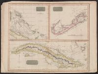
Search
You Searched For
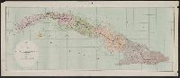
Search Results
- Published / Created:
- [1897?]
- Call Number:
- 855cbf 1897A
- Container / Volume:
- BRBL_00642
- Image Count:
- 1
- Resource Type:
- Maps, Atlases & Globes
- Description:
- Imperfect. Mutilated. Map torn into 2 sheets, each encased in mylar.
- Publisher:
- James McConnell School Supply Co.,
- Subject (Geographic):
- Cuba--Maps
- Found in:
- Beinecke Rare Book and Manuscript Library > Cuba
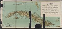
- Creator:
- Lucas, Fielding, Jr., 1781-1854
- Published / Created:
- [1823]
- Call Number:
- 855 1827B
- Container / Volume:
- BRBL_00641
- Image Count:
- 1
- Resource Type:
- Maps, Atlases & Globes
- Description:
- From Lucas's A general atlas containing distinct maps of all the known countries in the world, map # 81.
- Publisher:
- [F. Lucas, Jr.],
- Subject (Geographic):
- Cuba--Maps
- Subject (Name):
- B.T. Welch & Co and Lucas, Fielding, Jr., 1781-1854. A general atlas containing distinct maps of all the known countries in the world
- Found in:
- Beinecke Rare Book and Manuscript Library > Cuba / drawn and published by F. Lucas, Jr. ; B.T. Welch & Co., sc.
- Creator:
- Carey, Henry Charles, 1793-1879
- Published / Created:
- 1822]
- Call Number:
- 855 1827
- Container / Volume:
- BRBL_00695
- Image Count:
- 1
- Resource Type:
- Maps, Atlases & Globes
- Alternative Title:
- Geographical, statistical and historical map of Cuba and the Bahama Islands
- Description:
- From Carey's A complete historical, chronological, and geographical American atlas. Philadelphia, Pa. : H.C. Carey & I. Lea, 1822.
- Publisher:
- H.C. Carey & I. Lea,
- Subject (Geographic):
- Bahamas--Maps and Cuba--Maps
- Subject (Name):
- Carey & Lea, Carey, Henry Charles, 1793-1879. A complete historical, chronological, and geographical American atlas, and Tanner, Benjamin, 1775-1848
- Found in:
- Beinecke Rare Book and Manuscript Library > Cuba and the Bahama Islands / [cartographic material] / B. Tanner sc.
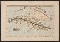
- Creator:
- Vandermaelen, Philippe, 1795-1869
- Published / Created:
- 1825]
- Call Number:
- 855 1825A
- Container / Volume:
- BRBL_00695
- Image Count:
- 1
- Resource Type:
- Maps, Atlases & Globes
- Description:
- Above neat line: Amér. sep. ... No. 67.
- Publisher:
- Philippe Vandermaelen,
- Subject (Geographic):
- Bahamas--Maps, Cuba--Maps, and Jamaica--Maps
- Subject (Name):
- Ode, Henri and Vandermaelen, Philippe, 1795-1869. Atlas universel de géographie physique, politique, statistique et minéralogique
- Found in:
- Beinecke Rare Book and Manuscript Library > Ile de Cuba / [cartographic material] / dressée et dessinée par Ph. Vandermaelen ; lithographiée par H. Ode, septembre 1825 ; la lettre par Frs. Charles.
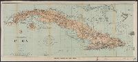
- Creator:
- Coello, Francisco, 1822-1898
- Published / Created:
- 1855
- Call Number:
- 855 1855
- Container / Volume:
- BRBL_00641
- Image Count:
- 1
- Resource Type:
- Maps, Atlases & Globes
- Alternative Title:
- Posesiones de America
- Description:
- Dissected and mounted on linen. Label on verso: Atlas de Espãna y sus posesiones de ultramar por Coello, Cuba 2a hoja.
- Publisher:
- [publisher not identified],
- Subject (Geographic):
- Cuba--Maps
- Subject (Name):
- Alebern, Camilo, Bacot, Leroux, and Madoz, Pascual
- Subject (Topic):
- Cities and towns--Cuba--Maps and Harbors--Cuba--Maps
- Found in:
- Beinecke Rare Book and Manuscript Library > Isla de Cuba / por el Teniente Coronel Capitan de Ingenieros ; D. Francisco Coello ; Las notas estadísticas e históricas han sido escritos por D. Pascual Madoz.