Skip to search
Skip to main content
Skip to first result
Search
You Searched For
Extent of Digitization
Completely digitized
Subject (Geographic)
Minnesota--Maps
Search Results
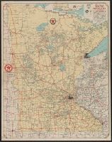
Creator:
Published / Created:
[1932]
Call Number:
814gmb 1932
Container / Volume:
BRBL_00559
Image Count:
2
Resource Type:
Maps, Atlases & Globes
Alternative Title:
Texaco road map, Minnesota :
Description:
"Texaco road map, 1932, United States," local route maps of Minneapolis-St. Paul and Duluth, distance table, indexes, ill., and text on verso.
Publisher:
Rand McNally and Co.,
Subject (Geographic):
Minnesota--Maps
Subject (Name):
Texas Company
Subject (Topic):
Roads--Minnesota--Maps
Found in:
Beinecke Rare Book and Manuscript Library > 1932 Texaco road map, Minnesota.
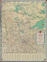
Creator:
Published / Created:
[1938]
Call Number:
814gmb 1938
Container / Volume:
BRBL_00559
Image Count:
2
Resource Type:
Maps, Atlases & Globes
Alternative Title:
Minnesota official road map and Phillips Petroleum Company 1938 official road map, Minnesota
Description:
In lower left: 438-J.C. 11-L.
Publisher:
H.M. Gousha,
Subject (Geographic):
Minnesota--Maps
Subject (Name):
Phillips Petroleum Company
Subject (Topic):
Roads--Minnesota--Maps
Found in:
Beinecke Rare Book and Manuscript Library > 1938 official road map, Minnesota / [prepared for] Phillips Petroleum Company.
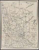
Creator:
Published / Created:
[1946]
Call Number:
814gmb 1946
Container / Volume:
BRBL_00559
Image Count:
1
Resource Type:
Maps, Atlases & Globes
Publisher:
State of Minnesota Dept. of Highways,
Subject (Geographic):
Minnesota--Maps
Subject (Topic):
Roads--Minnesota--Maps
Found in:
Beinecke Rare Book and Manuscript Library > 1946 condition map of Minnesota trunk highways : showing national and state markings.
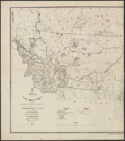
Published / Created:
1850
Call Number:
814 1850A
Container / Volume:
BRBL_00557
Image Count:
1
Resource Type:
Maps, Atlases & Globes
Description:
Notes: Entered acording to act of Congress, in the year 1850, by Thomas Cowperthwait & Co.
Publisher:
Charles Desilver,
Subject (Geographic):
Minnesota--Maps
Found in:
Beinecke Rare Book and Manuscript Library > Map of Minessota Territory. J. H. Young.
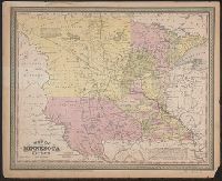
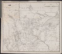
Creator:
Published / Created:
1886
Call Number:
821 1886A
Container / Volume:
BRBL_00566
Image Count:
2
Resource Type:
Maps, Atlases & Globes
Description:
"Prepared by authority of Brigadier General A.H. Terry, March, 1886."
Publisher:
Office of the Chief of Engineers,
Subject (Geographic):
Minnesota--Maps, Montana--Maps, North Dakota--Maps, South Dakota--Maps, and West (U.S.)--Maps
Subject (Name):
United States. War Dept. Office of the Chief of Engineers
Found in:
Beinecke Rare Book and Manuscript Library > Map of the Department of Dakota : including Minnesota, Dakota and Montana / compiled and drawn under the direction of John Biddle by E.H. Rakowicz.
Creator:
Published / Created:
1861
Call Number:
821 1863
Container / Volume:
BRBL_00566
Image Count:
1
Resource Type:
Maps, Atlases & Globes
Description:
"Entered according to Act of Congress, in the year 1861 by B.M. Smith and A.J. Hill, in the Clerk's Office of the District Court for the District of Minnesota."
Publisher:
Louis Buechner
Subject (Geographic):
Dakota Territory--Maps, Iowa--Maps, Minnesota--Maps, and Nebraska--Maps
Found in:
Beinecke Rare Book and Manuscript Library > Map of the ceded part of Dakota Territory : showing also portions of Minnesota, Iowa & Nebraska / compiled by B.M. Smith and A.J. Hill.
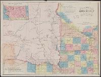
Creator:
Published / Created:
1861
Call Number:
821 1861
Container / Volume:
BRBL_00566
Image Count:
1
Resource Type:
Maps, Atlases & Globes
Description:
"Entered according to Act of Congress, in the year 1861 by B.M. Smith and A.J. Hill, in the Clerk's Office of the District Court for the District of Minnesota."
Publisher:
Louis Buechner
Subject (Geographic):
Dakota Territory--Maps, Iowa--Maps, Minnesota--Maps, and Nebraska--Maps
Subject (Name):
Buechner, Louis and Hill, A. J. (Alfred James), 1823-1895
Subject (Topic):
Cities and towns--Dakota Territory--Maps, Discoveries in geography--Maps, Indian reservations--Dakota Territory--Maps, Indian reservations--Nebraska--Maps, Indians of North America--Maps, and Military bas
Found in:
Beinecke Rare Book and Manuscript Library > Map of the ceded part of Dakota Territory : showing also portions of Minnesota, Iowa & Nebraska / compiled by B.M. Smith and A.J. Hill.
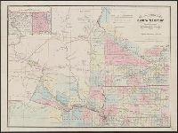
Creator:
Published / Created:
1849]
Call Number:
80 1849
Container / Volume:
BRBL_00533
Image Count:
1
Resource Type:
Maps, Atlases & Globes
Description:
Gives both Indian and later place names.
Publisher:
s.n.,
Subject (Geographic):
Minnesota--Maps
Subject (Name):
Morawski, P. S
Found in:
Beinecke Rare Book and Manuscript Library > Map of the territory of Minnesota : exhibiting the route of the expedition to the Red River of the north, in the summer of 1849 / by Capt. John Pope ; drawn by P.S. Morawski.
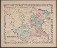
Creator:
Published / Created:
[1855 or 1856?]
Call Number:
814 1855H
Container / Volume:
BRBL_00557
Image Count:
1
Resource Type:
Maps, Atlases & Globes
Description:
"Entered accoding [sic] to Act of Congress in the year 1855, by J.H. Colton & Co. in ... the Southern District of New York."
Publisher:
J. H. Colton & Co.,
Subject (Geographic):
Minnesota--Maps, North Dakota--Maps, and South Dakota--Maps
Found in:
Beinecke Rare Book and Manuscript Library > Minnesota.
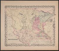
Creator:
Published / Created:
[1855 or 1856?]
Call Number:
814 1855F
Container / Volume:
BRBL_00557
Image Count:
1
Resource Type:
Maps, Atlases & Globes
Description:
"Entered according to Act of Congress in the year 1855, by J.H. Colton & Co. ..."
Publisher:
J.H. Colton & Co.,
Subject (Geographic):
Minnesota--Maps, North Dakota--Maps, and South Dakota--Maps
Found in:
Beinecke Rare Book and Manuscript Library > Minnesota.
Branch:v1.68.6 ,Deployed:2025-07-02T08:09:49-04:00