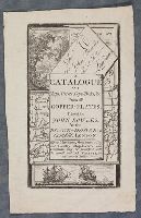
"Title page to catalogue of John Bowles, printer and printseller, at the Black Horse, Cornhill, London; text in rectangle at the centre, with naval scene showing two ships on the sea below; behind the text a map, a letter to Mr John Bowles, a landscap...
Description:
Title from item.
Publisher:
John Bowles
Subject (Topic):
Warships, Maps, Landscapes (Representations), and Eyes
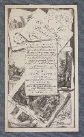
"Frontispiece for 'A Catalogue of News and Useful Maps Curious and Entertaining Prints, Books of Architecture, Great Variety of Drawing Books in all the Branches of Penmanship And the best of each Kind'; title on scroll, surrounded by prints and maps....
BEIN 1977 Folio 177: Imperfect: left sheet wanting. Right sheet measures 64.2 x 48.0 cm. Ms. note at head of title: Cook's voyages. Ms. note on verso: Map of Cook's last voyage. No. 12 of 34 maps bound together.
Publisher:
Printed for J. Bew
Subject (Name):
Cook, James, 1728-1779
Subject (Topic):
Travel, Maps, Voyages around the world, and World maps
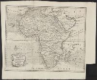
BEIN Roll Map 194: Imperfect: somewhat brittle, chipped, torn in places, with minimal loss of map image. Joined sheets measure 100 x 109 cm. Mounted on linen. In manuscript on verso: Jefferys's Map of New England 1755.
Publisher:
Thomas Jefferys
Subject (Geographic):
New England, New England., and United States New England. lcsh
BEIN 2003 Folio 85: No. 21 of 45 maps bound together with binder's spine title: Atlas of America; ms. table of contents. Bookplate: Robinson. Bookplate of Paul Mellon.
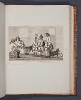
Bretherton, James, approximately 1730-1806, printmaker
Published / Created:
[2 January 1773]
Call Number:
Folio 75 B87 770 (Oversize)
Collection Title:
Page 61. Bunbury album.
Image Count:
1
Resource Type:
still image
Abstract:
A satire showing three men all with caricatured faces stand in front of two men, one of whom is obese and points to them, sit at a table. Behind them pinned to the wall are a map and portrait. Two dogs, one large and black and the other small and whit...
Description:
Title from text below image.
Publisher:
Publish'd as the act directs, 2d Jany. 1773, by J. Bretherton, No. 134 New Bond Street