Search
You Searched For
Search Results
- Creator:
- Bretez, Louis, d. 1738
- Published / Created:
- [1739?]
- Call Number:
- 1973 folio 44
- Collection Title:
- Plan de Paris commence l’annee 1734. Dessine et grave sous les ordres de Messire Michel Etienne
- Image Count:
- 1
- Resource Type:
- Maps, Atlases & Globes
- Found in:
- Beinecke Rare Book and Manuscript Library > [Untitled sectional plan of Paris]
- Creator:
- Bretez, Louis, d. 1738
- Published / Created:
- [1739?]
- Call Number:
- 1973 folio 44
- Collection Title:
- Plan de Paris commence l’annee 1734. Dessine et gravesous les ordres de Messire Michel Etienne
- Image Count:
- 1
- Resource Type:
- Maps, Atlases & Globes
- Found in:
- Beinecke Rare Book and Manuscript Library > [Untitled sectional plan of Paris]
- Published / Created:
- [1808]
- Call Number:
- In W890 Zz808
- Collection Title:
- The history of the rise, progress, and accomplishment of the abolition of the African slave-trade
- Image Count:
- 1
- Resource Type:
- Maps, Atlases & Globes
- Found in:
- Beinecke Rare Book and Manuscript Library > [Untitled map of abolition of the slave trade]
- Creator:
- Des Barres, Joseph F. W. (Joseph Frederick Wallet), 1722-1824
- Published / Created:
- 1775?-1781?]
- Call Number:
- 1983 Folio 25
- Image Count:
- 3
- Resource Type:
- Maps, Atlases & Globes
- Found in:
- Beinecke Rare Book and Manuscript Library > [The Atlantic Neptune : published for the use of the Royal Navy Great Britain / by Joseph F.W. Des Barres, esq.].
- Creator:
- Benitz, A.
- Published / Created:
- [1840]
- Call Number:
- 1973 Folio 105
- Collection Title:
- Atlas fisico y politico de la Republica de Venezuela ... por ... Agustin Codazzi ...
- Image Count:
- 1
- Resource Type:
- Maps, Atlases & Globes
- Found in:
- Beinecke Rare Book and Manuscript Library > [Provincia de Apure]
- Published / Created:
- 1739
- Call Number:
- 1975 2757
- Collection Title:
- El atlas abreviado, ò, El nuevo compendio de la geografia universal, politica, historica, i curiosa
- Image Count:
- 1
- Resource Type:
- Maps, Atlases & Globes
- Found in:
- Beinecke Rare Book and Manuscript Library > [Map of] Mogol
- Call Number:
- 1971 Folio 602
- Collection Title:
- Carte topographique de lEgypte et de plusiers parties des pays limitrophes; levee pendant
- Image Count:
- 1
- Resource Type:
- Maps, Atlases & Globes
- Found in:
- Beinecke Rare Book and Manuscript Library > [Map of Egypt, the Red Sea, Palestine, the Sinai Peninsula and other Middle Eastern landmarks]. pl. 2.
- Creator:
- Fee, Chas E
- Published / Created:
- c1891
- Call Number:
- Zc86 893sc
- Collection Title:
- The guide-book to Alaska and the northwest coast, including the shores of Washington, British
- Image Count:
- 1
- Resource Type:
- Maps, Atlases & Globes
- Found in:
- Beinecke Rare Book and Manuscript Library > [Map of Alaska]
- Published / Created:
- [1490]
- Call Number:
- 1978 Folio 114
- Collection Title:
- Cosmographia. [Translated into Latin by Jacobus Angelus, and edited by Nicolaus Germanus.]
- Image Count:
- 1
- Resource Type:
- Maps, Atlases & Globes
- Found in:
- Beinecke Rare Book and Manuscript Library > [Map depicting Europe, North Africa, the Middle East and Asia].
- Call Number:
- 1977 +435
- Collection Title:
- Geografia; cioè, Descrittione vniversale della terra. Partita in due volumi, nel primo de' quali si
- Image Count:
- 1
- Resource Type:
- Maps, Atlases & Globes
- Found in:
- Beinecke Rare Book and Manuscript Library > [Geographia. Italian]
- Call Number:
- 1977 +435
- Collection Title:
- Geografia; cioè, Descrittione vniversale della terra. Partita in due volumi, nel primo de' quali si
- Image Count:
- 1
- Resource Type:
- Maps, Atlases & Globes
- Found in:
- Beinecke Rare Book and Manuscript Library > [Geographia. Italian]
- Call Number:
- 1977 +379
- Collection Title:
- Geografia; cioè, Descrittione vniversale della terra. Partita in due volumi, nel primo de' quali si
- Image Count:
- 1
- Resource Type:
- Maps, Atlases & Globes
- Found in:
- Beinecke Rare Book and Manuscript Library > [Geographia. Italian]
- Call Number:
- Gfp94 +Gi597
- Collection Title:
- Geografia; cioè, Descrittione vniversale della terra. Partita in due volumi, nel primo de' quali si
- Image Count:
- 1
- Resource Type:
- Maps, Atlases & Globes
- Found in:
- Beinecke Rare Book and Manuscript Library > [Geographia. Italian]
- Creator:
- Cóvens et Mortier
- Published / Created:
- ca. 1730-ca. 1800]
- Call Number:
- 1973 Folio 71
- Image Count:
- 1
- Resource Type:
- Maps, Atlases & Globes
- Found in:
- Beinecke Rare Book and Manuscript Library > [Atlas nouveau contenant toutes les parties du monde ou sont exactement marqués les empires, monarchies, royaumes, états, republiques &c. Le tout recueilli par les meilleurs geógraphes.]
- Published / Created:
- Undated
- Call Number:
- 1978 595
- Collection Title:
- El atlas abreviado, o Compendiosa geografia, del mvndo antigvo, y nvevo, segun esta oy dividido
- Image Count:
- 1
- Resource Type:
- Maps, Atlases & Globes
- Found in:
- Beinecke Rare Book and Manuscript Library > Yslas Britanicas enque se comprehenden los reynos de Ynglaterra, Escocia, e Yrlanda
- Call Number:
- 1977 +392
- Collection Title:
- A survey of the cities of London and Westminster : containing the original, antiquity, increase
- Image Count:
- 1
- Resource Type:
- Maps, Atlases & Globes
- Found in:
- Beinecke Rare Book and Manuscript Library > Walbrook Ward and Dow Gate Ward with its division into parishes taken from the last surveys
- Call Number:
- Zc86 915yo
- Collection Title:
- Alaska days with John Muir / by S. Hall Young
- Image Count:
- 1
- Resource Type:
- Maps, Atlases & Globes
- Found in:
- Beinecke Rare Book and Manuscript Library > Voyages of Muir and Young 1879 and 1880 in southeastern Alaska
- Call Number:
- 1972 515
- Collection Title:
- Premier voyage autour du monde / par le Chevr. Pigafetta, sur l'escadre de Magellan, pendant les
- Image Count:
- 1
- Resource Type:
- Maps, Atlases & Globes
- Found in:
- Beinecke Rare Book and Manuscript Library > Voyage de Pigafetta
- Call Number:
- Gfp94 gf525j
- Collection Title:
- Geographiae vniversae ... opvs ... habentur Cl. Ptolemaei ... Geographicae enarrationis libri octo
- Image Count:
- 1
- Resource Type:
- Maps, Atlases & Globes
- Found in:
- Beinecke Rare Book and Manuscript Library > Vniversi orbis descriptop as vsvm navigantivm
- Call Number:
- 1977 1341
- Collection Title:
- Geographiae vniversae opvs habentur Cl. Ptolemaei ... Geographicae enarationis libri octo [tr. by W
- Image Count:
- 1
- Resource Type:
- Maps, Atlases & Globes
- Found in:
- Beinecke Rare Book and Manuscript Library > Vniversi orbis descriptio ad vsvm navigantivm
- Call Number:
- 1973 Folio 114
- Collection Title:
- The English pilot: describing the West-India navigation, from Hudson's-Bay to the river Amazones
- Image Count:
- 1
- Resource Type:
- Maps, Atlases & Globes
- Found in:
- Beinecke Rare Book and Manuscript Library > Virginia, Maryland, Pennsilvania, east & west New Jarsey
- Creator:
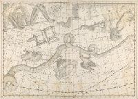
- Bode, Johann Elert, 1747-1826.
- Published / Created:
- 1801
- Call Number:
- QQn32 009
- Image Count:
- 1
- Resource Type:
- Maps, Atlases & Globes
- Found in:
- Beinecke Rare Book and Manuscript Library > Uranographia sive astrorum descriptio viginti tabul oeneis incisa ex recentissimis et absolutissimis Astrononmorum observationibus...
- Creator:
- Benitz, A.
- Published / Created:
- [1840]
- Call Number:
- 1973 Folio 105
- Collection Title:
- Atlas fisico y politico de la Republica de Venezuela ... por ... Agustin Codazzi ...
- Image Count:
- 1
- Resource Type:
- Maps, Atlases & Globes
- Found in:
- Beinecke Rare Book and Manuscript Library > Un cuadro de alturas que comprende las de las cordilleras de Merida, de la costa de Caracas, Coro, Cumana y Margarita, y ultimamente las del sistema de la Parima. Otro cuadro comparativo de la superficie y poblacion de cada provincia. Otro de los principa
- Creator:
- Jefferys, Thomas, d. 1771
- Published / Created:
- 1775
- Call Number:
- 1977 Folio 96
- Collection Title:
- The West-India atlas: or, A compendious description of the West-Indies: illustrated with forty
- Image Count:
- 1
- Resource Type:
- Maps, Atlases & Globes
- Found in:
- Beinecke Rare Book and Manuscript Library > Turks Islands, from a survey made in 1753, by the the sloops l'Aigle and l'Emeraude, by order of the French Governor of Hispaniola, with improvements from observations, made in 1770, in the Sr. Edward Hawke Kings Schooner
- Creator:
- Bry, Theodor de, 1528-1598
- Call Number:
- 1976 Folio 110
- Collection Title:
- The mariners mirrovr wherin may playnly be seen the courses, heights, distances, depths, sounding
- Image Count:
- 1
- Resource Type:
- Maps, Atlases & Globes
- Found in:
- Beinecke Rare Book and Manuscript Library > The sea coastes of the landes of Poyctou and Bordeaux ...as they shew and appeare, when you sayle there alongst betweene Picquelier and the River of Bordeaux called the Garonne
- Creator:
- Bry, Theodor de, 1528-1598
- Call Number:
- 1976 Folio 110
- Collection Title:
- The mariners mirrovr wherin may playnly be seen the courses, heights, distances, depths, sounding
- Image Count:
- 1
- Resource Type:
- Maps, Atlases & Globes
- Found in:
- Beinecke Rare Book and Manuscript Library > The sea coastes of Portugal betwene Camino & Montego eue as the countrie there aboutes is lying and situated with all the havens thereof exactly done, and corected with great dilligence
- Creator:
- Bry, Theodor de, 1528-1598
- Call Number:
- 1976 Folio 110
- Collection Title:
- The mariners mirrovr wherin may playnly be seen the courses, heights, distances, depths, sounding
- Image Count:
- 1
- Resource Type:
- Maps, Atlases & Globes
- Found in:
- Beinecke Rare Book and Manuscript Library > The sea coastes of England, from the Sorlinges by the landes end to Plymouth with the hauens and harbrowghes
- Creator:
- Bry, Theodor de, 1528-1598
- Call Number:
- 1976 Folio 110
- Collection Title:
- The mariners mirrovr wherin may playnly be seen the courses, heights, distances, depths, sounding
- Image Count:
- 1
- Resource Type:
- Maps, Atlases & Globes
- Found in:
- Beinecke Rare Book and Manuscript Library > The sea coastes of England betweene the Ile of Wight & Douer, with the principal hauens thereof according to their situation and appearing
- Creator:
- Fee, Chas E
- Published / Created:
- c1891
- Call Number:
- Zc86 893scd
- Collection Title:
- Appletons' guide-book to Alaska and the northwest coast ...
- Image Count:
- 1
- Resource Type:
- Maps, Atlases & Globes
- Found in:
- Beinecke Rare Book and Manuscript Library > The route of the Alaska excursion steamers
- Published / Created:
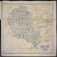
- 1884
- Call Number:
- Zc10 885up
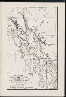
- Collection Title:
- Range and ranch cattle
- Image Count:
- 1
- Resource Type:
- Maps, Atlases & Globes
- Found in:
- Beinecke Rare Book and Manuscript Library > The range and ranch cattle area of the United States
- Call Number:
- 1977 +392
- Collection Title:
- A survey of the cities of London and Westminster : containing the original, antiquity, increase
- Image Count:
- 1
- Resource Type:
- Maps, Atlases & Globes
- Found in:
- Beinecke Rare Book and Manuscript Library > The parish of St. Johns Wapping
- Published / Created:
- c1889
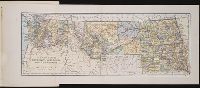
- Call Number:
- Zc10 889iv
- Collection Title:
- The new states; a sketch of the history and development of the states of North Dakota, South Dakota
- Image Count:
- 1
- Resource Type:
- Maps, Atlases & Globes
- Found in:
- Beinecke Rare Book and Manuscript Library > The new states North Dakota, South Dakota, Montana and Washington
- Creator:
- Waghenaer, Lucas Janszoon, 1534 or 5-1606
- Published / Created:
- ann. 1605.
- Call Number:
- 1976 Folio 46
- Image Count:
- 1
- Resource Type:
- Maps, Atlases & Globes
- Found in:
- Beinecke Rare Book and Manuscript Library > The mariners mirrovr wherin may playnly be seen the courses, heights, distances, depths, sounding, flouds and ebs, risings of lands, rocks ... of the harbouroughs, havens and ports of the greatest part of Europe: ... together w.th the rules and instrumeíÄ
- Creator:
- Dakota Territory Centennial Commission
- Call Number:
- Zc35 +961rp
- Collection Title:
- To Celebrate 100 years of Dakota Territory : the Dakota Territorial Centennial Commission presents
- Image Count:
- 1
- Resource Type:
- Maps, Atlases & Globes
- Found in:
- Beinecke Rare Book and Manuscript Library > The lands within the bold boundary were included, at some time or other, but never all at the same time, in Dakota Territory
- Call Number:
- 1973 Folio 114
- Collection Title:
- The English pilot: describing the West-India navigation, from Hudson's-Bay to the river Amazones
- Image Count:
- 1
- Resource Type:
- Maps, Atlases & Globes
- Found in:
- Beinecke Rare Book and Manuscript Library > The island of Jamaica
- Creator:
- Jefferys, Thomas, d. 1771
- Call Number:
- C6 033c
- Collection Title:
- The natural and civil history of the French dominions in North and South America : with an
- Image Count:
- 1
- Resource Type:
- Maps, Atlases & Globes
- Found in:
- Beinecke Rare Book and Manuscript Library > The island of Hispaniola called by the French St. Domingo. Subject to France and Spain. from the best authorities by Thomas Jeffreys, geographer to his Royal Highness the Prince of Wales
- Call Number:
- WeInd Ehc 762J
- Collection Title:
- A description of the Spanish islands and settlements on the coast of the West Indies / compiled
- Image Count:
- 1
- Resource Type:
- Maps, Atlases & Globes
- Found in:
- Beinecke Rare Book and Manuscript Library > The island of Hispaniola called by the French St. Domingo. Subject to France and Spain
- Creator:
- Bowen, Emanuel, d. 1767
- Published / Created:
- 1720
- Call Number:
- 1973 Folio 114
- Collection Title:
- The English pilot: describing the West-India navigation, from Hudson's-Bay to the river Amazones
- Image Count:
- 1
- Resource Type:
- Maps, Atlases & Globes
- Found in:
- Beinecke Rare Book and Manuscript Library > The harbour of Casco Bay and islands adjacent
- Creator:
- Jefferys, Thomas, d. 1771
- Call Number:
- 1977 Folio 96
- Collection Title:
- The West-India atlas: or, A compendious description of the West-Indies: illustrated with forty
- Image Count:
- 1
- Resource Type:
- Maps, Atlases & Globes
- Found in:
- Beinecke Rare Book and Manuscript Library > The harbour of Bluefields.
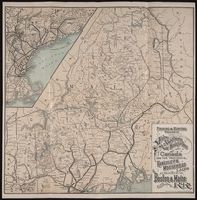
- Creator:
- Boston and Maine Railroad
- Published / Created:
- 1897 May 3
- Call Number:
- 2002 550
- Image Count:
- 1
- Resource Type:
- Maps, Atlases & Globes
- Found in:
- Beinecke Rare Book and Manuscript Library > The direct route to the fishing and hunting resorts of New Hampshire, Maine, and Canada : Lake Winnipesaukee, Rangeley Lakes, Lake St. John, Lake Megantic ...
- Creator:
- Chantry, John
- Call Number:
- Ee +633gb
- Collection Title:
- The voyages and travells of the ambassadors sent by Frederick, duke of Holstein, to the great Duke
- Image Count:
- 1
- Resource Type:
- Maps, Atlases & Globes
- Found in:
- Beinecke Rare Book and Manuscript Library > The course of the great River Wolga
- Call Number:
- 1977 +392
- Collection Title:
- A survey of the cities of London and Westminster : containing the original, antiquity, increase
- Image Count:
- 1
- Resource Type:
- Maps, Atlases & Globes
- Found in:
- Beinecke Rare Book and Manuscript Library > The Wards of Farington within and Baynards Castle with its divisions into parishes taken from the last survey with corrections
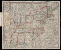
- Creator:
- Tanner, Henry Schenck, 1786-1858
- Published / Created:
- 1839
- Call Number:
- CE158 T35 1839
- Collection Title:
- The American traveller; or, Guide through the United States
- Image Count:
- 1
- Resource Type:
- Maps, Atlases & Globes
- Found in:
- Beinecke Rare Book and Manuscript Library > The Travellers Guide or Map of the Roads, Canals and Railroads of the United States with distances from place to place
- Published / Created:
- 1780
- Call Number:
- 1973 +100
- Collection Title:
- A Bengal atlas, containing maps of the theatre of war and commerce on that side of Hindoostan
- Image Count:
- 1
- Resource Type:
- Maps, Atlases & Globes
- Found in:
- Beinecke Rare Book and Manuscript Library > The Northern provinces of Bengal; with the Bootan, Morung, and Assam frontiers: inscribed to Hugh Inglis Esq by his affectionate friend J. Rennell
- Creator:
- Bowles, Carington, 1724-1793
- Published / Created:
- [1766]
- Call Number:
- ByzL 79t
- Collection Title:
- A new and accurate history and survey of London, Westminster, Southwark, and places adjacent
- Image Count:
- 1
- Resource Type:
- Maps, Atlases & Globes
- Found in:
- Beinecke Rare Book and Manuscript Library > The London guide, or, a pocket plan of the cities of London & Westminster and Borough of Southwark; with the new buildings, &c. to the present year
- Call Number:
- 1977 +392
- Collection Title:
- A survey of the cities of London and Westminster : containing the original, antiquity, increase
- Image Count:
- 1
- Resource Type:
- Maps, Atlases & Globes
- Found in:
- Beinecke Rare Book and Manuscript Library > The Custom House
- Published / Created:
- [1540]
- Call Number:
- E33 +540P
- Collection Title:
- Geographia vniversalis, vetvs et nova complectens Clavdii Ptolemaei Alexandrini enarrationis libros
- Image Count:
- 1
- Resource Type:
- Maps, Atlases & Globes
- Found in:
- Beinecke Rare Book and Manuscript Library > Tabula Europae IX
- Published / Created:
- 1817
- Call Number:
- Folio Q115 H84 1B
- Collection Title:
- Atlas geographique et physique des regions equinoxiales du nouveau continent, fonde sur des
- Image Count:
- 1
- Resource Type:
- Maps, Atlases & Globes
- Found in:
- Beinecke Rare Book and Manuscript Library > Tableau physique des Ils Canaries. Geographie des plantes du Pic de Teneriffe
- Published / Created:
- 1807-08
- Call Number:
- Folio Q115 H84 3A
- Collection Title:
- Atlas geographique et physique du royaume de la Nouvelle-Espagne, fonde sur des observations
- Image Count:
- 1
- Resource Type:
- Maps, Atlases & Globes
- Found in:
- Beinecke Rare Book and Manuscript Library > Tableau physique de la pente Orientale du Plateau de la Nouvelle Espagne (Chemin de Mexico a Veracruz par Puebla et Xalapa.) Dresse d'apres des mesures barometriques et trigonometriques, prises en 1804 par Mr. de Humboldt. pl. 12
- Published / Created:
- 1805-07
- Call Number:
- Folio Q115 H84 3A
- Collection Title:
- Atlas geographique et physique du royaume de la Nouvelle-Espagne, fonde sur des observations
- Image Count:
- 1
- Resource Type:
- Maps, Atlases & Globes
- Found in:
- Beinecke Rare Book and Manuscript Library > Tableau du Plateau central des Montagnes du Mexique, entre les 19 et 21 [degree] de Latitude boreale, (Chemin de Mexico a Guanaxuato) Dresse d'apres le Nivellement Barometrique de Mr. de Humboldt. pl. 14
- Call Number:
- 1971 Folio 602
- Collection Title:
- Carte topographique de lEgypte et de plusiers parties des pays limitrophes; levee pendant
- Image Count:
- 1
- Resource Type:
- Maps, Atlases & Globes
- Found in:
- Beinecke Rare Book and Manuscript Library > Tableau d'assembalge pour la carte topographique de l'Egypte en 47 feuilles et pour la carte geographique en 3 feuilles.
- Call Number:
- 1977 +392
- Collection Title:
- A survey of the cities of London and Westminster : containing the original, antiquity, increase
- Image Count:
- 1
- Resource Type:
- Maps, Atlases & Globes
- Found in:
- Beinecke Rare Book and Manuscript Library > St. Olave and St. Mary Magdalen Bermondsey Southwark, taken from the last survey with corrections
- Creator:
- Jefferys, Thomas, d. 1771
- Call Number:
- 1977 Folio 96
- Collection Title:
- The West-India atlas: or, A compendious description of the West-Indies: illustrated with forty
- Image Count:
- 1
- Resource Type:
- Maps, Atlases & Globes
- Found in:
- Beinecke Rare Book and Manuscript Library > South part of St. Domingo, of Hispaniola, by Thos Jeffreys geographer to his Majesty
- Call Number:
- 1977 +392
- Collection Title:
- A survey of the cities of London and Westminster : containing the original, antiquity, increase
- Image Count:
- 1
- Resource Type:
- Maps, Atlases & Globes
- Found in:
- Beinecke Rare Book and Manuscript Library > Shoreditch, Norton Folgate, and Crepple Gate without, taken from the last survey with corrections
- Creator:
- Russell, J.C
- Call Number:
- Defoe 57 W99 g816
- Collection Title:
- The Swiss family Ro
- Image Count:
- 1
- Resource Type:
- Maps, Atlases & Globes
- Found in:
- Beinecke Rare Book and Manuscript Library > Settlements of the Swiss pastor & his family in the desert island
- Creator:
- Stieler, Adolf, 1775-1836
- Call Number:
- Lxe2 +842s
- Image Count:
- 2
- Resource Type:
- Maps, Atlases & Globes
- Found in:
- Beinecke Rare Book and Manuscript Library > Schul-Atlas über alle Theile der Erde nach dem neuesten Zustande, und über das Weltgebäude : nach Stieler's Hand-Atlas verkleinert.
- Call Number:
- 1972 Folio 31
- Collection Title:
- El teniente general D. Jose Manuel de Goyeneche, primer conde de Guaqui; apuntes y datos para la
- Image Count:
- 1
- Resource Type:
- Maps, Atlases & Globes
- Found in:
- Beinecke Rare Book and Manuscript Library > Region del lago Titicaca. Mapa mandado levantar por el General Goyeneche. (Del Archivo del Condo de Guaqui.)
- Call Number:
- 1977 +392
- Collection Title:
- A survey of the cities of London and Westminster : containing the original, antiquity, increase
- Image Count:
- 1
- Resource Type:
- Maps, Atlases & Globes
- Found in:
- Beinecke Rare Book and Manuscript Library > Queen Hith Ward and Vintry Ward with their division into parishes taken from the last surveys
- Call Number:
- 1983 Folio 49
- Collection Title:
- Atlas françois, contenant les cartes geographiques dans les quelles sont tres exactement remarquez
- Image Count:
- 1
- Resource Type:
- Maps, Atlases & Globes
- Found in:
- Beinecke Rare Book and Manuscript Library > Provinces-Unies des pays-bas ...
- Published / Created:
- 1820
- Call Number:
- Folio Q115 H84 1B
- Collection Title:
- Atlas geographique et physique des regions equinoxiales du nouveau continent, fonde sur des
- Image Count:
- 1
- Resource Type:
- Maps, Atlases & Globes
- Found in:
- Beinecke Rare Book and Manuscript Library > Profit du Chemin de Carthagene des Indes au Plateau de Santa Fe de Bogata. pl. 6
- Published / Created:
- 1808
- Call Number:
- Folio Q115 H84 3A
- Collection Title:
- Atlas geographique et physique du royaume de la Nouvelle-Espagne, fonde sur des observations
- Image Count:
- 1
- Resource Type:
- Maps, Atlases & Globes
- Found in:
- Beinecke Rare Book and Manuscript Library > Profit du Canal de Huehuetoca (Desague Real.) Creuse pour preserver la Ville de Mexico du danger des Inondations. pl. 15
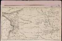
- Published / Created:
- 1722
- Call Number:
- Zc52 +722pe
- Collection Title:
- Derrotero de la expedicion en la provincia de los Texas, nuevo reyno de Philipinas, que de orden
- Image Count:
- 2
- Resource Type:
- Maps, Atlases & Globes
- Found in:
- Beinecke Rare Book and Manuscript Library > Presidio de n.s. de Loreto en la Bahia
- Call Number:
- 1977 +392
- Collection Title:
- A survey of the cities of London and Westminster : containing the original, antiquity, increase
- Image Count:
- 1
- Resource Type:
- Maps, Atlases & Globes
- Found in:
- Beinecke Rare Book and Manuscript Library > Portsoken ward being part of the parish of St. Buttolphs Aldgate, taken from the last survey, with corrections and additions
- Call Number:
- 1973 Folio 114
- Collection Title:
- The English pilot: describing the West-India navigation, from Hudson's-Bay to the river Amazones
- Image Count:
- 1
- Resource Type:
- Maps, Atlases & Globes
- Found in:
- Beinecke Rare Book and Manuscript Library > Port Bonavista
- Creator:
- Robert Sayer and John Bennett (Firm)
- Published / Created:
- 1779
- Call Number:
- 1977 Folio 78
- Collection Title:
- A New and accurate chart of the West-India Islands and coast, with the gulf passage through the New
- Image Count:
- 1
- Resource Type:
- Maps, Atlases & Globes
- Found in:
- Beinecke Rare Book and Manuscript Library > Plan of the city and harbour of Havanna. pl. 23
- Creator:
- De Lacy, W. W. (Walter Washington), 1819-1892
- Call Number:
- WA MSS 443
- Collection Title:
- Isaac Ingalls Stevens papers
- Container / Volume:
- Box 1 | Folder 29
- Image Count:
- 1
- Resource Type:
- Maps, Atlases & Globes
- Found in:
- Beinecke Rare Book and Manuscript Library > Plan of the battle of Grande Ronde fought Jul 17, 1856.
- Published / Created:
- 1720
- Call Number:
- C6 033c
- Collection Title:
- The natural and civil history of the French dominions in North and South America : with an
- Image Count:
- 1
- Resource Type:
- Maps, Atlases & Globes
- Found in:
- Beinecke Rare Book and Manuscript Library > Plan of New Orleans the capital of Louisiana; with the disposition of its quarters and canals as they have been traced by Mr. de la Tour in the year 1720
- Creator:
- Beautemps-Beaupré, Charles François, 1766-1854.
- Published / Created:
- 1822-43.
- Call Number:
- 1975 +8
- Image Count:
- 3
- Resource Type:
- Maps, Atlases & Globes
- Found in:
- Beinecke Rare Book and Manuscript Library > Pilote français... rédigé par M. Beautemps-Beaupré, ingénieur hydrographe en chef de la Marine... Publié par ordre du roi...
- Creator:
- Bromley, Walter
- Call Number:
- 1979 Folio 55
- Collection Title:
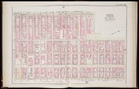
- Atlas of the city of New York, Manhattan Island. From actual surveys and official plans, by George
- Image Count:
- 1
- Resource Type:
- Maps, Atlases & Globes
- Found in:
- Beinecke Rare Book and Manuscript Library > Part of ward 19 New York City part of section 5, plate 22
- Creator:
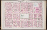
- Bromley, Walter
- Call Number:
- 1979 Folio 55
- Collection Title:
- Atlas of the city of New York, Manhattan Island. From actual surveys and official plans, by George
- Image Count:
- 1
- Resource Type:
- Maps, Atlases & Globes
- Found in:
- Beinecke Rare Book and Manuscript Library > Part of sections 34 & 5, part of wards 19, 20, 21, & 22, plate 20
- Creator:
- Arrowsmith, John, 1790-1873
- Published / Created:
- 1832
- Call Number:
- 1978 Folio 106
- Collection Title:
- Maps of the Orinoco-Essequibo region, South America. Compiled for the Commission appointed by the
- Image Count:
- 1
- Resource Type:
- Maps, Atlases & Globes
- Found in:
- Beinecke Rare Book and Manuscript Library > Part of a map of Colombia by J. Arrowsmith, London, 1832
- Call Number:
- 1977 +392
- Collection Title:
- A survey of the cities of London and Westminster : containing the original, antiquity, increase
- Image Count:
- 1
- Resource Type:
- Maps, Atlases & Globes
- Found in:
- Beinecke Rare Book and Manuscript Library > Part of Aldgate Ward
- Published / Created:
- 1665
- Call Number:
- 1973 905
- Collection Title:
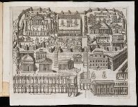
- Roma vetvs ac recens vtrivsqve aedificiis ad erviditam cognitionem expositis / auctore Alexandro
- Image Count:
- 1
- Resource Type:
- Maps, Atlases & Globes
- Found in:
- Beinecke Rare Book and Manuscript Library > Pars Fori Romani et eius Porticuum
- Creator:
- Cicogna, Pasquale, 1509-1595
- Published / Created:
- 1593
- Call Number:
- 1975 Folio 41
- Collection Title:
- Civitates orbis terrarvm ...
- Image Count:
- 1
- Resource Type:
- Maps, Atlases & Globes
- Found in:
- Beinecke Rare Book and Manuscript Library > Palma
- Creator:
- Great Britain. Hydrographic Dept.
- Call Number:
- Conrad +Zz1
- Image Count:
- 2
- Resource Type:
- Maps, Atlases & Globes
- Found in:
- Beinecke Rare Book and Manuscript Library > Original navigation charts used by Joseph Conrad.
- Published / Created:
- 1569?]
- Call Number:
- EE23 569L
- Collection Title:
- [Geografia tavole moderne di geografia de la maggior parte del mondo / di diversi avtori racoolte
- Image Count:
- 1
- Resource Type:
- Maps, Atlases & Globes
- Found in:
- Beinecke Rare Book and Manuscript Library > Nova Germaniae Descriptio
- Creator:
- Burr, David H., 1803-1875
- Published / Created:
- 1836
- Call Number:
- 1973 432
- Collection Title:
- Atlas of New York
- Image Count:
- 1
- Resource Type:
- Maps, Atlases & Globes
- Found in:
- Beinecke Rare Book and Manuscript Library > New-York
- Published / Created:
- [ca. 1896]
- Call Number:
- 36 N93 1896
- Container / Volume:
- BRBL_00125
- Image Count:
- 1
- Resource Type:
- Maps, Atlases & Globes
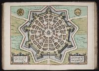
- Found in:
- Beinecke Rare Book and Manuscript Library > Neuester Plan der k[öniglichen] bayr[ischen] Stadt Nürnberg.
- Published / Created:
- 1859
- Call Number:
- Zc10 859re
- Collection Title:
- Map of and guide to the Kansas gold region; the map embracing both routes--the northern and
- Image Count:
- 1
- Resource Type:
- Maps, Atlases & Globes
- Found in:
- Beinecke Rare Book and Manuscript Library > Nebraska and Kanzas. Showing Pikes Peak and the gold region
- Call Number:
- Zc52 843Leb
- Collection Title:
- The legion of liberty
- Image Count:
- 1
- Resource Type:
- Maps, Atlases & Globes
- Found in:
- Beinecke Rare Book and Manuscript Library > Moral map of U.S., Jan. 1837
- Creator:
- Benitz, A.
- Published / Created:
- [1840]
- Call Number:
- 1973 Folio 105
- Collection Title:
- Atlas fisico y politico de la Republica de Venezuela ... por ... Agustin Codazzi ...
- Image Count:
- 1
- Resource Type:
- Maps, Atlases & Globes
- Found in:
- Beinecke Rare Book and Manuscript Library > Mapa fisico de Venezuela, divida en hoyas hydrograficas.
- Creator:
- Benitz, A.
- Published / Created:
- [1840]
- Call Number:
- 1973 Folio 105
- Collection Title:
- Atlas fisico y politico de la Republica de Venezuela ... por ... Agustin Codazzi ...
- Image Count:
- 1
- Resource Type:
- Maps, Atlases & Globes
- Found in:
- Beinecke Rare Book and Manuscript Library > Mapa de las costas de Tierra-Firme desde el Orinoco hasta Yucatan: de las islas Antillas y la mayor parte de las Lucayas, con las derrotas que siguio Dn. Cristobal Colon en sus descubrimientos por estos mares y las derrotas de otros navegantes que reconoc
- Creator:
- Horn, Hosea B
- Published / Created:
- 1852
- Call Number:
- Zc10 852ho
- Collection Title:
- Horn's overland guide, from the U.S. Indian sub-agency, Council Bluffs, on the Missouri River, to
- Image Count:
- 1
- Resource Type:
- Maps, Atlases & Globes
- Found in:
- Beinecke Rare Book and Manuscript Library > Map to illustrate Horn's overland guide to California and Oregon
- Call Number:
- Zc52 833hob
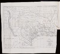
- Collection Title:
- Texas
- Image Count:
- 1
- Resource Type:
- Maps, Atlases & Globes
- Found in:
- Beinecke Rare Book and Manuscript Library > Map of the state of Coahuila and Texas
- Published / Created:
- 1859
- Call Number:
- Zc49 859by
- Collection Title:
- Hand book to the gold fields of Nebraska and Kansas: being a complete guide to the gold regions of
- Image Count:
- 1
- Resource Type:
- Maps, Atlases & Globes
- Found in:
- Beinecke Rare Book and Manuscript Library > Map of the gold region
- Creator:
- Atwood, J.M
- Published / Created:
- 1849
- Call Number:
- Zc72 849ro
- Collection Title:
- California and its gold regions; with a geographical and topographical view of the country, its
- Image Count:
- 1
- Resource Type:
- Maps, Atlases & Globes
- Found in:
- Beinecke Rare Book and Manuscript Library > Map of the United States, the British Provinces, Mexico &c. showing the routes of the U.S. mail steam packets to California and a plan of the gold region
- Published / Created:
- 1778
- Call Number:
- 1978 Folio 106
- Collection Title:
- Maps of the Orinoco-Essequibo region, South America. Compiled for the Commission appointed by the
- Image Count:
- 1
- Resource Type:
- Maps, Atlases & Globes
- Found in:
- Beinecke Rare Book and Manuscript Library > Map of the Spanish privince of Nueva Andalucia made at the order of the head of the Spanish Archive of the Indies by Luis de Surville, Assistant Archivist, 1778
- Creator:
- Gumilla, Joseph, d. 1750
- Published / Created:
- 1741
- Call Number:
- 1978 Folio 106
- Collection Title:
- Maps of the Orinoco-Essequibo region, South America. Compiled for the Commission appointed by the
- Image Count:
- 1
- Resource Type:
- Maps, Atlases & Globes
- Found in:
- Beinecke Rare Book and Manuscript Library > Map of the Jesuit missions of New Granada, by father Joseph Gumilla, S. J., Madrid, 1741
- Creator:
- Bry, Theodor de, 1528-1598
- Call Number:
- 1978 Folio 106
- Collection Title:
- Maps of the Orinoco-Essequibo region, South America. Compiled for the Commission appointed by the
- Image Count:
- 1
- Resource Type:
- Maps, Atlases & Globes
- Found in:
- Beinecke Rare Book and Manuscript Library > Map of Guiana by Theodore de Bry, 1599
- Creator:
- Sanson, Nicolas, 1600-1667
- Call Number:
- 1978 Folio 106
- Collection Title:
- Maps of the Orinoco-Essequibo region, South America. Compiled for the Commission appointed by the
- Image Count:
- 1
- Resource Type:
- Maps, Atlases & Globes
- Found in:
- Beinecke Rare Book and Manuscript Library > Map of Guiana and Caribana by N. Sanson d'Abbeville, Paris, 1656
- Call Number:
- Zc56 859so
- Collection Title:
- Charter and by-laws of the Sopori Land and Mining Company, incorporated by the state of Rhode
- Image Count:
- 1
- Resource Type:
- Maps, Atlases & Globes
- Found in:
- Beinecke Rare Book and Manuscript Library > Map of Arizona or the Gadsen Purchase with the position of its silver mines as now worked 1859
- Creator:
- Keulen, Gerard van
Keulen, Johannes van.
Marre, Jan de, 1696-1763.
Vooght, Claes Janszoon, d. 1696.
- Call Number:
- 1973 Folio 103
- Collection Title:
- De Nieuwe groote lichtende zee-fakkel ...
- Image Count:
- 1
- Resource Type:
- Maps, Atlases & Globes
- Found in:
- Beinecke Rare Book and Manuscript Library > Madagascar
- Creator:
- Law, John, 1671-1729
Marperger, Paul Jacob, 1656-1730.
- Published / Created:
- 1721
- Call Number:
- Zc20 721La
- Collection Title:
- Historische en geographische beschryving von Louisiana, gelegen in Noord America, aan de mond van
- Image Count:
- 1
- Resource Type:
- Maps, Atlases & Globes
- Found in:
- Beinecke Rare Book and Manuscript Library > Louisiana by de Rivier Missisippi.
- Creator:
- Friesen, F
- Published / Created:
- 1808
- Call Number:
- Folio Q115 H84 1B
- Collection Title:
- Atlas geographique et physique des regions equinoxiales du nouveau continent, fonde sur des
- Image Count:
- 1
- Resource Type:
- Maps, Atlases & Globes
- Found in:
- Beinecke Rare Book and Manuscript Library > Limite inferieure des Neiges perpetuelles a differentes Latitudes
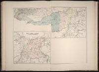
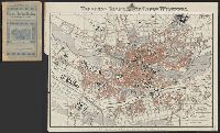
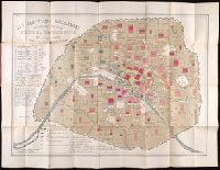
- Creator:
- Montigny, Léon.
- Published / Created:
- [1869]
- Call Number:
- 2015 523
- Image Count:
- 5
- Resource Type:
- Maps, Atlases & Globes
- Found in:
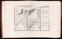
- Beinecke Rare Book and Manuscript Library > Les élections parisiennes de mai et juin 1869 [cartographic material] : application de la géométrie à la statistique / par Léon Montigny.
- Creator:
- Nolin, Jean Baptiste, 1648-1708
- Published / Created:
- 1691
- Call Number:
- 1984 Folio 3
- Collection Title:
- Atlas nouveau : contenant toutes les parties du monde ou sont exactement remarques les empires
- Image Count:
- 1
- Resource Type:
- Maps, Atlases & Globes
- Found in:
- Beinecke Rare Book and Manuscript Library > Les Etats de Savoye et de Piemont
- Creator:
- Robert Sayer and John Bennett (Firm)
- Published / Created:
- 1779
- Call Number:
- 1977 Folio 78
- Collection Title:
- A New and accurate chart of the West-India Islands and coast, with the gulf passage through the New
- Image Count:
- 1
- Resource Type:
- Maps, Atlases & Globes
- Found in:
- Beinecke Rare Book and Manuscript Library > Leogane and Port au Prince in the island of Hispaniola. pl. 33
- Creator:
- Humphrys, F
- Published / Created:
- 1850
- Call Number:
- 1975 Folio 26
- Collection Title:
- A new universal atlas containing maps of the various empires, kingdoms, states and republics of the
- Image Count:
- 1
- Resource Type:
- Maps, Atlases & Globes
- Found in:
- Beinecke Rare Book and Manuscript Library > Lengths of the principal rivers in the world
- Creator:
- Aa, Pieter van der, 1659-1733
Ferrarius, Philippus, d. 1626
Gueudeville, Nicolas, ca. 1654-ca. 1721
- Published / Created:
- 1713
- Call Number:
- 1978 Folio 112
- Image Count:
- 1
- Resource Type:
- Maps, Atlases & Globes
- Found in:
- Beinecke Rare Book and Manuscript Library > Le nouveau theatre du monde. ou La geographie royale, composée de nouvelles cartes tres-exactes ... Avec une description geographique et historique des quatre parties de l'univers, desquelles l'Europe en detail est écrite par Mr. Gueudeville, & les trois autres parties par Mr. Ferrarius ...
- Published / Created:
- 1819
- Call Number:
- Zc52 819Lhc
- Collection Title:
- Le Champ-dAsile, tableau topographique et historique du Texas, contenant des details sur le sol, le
- Image Count:
- 1
- Resource Type:
- Maps, Atlases & Globes
- Found in:
- Beinecke Rare Book and Manuscript Library > Le Champ-dAsile ou carte des etablissements fondes dans l'Amerique septentrionale