Skip to search
Skip to main content
Skip to first result
Search
You Searched For
Extent of Digitization
Partially digitized
Access
Public
Genre
Maps
Genre
Prints (Visual works)
New Search
Search Results
Call Number:
1977 1341
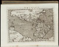
Collection Title:
Geographiae vniversae opvs habentur Cl. Ptolemaei ... Geographicae enarationis libri octo [tr. by W
Image Count:
1
Resource Type:
Books, Journals & Pamphlets
Subject (Topic):
Geography--Early works to 1800
Collection Created:
Venetiis : Apud Haeredes Simonis Galignani de Karera, 1596
Found in:
Beinecke Rare Book and Manuscript Library > America
Call Number:
Gfp94 gf525j
Collection Title:
Geographiae vniversae ... opvs ... habentur Cl. Ptolemaei ... Geographicae enarrationis libri octo
Image Count:
1
Resource Type:
Books, Journals & Pamphlets
Subject (Topic):
Geography--Early works to 1800
Collection Created:
Venetiis : Apud Haeredes Simonis Galignani de Karera, 1596
Found in:
Beinecke Rare Book and Manuscript Library > America
Creator:
Call Number:
C6 033c
Collection Title:
The natural and civil history of the French dominions in North and South America : with an
Image Count:
1
Resource Type:
Maps, Atlases & Globes
Description:
Plate between p. 68-9.
Subject (Geographic):
Atlantic Ocean--Charts, maps, etc., Atlantic Ocean--Maps--Early works to 1800, and Santo Domingo (Dominican Republic)
Collection Created:
London, Printed for T. Jeffreys, 1761
Found in:
Beinecke Rare Book and Manuscript Library > An authentic plan of the town and harbour of Cap Francois in the isle of St. Domingo. By Thomas Jefferys geographer to his Royal Highness the Prince of Wales
Call Number:
1978 +73
Collection Title:
The ecclesiastical history of New-England from its first planting in the year 1620 unto the year of
Image Count:
1
Resource Type:
Books, Journals & Pamphlets
Description:
Verso blank.
Subject (Geographic):
New England --Biography, New England --Church history, and New England --History --Colonial period, ca. 1600-1775
Collection Created:
London, Printed for Thomas Parkhurst, at the Bible and Three Crowns in Cheapside, 1702
Found in:
Beinecke Rare Book and Manuscript Library > An exact mapp of New England and New York
Call Number:
1977 +392
Collection Title:
A survey of the cities of London and Westminster : containing the original, antiquity, increase
Image Count:
1
Resource Type:
Maps, Atlases & Globes
Description:
Plate between p. 90-91.
Subject (Geographic):
London (England)--History
Collection Created:
London : Printed for A. Churchill, J. Knapton, R. Knaplock, J. Walthoe [and 6 others], 1720
Found in:
Beinecke Rare Book and Manuscript Library > Bishop Gate Street Ward taken from the last survey and corrected
Call Number:
1977 +392
Collection Title:
A survey of the cities of London and Westminster : containing the original, antiquity, increase
Image Count:
1
Resource Type:
Maps, Atlases & Globes
Description:
Plate between p. 14-15.
Subject (Geographic):
London (England)--History
Collection Created:
London : Printed for A. Churchill, J. Knapton, R. Knaplock, J. Walthoe [and 6 others], 1720
Found in:
Beinecke Rare Book and Manuscript Library > Bread Street Ward and Cordwainer Ward with it's division into parishes taken from the last survey
Published / Created:
1610
Call Number:
Ede +610C
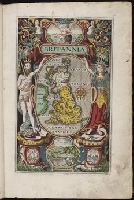
Collection Title:
Britain, or, A chronographicall description of the most flourishing kingdomes, England, Scotland
Image Count:
1
Resource Type:
Books, Journals & Pamphlets
Subject (Geographic):
Great Britain
Collection Created:
Londini : impensis G. Bishop & I. Norton, 1610
Found in:
Beinecke Rare Book and Manuscript Library > Britannia
Call Number:
1977 +392
Collection Title:
A survey of the cities of London and Westminster : containing the original, antiquity, increase
Image Count:
1
Resource Type:
Maps, Atlases & Globes
Description:
Plate between p. 150-151.
Subject (Geographic):
London (England)--History
Collection Created:
London : Printed for A. Churchill, J. Knapton, R. Knaplock, J. Walthoe [and 6 others], 1720
Found in:
Beinecke Rare Book and Manuscript Library > Candlewick Ward with its division into parishes. Corrected from the last survey
Creator:
Call Number:
Pequot H41
Collection Title:
Aenmerckelycke historische reys-beschryvinge door verscheyde landen veel grooter als die van geheel
Image Count:
1
Description:
Map: Carte dun nouueau monde, entre le Nouueau Mexique et la mer Glaciale, novellement decouvert par le R.P. Louis Hennepin, missionnire recollect natif dAht. en Hainaut, dediee a Sa Majeste britanique, le roy Guilaume Troisieme. Gasp. Bouttats fecit. [n.
Subject (Geographic):
Mississippi River Valley--Maps., Mississippi River--Discovery and exploration., New France--Discovery and exploration., New France--Maps, and North America--Discovery and exploration.
Collection Created:
Tot Utrecht : By A. Schouten, 1698
Found in:
Beinecke Rare Book and Manuscript Library > Carte d'un nouueau monde, entre le nouueau Mexique et la mer glacialle
Published / Created:
1755
Call Number:
ZZc90 755be
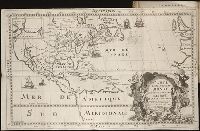
Collection Title:
Remarques sur la carte de lAmerique Septentrionale : comprise entre le 28e et le 72e degre de
Image Count:
1
Resource Type:
Maps, Atlases & Globes
Subject (Geographic):
Arctic regions. and Northwest Passage
Collection Created:
Paris : Didot, 1755
Found in:
Beinecke Rare Book and Manuscript Library > Carte de lAmerique septentrionale depuis le 28 degre de latitude jusqau 72
Branch:v1.61.8 ,Deployed:2024-06-20T11:15:02-04:00