Search
You Searched For
Search Results
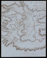
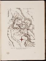
- Creator:
- De Lacy, W. W. (Walter Washington), 1819-1892
- Call Number:
- WA MSS 443
- Collection Title:
- Isaac Ingalls Stevens papers
- Container / Volume:
- Box 1 | Folder 29
- Image Count:
- 1
- Resource Type:
- Maps, Atlases & Globes
- Found in:
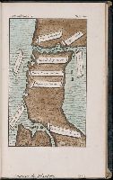
- Beinecke Rare Book and Manuscript Library > Plan of the battle of Grande Ronde fought Jul 17, 1856.
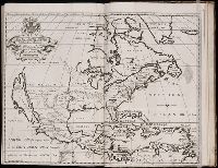
- Creator:
- Cóvens et Mortier
- Published / Created:
- ca. 1730-ca. 1800]
- Call Number:
- 1973 Folio 71
- Image Count:
- 1
- Resource Type:
- Maps, Atlases & Globes
- Found in:
- Beinecke Rare Book and Manuscript Library > [Atlas nouveau contenant toutes les parties du monde ou sont exactement marqués les empires, monarchies, royaumes, états, republiques &c. Le tout recueilli par les meilleurs geógraphes.]
- Published / Created:
- 1831
- Call Number:
- 1988 482
- Image Count:
- 1
- Resource Type:
- Maps, Atlases & Globes
- Found in:
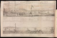
- Beinecke Rare Book and Manuscript Library > Description of a view of Hobart Town, Van Dieman's Land, and the surrounding country : now exhibiting at the Panorama, Strand / painted by the proprietor, Mr. R. Burford.
- Creator:
- Stockdale, John, 1749?-1814
- Published / Created:
- 1800 Nov. 24
- Call Number:
- CF1921 E38 1801
- Collection Title:
- An historical survey of the island of Saint Domingo, together with an account of the Maroon negroes
- Image Count:
- 1
- Resource Type:
- Maps, Atlases & Globes
- Found in:
- Beinecke Rare Book and Manuscript Library > A Map of the Island of St. Domingo
- Creator:
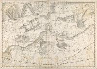
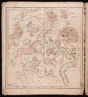
- Bode, Johann Elert, 1747-1826.
- Published / Created:
- 1801
- Call Number:
- QQn32 009
- Image Count:
- 1
- Resource Type:
- Maps, Atlases & Globes
- Found in:
- Beinecke Rare Book and Manuscript Library > Uranographia sive astrorum descriptio viginti tabul oeneis incisa ex recentissimis et absolutissimis Astrononmorum observationibus...
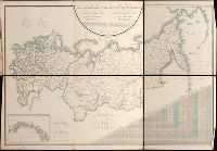
- Creator:
- Pi︠a︡dyshev, Vasiliĭ Petrovich, 1768-1835.
Пядышев, Василий Петрович, 1768-1835.
- Published / Created:
- 1820-1827.
- Call Number:
- EEdb 828P
- Image Count:
- 1
- Resource Type:
- Maps, Atlases & Globes
- Found in:
- Beinecke Rare Book and Manuscript Library > Geograficheskīĭ atlas Rossīĭskoĭ Imperīi T︠s︡arstva Polʹskago i Velikago Kni︠a︡zhestva Finli︠a︡ndskago [cartographic material] : raspolozhennyĭ po gubernīi︠a︡m na 80 listakh ... s generalʹnoi︠u︡ kartoi︠u︡ ... / sochinen po novi︠e︡ĭshim i dostovi︠e︡rnym svi︠e︡denīi︠a︡m ... Pi︠a︡dyshevym, nachat 1820-go, okonchen 1827-go goda = Atlas géographique de l'empire de Russie, du royaume de Pologne et du grand duché de Finlande ; divisé en gouvernements ... ; avec une carte générale ... / composé ... par ... Pi︠a︡discheff ...
- Creator:
- Burritt, Elijah H. (Elijah Hinsdale), 1794-1838.
- Published / Created:
- c1835.
- Call Number:
- 2000 Folio 110
- Image Count:
- 1
- Resource Type:
- Maps, Atlases & Globes
- Found in:
- Beinecke Rare Book and Manuscript Library > Atlas, designed to illustrate the geography of the heavens ... By Elijah H. Burritt ...
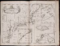
- Creator:
- Tanner, Henry Schenck, 1786-1858
- Published / Created:
- [1839?]
- Call Number:
- G1200 T34 1839 (LC)
- Image Count:
- 4
- Resource Type:
- Maps, Atlases & Globes
- Found in:
- Beinecke Rare Book and Manuscript Library > A new American atlas [cartographic material] : containing maps of the several states of the North American union ... / by Henry S. Tanner.
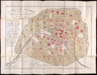
- Creator:
- Montigny, Léon.
- Published / Created:
- [1869]
- Call Number:
- 2015 523
- Image Count:
- 5
- Resource Type:
- Maps, Atlases & Globes
- Found in:
- Beinecke Rare Book and Manuscript Library > Les élections parisiennes de mai et juin 1869 [cartographic material] : application de la géométrie à la statistique / par Léon Montigny.
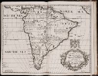
- Creator:
- Moll, Herman, d. 1732
- Published / Created:
- [178-?]
- Call Number:
- 1973 Folio 113
- Image Count:
- 2
- Resource Type:
- Maps, Atlases & Globes
- Found in:
- Beinecke Rare Book and Manuscript Library > Atlas minor: or A new and curious set of sixty two maps, in which are shewn all the empires, kingdoms, countries, states in all the known parts of the earth ... by Herman Moll ...
- Creator:
- Wytfliet, Corneille.
- Published / Created:
- 1597
- Call Number:
- 1977 +400
- Image Count:
- 2
- Resource Type:
- Maps, Atlases & Globes
- Found in:
- Beinecke Rare Book and Manuscript Library > Descriptionis Ptolemaicae avgmentvm, siue Occidentis notitia breui commentario illustrata, studio et opera Cornely Wytfliet Louaniensis.
- Creator:
- Great Britain. Hydrographic Dept.
- Call Number:
- Conrad +Zz1
- Image Count:
- 2
- Resource Type:
- Maps, Atlases & Globes
- Found in:
- Beinecke Rare Book and Manuscript Library > Original navigation charts used by Joseph Conrad.
- Creator:
- Kitchin, Thomas, d. 1784.
- Published / Created:
- 1773
- Call Number:
- 1979 Folio 59
- Image Count:
- 2
- Resource Type:
- Maps, Atlases & Globes
- Found in:
- Beinecke Rare Book and Manuscript Library > A general atlas, describing the whole universe. Being a compleat and new collection of the most approved maps extant; corrected with the utmost care, and augmented from the latest discoveries: the whole being an improvement of the maps of d'Anville and Robert ... By Thomas Kitchen, senior, and others ...
- Creator:
- Stieler, Adolf, 1775-1836
- Call Number:
- Lxe2 +842s
- Image Count:
- 2
- Resource Type:
- Maps, Atlases & Globes
- Found in:
- Beinecke Rare Book and Manuscript Library > Schul-Atlas über alle Theile der Erde nach dem neuesten Zustande, und über das Weltgebäude : nach Stieler's Hand-Atlas verkleinert.
- Creator:
- Beautemps-Beaupré, Charles François, 1766-1854.
- Published / Created:
- 1822-43.
- Call Number:
- 1975 +8
- Image Count:
- 3
- Resource Type:
- Maps, Atlases & Globes
- Found in:
- Beinecke Rare Book and Manuscript Library > Pilote français... rédigé par M. Beautemps-Beaupré, ingénieur hydrographe en chef de la Marine... Publié par ordre du roi...
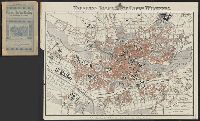
- Published / Created:
- [ca. 1896]
- Call Number:
- 36 N93 1896
- Container / Volume:
- BRBL_00125
- Image Count:
- 1
- Resource Type:
- Maps, Atlases & Globes
- Found in:
- Beinecke Rare Book and Manuscript Library > Neuester Plan der k[öniglichen] bayr[ischen] Stadt Nürnberg.
- Published / Created:
- 1797
- Call Number:
- 3213 1797
- Container / Volume:
- BRBL_00055
- Image Count:
- 1
- Resource Type:
- Maps, Atlases & Globes
- Found in:
- Beinecke Rare Book and Manuscript Library > A map of Kent.
- Creator:
- Jefferys, Thomas, d. 1771
- Call Number:
- 1977 Folio 96
- Collection Title:
- The West-India atlas: or, A compendious description of the West-Indies: illustrated with forty
- Image Count:
- 1
- Resource Type:
- Maps, Atlases & Globes
- Found in:
- Beinecke Rare Book and Manuscript Library > The harbour of Bluefields.
- Call Number:
- 1972 Folio 31
- Collection Title:
- El teniente general D. Jose Manuel de Goyeneche, primer conde de Guaqui; apuntes y datos para la
- Image Count:
- 1
- Resource Type:
- Maps, Atlases & Globes
- Found in:
- Beinecke Rare Book and Manuscript Library > Region del lago Titicaca. Mapa mandado levantar por el General Goyeneche. (Del Archivo del Condo de Guaqui.)
- Published / Created:
- 1720
- Call Number:
- C6 033c
- Collection Title:
- The natural and civil history of the French dominions in North and South America : with an
- Image Count:
- 1
- Resource Type:
- Maps, Atlases & Globes
- Found in:
- Beinecke Rare Book and Manuscript Library > Plan of New Orleans the capital of Louisiana; with the disposition of its quarters and canals as they have been traced by Mr. de la Tour in the year 1720
- Creator:
- Jefferys, Thomas, d. 1771
- Call Number:
- C6 033c
- Collection Title:
- The natural and civil history of the French dominions in North and South America : with an
- Image Count:
- 1
- Resource Type:
- Maps, Atlases & Globes
- Found in:
- Beinecke Rare Book and Manuscript Library > The island of Hispaniola called by the French St. Domingo. Subject to France and Spain. from the best authorities by Thomas Jeffreys, geographer to his Royal Highness the Prince of Wales
- Creator:
- Jefferys, Thomas, d. 1771
- Call Number:
- C6 033c
- Collection Title:
- The natural and civil history of the French dominions in North and South America : with an
- Image Count:
- 1
- Resource Type:
- Maps, Atlases & Globes
- Found in:
- Beinecke Rare Book and Manuscript Library > An authentic plan of the town and harbour of Cap Francois in the isle of St. Domingo. By Thomas Jefferys geographer to his Royal Highness the Prince of Wales
- Creator:
- Bennett, John
Sayer, Robert, 1725-1794
- Call Number:
- 1977 Folio 78
- Collection Title:
- A New and accurate chart of the West-India Islands and coast, with the gulf passage through the New
- Image Count:
- 1
- Resource Type:
- Maps, Atlases & Globes
- Found in:
- Beinecke Rare Book and Manuscript Library > A new general chart of the West Indies from the latest marine journals and surveys. Regulated and ascertained by astronomical observations
- Call Number:
- 1977 Folio 78
- Collection Title:
- A New and accurate chart of the West-India Islands and coast, with the gulf passage through the New
- Image Count:
- 1
- Resource Type:
- Maps, Atlases & Globes
- Found in:
- Beinecke Rare Book and Manuscript Library > A plan of Fort St. Louis harbour on the south side of Hispaniola, pl. 31.
- Published / Created:
- 1704
- Call Number:
- 1973 Folio 70
- Collection Title:
- A new sett of maps, both of antient and present geography ... Together with a Geographical treatise
- Image Count:
- 1
- Resource Type:
- Maps, Atlases & Globes
- Found in:
- Beinecke Rare Book and Manuscript Library > A New Map of North America Shewing its Principal Divisions, Chief Cities, Townes, Rivers, Mountains &c. Dedicated to His Highness William Duke of Glocester
- Published / Created:
- 1704
- Call Number:
- 1973 Folio 70
- Collection Title:
- A new sett of maps, both of antient and present geography ... Together with a Geographical treatise
- Image Count:
- 1
- Resource Type:
- Maps, Atlases & Globes
- Found in:
- Beinecke Rare Book and Manuscript Library > A New Map of South America; Shewing its General Divisions, Chief Cities, Towns; Rivers, Mountains &c. Dedicated to His Highness William Duke of Gloucester
- Published / Created:
- 1704
- Call Number:
- 1973 Folio 70
- Collection Title:
- A new sett of maps, both of antient and present geography ... Together with a Geographical treatise
- Image Count:
- 1
- Resource Type:
- Maps, Atlases & Globes
- Found in:
- Beinecke Rare Book and Manuscript Library > A New Map of the Most Considerable Plantations of the English in America. Dedicated to His Highness William Duke of Glocester
- Published / Created:
- 1704
- Call Number:
- Cxb e678ge
- Collection Title:
- The history of the bucaniers of America : from the first original down to this time; written in
- Image Count:
- 1
- Resource Type:
- Maps, Atlases & Globes
- Found in:
- Beinecke Rare Book and Manuscript Library > A Map of the Countrey and Citty of Panama. Part 3: Chap: 5.
- Creator:
- Buache, Philippe, 1700-1773
- Published / Created:
- 1756
- Call Number:
- Efd 726S
- Collection Title:
- A new voyage to Guinea: describing the customs, manners, soil, climate, habits, buildings
- Image Count:
- 1
- Resource Type:
- Maps, Atlases & Globes
- Found in:
- Beinecke Rare Book and Manuscript Library > A General Map of Senegal, Corrected and Improved with several particulars by Mr. Adanson, correspondent of the Royal Academy of Sciences. Drawn and executed by Philip Buache, 1756
- Creator:
- Law, John, 1671-1729
Marperger, Paul Jacob, 1656-1730.
- Published / Created:
- 1721
- Call Number:
- Zc20 721La
- Collection Title:
- Historische en geographische beschryving von Louisiana, gelegen in Noord America, aan de mond van
- Image Count:
- 1
- Resource Type:
- Maps, Atlases & Globes
- Found in:
- Beinecke Rare Book and Manuscript Library > Louisiana by de Rivier Missisippi.
- Call Number:
- 1973 +32
- Collection Title:
- La galerie agreable du monde, où l'on voit en un grand nombre de cartes tres-exactes et de belles
- Image Count:
- 1
- Resource Type:
- Maps, Atlases & Globes
- Found in:
- Beinecke Rare Book and Manuscript Library > Cour et Pompe Royale du Grand Mogol, pl. 29
- Call Number:
- 1973 +32
- Collection Title:
- La galerie agreable du monde, où l'on voit en un grand nombre de cartes tres-exactes et de belles
- Image Count:
- 1
- Resource Type:
- Maps, Atlases & Globes
- Found in:
- Beinecke Rare Book and Manuscript Library > Celebration de jour de naissance du Grand Mogol, etc., pl. 30.
- Call Number:
- 1973 +32
- Collection Title:
- La galerie agreable du monde, où l'on voit en un grand nombre de cartes tres-exactes et de belles
- Image Count:
- 1
- Resource Type:
- Maps, Atlases & Globes
- Found in:
- Beinecke Rare Book and Manuscript Library > Chatiment des gens de la cour disgraciez de
- Call Number:
- 1973 +32
- Collection Title:
- La galerie agreable du monde, où l'on voit en un grand nombre de cartes tres-exactes et de belles
- Image Count:
- 1
- Resource Type:
- Maps, Atlases & Globes
- Found in:
- Beinecke Rare Book and Manuscript Library > Cabinet du jardin de Grand Mogol, pl. 30a.
- Call Number:
- 1973 +32
- Collection Title:
- La galerie agreable du monde, où l'on voit en un grand nombre de cartes tres-exactes et de belles
- Image Count:
- 1
- Resource Type:
- Maps, Atlases & Globes
- Found in:
- Beinecke Rare Book and Manuscript Library > Cavalier du grand Mogol en pompeux equipage, pl. 32.
- Call Number:
- 1973 +32
- Collection Title:
- La galerie agreable du monde, où l'on voit en un grand nombre de cartes tres-exactes et de belles
- Image Count:
- 1
- Resource Type:
- Maps, Atlases & Globes
- Found in:
- Beinecke Rare Book and Manuscript Library > Mine de Diamans, aux Indes Orientales
- Call Number:
- 1977 +246
- Collection Title:
- Geografia; cioè, Descrittione vniversale della terra. Partita in due volumi, nel primo de' quali si
- Image Count:
- 1
- Resource Type:
- Maps, Atlases & Globes
- Found in:
- Beinecke Rare Book and Manuscript Library > Descrittione di tvtto'l mondo, secondo la prattica de Marinari. Vniversi orbis descriptio ad vsvm navigantivm
- Call Number:
- 1985 +31
- Collection Title:
- L'isole piu famose del mondo / descritte da Thomaso Porcacchi da Castiglione Arretino e intagliate
- Image Count:
- 1
- Resource Type:
- Maps, Atlases & Globes
- Found in:
- Beinecke Rare Book and Manuscript Library > Descrittione dell'isola Spagnuola prima iso la scoperta dal Colombo
- Call Number:
- 1985 +31
- Collection Title:
- L'isole piu famose del mondo / descritte da Thomaso Porcacchi da Castiglione Arretino e intagliate
- Image Count:
- 1
- Resource Type:
- Maps, Atlases & Globes
- Found in:
- Beinecke Rare Book and Manuscript Library > Descrittione dell'isola Cuba, che dal Colombo fu scoperta insieme con la Spagnuloa
- Call Number:
- 1974 +188
- Collection Title:
- L'isole piv famose del mondo descritte da Thomaso Porcacchi da Castiglione Arretino e intagliate da
- Image Count:
- 1
- Resource Type:
- Maps, Atlases & Globes
- Found in:
- Beinecke Rare Book and Manuscript Library > Descrittione dell' isola Spagnuola
- Call Number:
- 1974 +188
- Collection Title:
- L'isole piv famose del mondo descritte da Thomaso Porcacchi da Castiglione Arretino e intagliate da
- Image Count:
- 1
- Resource Type:
- Maps, Atlases & Globes
- Found in:
- Beinecke Rare Book and Manuscript Library > Descrittione dell' isola Cuba
- Call Number:
- 1976 +310
- Collection Title:
- L'isole piv famose del mondo descritte da Thomaso Porcacchi da Castiglione Arretino e intagliate da
- Image Count:
- 1
- Resource Type:
- Maps, Atlases & Globes
- Found in:
- Beinecke Rare Book and Manuscript Library > Descrittione dell'isola Spagnuola
- Call Number:
- 1976 +310
- Collection Title:
- L'isole piv famose del mondo descritte da Thomaso Porcacchi da Castiglione Arretino e intagliate da
- Image Count:
- 1
- Resource Type:
- Maps, Atlases & Globes
- Found in:
- Beinecke Rare Book and Manuscript Library > Descrittione dell'isola Cuba
- Call Number:
- Gfp94 +Gi597
- Collection Title:
- Geografia; cioè, Descrittione vniversale della terra. Partita in due volumi, nel primo de' quali si
- Image Count:
- 1
- Resource Type:
- Maps, Atlases & Globes
- Found in:
- Beinecke Rare Book and Manuscript Library > [Geographia. Italian]
- Call Number:
- 1977 +379
- Collection Title:
- Geografia; cioè, Descrittione vniversale della terra. Partita in due volumi, nel primo de' quali si
- Image Count:
- 1
- Resource Type:
- Maps, Atlases & Globes
- Found in:
- Beinecke Rare Book and Manuscript Library > [Geographia. Italian]
- Call Number:
- 1975 +1
- Collection Title:
- L'isole piv famose del mondo descritte da Thomaso Porcacchi da Castiglione Arretino e intagliate da
- Image Count:
- 1
- Resource Type:
- Maps, Atlases & Globes
- Found in:
- Beinecke Rare Book and Manuscript Library > Descrittione dell'isola Spagnuola
- Call Number:
- 1975 +1
- Collection Title:
- L'isole piv famose del mondo descritte da Thomaso Porcacchi da Castiglione Arretino e intagliate da
- Image Count:
- 1
- Resource Type:
- Maps, Atlases & Globes
- Found in:
- Beinecke Rare Book and Manuscript Library > Descrittione dell' isola Cuba
- Call Number:
- 1977 +435
- Collection Title:
- Geografia; cioè, Descrittione vniversale della terra. Partita in due volumi, nel primo de' quali si
- Image Count:
- 1
- Resource Type:
- Maps, Atlases & Globes
- Found in:
- Beinecke Rare Book and Manuscript Library > [Geographia. Italian]
- Call Number:
- 1977 +435
- Collection Title:
- Geografia; cioè, Descrittione vniversale della terra. Partita in due volumi, nel primo de' quali si
- Image Count:
- 1
- Resource Type:
- Maps, Atlases & Globes
- Found in:
- Beinecke Rare Book and Manuscript Library > [Geographia. Italian]
- Call Number:
- 1977 +250
- Collection Title:
- Geografia; cioe, Descrittione vniversale della terra. Partita in due volumi, nel primo de’ quali si
- Image Count:
- 1
- Resource Type:
- Maps, Atlases & Globes
- Found in:
- Beinecke Rare Book and Manuscript Library > Descrittione dell'America, odell'India Occidentale. America
- Call Number:
- 1977 +250
- Collection Title:
- Geografia; cioe, Descrittione vniversale della terra. Partita in due volumi, nel primo de’ quali si
- Image Count:
- 1
- Resource Type:
- Maps, Atlases & Globes
- Found in:
- Beinecke Rare Book and Manuscript Library > Descrittione di tvtto'l mondo, secondo la prattica de Marinari. Vniversi orbis descriptio ad vsvm navigantivm
- Call Number:
- 1977 1341
- Collection Title:
- Geographiae vniversae opvs habentur Cl. Ptolemaei ... Geographicae enarationis libri octo [tr. by W
- Image Count:
- 1
- Resource Type:
- Maps, Atlases & Globes
- Found in:
- Beinecke Rare Book and Manuscript Library > Vniversi orbis descriptio ad vsvm navigantivm
- Call Number:
- Gfp94 gf525j
- Collection Title:
- Geographiae vniversae ... opvs ... habentur Cl. Ptolemaei ... Geographicae enarrationis libri octo
- Image Count:
- 1
- Resource Type:
- Maps, Atlases & Globes
- Found in:
- Beinecke Rare Book and Manuscript Library > Vniversi orbis descriptop as vsvm navigantivm
- Call Number:
- 1977 +392
- Collection Title:
- A survey of the cities of London and Westminster : containing the original, antiquity, increase
- Image Count:
- 1
- Resource Type:
- Maps, Atlases & Globes
- Found in:
- Beinecke Rare Book and Manuscript Library > Portsoken ward being part of the parish of St. Buttolphs Aldgate, taken from the last survey, with corrections and additions
- Call Number:
- 1977 +392
- Collection Title:
- A survey of the cities of London and Westminster : containing the original, antiquity, increase
- Image Count:
- 1
- Resource Type:
- Maps, Atlases & Globes
- Found in:
- Beinecke Rare Book and Manuscript Library > The Custom House
- Call Number:
- 1977 +392
- Collection Title:
- A survey of the cities of London and Westminster : containing the original, antiquity, increase
- Image Count:
- 1
- Resource Type:
- Maps, Atlases & Globes
- Found in:
- Beinecke Rare Book and Manuscript Library > Aldgate Ward with its division into parishes. Taken from the last survey, with corrections & additions
- Call Number:
- 1977 +392
- Collection Title:
- A survey of the cities of London and Westminster : containing the original, antiquity, increase
- Image Count:
- 1
- Resource Type:
- Maps, Atlases & Globes
- Found in:
- Beinecke Rare Book and Manuscript Library > Part of Aldgate Ward
- Call Number:
- 1977 +392
- Collection Title:
- A survey of the cities of London and Westminster : containing the original, antiquity, increase
- Image Count:
- 1
- Resource Type:
- Maps, Atlases & Globes
- Found in:
- Beinecke Rare Book and Manuscript Library > Bishop Gate Street Ward taken from the last survey and corrected
- Call Number:
- 1977 +392
- Collection Title:
- A survey of the cities of London and Westminster : containing the original, antiquity, increase
- Image Count:
- 1
- Resource Type:
- Maps, Atlases & Globes
- Found in:
- Beinecke Rare Book and Manuscript Library > Cornhill Ward with its division into parishes, taken from the last survey &c
- Call Number:
- 1977 +392
- Collection Title:
- A survey of the cities of London and Westminster : containing the original, antiquity, increase
- Image Count:
- 1
- Resource Type:
- Maps, Atlases & Globes
- Found in:
- Beinecke Rare Book and Manuscript Library > Candlewick Ward with its division into parishes. Corrected from the last survey
- Call Number:
- 1977 +392
- Collection Title:
- A survey of the cities of London and Westminster : containing the original, antiquity, increase
- Image Count:
- 1
- Resource Type:
- Maps, Atlases & Globes
- Found in:
- Beinecke Rare Book and Manuscript Library > Walbrook Ward and Dow Gate Ward with its division into parishes taken from the last surveys
- Call Number:
- 1977 +392
- Collection Title:
- A survey of the cities of London and Westminster : containing the original, antiquity, increase
- Image Count:
- 1
- Resource Type:
- Maps, Atlases & Globes
- Found in:
- Beinecke Rare Book and Manuscript Library > Queen Hith Ward and Vintry Ward with their division into parishes taken from the last surveys
- Call Number:
- 1977 +392
- Collection Title:
- A survey of the cities of London and Westminster : containing the original, antiquity, increase
- Image Count:
- 1
- Resource Type:
- Maps, Atlases & Globes
- Found in:
- Beinecke Rare Book and Manuscript Library > Bread Street Ward and Cordwainer Ward with it's division into parishes taken from the last survey
- Call Number:
- 1977 +392
- Collection Title:
- A survey of the cities of London and Westminster : containing the original, antiquity, increase
- Image Count:
- 1
- Resource Type:
- Maps, Atlases & Globes
- Found in:
- Beinecke Rare Book and Manuscript Library > Cheape Ward with its division into parishes, taken from the last survey, with corrections and additions
- Call Number:
- 1977 +392
- Collection Title:
- A survey of the cities of London and Westminster : containing the original, antiquity, increase
- Image Count:
- 1
- Resource Type:
- Maps, Atlases & Globes
- Found in:
- Beinecke Rare Book and Manuscript Library > Coleman Street Ward and Bashishaw Ward taken from the last survey, with corrections and additions
- Call Number:
- 1977 +392
- Collection Title:
- A survey of the cities of London and Westminster : containing the original, antiquity, increase
- Image Count:
- 1
- Resource Type:
- Maps, Atlases & Globes
- Found in:
- Beinecke Rare Book and Manuscript Library > The Wards of Farington within and Baynards Castle with its divisions into parishes taken from the last survey with corrections
- Call Number:
- 1977 +392
- Collection Title:
- A survey of the cities of London and Westminster : containing the original, antiquity, increase
- Image Count:
- 1
- Resource Type:
- Maps, Atlases & Globes
- Found in:
- Beinecke Rare Book and Manuscript Library > Farington Ward without, with its divisions into parishes, taken from the last survey with corrections & amendments
- Call Number:
- 1977 +392
- Collection Title:
- A survey of the cities of London and Westminster : containing the original, antiquity, increase
- Image Count:
- 1
- Resource Type:
- Maps, Atlases & Globes
- Found in:
- Beinecke Rare Book and Manuscript Library > St. Olave and St. Mary Magdalen Bermondsey Southwark, taken from the last survey with corrections
- Call Number:
- 1977 +392
- Collection Title:
- A survey of the cities of London and Westminster : containing the original, antiquity, increase
- Image Count:
- 1
- Resource Type:
- Maps, Atlases & Globes
- Found in:
- Beinecke Rare Book and Manuscript Library > A mapp of the parishes of St. Saviours Southwark and St. Georges taken from the last survey with corrections
- Call Number:
- 1977 +392
- Collection Title:
- A survey of the cities of London and Westminster : containing the original, antiquity, increase
- Image Count:
- 1
- Resource Type:
- Maps, Atlases & Globes
- Found in:
- Beinecke Rare Book and Manuscript Library > A map of the parish if St. Katherines by the Tower
- Call Number:
- 1977 +392
- Collection Title:
- A survey of the cities of London and Westminster : containing the original, antiquity, increase
- Image Count:
- 1
- Resource Type:
- Maps, Atlases & Globes
- Found in:
- Beinecke Rare Book and Manuscript Library > The parish of St. Johns Wapping
- Call Number:
- 1977 +392
- Collection Title:
- A survey of the cities of London and Westminster : containing the original, antiquity, increase
- Image Count:
- 1
- Resource Type:
- Maps, Atlases & Globes
- Found in:
- Beinecke Rare Book and Manuscript Library > A map of the parish of St. Dustans Stepney and Stebunheath divided into hamlets
- Call Number:
- 1977 +392
- Collection Title:
- A survey of the cities of London and Westminster : containing the original, antiquity, increase
- Image Count:
- 1
- Resource Type:
- Maps, Atlases & Globes
- Found in:
- Beinecke Rare Book and Manuscript Library > Shoreditch, Norton Folgate, and Crepple Gate without, taken from the last survey with corrections
- Call Number:
- 1977 +392
- Collection Title:
- A survey of the cities of London and Westminster : containing the original, antiquity, increase
- Image Count:
- 1
- Resource Type:
- Maps, Atlases & Globes
- Found in:
- Beinecke Rare Book and Manuscript Library > Cow Cross being St. Sepulcher's parish without and the Charter House taken from the last survey with corrections
- Call Number:
- 1977 +392
- Collection Title:
- A survey of the cities of London and Westminster : containing the original, antiquity, increase
- Image Count:
- 1
- Resource Type:
- Maps, Atlases & Globes
- Found in:
- Beinecke Rare Book and Manuscript Library > The Prospect of Grays Inn
- Call Number:
- 1977 +392
- Collection Title:
- A survey of the cities of London and Westminster : containing the original, antiquity, increase
- Image Count:
- 1
- Resource Type:
- Maps, Atlases & Globes
- Found in:
- Beinecke Rare Book and Manuscript Library > The Prospect of Lincoln's Inn
- Call Number:
- 1977 +392
- Collection Title:
- A survey of the cities of London and Westminster : containing the original, antiquity, increase
- Image Count:
- 1
- Resource Type:
- Maps, Atlases & Globes
- Found in:
- Beinecke Rare Book and Manuscript Library > Somerset House
- Call Number:
- 1977 +392
- Collection Title:
- A survey of the cities of London and Westminster : containing the original, antiquity, increase
- Image Count:
- 1
- Resource Type:
- Maps, Atlases & Globes
- Found in:
- Beinecke Rare Book and Manuscript Library > A mapp of the parishes of St. Clements Danes, St. Mary Savoy; with the Rolls Liberty and Lincolns Inn, taken from the last survey with corrections and additions
- Call Number:
- Zc56 859so
- Collection Title:
- Charter and by-laws of the Sopori Land and Mining Company, incorporated by the state of Rhode
- Image Count:
- 1
- Resource Type:
- Maps, Atlases & Globes
- Found in:
- Beinecke Rare Book and Manuscript Library > Map of Arizona or the Gadsen Purchase with the position of its silver mines as now worked 1859
- Call Number:
- 1977 +392
- Collection Title:
- A survey of the cities of London and Westminster : containing the original, antiquity, increase
- Image Count:
- 2
- Resource Type:
- Maps, Atlases & Globes
- Found in:
- Beinecke Rare Book and Manuscript Library > The parish of St. James Clerkenwell taken from [the] last survey with corrections
- Creator:
- Bromley, Walter
- Call Number:
- 1979 Folio 55
- Collection Title:
- Atlas of the city of New York, Manhattan Island. From actual surveys and official plans, by George
- Image Count:
- 1
- Resource Type:
- Maps, Atlases & Globes
- Found in:
- Beinecke Rare Book and Manuscript Library > Part of sections 34 & 5, part of wards 19, 20, 21, & 22, plate 20
- Creator:
- Bromley, Walter
- Call Number:
- 1979 Folio 55
- Collection Title:
- Atlas of the city of New York, Manhattan Island. From actual surveys and official plans, by George
- Image Count:
- 1
- Resource Type:
- Maps, Atlases & Globes
- Found in:
- Beinecke Rare Book and Manuscript Library > Part of ward 19 New York City part of section 5, plate 22
- Creator:
- Chantry, John
- Call Number:
- Ee +633gb
- Collection Title:
- The voyages and travells of the ambassadors sent by Frederick, duke of Holstein, to the great Duke
- Image Count:
- 1
- Resource Type:
- Maps, Atlases & Globes
- Found in:
- Beinecke Rare Book and Manuscript Library > The course of the great River Wolga
- Creator:
- Nolin, Jean Baptiste, 1648-1708
- Published / Created:
- 1691
- Call Number:
- 1984 Folio 3
- Collection Title:
- Atlas nouveau : contenant toutes les parties du monde ou sont exactement remarques les empires
- Image Count:
- 1
- Resource Type:
- Maps, Atlases & Globes
- Found in:
- Beinecke Rare Book and Manuscript Library > Les Etats de Savoye et de Piemont
- Creator:
- Jaillot, Alexis Hubert, 1632?-1712
- Published / Created:
- 1692
- Call Number:
- 1984 Folio 3
- Collection Title:
- Atlas nouveau : contenant toutes les parties du monde ou sont exactement remarques les empires
- Image Count:
- 1
- Resource Type:
- Maps, Atlases & Globes
- Found in:
- Beinecke Rare Book and Manuscript Library > Comte de Namur dresse sur les memoirs les plus nouveaux presente a sa Majeste pour le service de ses troupes par le service de ses troupes par le service de ses troupes ...
- Creator:
- Sanson, Nicolas, 1600-1667
- Call Number:
- 1973 Folio 17
- Collection Title:
- Atlas francois, contenant les cartes geographiques dans les quelles sont tres exactement remarquez
- Image Count:
- 1
- Resource Type:
- Maps, Atlases & Globes
- Found in:
- Beinecke Rare Book and Manuscript Library > Atlas francois ...
- Creator:
- Sanson, Nicolas, 1600-1667
- Call Number:
- 1973 Folio 17
- Collection Title:
- Atlas francois, contenant les cartes geographiques dans les quelles sont tres exactement remarquez
- Image Count:
- 1
- Resource Type:
- Maps, Atlases & Globes
- Found in:
- Beinecke Rare Book and Manuscript Library > La Generalite de Paris divisee ens ses eslections
- Call Number:
- 1977 Folio 78
- Collection Title:
- A New and accurate chart of the West-India Islands and coast, with the gulf passage through the New
- Image Count:
- 1
- Resource Type:
- Maps, Atlases & Globes
- Found in:
- Beinecke Rare Book and Manuscript Library > A plan of the road of Port Paix in the island of Hispaniola, pl. 35.
- Call Number:
- 1977 Folio 78
- Collection Title:
- A New and accurate chart of the West-India Islands and coast, with the gulf passage through the New
- Image Count:
- 1
- Resource Type:
- Maps, Atlases & Globes
- Found in:
- Beinecke Rare Book and Manuscript Library > A plan of Monte-Christe Bay with the Seven Brothers on the north coast of St. Domingo, pl. 38
- Creator:
- Fee, Chas E
- Published / Created:
- c1891
- Call Number:
- Zc86 893scd
- Collection Title:
- Appletons' guide-book to Alaska and the northwest coast ...
- Image Count:
- 1
- Resource Type:
- Maps, Atlases & Globes
- Found in:
- Beinecke Rare Book and Manuscript Library > The route of the Alaska excursion steamers
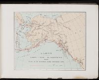
- Creator:
- Fee, Chas E
- Published / Created:
- c1891
- Call Number:
- Zc86 893sc
- Collection Title:
- The guide-book to Alaska and the northwest coast, including the shores of Washington, British
- Image Count:
- 1
- Resource Type:
- Maps, Atlases & Globes
- Found in:
- Beinecke Rare Book and Manuscript Library > [Map of Alaska]
- Call Number:
- Zc86 893sc
- Collection Title:
- The guide-book to Alaska and the northwest coast, including the shores of Washington, British
- Image Count:
- 1
- Resource Type:
- Maps, Atlases & Globes
- Found in:
- Beinecke Rare Book and Manuscript Library > Chilkat and Chilkoot Bays
- Creator:
- Harriman, Edward Henry, 1848-1909
- Call Number:
- ZZc86 899ha
- Collection Title:
- A souvenir of the Harriman Alaska Expedition : May-August, 1899 [graphic]
- Image Count:
- 1
- Resource Type:
- Maps, Atlases & Globes
- Found in:
- Beinecke Rare Book and Manuscript Library > Alaska with parts of Siberia Canada and Washington showing the route of the Harriman Alaska Expedition 1899
- Call Number:
- Zc86 915yo
- Collection Title:
- Alaska days with John Muir / by S. Hall Young
- Image Count:
- 1
- Resource Type:
- Maps, Atlases & Globes
- Found in:
- Beinecke Rare Book and Manuscript Library > Voyages of Muir and Young 1879 and 1880 in southeastern Alaska
- Call Number:
- 1973 +32
- Collection Title:
- La galerie agreable du monde, où l'on voit en un grand nombre de cartes tres-exactes et de belles
- Image Count:
- 1
- Resource Type:
- Maps, Atlases & Globes
- Found in:
- Beinecke Rare Book and Manuscript Library > La cour du grand Mogol a Lahor, pl. 28
- Published / Created:
- 1739
- Call Number:
- 1975 2757
- Collection Title:
- El atlas abreviado, ò, El nuevo compendio de la geografia universal, politica, historica, i curiosa
- Image Count:
- 1
- Resource Type:
- Maps, Atlases & Globes
- Found in:
- Beinecke Rare Book and Manuscript Library > [Map of] Mogol
- Published / Created:
- 1780
- Call Number:
- 1973 +100
- Collection Title:
- A Bengal atlas, containing maps of the theatre of war and commerce on that side of Hindoostan
- Image Count:
- 1
- Resource Type:
- Maps, Atlases & Globes
- Found in:
- Beinecke Rare Book and Manuscript Library > The Northern provinces of Bengal; with the Bootan, Morung, and Assam frontiers: inscribed to Hugh Inglis Esq by his affectionate friend J. Rennell
- Call Number:
- 1972 515
- Collection Title:
- Premier voyage autour du monde / par le Chevr. Pigafetta, sur l'escadre de Magellan, pendant les
- Image Count:
- 1
- Resource Type:
- Maps, Atlases & Globes
- Found in:
- Beinecke Rare Book and Manuscript Library > Voyage de Pigafetta
- Call Number:
- Zc50 +601hec
- Collection Title:
- Historia general de los hechos de los castellanos en las islas i tierra firme del mar oceano
- Image Count:
- 1
- Resource Type:
- Maps, Atlases & Globes
- Found in:
- Beinecke Rare Book and Manuscript Library > Descripcion de la l'audiencia de Panama
- Call Number:
- Zc50 +601hec
- Collection Title:
- Historia general de los hechos de los castellanos en las islas i tierra firme del mar oceano
- Image Count:
- 1
- Resource Type:
- Maps, Atlases & Globes
- Found in:
- Beinecke Rare Book and Manuscript Library > Descripcion de la l'audiencia del Nuevo Reino