Also appeared in Faden's [General atlas. London : William Faden, 1811?]., No. 10 of 43 maps bound together in composite atlas., Relief shown pictorially., and Scale [1: 510,000].
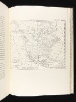
The discovery, settlement, and present state of Kentucky: and an essay towards the topography and
Image Count:
1
Description:
Engrav'd for S. Campbell's Edition of Imlay's Description of Kentucky., Preceding title page., and Teaching resource: Professor John Mack Faragher, History 141: The American West.
Subject (Geographic):
Kentucky --Maps --Early works to 1800 and Ohio River Valley
Chandos, James Brydges, Duke of, 1674-1744 Mayo, William., creator Senex, John, d. 1740
Published / Created:
1722
Call Number:
2003 Folio 85
Image Count:
1
Alternative Title:
New and exact map of the island of Barbadoes in America
Description:
BEIN 2003 Folio 85: No. 39 of 45 maps bound together with binder's spine title: Atlas of America; ms. table of contents. Bookplate: Robinson. Bookplate of Paul Mellon., by William Mayo., Cartouche with dedication to: The most high, puissant & noble prince, Iames Bruges, Duke of Chandos., Cartouche, Explanation, includes Contents of the parishes., Engraved by Iohn Senex, 1722., Hand colored., Insets: A plan of the Bridge town; A prospect of Codrington College &c., Relief shown pictorially., and Scale [ca. 1:33,000].
Map of the world showing routes of Cook's expeditions, with notes on ice, wild life etc. seen. Relief shown pictorially; imaginary coastline for eastern coast of Australian Bight., No. 1 of 43 maps bound together in composite atlas., and Scale [ca.1:68 000 000].
Publisher:
Published by Wm. Faden, Geographer to the King, Charing Cross
Subject (Name):
Cook, James, 1728-1779 and Mulgrave, Constantine John Phipps, Lord
Subject (Topic):
Discoveries in geography --Maps --To 1800 and World maps --Early works to 1800
Bar scales given in "great French leagues," "common French leagues," and "British miles"., Prime meridian: Paris., Relief shown pictorially., Sheet measures 55.6 x 73.6 cm. No. 16 of 34 maps bound together., and Watermark.
Publisher:
Printed for Robert Sayer,
Subject (Geographic):
France--Administrative and political divisions--Maps--Early works to 1800 and France--Maps--Early works to 1800
BEIN 2003 Folio 85: No. 31 of 45 maps bound together with binder's spine title: Atlas of America; ms. table of contents. Bookplate: Robinson. Bookplate of Paul Mellon., Hand colored., Includes inset A general plan of Port Royal, in which the different states of the town are accurately laid down, ca. 1:3,200., Relief shown pictorially. Soundings shown in fathoms., Scale [ca. 1:420,000]., and the greatest part drawn or corrected from actual surveys made by Mr. Sheffield and others.
Publisher:
Printed for John Bowles ... and Carington Bowles
Subject (Geographic):
Jamaica -- Maps -- Early works to 1800 and Port Royal (Jamaica) -- Maps -- Early works to 1800
BEIN 2003 Folio 85: No. 14 of 45 maps bound together with binder's spine title: Atlas of America; ms. table of contents. Bookplate: Robinson. Bookplate of Paul Mellon., Hand colored., Includes table of sources of observations., Relief shown pictorially. Depths shown by soundings., Scale [ca. 1:2,600,000]., Scale ca. 1:1,900,000;English marine leagues 20 to a degree; English miles 69 1/2 to a degree., and Shows Maritime Provinces, New England, and St. Lawrence Valley region to Montreal.
Publisher:
Thos. Jefferys
Subject (Geographic):
Canada -- Maps -- Early works to 1800, Maritime Provinces -- Maps -- Early works to 1800, New England -- Maps -- Early works to 1800, Nova Scotia -- Maps -- Early works to 1800, and Saint Lawrence River Valley -- Maps -- Early works to 1800