Search
You Searched For
Search Results
- Creator:
- Great Britain. Army. 44th Regiment
Smith, Robert, fl. 1814
- Published / Created:
- [1814]
- Call Number:
- GEN MSS FILE 366 (Brsides)
- Image Count:
- 1
- Found in:
- Beinecke Rare Book and Manuscript Library > Sketch of the march of the British army under M. Genl. Ross from the 19th to the 29th Augt 1814
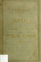
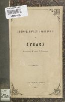
- Creator:
- Zamyslovskīĭ, E. (Egor), 1841-1896
- Published / Created:
- 1887.
- Call Number:
- G2111 S1 Z35 (LC)
- Image Count:
- 278
- Found in:
- Sterling Memorial Library > Obʹʹiasnenīi︠a︡ k uchebnomu atlasu po russkoĭ istorīi
- Creator:
- Middendorff, Alexander Theodor von, 1815-1894
- Published / Created:
- 1848-1875.
- Call Number:
- S26 0100
- Container / Volume:
- 3
- Image Count:
- 676
- Found in:
- Sterling Memorial Library > Reise in den aussersten Norden und Osten Sibiriens wahrend der Jahre 1843 und 1844 mit allerhochster Genehmigung auf Veranstaltung der Kaiserlichen Akademie der Wissenschaften zu St. Petersburg ausgefuhrt und in Verbindung mit vielen Gelehrten herausgegeben von A. Th. v. Middendorff
- Call Number:
- OSB MSS 155
- Container / Volume:
- Box
- Image Count:
- 30
- Found in:
- Beinecke Rare Book and Manuscript Library > Documents concerning ship captains and shipping, 1762-circa 1809
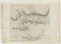
- Creator:
- Blaskowitz, Charles
- Published / Created:
- 1777.
- Call Number:
- 777.09.01.05++
- Image Count:
- 1
- Found in:
- Lewis Walpole Library > A plan of the town of Newport in Rhode Island
- Published / Created:
- 1784]
- Call Number:
- 784.00.00.78+
- Image Count:
- 1
- Found in:
- Lewis Walpole Library > A Representation, of the sea fight, on the 5th of Sepr. 1781, between Rear Admiral Graves and the Count de Grasse
- Creator:
- Blaskowitz, Charles
- Published / Created:
- 1777.
- Call Number:
- Drawer 777.07.22.01+
- Image Count:
- 1
- Found in:
- Lewis Walpole Library > A topographical chart of the bay of Narraganset in the province of New England : with all the isles contained therein, among which Rhode Island and Connonicut have been particularly surveyed, shewing the true position & bearings of the banks, shoals, rocks &c. as likewise the soundings: To which have been added the several works & batteries raised by the Americans. Taken by order of the principal farmers on Rhode Island
- Published / Created:
- [not before 1773]
- Call Number:
- LWL Mss Vol. 198 Rolled
- Image Count:
- 1
- Resource Type:
- unspecified
- Found in:
- Lewis Walpole Library > Map of Farmington including the lots and names of owners, 1645-1773
- Creator:
- Tebenʹkov, Mikhail Dmitrievich, -1872
- Published / Created:
- 1852.
- Call Number:
- Ega 852Ta
- Image Count:
- 190
- Found in:
- Sterling Memorial Library > Atlas si︠e︡verozapadnykh beregov Ameriki ot Beringova proliva do mysa Korrientes i ostrovov Aleutskikh s prisovokupleniem ni︠e︡kotorykh mi︠e︡st si︠e︡verovostochnago berega Azii. Sostavil kapitan 1-go ranga Tebi︠e︡nʹkov
- Creator:
- Middendorff, Alexander Theodor von, 1815-1894
- Published / Created:
- 1848-1875.
- Call Number:
- S26 0100
- Container / Volume:
- 2
- Image Count:
- 912
- Found in:
- Sterling Memorial Library > Reise in den aussersten Norden und Osten Sibiriens wahrend der Jahre 1843 und 1844 mit allerhochster Genehmigung auf Veranstaltung der Kaiserlichen Akademie der Wissenschaften zu St. Petersburg ausgefuhrt und in Verbindung mit vielen Gelehrten herausgegeben von A. Th. v. Middendorff
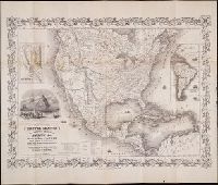
- Creator:
- Atwood, J.M
- Published / Created:
- 1849
- Call Number:
- Zc72 849ro
- Collection Title:
- California and its gold regions; with a geographical and topographical view of the country, its
- Image Count:
- 1
- Found in:
- Beinecke Rare Book and Manuscript Library > Map of the United States The British Provinces Mexico & c. Showing the Routes of the U.S. Mail Steam Packets to California, and a Plan of the Gold Region
- Published / Created:
- 1890-91
- Call Number:
- WA Photos 261
- Collection Title:
- The battle of Wounded Knee
- Image Count:
- 2
- Found in:
- Beinecke Rare Book and Manuscript Library > Diagram of the situation at the battle of Wounded Knee at the time the Indians opened fire
- Published / Created:
- undated
- Call Number:
- WA MSS S-2962
- Collection Title:
- Northern Pacific Railway Company maps and drawings
- Container / Volume:
- Box 1 | Map 11
- Image Count:
- 1
- Resource Type:
- Maps, Atlases & Globes
- Found in:
- Beinecke Rare Book and Manuscript Library > (IDAHO & WASHINGTON) [Anon.] [Untitled map of northwestern Idaho and northeastern Washington].
- Creator:
- Gibboney, J. M
Kendrick, J. W
- Published / Created:
- 1890
- Call Number:
- WA MSS S-2962
- Collection Title:
- Northern Pacific Railway Company maps and drawings
- Container / Volume:
- Box 1 | Map 10
- Image Count:
- 2
- Resource Type:
- Maps, Atlases & Globes
- Found in:
- Beinecke Rare Book and Manuscript Library > (IDAHO) Kendrick, J. W., Surveyor. Map Showing Definite Location of the Spokane & Palouse Ry. (Lewiston Extension). From Julietta to Lewiston Idaho Territory. Distance 24-1/lO Miles. Drawn by J. M. Gibboney. Assistant Engineer's Office, Tacoma, Washington. Scale 1 in.=2000 ft.
- Creator:
- Beckler, Eldridge H
Bischoff, A
- Published / Created:
- 1891 April 6
- Call Number:
- WA MSS S-2962
- Collection Title:
- Northern Pacific Railway Company maps and drawings
- Container / Volume:
- Box 1 | Map 34
- Image Count:
- 1
- Resource Type:
- Maps, Atlases & Globes
- Found in:
- Beinecke Rare Book and Manuscript Library > (MONTANA) Bischoff, A. Map of North- West part of Montana...Great Northern Line St. Paul, Minneapolis & Manitoba Ry. Pacific Extension. Elbridge H. Beckler, Chief Engineer. Helena, Mont. Scale 1 in.= 2 miles.
- Published / Created:
- 1886
- Call Number:
- WA MSS S-2962
- Collection Title:
- Northern Pacific Railway Company maps and drawings
- Container / Volume:
- Box 1 | Map 31
- Image Count:
- 1
- Resource Type:
- Maps, Atlases & Globes
- Found in:
- Beinecke Rare Book and Manuscript Library > (MONTANA) [Anon.] Map of a Portion of Montana Territory.
- Creator:
- Roberts. E.J
- Published / Created:
- 1887 August
- Call Number:
- WA MSS S-2962
- Collection Title:
- Northern Pacific Railway Company maps and drawings
- Container / Volume:
- Box 1 | Map 33
- Image Count:
- 2
- Resource Type:
- Maps, Atlases & Globes
- Found in:
- Beinecke Rare Book and Manuscript Library > (MONTANA) Roberts, E. J. Montana Extension. The Saint Paul, Minneapolis and Manitoba Ry. Co. Scale 12 miles to 1 inch.
- Published / Created:
- 1891 September 10
- Call Number:
- WA MSS S-2962
- Collection Title:
- Northern Pacific Railway Company maps and drawings
- Container / Volume:
- Box 1 | Map 40
- Image Count:
- 1
- Resource Type:
- Maps, Atlases & Globes
- Found in:
- Beinecke Rare Book and Manuscript Library > (WASHINGTON) [Anon.] Sketch of Country North of Spokane Wash. Helena Mont.
- Published / Created:
- undated
- Call Number:
- WA MSS S-2962
- Collection Title:
- Northern Pacific Railway Company maps and drawings
- Container / Volume:
- Box 1 | Map 36
- Image Count:
- 1
- Resource Type:
- Maps, Atlases & Globes
- Found in:
- Beinecke Rare Book and Manuscript Library > (MONTANA) [Anon.] [Untitled map of a part of north central Montana.]
- Published / Created:
- undated
- Call Number:
- WA MSS S-2962
- Collection Title:
- Northern Pacific Railway Company maps and drawings
- Container / Volume:
- 3 (Roll) | Map 24
- Image Count:
- 1
- Resource Type:
- Maps, Atlases & Globes
- Found in:
- Beinecke Rare Book and Manuscript Library > (MONTANA & IDAHO) [Anon.] [Untitled map of far northwestern Montana and a part of the Idaho panhandle.]