Search
You Searched For
Search Results
- Published / Created:
- 1850
- Call Number:
- 1976 Folio 96
- Collection Title:
- A new universal atlas containing maps of the various empires, kingdoms, states and republics of the
- Image Count:
- 1
- Resource Type:
- Maps, Atlases & Globes
- Found in:
- Beinecke Rare Book and Manuscript Library > 10. Map of Connecticut
- Creator:
- Delarochette, L. (Louis), 1731-1802, creator
Faden, William, 1749-1836
Palmer, William, 1750-1836
- Published / Created:
- 1784 March 1
- Call Number:
- 1982 Folio 10
- Image Count:
- 1
- Found in:
- Beinecke Rare Book and Manuscript Library > A chart of the Antilles, or, Charibbee, or, Caribs Islands, with the Virgin Isles
- Creator:
- Delarochette, L. (Louis), 1731-1802
Dicquemare, (Jacques-Francois), M. l'abbe, 1733-1789, creator
Faden, William, 1749-1836
- Published / Created:
- 1780 June 17
- Call Number:
- 1982 Folio 10
- Image Count:
- 1
- Found in:
- Beinecke Rare Book and Manuscript Library > A chart of the British Channel and the Bay of Biscay with a part of the North Sea, and the entrance of St. George's Channel
- Creator:
- Delarochette, L. (Louis), 1731-1802, creator
- Published / Created:
- 1780 June 28
- Call Number:
- 1982 Folio 10
- Image Count:
- 1
- Found in:
- Beinecke Rare Book and Manuscript Library > A chart of the coasts of Spain and Portugal, with the Balearic Islands, and part of the coast of Barbary
- Creator:
- Delarochette, L. (Louis), 1731-1802, creator
- Published / Created:
- 1781 January 1
- Call Number:
- 1982 Folio 10
- Image Count:
- 1
- Found in:
- Beinecke Rare Book and Manuscript Library > A chart of the islands of Jersey and Guernsey, Sark, Herm and Alderney, with the adjacent coast of France
- Creator:
- Moll, Herman, d. 1732
- Published / Created:
- [1732]
- Call Number:
- E1015 M66 1732
- Collection Title:
- Atlas minor: or a set of sixty-two new and correct maps, of all parts of the world. All composed
- Image Count:
- 1
- Resource Type:
- Maps, Atlases & Globes
- Found in:
- Beinecke Rare Book and Manuscript Library > A general map of Great Britain and Ireland with part of Germany, Holland, Flanders, France &c. agreeable to modern history
- Creator:
- Faden, William, 1749-1836
Rennell, James, 1742-1830, creator
- Published / Created:
- 1786 January 1
- Call Number:
- 1982 Folio 10
- Image Count:
- 1
- Found in:
- Beinecke Rare Book and Manuscript Library > A map of Bengal, Bahar, Oude & Allahabad with part of Agra and Delhi : exhibiting the course of the Ganges from Hurdwar to the sea
- Creator:
- Anville, Jean Baptiste Bourguignon d', 1697-1782
Kitchin, Thomas, d. 1784
Sayer, Robert, 1725-1794, creator
- Published / Created:
- 1787 July 1
- Call Number:
- 1982 Folio 10
- Image Count:
- 2
- Found in:
- Beinecke Rare Book and Manuscript Library > A map of South America : containing Tierra-Firma, Guayana, New Granada, Amazonia, Brasil, Peru, Paraguay, Chaco, Tucuman, Chili and Patagonia : from Mr. d'Anville with several improvements and additions, and the newest discoveries
- Creator:
- Faden, William, 1749-1836, creator
- Published / Created:
- 1789 January 1
- Call Number:
- 1982 Folio 10
- Image Count:
- 1
- Found in:
- Beinecke Rare Book and Manuscript Library > A map of the Austrian possessions in the Netherlands or Low Countries, with the principalities of Liege and Stavelo, & ca : reduced from the trigonometric survey made by order of H.R.H. the Prince Charles of Lorraine
- Creator:
- Faden, William, 1749-1836, creator
- Published / Created:
- 1785 March 1
- Call Number:
- 1982 Folio 10
- Image Count:
- 2
- Found in:
- Beinecke Rare Book and Manuscript Library > A map of the Mediterranean Sea, with the adjacent regions and seas in Europe, Asia, and Africa
- Creator:
- Faden, William, 1749-1836, creator
- Published / Created:
- 1789 January 1
- Call Number:
- 1982 Folio 10
- Image Count:
- 1
- Found in:
- Beinecke Rare Book and Manuscript Library > A map of the seven united provinces, with the land of Drent, and the generality Lands
- Creator:
- Berry, William, fl. 1669-1708, creator
Sanson, Nicolas, 1600-1667
- Published / Created:
- 1680
- Call Number:
- 1973 Folio 10
- Image Count:
- 1
- Resource Type:
- Maps, Atlases & Globes
- Found in:
- Beinecke Rare Book and Manuscript Library > A mapp of all the world in two hemispheres in which are exactly described all the parts of the earth and seas
- Creator:
- Tanner, Henry Schenck, 1786-1858
- Published / Created:
- [1839?]
- Call Number:
- G1200 T34 1839 (LC)
- Image Count:
- 4
- Resource Type:
- Maps, Atlases & Globes
- Found in:
- Beinecke Rare Book and Manuscript Library > A new American atlas [cartographic material] : containing maps of the several states of the North American union ... / by Henry S. Tanner.
- Creator:
- Browne, Christopher, fl. 1684-1712, creator
- Published / Created:
- [169-?]
- Call Number:
- 1973 Folio 10
- Image Count:
- 1
- Resource Type:
- Maps, Atlases & Globes
- Found in:
- Beinecke Rare Book and Manuscript Library > A new chart of the sea coasts of France: together with the English Chanell describing ye severall harbors, sands, rocks, and anchoridges, etc. on the said coasts
- Creator:
- Faden, William, 1749-1836, creator
- Published / Created:
- 1787 January 1
- Call Number:
- 1982 Folio 10
- Image Count:
- 1
- Found in:
- Beinecke Rare Book and Manuscript Library > A new general chart of the world : exhibiting the whole of the discoveries made by the late Captain James Cook, F.R.S. with the tracks of the ships under his command : also those of Cap'n Phipps (now Lord Mulgrave) in his expedition to the North Pole
- Creator:
- Browne, Christopher, fl. 1684-1712, bookseller
Morden, Robert, d. 1703, creator
Petty, William, Sir, 1623-1687
- Published / Created:
- [ca. 1700]
- Call Number:
- 1973 Folio 10
- Image Count:
- 1
- Resource Type:
- Maps, Atlases & Globes
- Found in:
- Beinecke Rare Book and Manuscript Library > A new map of Ireland
- Creator:
- Beaufort, Daniel Augustus, 1739-1821, creator
Faden, William, 1749-1836
- Published / Created:
- 1792
- Call Number:
- 1982 Folio 10
- Image Count:
- 2
- Found in:
- Beinecke Rare Book and Manuscript Library > A new map of Ireland, civil and ecclesiastical
- Published / Created:
- 1833
- Call Number:
- 2002 Folio 97
- Collection Title:
- Tanner’s universal atlas : subscription price $1.00 a number, seperate [sic] numbers $1.50 each
- Image Count:
- 1
- Resource Type:
- Maps, Atlases & Globes
- Found in:
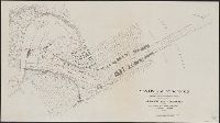
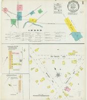
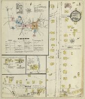
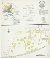
- Beinecke Rare Book and Manuscript Library > A new map of Maine
- Published / Created:
- 1850
- Call Number:
- 1975 Folio 26
- Collection Title:
- A new universal atlas containing maps of the various empires, kingdoms, states and republics of the
- Image Count:
- 1
- Resource Type:
- Maps, Atlases & Globes
- Found in:
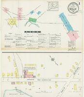
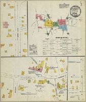
- Beinecke Rare Book and Manuscript Library > A new map of Maine
- Published / Created:
- 1846
- Call Number:
- 1976 Folio 93
- Collection Title:
- Mitchell’s universal atlas
- Image Count:
- 1
- Resource Type:
- Maps, Atlases & Globes
- Found in:
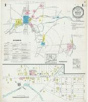
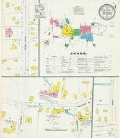
- Beinecke Rare Book and Manuscript Library > A new map of Maine
- Published / Created:
- 1833
- Call Number:
- 1976 Folio 98
- Collection Title:
- A new universal atlas, containing maps of the various empires, kingdoms, states and republics of
- Image Count:
- 1
- Resource Type:
- Maps, Atlases & Globes
- Found in:
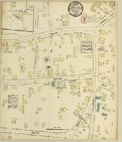
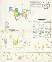
- Beinecke Rare Book and Manuscript Library > A new map of Maine
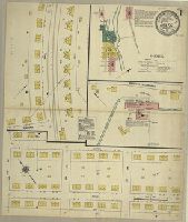
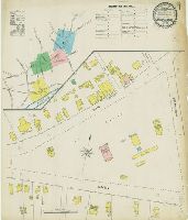
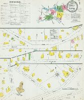
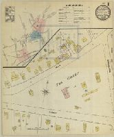
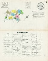
- Published / Created:
- 1850
- Call Number:
- 1976 Folio 96
- Collection Title:
- A new universal atlas containing maps of the various empires, kingdoms, states and republics of the
- Image Count:
- 1
- Resource Type:
- Maps, Atlases & Globes
- Found in:
- Beinecke Rare Book and Manuscript Library > A new map of Maine
- Call Number:
- 1976 Folio 94
- Collection Title:
- A new universal atlas containing maps of the various empires, kingdoms, states and republics of the
- Image Count:
- 1
- Resource Type:
- Maps, Atlases & Globes
- Found in:
- Beinecke Rare Book and Manuscript Library > A new map of Maine
- Creator:
- Faden, William, 1749-1836, creator
- Published / Created:
- 1788 June 24
- Call Number:
- 1982 Folio 10
- Image Count:
- 2
- Found in:
- Beinecke Rare Book and Manuscript Library > A new map of the German empire and the neighbouring states with their principal post roads : originally published by the Royal Academy of Berlin
- Creator:
- Faden, William, 1749-1836
Jefferys, Thomas, d. 1771, creator
- Published / Created:
- 1789 June 1
- Call Number:
- 1982 Folio 10
- Image Count:
- 1
- Found in:
- Beinecke Rare Book and Manuscript Library > A new map of the King of Great Britain's dominions in Germany or the electorate of Brunswick-Luneburg and its dependencies
- Creator:
- Kitchin, Thomas, d. 1784, creator
Sayer, Robert, 1725-1794
- Published / Created:
- 1787 January 1
- Call Number:
- 1982 Folio 10
- Image Count:
- 1
- Found in:
- Beinecke Rare Book and Manuscript Library > A new map of the Kingdom of Poland with its dismembered provinces
- Creator:
- Sayer, Robert, 1725-1794, creator
- Published / Created:
- 1788 October 10
- Call Number:
- 1982 Folio 10
- Image Count:
- 1
- Found in:
- Beinecke Rare Book and Manuscript Library > A new map of the Northern States containing the Kingdoms of Sweden, Denmark, and Norway, with the western parts of Russia, Livonia, Courland &ca
- Creator:
- Browne, Christopher, fl. 1684-1712, bookseller
Morden, Robert, d. 1703, creator
- Published / Created:
- [168-?]
- Call Number:
- 1973 Folio 10
- Image Count:
- 1
- Resource Type:
- Maps, Atlases & Globes
- Found in:
- Beinecke Rare Book and Manuscript Library > A new map of the estates of Savoy [and] Piedmont: with the countries adjacent
- Creator:
- Anville, Jean Baptiste Bourguignon d', 1697-1782
Pownall, Thomas, 1722-1805
Sayer, Robert, 1725-1794, creator
- Published / Created:
- 1786
- Call Number:
- 1982 Folio 10
- Image Count:
- 2
- Found in:
- Beinecke Rare Book and Manuscript Library > A new map of the whole continent of America : divided into North and South and West Indies wherein are exactly described the United States of North America as well as the several European possessions according to the preliminaries of peace signed at Versa
- Creator:
- Browne, Christopher, fl. 1684-1712, creator
- Published / Created:
- [ca. 1700?]
- Call Number:
- 1973 Folio 10
- Image Count:
- 1
- Resource Type:
- Maps, Atlases & Globes
- Found in:
- Beinecke Rare Book and Manuscript Library > A new mapp of Rome shewing its antient and present scituation
- Creator:
- Berry, William, fl. 1669-1708, creator
- Published / Created:
- [1689?]
- Call Number:
- 1973 Folio 10
- Image Count:
- 1
- Resource Type:
- Maps, Atlases & Globes
- Found in:
- Beinecke Rare Book and Manuscript Library > A new mapp of the kingdome of England and Wales: containing all the cities, market towns, with the roades from town to town, and the numbers of reputed miles between them, are given by inspection without scale or compass
- Creator:
- Browne, Christopher, fl. 1684-1712, bookseller
Morden, Robert, d. 1703, creator
Nicholls, Sutton, engraver
- Published / Created:
- [ca. 1700]
- Call Number:
- 1973 Folio 10
- Image Count:
- 1
- Resource Type:
- Maps, Atlases & Globes
- Found in:
- Beinecke Rare Book and Manuscript Library > A new mapp of the sea coasts of England, Scotland, and Ireland: with the adjacent coasts of France, Holand, Denmark & Norway, shewing the scituation and distance of the several ports, harbors, havens, creeks, sands &c
- Creator:
- Browne, Christopher, fl. 1684-1712
Fer, Nicolas de, 1646-1720, creator
- Published / Created:
- [1704?]
- Call Number:
- 1973 Folio 10
- Image Count:
- 1
- Resource Type:
- Maps, Atlases & Globes
- Found in:
- Beinecke Rare Book and Manuscript Library > A new mapp of the theatre of the warr in Flanders and on the Rhine: together with the Dutch and French frontiers and their conquests in the same
- Published / Created:
- Undated
- Call Number:
- 1973 Folio 10
- Image Count:
- 1
- Resource Type:
- Maps, Atlases & Globes
- Found in:
- Beinecke Rare Book and Manuscript Library > A view of Prince Charles's passage over ye Rhine being a new and correct plan of that river from ye city of Maintz to Fort Louis
- Creator:
- Lotter, Tobias Conrad, 1717-1777
Seutter, Matthaeus, 1678-1756
- Published / Created:
- ca. 1750
- Call Number:
- 1973 Folio 30
- Collection Title:
- [Atlas factice of 32 maps and 1 distance table, produced by the Homann Erben firm]
- Image Count:
- 2
- Found in:
- Beinecke Rare Book and Manuscript Library > Accuratissima delineatio geographica dioecesis ac praefecturae Dresdensis [cartographic material] : cujus urbes, oppida et pagi, loca item contermina, et quae in singulis notatu digniora videntur exactiori methodo geometrice designata sistuntur / per Matt
- Creator:
- Blaeu, Joan, 1596-1673, creator
- Published / Created:
- [ca. 1690]
- Call Number:
- 1973 Folio 10
- Image Count:
- 1
- Resource Type:
- Maps, Atlases & Globes
- Found in:
- Beinecke Rare Book and Manuscript Library > Aethiopia inferior vel exterior: partes magis Septentrionales, quae hic desiderantur, vide in tabula Aethiopiae superioris
- Creator:
- Blaeu, Joan, 1596-1673, creator
- Published / Created:
- [ca. 1690?]
- Call Number:
- 1973 Folio 10
- Image Count:
- 1
- Resource Type:
- Maps, Atlases & Globes
- Found in:
- Beinecke Rare Book and Manuscript Library > Aethiopia superior vel interior, vulgo Abissinorum sive Presbiteri Ioannis imperium
- Creator:
- Berry, William, fl. 1669-1708, creator
Sanson, Nicolas, 1600-1667
- Published / Created:
- 1680
- Call Number:
- 1973 Folio 10
- Image Count:
- 1
- Resource Type:
- Maps, Atlases & Globes
- Found in:
- Beinecke Rare Book and Manuscript Library > Africa : divided according to the extent of its principall parts in which are distinguished one from the other the empires, monarchies, kingdoms, states and peoples, which at this time inhabite Africa
- Creator:
- Anville, Jean Baptiste Bourguignon d', 1697-1782
Boulton, S., creator
Sayer, Robert, 1725-1794
- Published / Created:
- 1787 January 6
- Call Number:
- 1982 Folio 10
- Image Count:
- 2
- Found in:
- Beinecke Rare Book and Manuscript Library > Africa : with all its states, kingdoms, republics, regions, islands, & ca., improved and inlarged from D'Anville's map : to which have been added a particular chart of the Gold Coast wherein are distinguished all the European forts and factories
- Creator:
- Hase, Johann Matthias, 1684-1742
Homann Erben (Firm)
- Published / Created:
- 1737
- Call Number:
- 1975 Folio 31
- Collection Title:
- [Atlas factice of 42 maps, produced by the Homann Erben firm]
- Image Count:
- 1
- Found in:
- Beinecke Rare Book and Manuscript Library > Africa secundum legitimas projectionis stereographicae regulas et juxta recentissimas relationes et observationes in subsidium vocatis quoque veterum Leonis Africani Nubiensis Geographi et aliorum monumentis et eleminatis fabulosis aliorum designationibus
- Creator:
- Hase, Johann Matthias, 1684-1742
Homann Erben (Firm)
- Published / Created:
- 1737
- Call Number:
- 1973 Folio 30
- Collection Title:
- [Atlas factice of 32 maps and 1 distance table, produced by the Homann Erben firm]
- Image Count:
- 2
- Found in:
- Beinecke Rare Book and Manuscript Library > Africa secundum legitimas projectionis stereographicae regulas et juxta recentissimas relationes et observationes in subsidium vocatis quoque veterum Leonis Africani Nubiensis Geographi et aliorum monumentis et eleminatis fabulosis aliorum designationibus
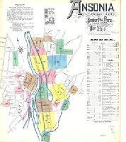
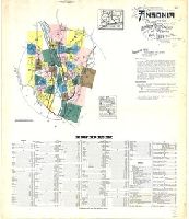
- Creator:
- Sanborn-Perris Map Co., issuing body
- Published / Created:
- 1890
- Call Number:
- 766 An81 1890
- Image Count:
- 13
- Resource Type:
- Maps, Atlases & Globes
- Found in:
- Beinecke Rare Book and Manuscript Library > Ansonia, New Haven Co., Connecticut.
- Creator:
- Sanborn Map Company, issuing body
- Published / Created:
- 1924
- Call Number:
- 766 An81 1924
- Image Count:
- 39
- Resource Type:
- Maps, Atlases & Globes
- Found in:
- Beinecke Rare Book and Manuscript Library > Ansonia, New Haven Co., Connecticut.
- Creator:
- Anville, Jean Baptiste Bourguignon d', 1697-1782
Cook, James, 1728-1779
Kitchin, Thomas, d. 1784, creator
Sayer, Robert, 1725-1794
- Published / Created:
- 1787 January 6
- Call Number:
- 1982 Folio 10
- Image Count:
- 2
- Found in:
- Beinecke Rare Book and Manuscript Library > Asia and its islands according to d'Anville : divided into empires, kingdoms, states, regions, & ca. with the European possessions and settlements in the East Indies and an exact delineation of all the discoveries made in the eastern parts by the English
- Creator:
- Berry, William, fl. 1669-1708, creator
Sanson, Nicolas, 1600-1667
- Published / Created:
- 1680
- Call Number:
- 1973 Folio 10
- Image Count:
- 1
- Resource Type:
- Maps, Atlases & Globes
- Found in:
- Beinecke Rare Book and Manuscript Library > Asia divided into its principall regions in which may be seen the extent of the empires, monarchies, kingdoms and states which at present divide Asia
- Creator:
- Boehm, Augustus Gottlieb
Hase, Johann Matthias, 1684-1742
Homann Erben (Firm)
- Published / Created:
- 1744
- Call Number:
- 1973 Folio 30
- Collection Title:
- [Atlas factice of 32 maps and 1 distance table, produced by the Homann Erben firm]
- Image Count:
- 2
- Found in:
- Beinecke Rare Book and Manuscript Library > Asia secundum legitimas projectionis stereographicae regulas et juxta recentissimas observation [cartographic material] : et relationes explosis aliorum fabulosis designationibus et narrationibus, adhibitis quoque veterum monumentis et recentiorum itinera
- Creator:
- Boehm, Augustus Gottlieb
Hase, Johann Matthias, 1684-1742
Homann Erben (Firm)
- Published / Created:
- 1744
- Call Number:
- 1975 Folio 31
- Collection Title:
- [Atlas factice of 42 maps, produced by the Homann Erben firm]
- Image Count:
- 1
- Found in:
- Beinecke Rare Book and Manuscript Library > Asia secundvm legitimas projectionis stereographicae regvlas et jvxta recentissimas observationes [cartographic material] : et relationes explosis aliorum fabulosis designationibus et narrationibus, adhibitis quoque veterum monumentis et recentiorum itine
- Creator:
- Danckerts, Justus, 1635-1701
Danckerts, Theodore
- Published / Created:
- [1703?]
- Call Number:
- 1975 Folio 55
- Image Count:
- 6
- Found in:
- Beinecke Rare Book and Manuscript Library > Atlas
- Creator:
- Moll, Herman, d. 1732
- Published / Created:
- [1732]
- Call Number:
- E1015 M66 1732
- Image Count:
- 1
- Found in:
- Beinecke Rare Book and Manuscript Library > Atlas minor: or a set of sixty-two new and correct maps, of all parts of the world. All composed and done by Herman Moll, geographer ...
- Creator:
- Luiken, Caspar, 1672-1708
- Published / Created:
- [approximately 1710]
- Call Number:
- BrSides Folio 2019 86
- Image Count:
- 2
- Resource Type:
- Maps, Atlases & Globes
- Found in:
- Beinecke Rare Book and Manuscript Library > Atlas novus terrarum orbis imperia, regna et status exactis tabulis geographicè demonstrans operâ Iohannis Baptistae Homanni ... Noribergae / Caspar Luycken fecit.
- Creator:
- Tuttle-Ayers-Woodward Co
- Call Number:
- 816ad K134 1925
- Container / Volume:
- BRBL_00563
- Image Count:
- 29
- Resource Type:
- Maps, Atlases & Globes
- Found in:
- Beinecke Rare Book and Manuscript Library > Atlas of Kansas City, Missouri, and environs, 1925.
- Published / Created:
- 1882
- Call Number:
- 812 1882
- Container / Volume:
- BRBL_00555
- Image Count:
- 16
- Resource Type:
- Maps, Atlases & Globes
- Found in:
- Beinecke Rare Book and Manuscript Library > Atlas of the geological survey of Wisconsin / T.C. Chamberlin, chief geologist ; R.D. Irving, Moses Strong, assistant geologists ; W.I.L. Nicodemus, topographical assistant ; T.B. Brooks ... [et al.], contributors.
- Published / Created:
- 1882
- Call Number:
- 812 1882
- Container / Volume:
- BRBL_00555
- Image Count:
- 27
- Resource Type:
- Maps, Atlases & Globes
- Found in:
- Beinecke Rare Book and Manuscript Library > Atlas of the geological survey of Wisconsin / T.C. Chamberlin, chief geologist ; R.D. Irving, Moses Strong, assistant geologists ; W.I.L. Nicodemus, topographical assistant ; T.B. Brooks ... [et al.], contributors.
- Published / Created:
- 1882
- Call Number:
- 812 1882
- Container / Volume:
- BRBL_00555
- Image Count:
- 2
- Resource Type:
- Maps, Atlases & Globes
- Found in:
- Beinecke Rare Book and Manuscript Library > Atlas of the geological survey of Wisconsin / T.C. Chamberlin, chief geologist ; R.D. Irving, Moses Strong, assistant geologists ; W.I.L. Nicodemus, topographical assistant ; T.B. Brooks ... [et al.], contributors.
- Creator:
- Wisconsin Geological and Natural History Survey
- Published / Created:
- 1877-1882
- Call Number:
- 812gbc 1876
- Container / Volume:
- BRBL_00556
- Image Count:
- 7
- Resource Type:
- Maps, Atlases & Globes
- Found in:
- Beinecke Rare Book and Manuscript Library > Atlas of the geological survey of Wisconsin / T.C. Chamberlin, chief geologist ; R.D. Irving, Moses Strong, assistant geologists ; W.I.L. Nicodemus, topographical assistant ; T.B. Brooks ... [et al.], special contributors.
- Creator:
- Woerl, Joseph Edmund
- Published / Created:
- 1840
- Call Number:
- 30 1840
- Container / Volume:
- BRBL_00031
- Image Count:
- 4
- Resource Type:
- Maps, Atlases & Globes
- Found in:
- Beinecke Rare Book and Manuscript Library > Atlas von Südwest-Deutschland und dem Alpenlande : in 48 Blättern und 6 statistischen Tabellen / entworfen u. bearbeitet von J.E. Woerl.
- Creator:
- Woerl, Joseph Edmund
- Published / Created:
- 1840
- Call Number:
- 30 1840
- Container / Volume:
- BRBL_00031
- Image Count:
- 1
- Resource Type:
- Maps, Atlases & Globes
- Found in:
- Beinecke Rare Book and Manuscript Library > Atlas von Südwest-Deutschland und dem Alpenlande : in 48 Blättern und 6 statistischen Tabellen / entworfen u. bearbeitet von J.E. Woerl.
- Creator:
- Sanborn Map Company, issuing body
- Published / Created:
- 1911
- Call Number:
- 766 B217 1911
- Image Count:
- 3
- Resource Type:
- Maps, Atlases & Globes
- Found in:
- Beinecke Rare Book and Manuscript Library > Baltic, New London County, Connecticut.
- Creator:
- Sanborn Map Company, issuing body
- Published / Created:
- 1932
- Call Number:
- 766 B217 1932
- Image Count:
- 5
- Resource Type:
- Maps, Atlases & Globes
- Found in:
- Beinecke Rare Book and Manuscript Library > Baltic, New London County, Connecticut.
- Creator:
- Blaeu, Joan, 1596-1673, creator
- Published / Created:
- [ca. 1670]
- Call Number:
- 1973 Folio 10
- Image Count:
- 1
- Resource Type:
- Maps, Atlases & Globes
- Found in:
- Beinecke Rare Book and Manuscript Library > Barbaria
- Creator:
- Homann, Johann Baptist, 1663-1724, creator
- Published / Created:
- 1720?
- Call Number:
- 1975 Folio 31
- Collection Title:
- [Atlas factice of 42 maps, produced by the Homann Erben firm]
- Image Count:
- 1
- Found in:
- Beinecke Rare Book and Manuscript Library > Belgii pars septentrionalis communi nomine vulgo Hollandia nuncupata continens statum potentissimae Batavorum Reipublicea sev provincias VII foederatas / exhibente Io. Baptista Homanno
- Creator:
- Homann Erben (Firm)
Mayer, Tobias, 1723-1762
Schneider, R. A.
- Published / Created:
- 1747 [i.e. 1748?]
- Call Number:
- 1975 Folio 31
- Collection Title:
- [Atlas factice of 42 maps, produced by the Homann Erben firm]
- Image Count:
- 1
- Found in:
- Beinecke Rare Book and Manuscript Library > Belgii universi seu inferioris Germaniae quam XVII provinciae Austriaco Gallico et Batavo sceptro parentes constituunt nova tabula geographica / [cartographic material] / a Tobia Majero, Math. Cult. ad leges legitimae delineationis revocata
- Creator:
- Homann Erben (Firm)
Mayer, Tobias, 1723-1762
- Published / Created:
- 1748
- Call Number:
- 1973 Folio 30
- Collection Title:
- [Atlas factice of 32 maps and 1 distance table, produced by the Homann Erben firm]
- Image Count:
- 2
- Found in:
- Beinecke Rare Book and Manuscript Library > Belgii universi seu inferioris Germaniae quam XVII provinciae Austriaco Gallico et Batavo sceptro parentes constituunt nova tabula geographica / [cartographic material] / a Tobia Majero, Math. Cult. ad leges legitimae delineationis revocata
- Creator:
- Cassini, Cesar-Francois, 1714-1784
Mayer, Tobias, 1723-1762
Snellius, Willebrord, 1580-1626
- Published / Created:
- 1747
- Call Number:
- 1975 Folio 31
- Collection Title:
- [Atlas factice of 42 maps, produced by the Homann Erben firm]
- Image Count:
- 1
- Resource Type:
- Maps, Atlases & Globes
- Found in:
- Beinecke Rare Book and Manuscript Library > Belgivm Catholicvm seu decem provinciae Germaniae inferioris : cum confiniis Germaniae svp. et Franciae legitime omnia delineata et ad ductum observationum astronomicarum, nec non geometricarum operationum a Cassinio Snellio Muschenbrokio aliisqve rite ha
- Creator:
- Cassini, Cesar-Francois, 1714-1784
Homann Erben (Firm)
Mayer, Tobias, 1723-1762
Snellius, Willebrord, 1580-1626
- Call Number:
- 1973 Folio 30
- Collection Title:
- [Atlas factice of 32 maps and 1 distance table, produced by the Homann Erben firm]
- Image Count:
- 2
- Found in:
- Beinecke Rare Book and Manuscript Library > Belgivm Catholicvm seu decem provinciae Germaniae inferioris : cum confiniis Germaniae svp. et Franciae legitime omnia delineata et ad ductum observationum astronomicarum, nec non geometricarum operationum a Cassinio Snellio Muschenbrokio aliisqve rite ha
- Creator:
- Sanborn Map & Publishing Co., issuing body
- Published / Created:
- 1887
- Call Number:
- 766 B45 1887
- Image Count:
- 2
- Resource Type:
- Maps, Atlases & Globes
- Found in:
- Beinecke Rare Book and Manuscript Library > Berlin, Conn.
- Creator:
- Sanborn-Perris Map Co., issuing body
- Published / Created:
- 1895
- Call Number:
- 766 B45 1895
- Image Count:
- 3
- Resource Type:
- Maps, Atlases & Globes
- Found in:
- Beinecke Rare Book and Manuscript Library > Berlin, Hartford Co., Conn.
- Creator:
- Sanborn-Perris Map Co., issuing body
- Published / Created:
- 1901
- Call Number:
- 766 B45 1901
- Image Count:
- 4
- Resource Type:
- Maps, Atlases & Globes
- Found in:
- Beinecke Rare Book and Manuscript Library > Berlin, Hartford Co., Conn.
- Creator:
- Sanborn Map Company, issuing body
- Published / Created:
- 1908
- Call Number:
- 766 B45 1908
- Image Count:
- 8
- Resource Type:
- Maps, Atlases & Globes
- Found in:
- Beinecke Rare Book and Manuscript Library > Berlin, Hartford County, Connecticut.
- Creator:
- Sanborn Map Company, issuing body
- Published / Created:
- 1914
- Call Number:
- 766 B45 1914
- Image Count:
- 9
- Resource Type:
- Maps, Atlases & Globes
- Found in:
- Beinecke Rare Book and Manuscript Library > Berlin, Hartford County, Connecticut.
- Creator:
- Sanborn Map Company, issuing body
- Published / Created:
- 1927
- Call Number:
- 766 B45 1927
- Image Count:
- 8
- Resource Type:
- Maps, Atlases & Globes
- Found in:
- Beinecke Rare Book and Manuscript Library > Berlin, Hartford County, Connecticut.
- Creator:
- Sanborn Map & Publishing Co., issuing body
- Published / Created:
- 1884
- Call Number:
- 766 B467 1884
- Image Count:
- 2
- Resource Type:
- Maps, Atlases & Globes
- Found in:
- Beinecke Rare Book and Manuscript Library > Bethel, Conn.
- Creator:
- Sanborn Map & Publishing Co., issuing body
- Published / Created:
- 1889
- Call Number:
- 766 B467 1889
- Image Count:
- 3
- Resource Type:
- Maps, Atlases & Globes
- Found in:
- Beinecke Rare Book and Manuscript Library > Bethel, Conn.
- Creator:
- Sanborn-Perris Map Co., issuing body
- Published / Created:
- 1895
- Call Number:
- 766 B467 1895
- Image Count:
- 4
- Resource Type:
- Maps, Atlases & Globes
- Found in:
- Beinecke Rare Book and Manuscript Library > Bethel, Conn., Fairfield Co.
- Creator:
- Sanborn-Perris Map Co., issuing body
- Published / Created:
- 1901
- Call Number:
- 766 B467 1901
- Image Count:
- 5
- Resource Type:
- Maps, Atlases & Globes
- Found in:
- Beinecke Rare Book and Manuscript Library > Bethel, Fairfield Co., Conn.
- Creator:
- Sanborn Map Company, issuing body
- Published / Created:
- 1906
- Call Number:
- 766 B467 1906
- Image Count:
- 5
- Resource Type:
- Maps, Atlases & Globes
- Found in:
- Beinecke Rare Book and Manuscript Library > Bethel, Fairfield Co., Conn.
- Creator:
- Sanborn Map Company, issuing body
- Published / Created:
- 1912
- Call Number:
- 766 B467 1912
- Image Count:
- 7
- Resource Type:
- Maps, Atlases & Globes
- Found in:
- Beinecke Rare Book and Manuscript Library > Bethel, Fairfield County, Connecticut.
- Creator:
- Sanborn Map Company, issuing body
- Published / Created:
- 1927
- Call Number:
- 766 B467 1927
- Image Count:
- 10
- Resource Type:
- Maps, Atlases & Globes
- Found in:
- Beinecke Rare Book and Manuscript Library > Bethel, Fairfield County, Connecticut.
- Creator:
- Sanborn Map & Publishing Co., issuing body
- Published / Created:
- 1886
- Call Number:
- 766 B53 1886
- Image Count:
- 11
- Resource Type:
- Maps, Atlases & Globes
- Found in:
- Beinecke Rare Book and Manuscript Library > Birmingham, Connecticut.
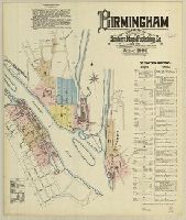
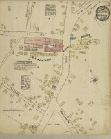
- Creator:
- Sanborn-Perris Map Co., issuing body
- Published / Created:
- 1892
- Call Number:
- 766 B53 1892
- Image Count:
- 14
- Resource Type:
- Maps, Atlases & Globes
- Found in:
- Beinecke Rare Book and Manuscript Library > Birmingham, including Shelton and Derby Narrows, Connecticut.
- Creator:
- Sanborn Map Company, issuing body
- Published / Created:
- 1932
- Call Number:
- 766 B62 1932
- Image Count:
- 3
- Resource Type:
- Maps, Atlases & Globes
- Found in:
- Beinecke Rare Book and Manuscript Library > Bloomfield, Hartford County, Connecticut.
- Creator:
- Homann Erben (Firm)
Muller, J. C. (Johann Christoph), 1673-1721
- Published / Created:
- ca. 1730?
- Call Number:
- 1975 Folio 31
- Collection Title:
- [Atlas factice of 42 maps, produced by the Homann Erben firm]
- Image Count:
- 2
- Found in:
- Beinecke Rare Book and Manuscript Library > Bohemiae Regnum in XII Circulos divisum [cartographic material] : cum Com. Glac. et Distr. Egerano ceterisq[ue] circumjacentibiis terris / ex Muellerianis aliisq[ue] chorographicis subsidys delineatum nunc noviter revisum et emendatius per Homannianos Her
- Creator:
- Sanborn Map Company, issuing body
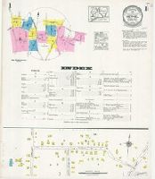
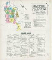
- Published / Created:
- 1924
- Call Number:
- 766 B72 1924
- Image Count:
- 24
- Resource Type:
- Maps, Atlases & Globes
- Found in:
- Beinecke Rare Book and Manuscript Library > Branford : including Short Beach, Indian Neck, Pine Orchard, Stony Creek and Pine Orchard West, New Haven Co., Connecticut.
- Creator:
- Sanborn Map & Publishing Co., issuing body
- Published / Created:
- 1884
- Call Number:
- 766 B72 1884
- Image Count:
- 2
- Resource Type:
- Maps, Atlases & Globes
- Found in:
- Beinecke Rare Book and Manuscript Library > Branford, Conn.
- Creator:
- Sanborn-Perris Map Co., issuing body
- Published / Created:
- 1895
- Call Number:
- 766 B72 1895A
- Image Count:
- 4
- Resource Type:
- Maps, Atlases & Globes
- Found in:
- Beinecke Rare Book and Manuscript Library > Branford, New Haven Co., Conn.
- Creator:
- Sanborn-Perris Map Co., issuing body
- Published / Created:
- 1901
- Call Number:
- 766 B72 1901
- Image Count:
- 8
- Resource Type:
- Maps, Atlases & Globes
- Found in:
- Beinecke Rare Book and Manuscript Library > Branford, New Haven Co., Conn.
- Creator:
- Sanborn Map & Publishing Co., issuing body
- Published / Created:
- 1889
- Call Number:
- 766 B72 1889A
- Image Count:
- 6
- Resource Type:
- Maps, Atlases & Globes
- Found in:
- Beinecke Rare Book and Manuscript Library > Branford, New Haven Co., Conn.
- Creator:
- Sanborn Map Company, issuing body
- Published / Created:
- 1914
- Call Number:
- 766 B72 1914
- Image Count:
- 14
- Resource Type:
- Maps, Atlases & Globes
- Found in:
- Beinecke Rare Book and Manuscript Library > Branford, New Haven County, Connecticut.
- Creator:
- Sanborn Map Company, issuing body
- Published / Created:
- 1908
- Call Number:
- 766 B72 1908
- Image Count:
- 12
- Resource Type:
- Maps, Atlases & Globes
- Found in:
- Beinecke Rare Book and Manuscript Library > Branford, New Haven, Connecticut.
- Creator:
- Sanborn Map & Publishing Co., issuing body
- Published / Created:
- 1884
- Call Number:
- 766 B76 1884
- Image Count:
- 20
- Resource Type:
- Maps, Atlases & Globes
- Found in:
- Beinecke Rare Book and Manuscript Library > Bridgeport, Conn.
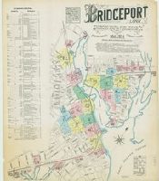
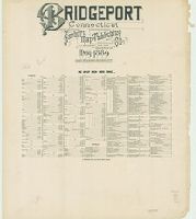
- Creator:
- Sanborn Map & Publishing Co., issuing body
- Published / Created:
- 1889
- Call Number:
- 766 B76 1889
- Image Count:
- 37
- Resource Type:
- Maps, Atlases & Globes
- Found in:
- Beinecke Rare Book and Manuscript Library > Bridgeport, Connecticut.
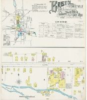
- Creator:
- Sanborn-Perris Map Co., issuing body
- Published / Created:
- 1890
- Call Number:
- 766 B77 1890
- Image Count:
- 9
- Resource Type:
- Maps, Atlases & Globes
- Found in:
- Beinecke Rare Book and Manuscript Library > Bristol and Forestville, Hartford Co., Connecticut.
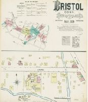
- Creator:
- Sanborn Map & Publishing Co., issuing body
- Published / Created:
- 1884
- Call Number:
- 766 B77 1884
- Image Count:
- 5
- Resource Type:
- Maps, Atlases & Globes
- Found in:
- Beinecke Rare Book and Manuscript Library > Bristol, Conn.
- Creator:
- Sanborn-Perris Map Co., issuing body
- Published / Created:
- 1901
- Call Number:
- 766 C16 1901
- Image Count:
- 2
- Resource Type:
- Maps, Atlases & Globes
- Found in:
- Beinecke Rare Book and Manuscript Library > Canaan, Litchfield Co., Conn.
- Creator:
- Sanborn Map Company, issuing body
- Published / Created:
- 1923
- Call Number:
- 766 C16 1923
- Image Count:
- 7
- Resource Type:
- Maps, Atlases & Globes
- Found in:
- Beinecke Rare Book and Manuscript Library > Canaan, Litchfield County, Connecticut.
- Creator:
- Homann Erben (Firm)
Homann, Johann Baptist, 1663-1724
- Published / Created:
- 1743
- Call Number:
- 1975 Folio 31
- Collection Title:
- [Atlas factice of 42 maps, produced by the Homann Erben firm]
- Image Count:
- 1
- Found in:
- Beinecke Rare Book and Manuscript Library > Carta Geographica, la quale rappresenta lo Stato della Republica di Genova partita nella Riviera di Levante et di Ponente / [cartographic material] / data in publico per gli Heredi d'Homann ; con privil. imp le 1743 = Staat von der Republic Genova, nach s
- Creator:
- Benitz, A.
- Published / Created:
- [1840]
- Call Number:
- 1973 Folio 105
- Collection Title:
- Atlas fisico y politico de la Republica de Venezuela ... por ... Agustin Codazzi ...
- Image Count:
- 1
- Resource Type:
- Maps, Atlases & Globes
- Found in:
- Beinecke Rare Book and Manuscript Library > Carta del Canton de Angostura de la provincia de la Guayana
- Creator:
- Benitz, A.
- Published / Created:
- [1840]
- Call Number:
- 1973 Folio 105
- Collection Title:
- Atlas fisico y politico de la Republica de Venezuela ... por ... Agustin Codazzi ...
- Image Count:
- 1
- Resource Type:
- Maps, Atlases & Globes
- Found in:
- Beinecke Rare Book and Manuscript Library > Carta del Canton de Upata de la provincia de la Guayana
- Creator:
- Faden, William, 1749-1836, creator
- Published / Created:
- 1783 February 24
- Call Number:
- 1982 Folio 10
- Image Count:
- 1
- Found in:
- Beinecke Rare Book and Manuscript Library > Carte generale des etats du roi de Sardaigne
- Creator:
- Sanborn Map Company, issuing body
- Published / Created:
- 1927
- Call Number:
- 766 C33 1927
- Image Count:
- 2
- Resource Type:
- Maps, Atlases & Globes
- Found in:
- Beinecke Rare Book and Manuscript Library > Central Village, Windham County, Connecticut.