
Search


Limit your search
- cartographic✖[remove]446
- Atlases✖[remove]446
- Cadastral maps222
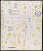
- Fire insurance maps222
- Connecticut220
- local220
- Maps in books205
- Engravings192
- Maps192
- Hand coloring183
- Marginalia36
- Sanborn Map Company, issuing body120
- Sanborn-Perris Map Co., issuing body62
- Homann Erben (Firm)42
- Sanborn Map & Publishing Co., issuing body34
- Homann, Johann Baptist, 1663-172430
- Berry, William, fl. 1669-1708, creator29
- Sanson, Nicolas, 1600-166726
- Faden, William, 1749-1836, creator13
- Hase, Johann Matthias, 1684-174213
- Mayer, Tobias, 1723-176210
- Atlases, German --Early works to 180073
- Fire risk assessment--Connecticut--Berlin--Maps11
- Fire risk assessment--Connecticut--Bristol--Maps8
- Fire risk assessment--Connecticut--Killingly (Town)--Maps8
- Fire risk assessment--Connecticut--Milford--Maps8
- Fire risk assessment--Connecticut--New Haven--Maps8
- Real property--Connecticut--Bristol--Maps8
- Real property--Connecticut--Killingly (Town)--Maps8
- Real property--Connecticut--Milford--Maps8
- Real property--Connecticut--New Haven--Maps8
- Library of Congress Stamp189
- Library of Congress. Map Division Stamp21
- Library of Congress Ownership16
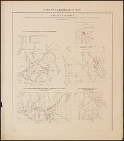
- Chamberlin, Thomas C. (Thomas Chrowder), 1843-19284
- Irving, R. D3
- Strong, Moses McCure3
- Cook, James, 1728-17792
- Greenwich Insurance Company Stamp2
- K.K. Universitäts-Bibliothek Innsbruck Stamp2
- P.S. Duval & Son2