Skip to search
Skip to main content
Skip to first result
Search
You Searched For
Format
cartographic
Genre
Hand coloring
Search Results
Creator:
Published / Created:
1854
Call Number:
Folio 296
Image Count:
1
Resource Type:
Books, Journals & Pamphlets
Description:
Hand colored map.
Publisher:
Published for the author by E. Stanford; [etc., etc.]
Subject (Geographic):
Africa, Central --Maps and Africa, Central--Description and travel
Subject (Name):
Overweg, Adolf,--1822-1852, Richardson, James,--1806-1851, and Vogel, Eduard,--1829-1856
Found in:
Beinecke Rare Book and Manuscript Library > ... An account of the progress of the expedition to Central Africa, performed by order of Her Majesty's Foreign office, under Messrs. Richardson, Barth, Overweg & Vogel, in the years 1850, 1851, 1852, and 1853. Consisting of maps and illustrations, with descriptive notes, constructed and comp. from official and private materials by Augustus Petermann ...
Published / Created:
1850
Call Number:
1976 Folio 96
Collection Title:
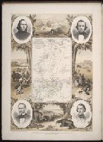
A new universal atlas containing maps of the various empires, kingdoms, states and republics of the
Image Count:
1
Resource Type:
Maps, Atlases & Globes
Publisher:
Thomas, Cowperthwait & Co
Subject (Geographic):
Connecticut
Collection Created:
Philadelphia, Cowperthwait, DeSilver & Butler, 1854, c1850
Found in:
Beinecke Rare Book and Manuscript Library > 10. Map of Connecticut
Published / Created:
1776
Call Number:
Cb23 27
Collection Title:
The American military pocket atlas : being an approved collection of correct maps, both general and
Image Count:
1
Alternative Title:
The Seat of war, in the northern colonies, containing the province of Quebec, Newfoundland, Nova-Scotia, New-England, New-York, New-Jersey, Pennsylvania, &ca
Description:
14th August 1776.
Publisher:
Printed for Robt. Sayer & Jno. Bennett, Map and Sea Chartsellers, No. 53, Fleet Street, as the Act directs
Subject (Geographic):
New England --Maps --Early works to 1800, North America --Maps --Early works to 1800, and United States --History --Revolution, 1775-1783 --Maps
Collection Created:
London : Printed for R. Sayer and J. Bennet, [1776]
Found in:
Beinecke Rare Book and Manuscript Library > A General map of the northern British colonies in America. which comprehends the province of Quebec, the government of Newfoundland, Nova-Scotia, New-England and New-York. From the maps published by the Admiralty and Board of Trade regulated by the astronomic and trigonometric observations of M. von Holland and corrected from Governor Pownall's late map 1776.
Creator:
Published / Created:
1776
Call Number:
Cb23 27
Collection Title:
The American military pocket atlas : being an approved collection of correct maps, both general and
Image Count:
1
Alternative Title:
The Seat of war, in the southern British colonies, comprehending North and South Carolina, Georgia, east and west Florida, &ca
Description:
15th Oct. 1776.
Publisher:
Printed for R. Sayer & J. Bennett, Map, Chart and Printsellers, No. 53 Fleet Street, as the Act directs
Subject (Geographic):
North America --Maps --Early works to 1800, Southern States --Maps --Early works to 1800, and United States --History --Revolution, 1775-1783 --Maps
Collection Created:
London : Printed for R. Sayer and J. Bennet, [1776]
Found in:
Beinecke Rare Book and Manuscript Library > A General map of the southern British colonies, in America, comprehending North and South Carolina, Georgia, east and west Florida, with the neighbouring Indian countries. From the modern surveys of engineer de Brahm, Capt. Collet, Mouzon & others; and from the large hydrographical survey of the coasts of east and west Florida
Published / Created:
1783
Call Number:
Cb21 35B
Collection Title:
History of the war with America, France, Spain, and Holland; commencing in 1775 and ending in 1783
Image Count:
1
Description:
Preceding title page.
Publisher:
I. Fielding
Subject (Geographic):
Great Britain --History --1760-1789, United States --History --Revolution, 1775-1783, and United States --Maps --Early works to 1800
Collection Created:
London, J. Fielding, 1785-86
Found in:
Beinecke Rare Book and Manuscript Library > A Map of the United States of America, as settled by the peace of 1783
Creator:
Published / Created:
1776
Call Number:
Cb23 27
Collection Title:
The American military pocket atlas : being an approved collection of correct maps, both general and
Image Count:
1
Description:
Augst. 5th. 1776.
Publisher:
Printed for Robt. Sayer & Jno. Bennett, Map & Sea Chartsellers No. 53 Fleet Street, as the Act directs
Subject (Geographic):
North America --Maps --Early works to 1800 and United States --History --Revolution, 1775-1783 --Maps
Collection Created:
London : Printed for R. Sayer and J. Bennet, [1776]
Found in:
Beinecke Rare Book and Manuscript Library > A Survey of Lake Champlain, including Lake George, Crown Point and St. John. Surveyed by order of His Excellency Major General Sr. Jeffery Amherst, knight of the most honble. Order of the Bath, Commander in Chief of His Majesty's forces in North America (now Lord Amherst) by William Brassier, draughtsman, 1762
Creator:
Published / Created:
1771
Call Number:
755 1771C
Container / Volume:
BRBL_00429
Image Count:
1
Resource Type:
Maps, Atlases & Globes
Abstract:
Subject: Map of the central part of the United States showing the middle Atlantic states, and the Ohio River Valley region. Includes anecdotes on the different Indian nations and the lands. Shows dates of settlements and agreements, locations of quarr...
Alternative Title:
Middle British colonies.
Description:
Differs from other copies in extension of the Connecticut River north beyond "Great Falls." Differs also in coloration of boundaries: Ohio River is colored as a boundary: Pennsylvania is shown as extending north to Lake Ontario, etc.
Publisher:
Printed for Carington Bowles,
Subject (Geographic):
Canada--Maps--Early works to 1800, Middle Atlantic States--Maps--Early works to 1800, Northeastern States--Maps--Early works to 1800, and Ohio River Valley--Maps--Early works to 1800
Subject (Name):
Bowles, Carington, 1724-1793, publisher
Subject (Topic):
British--America--Maps--Early works to 1800 and Chron.--1771
Found in:
Beinecke Rare Book and Manuscript Library > A general map of the middle British colonies in America : viz. Virginia, Maryland, Delaware, Pensilvania, New-Jersey, New York, Connecticut & Rhode-Island : of Aquanishuonigy the country of the confederate Indians comprehending Aquanishuonigy proper, thei