Search
You Searched For
Search Results
- Creator:
- Moll, Herman, d. 1732
- Published / Created:
- [1732]
- Call Number:
- E1015 M66 1732
- Image Count:
- 1
- Found in:
- Beinecke Rare Book and Manuscript Library > Atlas minor: or a set of sixty-two new and correct maps, of all parts of the world. All composed and done by Herman Moll, geographer ...
- Creator:
- Moll, Herman, d. 1732
- Published / Created:
- [1732]
- Call Number:
- E1015 M66 1732
- Collection Title:
- Atlas minor: or a set of sixty-two new and correct maps, of all parts of the world. All composed
- Image Count:
- 1
- Found in:
- Beinecke Rare Book and Manuscript Library > The Island of St. Christophers, alias St. Kitts By H. Moll Geographer
- Call Number:
- CC68 21
- Collection Title:
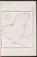
- Views of ancient monuments in Central America : Chiapas and Yucatan / by F. Catherwood ...
- Image Count:
- 1
- Found in:
- Beinecke Rare Book and Manuscript Library > Outline map of Central America and Yucatan showing the situation of the ruined cities & monuments
- Call Number:
- Zc20 697heg
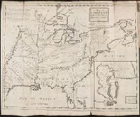
- Collection Title:
- A new discovery of a vast country in America : extending above four thousand miles, between New
- Image Count:
- 1
- Found in:
- Beinecke Rare Book and Manuscript Library > A map of a large country newly discovered in the northern America situated between New Mexico and the frozen sea, together with the course of the Great River Meschasipi. Dedicated to His Ma.ty William III King of Great Britain. By Father Lewis Hennepin, m
- Call Number:
- Zc20 697heg
- Collection Title:
- A new discovery of a vast country in America : extending above four thousand miles, between New
- Image Count:
- 1
- Found in:
- Beinecke Rare Book and Manuscript Library > A map of a new world between New Mexico and the frozen sea newly discovered by Father Lewis Hennepin, missionary recollect and native of Aht in Hainault. Dedicated to his majesty of Great Britain William III
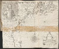
- Creator:
- Eddy, J.
Lowe, George, fl. 1613?-ca. 1615?
- Published / Created:
- 1614-16
- Call Number:
- Zd 176
- Collection Title:
- Path-way to experience to erect a plantation
- Image Count:
- 1
- Found in:
- Beinecke Rare Book and Manuscript Library > New England: the most remarqueable parts thus named by the high and mighty Prince Charles, Prince of Great Britaine
- Call Number:
- Zc90 +744do
- Collection Title:
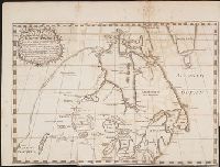
- An account of the countries adjoining to Hudson's Bay, in the North-west part of America
- Image Count:
- 1
- Found in:
- Beinecke Rare Book and Manuscript Library > A new map of part of North America from the latitude of 40 to 68 degrees. Including the late discoveries made on board the Furnace Bomb Ketch in 1742. And the western rivers & lakes falling into Nelson River in Hudson's Bay, as described by Joseph La Fran
- Published / Created:
- 1793
- Call Number:
- CF352 I54 1793
- Collection Title:
- The discovery, settlement, and present state of Kentucky: and an essay towards the topography and
- Image Count:
- 1
- Found in:
- Beinecke Rare Book and Manuscript Library > A map of the state of Kentucky, drawn from the best authorities
- Creator:
- Jefferys, Thomas, d. 1771
- Call Number:
- Z6 70
- Collection Title:
- An enquiry into the causes of the alienation of the Delaware and Shawanese Indians from the British
- Image Count:
- 1
- Found in:
- Beinecke Rare Book and Manuscript Library > A map of the province of Pensylvania. intended chiefly to illustrate the account of the several Indian purchases made by the proprietaries of the said province the claims made by the Indians, on lands settled and not purchased of them and the tract they n
- Call Number:
- Egf 778Hb
- Collection Title:
- A topographical description of Virginia, Pennsylvania, Maryland and North Carolina : comprehending
- Image Count:
- 1
- Found in:
- Beinecke Rare Book and Manuscript Library > A plan of the several villages in the Illinois country, with part of the river Mississippi &c. by Thos. Hutchins
- Call Number:
- Taylor 322
- Collection Title:
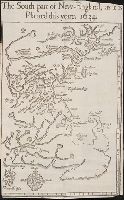
- Nevv Englands prospect; a true, lively, and experimentall description of that part of America
- Image Count:
- 1
- Found in:
- Beinecke Rare Book and Manuscript Library > The south part of New-England, as it is planted this yeare, 1634
- Call Number:
- Zc20 720so
- Collection Title:
- Some considerations on the consequences of the French settling colonies on the Mississippi, with
- Image Count:
- 1
- Found in:
- Beinecke Rare Book and Manuscript Library > A new map of Louisiana and the River Mississipi
- Call Number:
- C55 025
- Collection Title:
- Voyages and travels of an Indian interpreter and trader, describing the manners and customs of the
- Image Count:
- 1
- Found in:
- Beinecke Rare Book and Manuscript Library > Sketch of the western countries of Canada 1791
- Call Number:
- Egi M6 722
- Collection Title:
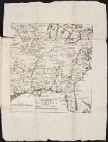
- A description of the English province of Carolana, by the Spaniards call'd Florida, and by the
- Image Count:
- 1
- Found in:
- Beinecke Rare Book and Manuscript Library > A map of Carolana and of the River Meschacebe & c.
- Creator:
- Hole, William, d. 1624, engraver
- Published / Created:
- [ca. 1606]
- Call Number:
- Taylor 301
- Collection Title:
- The generall historie of Virginia, New-England, and the Summer Iles : with the names of the
- Image Count:
- 1
- Found in:
- Beinecke Rare Book and Manuscript Library > Virginia
- Published / Created:
- 1801
- Call Number:
- Zc90 801mab
- Collection Title:
- Voyages from Montreal, on the river St. Laurence, through the continent of North America, to the
- Image Count:
- 1
- Found in:
- Beinecke Rare Book and Manuscript Library > A map of America, between latitudes 40 and 70 north and longitudes 45 and 180 west, exhibiting Mackenzie's track from Montreal to Fort Chipewyan & from thence to the North Sea In 1789 & to the West Pacific Ocean in 1793
- Published / Created:
- 1783
- Call Number:
- Cb21 35B
- Collection Title:
- History of the war with America, France, Spain, and Holland; commencing in 1775 and ending in 1783
- Image Count:
- 1
- Found in:
- Beinecke Rare Book and Manuscript Library > A Map of the United States of America, as settled by the peace of 1783
- Call Number:
- CE143 A28
- Collection Title:
- An account of the Spanish settlements in America. In four parts ... To which is annexed, a succinct
- Image Count:
- 1
- Found in:
- Beinecke Rare Book and Manuscript Library > A New general map of America drawn from several accurate particular maps and charts and regulated by astronomical observations
- Call Number:
- Zd 147
- Collection Title:
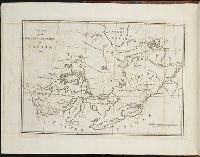
- The history of the Five Indian nations of Canada : which are dependent on the province of New-York
- Image Count:
- 1
- Found in:
- Beinecke Rare Book and Manuscript Library > A Map of the country of the Five Nations, belonging to the province of New York; and of the lakes near which the nations of far Indians live, with part of Canada
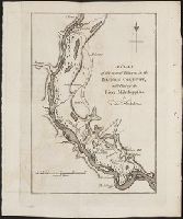
- Call Number:
- Taylor 376
- Collection Title:
- The discoveries of John Lederer : in three several marches from Virginia, to the west of Carolina
- Image Count:
- 1
- Found in:
- Beinecke Rare Book and Manuscript Library > A Map of the whole territory traversed by John Lederer in his three marches