Search
You Searched For
Search Results
- Creator:
- Walling, Henry Francis, 1825-1888
- Published / Created:
- 1858
- Call Number:
- 764 N76 1858
- Container / Volume:
- BRBL_00458
- Image Count:
- 6
- Resource Type:
- Maps, Atlases & Globes
- Found in:
- Beinecke Rare Book and Manuscript Library > Map of the county of Norfolk, Massachusetts / based upon the details of the trigonometrical survey of the state; the details from actual surveys under the direction of Henry F. Walling. Supt. of the state map.
- Creator:
- Clason Map Co
- Published / Created:
- 1909
- Call Number:
- 831 H36 1909
- Container / Volume:
- BRBL_00580
- Image Count:
- 6
- Resource Type:
- Maps, Atlases & Globes
- Found in:
- Beinecke Rare Book and Manuscript Library > Map of city of Helena, Montana / Copyrighted 1909 by Geo. S. Clason.
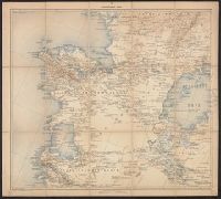
- Creator:
- McGee, W. J., 1853-1912
- Published / Created:
- [1893?]
- Call Number:
- 75CA 1893
- Container / Volume:
- BRBL_00408
- Image Count:
- 10
- Resource Type:
- Maps, Atlases & Globes
- Found in:
- Beinecke Rare Book and Manuscript Library > Reconnoissance map of the United States showing the distribution of the geologic system so far as known / compiled from data in possession of the U.S. Geological Survey by W.J. McGee, 1893.
- Creator:
- United States. Army. Engineer Aviation Topographic Battalion, 942nd
- Published / Created:
- 1945
- Call Number:
- 57gfb 1945
- Container / Volume:
- BRBL_00306
- Image Count:
- 10
- Resource Type:
- Maps, Atlases & Globes
- Found in:
- Beinecke Rare Book and Manuscript Library > Japan electric power / drawn and reproduced by Co B, 942nd Engr. Avn. Topo. Bn, 325th Ric., US Army.
- Creator:
- Mitchell, John, 1711-1768
- Published / Created:
- 1776]
- Call Number:
- 71 1776D
- Container / Volume:
- BRBL_00365
- Image Count:
- 8
- Resource Type:
- Maps, Atlases & Globes
- Found in:
- Beinecke Rare Book and Manuscript Library > Amérique septentrionale avec les routes : distances en miles, villages, et etablissements françois et anglois / par le docteur Mitchel ; traduit de l'Anglois à Paris par Le Rouge, ingr. géographe du roy, Rue des Grands Augustins 1756.
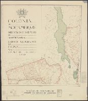
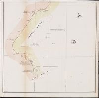
- Creator:
- Mozambique. Direcção dos Serviços de Agrimensura
- Published / Created:
- 1929
- Call Number:
- 636 1929
- Container / Volume:
- BRBL_00337
- Image Count:
- 8
- Resource Type:
- Maps, Atlases & Globes
- Found in:
- Beinecke Rare Book and Manuscript Library > Colónia de Moçambiqve : esboço geografico da colonía na escala de 1/1.000.000 / Direcção dos Serviços de Agrimensura ; comp., B.A. Lourinho ; des., R.J. Ximénes.
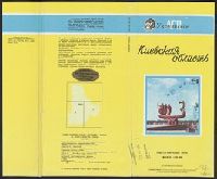
- Creator:
- Ukraïnsʹke aeroheodezychne pidpryi︠e︡mstvo
- Published / Created:
- 1992
- Call Number:
- 3531 1992
- Container / Volume:
- BRBL_00111
- Image Count:
- 8
- Resource Type:
- Maps, Atlases & Globes
- Found in:
- Beinecke Rare Book and Manuscript Library > Kievskai︠a︡ oblastʹ, obshchegeograficheskai︠a︡ karta : masshtab 1:200 000 / Ukrainskoe AGP ; karta sostavlena i podgotovlena k pechati Ukrainskim aėrogeodezicheskim predprii︠a︡tiem v 1992 g.
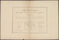
- Published / Created:
- 1879
- Call Number:
- 40 R66 1879
- Container / Volume:
- BRBL_00218
- Image Count:
- 8
- Resource Type:
- Maps, Atlases & Globes
- Found in:
- Beinecke Rare Book and Manuscript Library > Carta Topografica dell'agro Romano Territori Limitrofi.
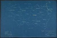
- Published / Created:
- 1919
- Call Number:
- 11hcf 1919C-11
- Image Count:
- 8
- Resource Type:
- Maps, Atlases & Globes
- Found in:
- Beinecke Rare Book and Manuscript Library > Base Map of Vosges Department: Taken from File No. 74-A-3 / American Commision to Negotiate Peace, War Damages in Allied Countries.
- Published / Created:
- 1919
- Call Number:
- 11hcf 1919C-9
- Container / Volume:
- BRBL_00010V
- Image Count:
- 5
- Resource Type:
- Maps, Atlases & Globes
- Found in:
- Beinecke Rare Book and Manuscript Library > Base Map of Marne Department : Taken from File 74-A-3 / American Commision to Negotiate Peace, War Damages in Allied Countries.
- Creator:
- Russia. Armii︠a︡. Glavnyi shtab. Voennotopograficheskii otdiel
- Published / Created:
- 1889-.
- Call Number:
- 547 1892
- Container / Volume:
- BRBL_00291
- Image Count:
- 5
- Resource Type:
- Maps, Atlases & Globes
- Found in:
- Beinecke Rare Book and Manuscript Library > Karta iuzhnoī pogranichnoī polosy Asiatskoī Rossīi. Pod redaktsieī General-Maīora Bol' sheva.
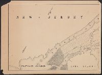
- Creator:
- Lee, Thomas Jefferson, 1808-1891
- Published / Created:
- 1842?]
- Call Number:
- 796fab Sa13 1842H
- Container / Volume:
- BRBL_00530
- Image Count:
- 5
- Resource Type:
- Maps, Atlases & Globes
- Found in:
- Beinecke Rare Book and Manuscript Library > Map of the river Sabine from its mouth on the Gulf of Mexico in the sea to Logan's Ferry in latitude 31⁰, 58', 24" north, shewing the boundary between the United States and the Republic of Texas between said points, as marked and laid down by survey in 18
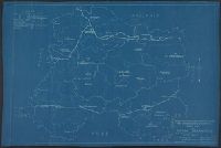
- Creator:
- Anderson, P., civil engr
- Published / Created:
- 1845
- Call Number:
- 766gme 1845N
- Container / Volume:
- BRBL_00475A
- Image Count:
- 5
- Resource Type:
- Maps, Atlases & Globes
- Found in:
- Beinecke Rare Book and Manuscript Library > Map exhibiting the experimental and located lines for the New-York and New-Haven Rail-Road. Projected and drawn by P. Anderson, civil engr.
- Published / Created:
- 1857
- Call Number:
- 764 P74 1857
- Container / Volume:
- BRBL_00459
- Image Count:
- 5
- Resource Type:
- Maps, Atlases & Globes
- Found in:
- Beinecke Rare Book and Manuscript Library > Map of the county of Plymouth, Massachusetts. From actual survey under the direcction of Henry F. Walling ... 1857.
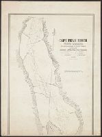
- Published / Created:
- 1839
- Call Number:
- 785cea C17 1839A
- Container / Volume:
- BRBL_00514
- Image Count:
- 5
- Resource Type:
- Maps, Atlases & Globes
- Found in:
- Beinecke Rare Book and Manuscript Library > Cape Fear River ... by Lieutenant James Glynn ... Continuation of the Survey of Cape Fear River ... by Lieut. James Glynn.
- Published / Created:
- [1760?]
- Call Number:
- 428 1760
- Container / Volume:
- BRBL_00247
- Image Count:
- 5
- Resource Type:
- Maps, Atlases & Globes
- Found in:
- Beinecke Rare Book and Manuscript Library > Atlas Tyrolensis.
- Creator:
- Survey of India
- Published / Created:
- 19--]
- Call Number:
- 59 M26 1917
- Container / Volume:
- BRBL_00318
- Image Count:
- 5
- Resource Type:
- Maps, Atlases & Globes
- Found in:
- Beinecke Rare Book and Manuscript Library > Madras / published under the direction of Colonel Sir S.G. Burrard, K.S.C.I., R.E., F.R.S., Surveyor General of India, 1917.
- Creator:
- Geological Survey of Great Britain
Great Britain. Ordnance Survey
- Published / Created:
- 1864
- Call Number:
- 32625 1865
- Container / Volume:
- BRBL_00071
- Image Count:
- 5
- Resource Type:
- Maps, Atlases & Globes
- Found in:
- Beinecke Rare Book and Manuscript Library > Stirlingshire.
- Creator:
- Canada. Dept. of the Interior
- Published / Created:
- [1914?]
- Call Number:
- 737 C88 1914
- Container / Volume:
- BRBL_00385
- Image Count:
- 5
- Resource Type:
- Maps, Atlases & Globes
- Found in:
- Beinecke Rare Book and Manuscript Library > Map of Crowsnest Forest and Waterton Lakes Park, Rocky Mountains Forest Reserve / drawn and printed at the Surveyor General's Office.
- Creator:
- Freyhold, Edward
- Published / Created:
- 1879
- Call Number:
- 80 1879
- Container / Volume:
- BRBL_00536
- Image Count:
- 5
- Resource Type:
- Maps, Atlases & Globes
- Found in:
- Beinecke Rare Book and Manuscript Library > Map of the territory of the United States, west of the Mississippi River / prepared by authority of the Hon. the Secretary of War, in the office of the Chief of Engineers under the direction of Brig. Gen. A.A. Humphreys, Chief of Engrs. Bvt. Major General