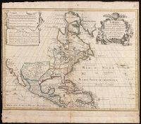
Includes five bar scales., Relief shown pictorially., and Watermark. Manuscript number in upper right corner: jj5. Reinforced at bottom with paper. From the Karpinski Collection.
Publisher:
Venalis prostat Augustae Vindelic apud Jeremiam Wolff,
Subject (Geographic):
NorthAmerica--Maps.
Subject (Name):
Karpinski, Louis Charles,--1878-1956--Ownership. and Wolf, Jeremias, 1663?-1724, pulbisher.
Map of the Northern Pacific Railroad, showing the intercontinental routes, oceanic currents and steamboat lines around the world. and Profiles of the Northern Pacific and the Central and Union Pacific Railroads, showing the difference in configuration of the country along the respective routes.
Description:
Imperfect: chipped along folds, with some loss of text. Backed with paper., Includes inset of "Map of the Northern Pacific Railroad, showing the intercontinental routes, oceanic currents and steamboat lines around the world," text, and "Profiles of the Northern Pacific and the Central and Union Pacific Railroads, showing the difference in configuration of the country along the respective routes.", Prime meridians: Greenwich and Washington., and Relief shown by hachures and spot heights.
Subject (Geographic):
NorthAmerica--Maps.
Subject (Name):
Northern Pacific Railroad Company--Maps.
Subject (Topic):
Railroads--Canada--Maps. and Railroads--United States--Maps.
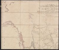
Appears in Atlas to Thompson's Alcedo; or, dictionary of America & West Indies, 1816., Relief shown by hachures., and Shows points of interest, aids to navigation, and historical information.
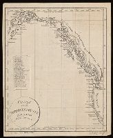
Covers western coast of North America from northern California to Alaska., In lower left margin: F. d. Allg. Geogr. Ephem. VIII B. 3 Stk., Includes index of inlets, canals, and bays., Relief shown by hachures., and Watermark. Manuscript annotations on recto and verso.
Copy 2: Imperfect: two southern sheets wanting. Borders hand colored. Dissected and mounted on linen, 50 x 115 cm. Stamp on verso, "Yale University Library, Karpinski-Von Wieser Map Collection.", Copy 2: Watermarks. Borders hand colored. Stamp on verso of northern sheets: 34. Stamp on verso of southern sheets: 35. Manuscript annotations in 20th century hand on verso of northern sheets., Insets: A particular map of Baffin and Hudson's Bay -- The passage by land to California., Prime meridians: London and Ferro., and Relief shown pictorially.
Publisher:
Publish'd by Laurie & Whittle, No. 53 Fleet Street,
Copy 1: two northern sheets joined and two southern sheets joined. Borders hand colored. Stamps, "Yale, Horace Brown, 1900S.", Copy 1: Watermarks. Borders hand colored. Stamp on verso of northern sheets: 62. Stamp on verso of southern sheets: 63., Insets: A particular map of Baffin and Hudson's Bay -- The passage by land to California., Prime meridians: London and Ferro., and Relief shown pictorially.
Publisher:
Publish'd by Laurie & Whittle, No. 53 Fleet Street,
Copy 3: Interiors hand colored. Stamp on verso of northern sheets: 37. Stamp on verso of southern sheets: 38., Insets: A particular map of Baffin and Hudson's Bay -- The passage by land to California., Prime meridians: London and Ferro., and Relief shown pictorially.
Publisher:
Publish'd by Laurie & Whittle, No. 53 Fleet Street,
Atwood, John M., approximately 1818- cartographer.
Published / Created:
1849
Call Number:
71 1849
Image Count:
1
Resource Type:
Maps, Atlases & Globes
Description:
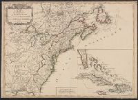
Includes 2 insets, ill., and distance table., Prime meridians: Greenwich and Washington., Relief shown by hachures and spot heights., Shows California's gold region and western trails., and Variant ed. in same year.
Publisher:
J.H. Colton,
Subject (Geographic):
NorthAmerica--Maps.
Subject (Name):
Colton, J. H. (Joseph Hutchins), 1800-1893, publisher.