Skip to search
Skip to main content
Skip to first result
Search
You Searched For
Format
cartographic
Genre
Maps.
Search Results
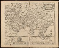
Creator:
Published / Created:
[1652?]
Call Number:
BrSides Folio 2017 6
Image Count:
1
Resource Type:
Maps, Atlases & Globes
Description:
Imperfect: torn along fold, with some loss of text. Manuscript number in upper left corner, "36."
Publisher:
[Nikolaas Blankaart],
Subject (Geographic):
Asia--Maps--Early works to 1800.
Subject (Name):
Schaep, Gerardus, dedicatee.
Found in:
Beinecke Rare Book and Manuscript Library > Asia antiqua cum finitimis Africae et Europae regionibus / Nicolaus Blancardus Belga, Leidensis, ad lucem aevi veteris delineabat.
Published / Created:
1910?]
Call Number:
11hcf 1919C-14
Image Count:
1
Resource Type:
Maps, Atlases & Globes
Publisher:
s.n.,
Subject (Geographic):
Austria--Maps., Balkan Peninsula--Maps., and Hungary--Maps.
Found in:
Beinecke Rare Book and Manuscript Library > Austria-Hungary.
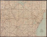
Creator:
Published / Created:
[1908]
Call Number:
762gmb 1908
Container / Volume:
BRBL_00451
Image Count:
1
Resource Type:
Maps, Atlases & Globes
Alternative Title:
Automobile map of New Hampshire, central and Automobile map of New Hampshire, south
Description:
Automobile map of New Hampshire, south, No. 13 -- Automobile map of New Hampshire central, No. 14.
Publisher:
Walker Lith. & Pub. Co.,
Subject (Geographic):
New Hampshire--Maps.
Subject (Name):
Walker Lith. & Pub. Co.
Subject (Topic):
Roads--New Hampshire--Maps.
Found in:
Beinecke Rare Book and Manuscript Library > Automobile map of New Hampshire / Automobile Club of America.
Creator:
Published / Created:
1900
Call Number:
771 N49 1900J
Image Count:
4
Resource Type:
Maps, Atlases & Globes
Alternative Title:
LVIII., Monument record sheet LVIII., and Part of Monument record sheet LVIII :
Description:
Accompanied, as issued, by Monument record sheet LVIII. "Gift of Sarah Day Woodward"--Manuscript note.
Publisher:
Board of Public Improvements
Subject (Geographic):
Brooklyn (New York, N.Y.)--Maps.
Subject (Name):
Woodward, Sarah Day--Ownership.
Subject (Topic):
Monuments--New York (State)--New York--Maps.
Found in:
Beinecke Rare Book and Manuscript Library > Borough of Brooklyn, showing investigation and adjustment of monuments carried on by the Topographical Bureau.
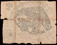
Creator:
Published / Created:
[approximately 1850?]
Call Number:
38 P21 1850A
Image Count:
1
Resource Type:
Maps, Atlases & Globes
Alternative Title:
Plan of Paris, and map of the environs
Description:
Imperfect: Mutilated with loss of information. Autograph: Walter Hills ... London.
Publisher:
[George Bradshaw],
Subject (Geographic):
Paris (France)--Maps.
Subject (Name):
Hills, Walter--Autograph.
Found in:
Beinecke Rare Book and Manuscript Library > Bradshaw's plan of Paris, and map of the environs.
Published / Created:
[between 1652 and 1684]
Call Number:
BrSides Double Folio 2019 99
Image Count:
1
Resource Type:
Maps, Atlases & Globes
Abstract:
Map of Great Britain, and part of Ireland.
Alternative Title:
Britannia prout divisa fuit temporibus Anglo-Saxonum praesertim durante illorum heptarchia.
Description:
Border illustrations include seven Anglo-Saxon kings on the left; the conversion to Christianity of a further seven are depicted on the right.
Publisher:
[Jan Jansson],
Subject (Geographic):
Great Britain--Maps--Early works to 1800.
Found in:
Beinecke Rare Book and Manuscript Library > Britannia prout divisa fuit temporibus Anglo-Saxonvm praesertim durante illorum heptarchia.
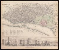
Creator:
Published / Created:
Novr. 1842.
Call Number:
BrSides Folio 2019 94
Image Count:
1
Resource Type:
Maps, Atlases & Globes
Description:
Coordinates not present on map and are approximated.
Publisher:
Published by Chapman & Hall, 186 Strand,
Subject (Geographic):
Kolkata (India)--Maps.
Subject (Name):
Chapman and Hall
Found in:
Beinecke Rare Book and Manuscript Library > Calcutta / published under the superintendence of the Society for the Diffusion of Knowledge.
Creator:
Published / Created:
1755
Call Number:
755 1755J
Container / Volume:
BRBL_00427
Image Count:
1
Resource Type:
Maps, Atlases & Globes
Description:
"Avec Privilege du Roi."
Publisher:
[Georges-Louis Le Rouge] Rue des Augustins,
Subject (Geographic):
Atlantic States--Maps--Early works to 1800., France--Colonies--America--Maps--Early works to 1800., Great Britain--Colonies--America--Maps--Early works to 1800., Maritime Provinces--Maps--Early works to 1800., and United States--History--French and Indian War, 1754-1763--Maps--Early works to 1800.
Found in:
Beinecke Rare Book and Manuscript Library > Canada et Louisiane / par le Sr. Le Rouge, ingenieur geographe du roy.
Creator:
Published / Created:
1755
Call Number:
755 1755C
Container / Volume:
BRBL_00427
Image Count:
1
Resource Type:
Maps, Atlases & Globes
Description:
"Avec Privilege du Roi."
Publisher:
[Georges-Louis Le Rouge] Rue des Augustins,
Subject (Geographic):
Atlantic States--Maps--Early works to 1800., France--Colonies--America--Maps--Early works to 1800., Great Britain--Colonies--America--Maps--Early works to 1800., Maritime Provinces--Maps--Early works to 1800., and United States--History--French and Indian War, 1754-1763--Maps--Early works to 1800.
Found in:
Beinecke Rare Book and Manuscript Library > Canada et Louisiane / par le Sr. Le Rouge, ingenieur geographe du roy.
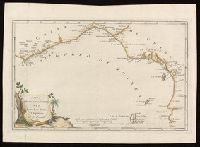
Creator:
Published / Created:
1781
Call Number:
BrSides Folio 2017 19
Image Count:
1
Resource Type:
Maps, Atlases & Globes
Description:
Bar scale given in "Leghe marine Francesi ed Inglesi di 20 al grado."
Publisher:
[publisher not identified],
Subject (Geographic):
Africa, Central--Maps--Early works to 1800. and Africa, West--Maps--Early works to 1800.
Subject (Topic):
Coasts--Africa, Central--Maps--Early works to 1800. and Coasts--Africa, West--Maps--Early works to 1800.
Found in:
Beinecke Rare Book and Manuscript Library > Carta della bassa Guinea tra il capo tres puntas, e l'equatore / di Mr. d'Anville.