[Atlas factice of 42 maps, produced by the Homann Erben firm]
Image Count:
2
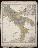
Alternative Title:
Novissima & exactissima totius regni Neapolis tabula, Novissima and exactissima totius regni Neapolis tabula, and Novissima and exactissima totivs regni Neapolis tabvla
Publisher:
Johann Baptist Homann
Subject (Geographic):
Naples (Italy : Province) --Maps --Early works to 1800 and Naples (Kingdom) --Maps --Early works to 1800
Hase, Johann Matthias, 1684-1742 Homann Erben (Firm) Lowitz, G. M. (George Moritz), 1722-1774
Published / Created:
1746
Call Number:
1975 Folio 31
Collection Title:
[Atlas factice of 42 maps, produced by the Homann Erben firm]
Image Count:
1
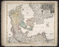
Alternative Title:
Mappe-monde qui represente les deux hemispheres savoir celui de l’orient et celui de l’occident, tiree des quatre cartes generales de feu M. le profess. Hasius, dressee par Mr. G.M. Lowitz et publiee par les Heritiers de Homann, avec privil. imper and Planiglobii terrestris mappa vniversalis
Publisher:
Homann Erben
Subject (Topic):
Atlases, German --Early works to 1800, Religion --Maps --Early works to 1800, and World maps --Early works to 1800
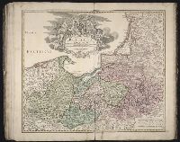
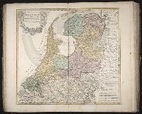
[Atlas factice of 96 maps by Blaeu, Visscher, Jansson, Hondius and others]
Image Count:
2
Description:
Imperfect: cartouche cut-out and replaced in ms. Sheet measures 38.1 x 49.3 cm. Reinforced along edges with printed waste. No. 84 of 92 maps bound together. and Numbered 90 on verso.
Publisher:
Apud Guiljelmum Blaeu
Subject (Geographic):
Salzburg (Austria : Land) --Maps --Early works to 1800
Descriptio ac delineatio geographica detectionis freti, sive, transitus ad occasum supra terras
Image Count:
1
Abstract:
Map depicts the Coat of Arms of the United Kingdom (era of the Union of the Crowns), reigning between the years 1603-1707.
Alternative Title:
Tabula nautica ...
Description:
Bound in after p. [6]., In ink on recto: place names "Okkak", "Nain"[?] and one longer handwritten note on the bottom margin., Map cut and folded irregularly., Map has been repaired with multiple pieces of tape on verso., Map has multiple small stains on both the recto and verso., Printed on recto in lower right corner: A1., and Scale [ca. 1:9,000,000].
Subject (Geographic):
North Atlantic Ocean --Maps --Early works to 1800
Subject (Name):
Hudson, Henry, d. 1611
Collection Created:
Amsterodami Ex officina Hesse lij Gerardi. Anno 1613