Search
You Searched For
Search Results
- Creator:
- Kip, Johannes, 1653-1722
- Published / Created:
- 1903
- Call Number:
- 32 L84 1720/1903
- Container / Volume:
- BRBL_00736
- Image Count:
- 12
- Resource Type:
- Maps, Atlases & Globes
- Found in:
- Beinecke Rare Book and Manuscript Library > A prospect of the city of London, Westminster and St. James Park = veue et perspective de la ville de Londre, Westminster et Parc St. Jacques / John Kip delineavit et sculpsit.
- Creator:
- La Rochefoucauld-Liancourt, François-Alexandre-Frédéric, duc de, 1747-1827
- Published / Created:
- 1799]
- Call Number:
- 755 1799C
- Container / Volume:
- BRBL_00436
- Image Count:
- 1
- Resource Type:
- Maps, Atlases & Globes
- Found in:
- Beinecke Rare Book and Manuscript Library > Carte des Etats-unis : provinces septentrionales.
- Creator:
- La Rochefoucauld-Liancourt, François-Alexandre-Frédéric, duc de, 1747-1827
- Published / Created:
- 1799]
- Call Number:
- 755 1799D
- Container / Volume:
- BRBL_00436
- Image Count:
- 1
- Resource Type:
- Maps, Atlases & Globes
- Found in:
- Beinecke Rare Book and Manuscript Library > Carte des etats-unis : provinces méridionales.
- Creator:
- Capitaine, Louis, ca. 1749-ca. 1797
- Published / Created:
- 1799]
- Call Number:
- 755 1799B
- Container / Volume:
- BRBL_00436
- Image Count:
- 1
- Resource Type:
- Maps, Atlases & Globes
- Found in:
- Beinecke Rare Book and Manuscript Library > Carte génerale des Etats-Unis de l'Amérique Septentrionale : divisée en ses 17 provinces / par L. Capitaine Ier. ingenieur et Associé de la Carte géné'le. de la France en 180 fles.
- Creator:
- Popple, Henry, -1743
- Published / Created:
- [ca. 1741]
- Call Number:
- 755 1734A
- Container / Volume:
- BRBL_00426
- Image Count:
- 1
- Resource Type:
- Maps, Atlases & Globes
- Found in:
- Beinecke Rare Book and Manuscript Library > A map of the British Empire in America, with the French, Spanish and Hollandish settlements adjacent thereto / by Henry Popple.
- Creator:
- Popple, Henry, -1743
- Published / Created:
- [ca. 1741]
- Call Number:
- 71 1741
- Container / Volume:
- BRBL_00687
- Image Count:
- 1
- Resource Type:
- Maps, Atlases & Globes
- Found in:
- Beinecke Rare Book and Manuscript Library > A map of the British Empire in America, with the French, Spanish and Hollandish settlements adjacent thereto / by Henry Popple.
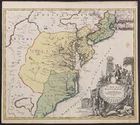
- Creator:
- Homann, Johann Baptist, 1663-1724
- Published / Created:
- ca. 1730]
- Call Number:
- 783 1759
- Container / Volume:
- BRBL_00691
- Image Count:
- 1
- Resource Type:
- Maps, Atlases & Globes
- Found in:
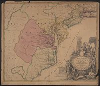
- Beinecke Rare Book and Manuscript Library > Virginia, Marylandia et Carolina in America septentrionali Brittannorum industria excultæ / repraesentatae à Ioh. Bapt. Homann, S.C.M. Geog.
- Creator:
- Capitaine du Chesnoy, Michel, 1746-1804
- Published / Created:
- [1779]
- Call Number:
- 755 1775C
- Container / Volume:
- BRBL_00429
- Image Count:
- 1
- Resource Type:
- Maps, Atlases & Globes
- Found in:
- Beinecke Rare Book and Manuscript Library > Carte du théatre de la guerre dans l'Amerique Septentrionale pendant les années 1775, 76, 77, et 78 [cartographic material] : où se trouvent les principaux camps avec les différentes places et epoques des batailles qui se sont données pendent ces cam
- Creator:
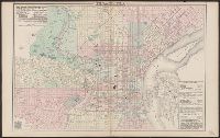
- O.W. Gray & Son
- Published / Created:
- c1876.
- Call Number:
- 774 P53 1876A
- Container / Volume:
- BRBL_00500
- Image Count:
- 1
- Resource Type:
- Maps, Atlases & Globes
- Found in:
- Beinecke Rare Book and Manuscript Library > Philadelphia / [cartographic material] / O.W. Gray & Son.
- Creator:
- Popple, Henry, -1743
- Published / Created:
- [ca. 1741]
- Call Number:
- 85 1760A
- Container / Volume:
- BRBL_00693
- Image Count:
- 1
- Resource Type:
- Maps, Atlases & Globes
- Found in:
- Beinecke Rare Book and Manuscript Library > A map of the British Empire in America, with the French, Spanish and Hollandish settlements adjacent thereto / by Henry Popple.
- Creator:
- Popple, Henry, -1743
- Published / Created:
- [ca. 1741]
- Call Number:
- 89 1733
- Container / Volume:
- BRBL_00697
- Image Count:
- 1
- Resource Type:
- Maps, Atlases & Globes
- Found in:
- Beinecke Rare Book and Manuscript Library > A map of the British Empire in America, with the French, Spanish and Hollandish settlements adjacent thereto / by Henry Popple.
- Creator:
- Homann, Johann Baptist, 1663-1724
- Published / Created:
- ca. 1714]
- Call Number:
- 755 1759
- Container / Volume:
- BRBL_00728
- Image Count:
- 1
- Resource Type:
- Maps, Atlases & Globes
- Found in:
- Beinecke Rare Book and Manuscript Library > Virginia, Marylandia et Carolina in America septentrionali Brittannorum industria excultae / repraesentatae à Ioh. Bapt. Homann, S.C.M. Geog.
- Creator:
- Homann, Johann Baptist, 1663-1724
- Published / Created:
- ca. 1714]
- Call Number:
- 755 1714
- Container / Volume:
- BRBL_00425
- Image Count:
- 1
- Resource Type:
- Maps, Atlases & Globes
- Found in:
- Beinecke Rare Book and Manuscript Library > Virginia, Marylandia et Carolina in America septentrionali Brittannorum industria excultae / repraesentatae à Ioh. Bapt. Homann, S.C.M. Geog.
- Creator:
- Lafon, Barthélémy, 1769-1820
- Published / Created:
- [1806]
- Call Number:
- 795 Or5 1806
- Container / Volume:
- BRBL_00522
- Image Count:
- 1
- Resource Type:
- Maps, Atlases & Globes
- Found in:
- Beinecke Rare Book and Manuscript Library > Carte générale du territoire d'Orléans comprenant aussi la Floride Occidentale et une portion du territoire du Mississipi : dresée d'après les observations les plus récentes / par Bmi. Lafon ... 1806.
- Creator:
- Popple, Henry, -1743
- Published / Created:
- [ca. 1741]
- Call Number:
- 85 1734
- Container / Volume:
- BRBL_00636
- Image Count:
- 1
- Resource Type:
- Maps, Atlases & Globes
- Found in:
- Beinecke Rare Book and Manuscript Library > A map of the British Empire in America, with the French, Spanish and Hollandish settlements adjacent thereto / by Henry Popple.
- Creator:
- Trudeau, Charles Laveau, ca. 1750-1816
- Published / Created:
- 1808]
- Call Number:
- BrSide4o Zc22 808thha
- Image Count:
- 4
- Resource Type:
- Maps, Atlases & Globes
- Found in:
- Beinecke Rare Book and Manuscript Library > [Plans of New Orleans to accompany J.B.S. Thierry's Examen des droits des Etats Unis et des pretentions de Mr. Edouard Livingston sur la batture de Mr. Edouard Livingston sur la batture en face du faubourg Ste. Marie].
- Creator:
- Homann, Johann Baptist, 1663-1724
- Published / Created:
- ca. 1730]
- Call Number:
- 755 1714A
- Container / Volume:
- BRBL_00425
- Image Count:
- 1
- Resource Type:
- Maps, Atlases & Globes
- Found in:
- Beinecke Rare Book and Manuscript Library > Virginia, Marylandia et Carolina in America septentrionali Brittannorum industria excultæ / repraesentatae à Ioh. Bapt. Homann, S.C.M. Geog.
- Creator:
- Homann, Johann Baptist, 1663-1724
- Published / Created:
- ca. 1714]
- Call Number:
- 755 1714B
- Container / Volume:
- BRBL_00425
- Image Count:
- 1
- Resource Type:
- Maps, Atlases & Globes
- Found in:
- Beinecke Rare Book and Manuscript Library > Virginia, Marylandia et Carolina in America septentrionali Brittannorum industria excultae / repraesentatae à Ioh. Bapt. Homann, S.C.M. Geog.
- Creator:
- Popple, Henry, -1743
- Published / Created:
- [ca. 1741]
- Call Number:
- 755 1734B
- Container / Volume:
- BRBL_00426
- Image Count:
- 1
- Resource Type:
- Maps, Atlases & Globes
- Found in:
- Beinecke Rare Book and Manuscript Library > A map of the British Empire in America, with the French, Spanish and Hollandish settlements adjacent thereto / by Henry Popple.
- Creator:
- Blaeu, Willem Janszoon, 1571-1638
- Published / Created:
- 1645-1650]
- Call Number:
- 217 1630
- Container / Volume:
- BRBL_00732
- Image Count:
- 2
- Resource Type:
- Maps, Atlases & Globes
- Found in:
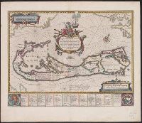
- Beinecke Rare Book and Manuscript Library > Mappa Aestivarum insularum, alias Barmudas dictarum : ad ostia Mexicani aestuarij jacentium in latitudine graduum 32 minutorum 25 ad Anglia, Londino scilicet versus Libonotum 3300 miliaribus Anglicanis, et a Roanoack (qui locus est in Virginia) versus Eur
- Creator:
- Eveil Economique de l'Indochine
- Published / Created:
- 192-?]
- Call Number:
- 5816 192X
- Container / Volume:
- BRBL_00313
- Image Count:
- 2
- Resource Type:
- Maps, Atlases & Globes
- Found in:
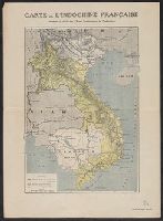
- Beinecke Rare Book and Manuscript Library > Carte de l'Indochine Française / dressée et éditée par l'Eveil Economique de l'Indochine.
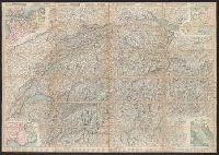
- Creator:
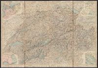
- Leuthold, H. F
- Published / Created:
- 1860
- Call Number:
- 37 1860A
- Image Count:
- 2
- Resource Type:
- Maps, Atlases & Globes
- Found in:
- Beinecke Rare Book and Manuscript Library > Roadmap of Switzerland = Reisekarte der Schweiz = Carta stradale della Svizzera = Carte routière de la Suisse : en partie tirée de l'atlas topographique de la confederation / dresée et gravée par Mullhaupt ; publiée par H.F. Leuthold editeur ; ecrit
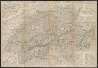
- Creator:
- Leuthold, H. F
- Published / Created:
- 1861
- Call Number:
- 37 1861A
- Image Count:
- 2
- Resource Type:
- Maps, Atlases & Globes
- Found in:
- Beinecke Rare Book and Manuscript Library > Roadmap of Switzerland = Reisekarte der Schweiz = Carta stradale della Svizzera = Carte routière de la Suisse : en partie tirée de l'atlas topographique de la confederation / dresée et gravée par Mullhaupt ; publiée par H.F. Leuthold editeur ; ecrit
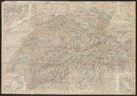
- Creator:
- Leuthold, H. F
- Published / Created:
- 1858
- Call Number:
- 37 1858
- Image Count:
- 2
- Resource Type:
- Maps, Atlases & Globes
- Found in:
- Beinecke Rare Book and Manuscript Library > Roadmap of Switzerland = Reisekarte der Schweiz = Carta stradale della Svizzera = Carte routière de la Suisse : en partie tirée de l'atlas topographique de la confederation / dresée et gravée par Mullhaupt ; publiée par H.F. Leuthold editeur ; ecrit
- Creator:
- Leuthold, H. F
- Published / Created:
- 1867
- Call Number:
- 37 1867
- Image Count:
- 2
- Resource Type:
- Maps, Atlases & Globes
- Found in:
- Beinecke Rare Book and Manuscript Library > Roadmap of Switzerland = Reisekarte der Schweiz = Carta stradale della Svizzera = Carte routière de la Suisse : en partie tirée de l'atlas topographique de la confederation / dresée et gravée par Mullhaupt ; publiée par H.F. Leuthold editeur ; ecrit
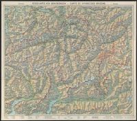
- Creator:
- Imhof, Eduard, 1895-1986
- Published / Created:
- 1944
- Call Number:
- 3763 1944
- Container / Volume:
- BRBL_00150A
- Image Count:
- 2
- Resource Type:
- Maps, Atlases & Globes
- Found in:
- Beinecke Rare Book and Manuscript Library > Reisekarte von Graubünden, Schweiz = Carte de voyage des Grisons, Suisse.
- Creator:
- Leuthold, H. F
- Published / Created:
- 1856
- Call Number:
- 37 1856
- Image Count:
- 2
- Resource Type:
- Maps, Atlases & Globes
- Found in:
- Beinecke Rare Book and Manuscript Library > Roadmap of Switzerland = Reisekarte der Schweiz = Carta stradale della Svizzera = Carte routière de la Suisse : en partie tirée de l'atlas topographique de la confederation / dresée et gravée par Mullhaupt ; publiée par H.F. Leuthold editeur ; ecrit
- Published / Created:
- ca. 1918]
- Call Number:
- 38gme P21 1912
- Container / Volume:
- BRBL_00171
- Image Count:
- 2
- Resource Type:
- Maps, Atlases & Globes
- Found in:
- Beinecke Rare Book and Manuscript Library > Paris [cartographic material] : couleurs-guide-plan / offert par les Grands Magasins du Louvre.
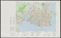
- Creator:
- Canada. Mapping and Charting Establishment
- Published / Created:
- c1979.
- Call Number:
- 739 V66 1976
- Container / Volume:
- BRBL_00391
- Image Count:
- 2
- Resource Type:
- Maps, Atlases & Globes
- Found in:
- Beinecke Rare Book and Manuscript Library > Military city map 1:25 000. Victoria [map] / produced by the Mapping and Charting Establishment, Department of National Defence, Canada = Carte militaire de la ville 1:25 000. Victoria / publiée par le Service de la cartographie, Ministére de la défens
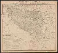
- Creator:
- Županić, Niko
- Published / Created:
- 1915
- Call Number:
- 11hcf 1919E-27
- Container / Volume:
- BRBL_00010ZA
- Image Count:
- 1
- Resource Type:
- Maps, Atlases & Globes
- Found in:
- Beinecke Rare Book and Manuscript Library > Jugoslovenska zemlja = The Jugoslav territory = Le territoire Iougoslave : Map of Jugoslav territory / by Dr. Niko Županić ; Issued for the Jugoslav community in London.
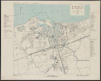
- Creator:
- Great Britain. Inter-service Topographical Dept
- Published / Created:
- 1943, 1944 printing.
- Call Number:
- 38 R81 1944
- Container / Volume:
- BRBL_00165
- Image Count:
- 1
- Resource Type:
- Maps, Atlases & Globes
- Found in:
- Beinecke Rare Book and Manuscript Library > Royan [cartographic material] : plan of town / compiled and drawn by Inter Service Topographical Dept. ; produced under the Superintendence of Vice-Admiral John Edgell, hydrographer.
- Creator:
- Great Britain. Inter-service Topographical Dept
- Published / Created:
- 1943, 1944 printing.
- Call Number:
- 38 Sa233 1944
- Container / Volume:
- BRBL_00165
- Image Count:
- 1
- Resource Type:
- Maps, Atlases & Globes
- Found in:
- Beinecke Rare Book and Manuscript Library > St. Malo [cartographic material] : plan of port and town / compiled and drawn by Inter-Service Topographical Dept. ; produced under the Superintendence of Vice-Admiral John Edgell, hydrographer.
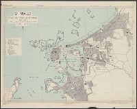
- Creator:
- United States. Army Map Service
- Published / Created:
- 1943
- Call Number:
- 38 R75 1943
- Container / Volume:
- BRBL_00165
- Image Count:
- 1
- Resource Type:
- Maps, Atlases & Globes
- Found in:
- Beinecke Rare Book and Manuscript Library > Rouen, city plan [cartographic material] / prepared under the direction of the Chief of Engineers, U.S. Army, 1943.
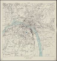
- Creator:
- United States. Army Map Service
- Published / Created:
- 1943
- Call Number:
- 38 Sa24 1943
- Container / Volume:
- BRBL_00165
- Image Count:
- 1
- Resource Type:
- Maps, Atlases & Globes
- Found in:
- Beinecke Rare Book and Manuscript Library > St. Nazaire, city plan [cartographic material] / prepared under the direction of the Chief of Engineers, U.S. Army, Washington, D.C.
- Creator:
- Teleki, Pál, gróf, 1879-1941
- Published / Created:
- 1919
- Call Number:
- 11hcf 1919-51
- Container / Volume:
- BRBL_00010L
- Image Count:
- 1
- Resource Type:
- Maps, Atlases & Globes
- Found in:
- Beinecke Rare Book and Manuscript Library > Magyarország néprajzi térképe a népsürüség alapján = / szerkesztette Grof Teleki Pál = Ethnographical map of Hungary based on the density of population / by Count Paul Teleki = Carte ethnographique de la Hongrie construite en la accordance avec
- Creator:
- Dufrénoy (Firm)
Wuhrer, L
- Published / Created:
- [1920?]
- Call Number:
- 11hcf 1919D-15
- Container / Volume:
- BRBL_00010W
- Image Count:
- 1
- Resource Type:
- Maps, Atlases & Globes
- Found in:
- Beinecke Rare Book and Manuscript Library > Les revendications italiennes envers l'Autriche qui a combattu pour le Pangermanisme contre l'Entente et les revendications italiennes envers les Yougoslaves qui, étant le rempart contre le Pangermanisme, sont les alliés naturels de l'Entente = the Ital
- Creator:
- Dufrénoy (Firm)
Wuhrer, L
- Published / Created:
- [1920?]
- Call Number:
- 11hcf 1919E-33
- Container / Volume:
- BRBL_00010ZA
- Image Count:
- 1
- Resource Type:
- Maps, Atlases & Globes
- Found in:
- Beinecke Rare Book and Manuscript Library > Les revendications italiennes envers l'Autriche qui a combattu pour le Pangermanisme contre l'Entente et les revendications italiennes envers les Yougoslaves qui, étant le rempart contre le Pangermanisme, sont les alliés naturels de l'Entente = the Ital
- Creator:
- Wyld, James, 1812-1887
- Published / Created:
- [1862]
- Call Number:
- 32 L84 1862
- Container / Volume:
- BRBL_00050
- Image Count:
- 1
- Resource Type:
- Maps, Atlases & Globes
- Found in:
- Beinecke Rare Book and Manuscript Library > Wyld's new plan of London = Nouveau plan des Londres = Neuer Plan von London.
- Published / Created:
- [1946?]
- Call Number:
- 331 1946
- Container / Volume:
- BRBL_00079
- Image Count:
- 1
- Resource Type:
- Maps, Atlases & Globes
- Found in:
- Beinecke Rare Book and Manuscript Library > Map of the Netherlands = Karte der Niederlande = Carte de Pays-Bas.
- Published / Created:
- [1917?]
- Call Number:
- 335 Y93 1917
- Container / Volume:
- BRBL_00087
- Image Count:
- 1
- Resource Type:
- Maps, Atlases & Globes
- Found in:
- Beinecke Rare Book and Manuscript Library > Champ de bataille de l'Yser = The Yser battlefield.
- Creator:
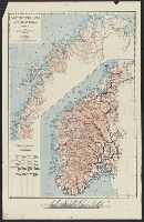
- Landslaget for reiselivet i Norge
- Published / Created:
- [1900?]
- Call Number:
- 344ag 1900
- Container / Volume:
- BRBL_00095
- Image Count:
- 1
- Resource Type:
- Maps, Atlases & Globes
- Found in:
- Beinecke Rare Book and Manuscript Library > Turistkart over Norge = Tourist map of Norway = Carte de Norvège pour les tourists = Touristenkarte über Norwegen.
- Creator:
- United States. Army Map Service
- Published / Created:
- 1943
- Call Number:
- 38 C71 1943
- Container / Volume:
- BRBL_00157
- Image Count:
- 1
- Resource Type:
- Maps, Atlases & Globes
- Found in:
- Beinecke Rare Book and Manuscript Library > Colmar [cartographic material] : city plan / prepared under the direction of the Chief of Engineers, U.S. Army, 1943.
- Creator:
- Great Britain. Inter-service Topographical Dept
- Published / Created:
- 1943, 1944 printing.
- Call Number:
- 38 F31 1944
- Container / Volume:
- BRBL_00157
- Image Count:
- 1
- Resource Type:
- Maps, Atlases & Globes
- Found in:
- Beinecke Rare Book and Manuscript Library > Fécamp, plan of port and town [cartographic material] / compiled and drawn by Inter-Service Topographical Dept. ; produced under the Superintendence of Vice-Admiral John Edgell, hydrographer.
- Creator:
- Great Britain. Inter-service Topographical Dept
- Published / Created:
- 1943, 1944 printing.
- Call Number:
- 38 D742 1944
- Container / Volume:
- BRBL_00157
- Image Count:
- 1
- Resource Type:
- Maps, Atlases & Globes
- Found in:
- Beinecke Rare Book and Manuscript Library > Douarnenez-Tréboul [cartographic material] : plan of port and town / compiled and drawn by Inter-Service Topographical Dept. ; produced under the Superintendence of Vice-Admiral John Edgell, hydrographer.
- Creator:
- Great Britain. Inter-service Topographical Dept
- Published / Created:
- 1943
- Call Number:
- 38 D92 1943
- Container / Volume:
- BRBL_00157
- Image Count:
- 1
- Resource Type:
- Maps, Atlases & Globes
- Found in:
- Beinecke Rare Book and Manuscript Library > Dunkerque [cartographic material] : plan of port & town / compiled and drawn by Inter-Service Topographical Dept. ; produced under the Superintendence of Vice-Admiral John Edgell, hydrographer.
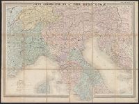
- Creator:
- Andriveau-Goujon, E. (Eugène), 1832-1897
- Published / Created:
- 1859
- Call Number:
- 40 1859F
- Container / Volume:
- BRBL_00201
- Image Count:
- 1
- Resource Type:
- Maps, Atlases & Globes
- Found in:
- Beinecke Rare Book and Manuscript Library > Carte strategique de L'Italie septentrionale [cartographic material] / Imp. Lemercier, Paris.
- Creator:
- Great Britain. War Office. General Staff. Geographical Section
- Published / Created:
- 1919?]
- Call Number:
- 434fd 1919
- Container / Volume:
- BRBL_00251
- Image Count:
- 1
- Resource Type:
- Maps, Atlases & Globes
- Found in:
- Beinecke Rare Book and Manuscript Library > Tcheco-Slovaquie [cartographic material] = Czecho-Slovakia.
- Creator:
- Županić, Niko
- Published / Created:
- 1915
- Call Number:
- 46ed 1915
- Container / Volume:
- BRBL_00260
- Image Count:
- 1
- Resource Type:
- Maps, Atlases & Globes
- Found in:
- Beinecke Rare Book and Manuscript Library > Map of Jugoslav territory [cartographic material] / by Niko Županić.
- Creator:
- Freytag, Berndt und Artaria
- Published / Created:
- 1941
- Call Number:
- 45gmb 1941A
- Container / Volume:
- BRBL_00258
- Image Count:
- 1
- Resource Type:
- Maps, Atlases & Globes
- Found in:
- Beinecke Rare Book and Manuscript Library > Strassenkarte 1:300,000. 56, Lugoj [cartographic material].
- Creator:
- Kiepert, Heinrich, 1818-1899
- Published / Created:
- 1890-1892
- Call Number:
- 501 1890
- Container / Volume:
- BRBL_00276
- Image Count:
- 1
- Resource Type:
- Maps, Atlases & Globes
- Found in:
- Beinecke Rare Book and Manuscript Library > Specialkarte vom westlichen Kleinasien : nach seinen eigenen Reisen und anderen grösstenteils noch unveröffentlichten Routenaufnahmen bearbeitet / von Heinrich Kiepert = Carte de la partie occidentale de l 'Asie mineure / dressée par Henri Kiepert d'ap
- Creator:
- Vallier & Blanc
- Published / Created:
- [1941]
- Call Number:
- 53f 1941
- Container / Volume:
- BRBL_00287
- Image Count:
- 1
- Resource Type:
- Maps, Atlases & Globes
- Found in:
- Beinecke Rare Book and Manuscript Library > South-eastern Europe [cartographic material] = Europe Sud-est = Südost-Europa.
- Creator:
- Great Britain. War Office. General Staff. Geographical Section
- Published / Created:
- 1942
- Call Number:
- 66gmb 1942
- Container / Volume:
- BRBL_00348
- Image Count:
- 1
- Resource Type:
- Maps, Atlases & Globes
- Found in:
- Beinecke Rare Book and Manuscript Library > Africa road map 1:2,000,000 and 1:500,000, Maroc-Algerie-Tunisie.
- Creator:
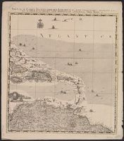
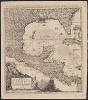
- Visscher, Nicolaes, 1649-1702
- Published / Created:
- [ca. 1690?]
- Call Number:
- 731 1690
- Container / Volume:
- BRBL_00376A
- Image Count:
- 1
- Resource Type:
- Maps, Atlases & Globes
- Found in:
- Beinecke Rare Book and Manuscript Library > Nova tabula geographica complectens borealiorem Americae partem : in qua exacte delineatae sunt Canada sive Nova Francia, Nova Scotia, Nova Anglia, Novum Belgium, Pensylvania, Virginia, Carolina, et Terra Nova, cum omnibus littorum pulvinorumque profundit
- Call Number:
- Zc20 720so
- Collection Title:
- Some considerations on the consequences of the French settling colonies on the Mississippi, with
- Image Count:
- 1
- Found in:
- Beinecke Rare Book and Manuscript Library > A new map of Louisiana and the River Mississipi
- Creator:
- Sotzmann, D. F
- Call Number:
- Zm Sp79
- Collection Title:
- Allgemeines historisches Taschenbuch, oder, Abriss der merkwurdigsten neuen Welt-Begebenheiten
- Image Count:
- 1
- Found in:
- Beinecke Rare Book and Manuscript Library > Die Vereinigten Staaten von Nord America. nach der von Wm Faden 1783
- Published / Created:
- 1612
- Call Number:
- Pequot G325
- Collection Title:
- Descriptio ac delineatio geographica detectionis freti, sive, transitus ad occasum supra terras
- Image Count:
- 1
- Found in:
- Beinecke Rare Book and Manuscript Library > Tabula nautica ...
- Creator:
- Seale, Richard William
- Published / Created:
- [1783?]
- Call Number:
- 1977 Folio 177
- Image Count:
- 4
- Resource Type:
- Maps, Atlases & Globes
- Found in:
- Beinecke Rare Book and Manuscript Library > England and Ireland : containing all the cities, boroughs, markettowns & principal villages : with the coast of France from Calais to Brest delineated and engraved from actual surveys / by Richard William Seale.
- Published / Created:
- 1612
- Call Number:
- Taylor 258
- Collection Title:
- Descriptio ac delineatio geographica detectionis freti, sive, transitus ad occasum supra terras
- Image Count:
- 1
- Found in:
- Beinecke Rare Book and Manuscript Library > Tabula nautica, qua repraesentantur orae maritimae, meatus, ac freta, noviter a H. Hudsono Anglo ad Caurum supra Novam Franciam
- Creator:
- Crublier d'Opterre, Henri, 1739-1799
- Published / Created:
- 1783
- Call Number:
- GEN MSS 499
- Collection Title:
- Henri Crublier d'Opterre journal and maps, [1776]-1783.
- Container / Volume:
- Bsd folder 10
- Image Count:
- 3
- Found in:
- Beinecke Rare Book and Manuscript Library > Unidentified. 'Amérique Septentrionale, 1783. Plan de la Ville et du Port de Ports-mouth, dans le newhampshire.'