Search
You Searched For
Search Results
- Creator:
- Burr, Henry A
- Published / Created:
- 1853
- Call Number:
- 75GM 1853
- Container / Volume:
- BRBL_00410
- Image Count:
- 1
- Resource Type:
- Maps, Atlases & Globes
- Found in:
- Beinecke Rare Book and Manuscript Library > Disturnell's new map of the United States and Canada : showing all the canals, rail roads, telegraph lines and principal stage routes / Drawn by Henry A. Burr.
- Creator:
- Burr, Henry A
- Published / Created:
- 1850
- Call Number:
- 75 1850
- Container / Volume:
- BRBL_00400
- Image Count:
- 2
- Resource Type:
- Maps, Atlases & Globes
- Found in:
- Beinecke Rare Book and Manuscript Library > Disturnell's new map of the United States and Canada : showing all the canals, rail roads, telegraph lines and principal stage routes / drawn by Henry A. Burr, topographer to the Post Office Dep't., Washington, D.C. ; engraved by J.M. Atwood, N.Y.
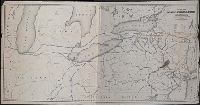
- Creator:
- Goldthwait, J. H
- Published / Created:
- 1861
- Call Number:
- 75 1861D
- Container / Volume:
- BRBL_00402
- Image Count:
- 1
- Resource Type:
- Maps, Atlases & Globes
- Found in:
- Beinecke Rare Book and Manuscript Library > Goldthwait's map of the United States & Canada : exhibiting the railroads with their distances, single and double tracks and width of gauge, and the time compared with noon at Washington & Greenwich / by J.H. Goldthwait.
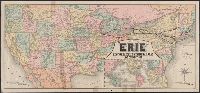
- Creator:
- Rand McNally and Company
- Published / Created:
- 1883
- Call Number:
- 75gme 1883
- Container / Volume:
- BRBL_00413
- Image Count:
- 2
- Resource Type:
- Maps, Atlases & Globes
- Found in:
- Beinecke Rare Book and Manuscript Library > Map of the "Erie" : New-York, Lake Erie and Western Rail Road and connections.
- Creator:
- Poole Brothers
- Published / Created:
- [1927], c1911.
- Call Number:
- 73gme 1927
- Container / Volume:
- BRBL_00376
- Image Count:
- 1
- Resource Type:
- Maps, Atlases & Globes
- Found in:
- Beinecke Rare Book and Manuscript Library > Map of the Canadian Pacific Railway, the Minneapolis, St. Paul & Sault Ste. Marie Railway, the Duluth, South Shore & Atlantic Railway, the Spokane International Railway and connections / Poole Bros, Chicago.
- Creator:
- Poole Brothers
- Published / Created:
- [1901?], c1893.
- Call Number:
- 73eu 1901
- Container / Volume:
- BRBL_00375B
- Image Count:
- 1
- Resource Type:
- Maps, Atlases & Globes
- Found in:
- Beinecke Rare Book and Manuscript Library > Map of the Canadian Pacific Railway, the Minneapolis, St. Paul and Sault Ste. Marie Railway, the Duluth, South Shore and Atlantic Railway and connections / Poole Bros, engravers.
- Published / Created:
- 1853
- Call Number:
- 754gme 1853
- Container / Volume:
- BRBL_00419
- Image Count:
- 1
- Resource Type:
- Maps, Atlases & Globes
- Found in:
- Beinecke Rare Book and Manuscript Library > Map of the Delaware, Lackawanna & Western railroad : with its principal connections.
- Creator:
- J.H. Colton & Co.
- Published / Created:
- 1858
- Call Number:
- 754gme 1858
- Container / Volume:
- BRBL_00420
- Image Count:
- 1
- Resource Type:
- Maps, Atlases & Globes
- Found in:
- Beinecke Rare Book and Manuscript Library > Map of the Mississippi and Missouri Railroad : and its connections.
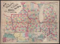
- Published / Created:
- 1870
- Call Number:
- 80 1870B
- Container / Volume:
- BRBL_00535
- Image Count:
- 1
- Resource Type:
- Maps, Atlases & Globes
- Found in:
- Beinecke Rare Book and Manuscript Library > Map of the North West : from explorations by the United States Engineers & Royal Engineers of England and Union & Northern Pacific R.R. surveys.
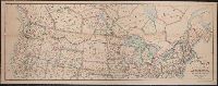
- Creator:
- National Railway Publication Company
- Published / Created:
- [187-?]
- Call Number:
- 71gme 1875
- Container / Volume:
- BRBL_00372
- Image Count:
- 1
- Resource Type:
- Maps, Atlases & Globes
- Found in:
- Beinecke Rare Book and Manuscript Library > Map of the Northern Pacific R.R., its connections and tributary country.