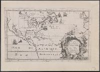
Photocopy of map from Hennepin's Description de la Louisiane. Paris, 1683. and Relief shown pictorially.
Publisher:
s.n.,
Subject (Geographic):
North America--Maps
Subject (Name):
Guérard, Nicholas and Hennepin, Louis, 17th cent. Description de la Louisiane, nouvellement decouverte au sud' oüest de la Nouvelle France, par ordre du roy
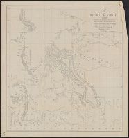
"This map made for the North West Company in 1813 and 1814 ....", Covers British Columbia, portions of Alberta, and U.S. Pacific Northwest., Includes text., Relief shown by hachures., and Reprint of 1814[?] map.
Publisher:
s.n.,
Subject (Geographic):
Canada, Western--Maps and Northwest, Pacific--Maps
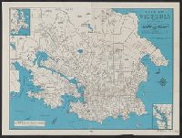
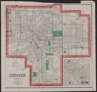
"Copyrighted [blank space where date would be] by the Clason Map Co., Denver Colo.", In lower right: A D Jr., and Includes inset of Denver's business district.
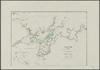
"No. 109-1947.", "S. 40.", Insets: Road to Fraser's Hill farm. Scale [1:6 336]. 8 chains to an in. -- Sketch of road from the Gap to Fraser's Hill. Scale [1:12 672]. 16 chains to an in., and Map of Bukit Fraser showing transportation, water features, recreation
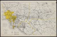
"Constructed between 1933 and 1936, and originally named Boulder Dam, it [Hoover Dam] was renamed in 1947...."--"Hoover Dam," Encyclopedia Britannica Online, accessed 5/15/2002. and Includes ill. showing "Boulder Dam" in relation to L.A. and text of "Dominant factors."
Publisher:
California Map Company, 1120 Story Building, 610 So. Broadway,
Subject (Geographic):
Los Angeles (Calif.)--Maps, Los Angeles Metropolitan Area (Calif.)--Maps, Orange County (Calif.)--Maps, Riverside County (Calif.)--Maps, and San Bernardino County (Calif.)--Maps
Subject (Topic):
Roads--California--Los Angeles Metropolitan Area--Maps