Guessefeld, F. L. (Franz Ludwig), 1744-1807 Harenberg, Johann Christoph, 1696-1774 Hase, Johann Matthias, 1684-1742 Homann Erben (Firm) Homann, Johann Baptist, 1663-1724 Lopez, D. T. Mayer, Tobias, 1723-1762 Rizzi-Zannoni, Giovanni Antonio, 1736-1814 Sperges, Joseph, Freiherr von, 1725-1791
Published / Created:
[1710-1786]
Call Number:
1983 Folio 23
Image Count:
2
Abstract:
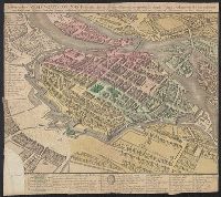
A collection of maps issued by the Johann Baptist Homann or the Homann Erben firm between 1710 and 1786, made by various cartographers besides the Homann and the Homann Erben firm.
All volumes bound to match 1973 Folio 72. Factitious collection of about 549 maps taken from the atlases of the 17th and the beginning of the 18th cent., put together with the title "Atlas" and bound in 6 volumes. These volumes originally bore the imprint: Amstelaedamii apvd Reiniervm & Josvam Ottens. Over these words on the title-pages of v. 1-2, 4-6 is the name of Henrik de Leth who painted them. Volume 3 has only the erased imprint of Ottens., For fuller description see Phillips 3448 and C. Koeman's Atlantes Neerlandici, bibliography of terrestrial, maritime and celestial atlases and pilot books, published in the Netherlands up to 1800, Amsterdam c1967-71, v. 2, p. 63-83., and Maps by P. Schenck and son, G. Valck, F. de Wit, N. Visscher and others.
Publisher:
chez J. Covens & C. Mortier,
Subject (Geographic):
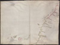
Denmark --Maps --Early works to 1800
Subject (Name):
Reiner et Josua Ottens (Firm), Schenk, Peter, 1660-1718 or 1719., and Valck, G. (Gerard), 1651 or 1652-1726.
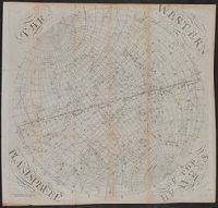
The earth's eastern planisphere., The earth's western planisphere., The eastern planisphere of the heavens., and The western planisphere of the heavens.
Description:
2 astronomical charts, 2 hemispherical maps, 1 untitled slider sheet. and Imperfect: Sheet 5 trimmed, with some loss of text.
Publisher:
Published ... by S. Dunn & W. Owen,
Subject (Geographic):
Eastern Hemisphere--Maps--Early works to 1800 and Western Hemisphere--Maps--Early works to 1800
Subject (Name):
Dunn, Samuel, d. 1794, publisher
Subject (Topic):
Constellations--Charts, diagrams, etc.--Early works to 1800
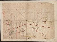
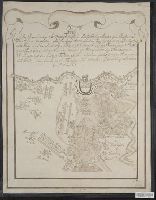
In manuscript on map: Kapitan" Matveĭ Loginov"; on verso: Ural-Gebiet, zwischen Kasan u. Jekaterinburg; stampf of the Königliches Kartographisches Institut, Berlin., Relief shown pictorially and by spot heights., and Title devised by cataloger.
Subject (Geographic):
Orenburgskai︠a︡ oblastʹ (Russia)--Maps--Early works to 1800. and Ural Mountains (Russia)--Maps--Early works to 1800.