Search
You Searched For
Search Results
- Creator:
- Maury, Matthew Fontaine, 1806-1873
- Published / Created:
- 1850
- Call Number:
- 11cfk 1850D-1
- Container / Volume:
- BRBL_00773
- Image Count:
- 4
- Resource Type:
- Maps, Atlases & Globes
- Found in:
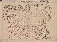
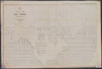
- Beinecke Rare Book and Manuscript Library > Wind and current chart of the North Atlantic [cartographic material] : thermal sheet / by M.F. Maury, A.M. Lieut. U.S. Navy, Superint'dt. of U.S.N. Observatory ; compiled from materials in the Bureau of Ordnance and Hydrography, Commodore Lewis Warrington, Chief of Bureau ; drawn by Lt. Benjn. S. Gantt, U.S.N.
- Published / Created:
- [1813]
- Call Number:
- 774 M193 1813
- Container / Volume:
- BRBL_00714
- Image Count:
- 4
- Resource Type:
- Maps, Atlases & Globes
- Found in:
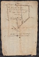
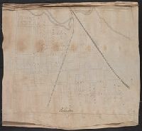
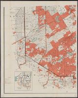
- Beinecke Rare Book and Manuscript Library > [Manuscript map of McKean County].
- Creator:
- Istituto geografico militare (Italy)
- Published / Created:
- 1912
- Call Number:
- 69 1912
- Container / Volume:
- BRBL_00352
- Image Count:
- 4
- Resource Type:
- Maps, Atlases & Globes
- Found in:
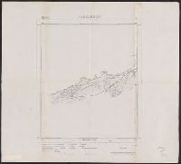
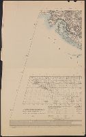
- Beinecke Rare Book and Manuscript Library > Levate topografiche al 25 000 dei dintorni di Tripoli [cartographic material] / rilievo eseguito dal personale dell'Istituto geografico militare messo a disposizione del Comando del Corpo d'occupazione.
- Creator:
- Rizzi-Zannoni, Giovanni Antonio, 1736-1814, cartographer
- Published / Created:
- 1795
- Call Number:
- 402 1795
- Container / Volume:
- BRBL_00233
- Image Count:
- 4
- Resource Type:
- Maps, Atlases & Globes
- Found in:
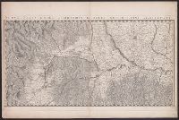
- Beinecke Rare Book and Manuscript Library > Nuova carta della Lombardia e delle sue regioni aggiacenti / formata d'ordine di S.M. Siciliana dal Reg. Geogr. G.A. Rizzi-Zannoni ; Gius. Guerra Nap. Reg. inc.
- Published / Created:
- 1884]
- Call Number:
- 32ex Ab97 1884
- Container / Volume:
- BRBL_00075
- Image Count:
- 4
- Resource Type:
- Maps, Atlases & Globes
- Found in:
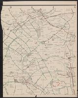
- Beinecke Rare Book and Manuscript Library > [Map of one hundred square miles round Abury; showing the British and Roman Stone and Earthworks of the Downs of North Wilts; by the Rev. A.C. Smith.
- Published / Created:
- [1870?]
- Call Number:
- 766 N46 1870H
- Container / Volume:
- BRBL_00712
- Image Count:
- 4
- Resource Type:
- Maps, Atlases & Globes
- Found in:
- Beinecke Rare Book and Manuscript Library > Manuscript maps of New Haven.
- Creator:
- McKinley Publishing Company
- Published / Created:
- [1912], ©1912.
- Call Number:
- 50cf 1906
- Container / Volume:
- BRBL_00274
- Image Count:
- 4
- Resource Type:
- Maps, Atlases & Globes
- Found in:
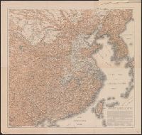
- Beinecke Rare Book and Manuscript Library > McKinley's wall outline maps, Asia.
- Published / Created:
- 1901
- Call Number:
- 4828ed 1901
- Container / Volume:
- BRBL_00265
- Image Count:
- 4
- Resource Type:
- Maps, Atlases & Globes
- Found in:
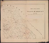
- Beinecke Rare Book and Manuscript Library > Karte ethnographique du vilayet de Salonique.
- Published / Created:
- [1920?].
- Call Number:
- 38gmb 1920A
- Container / Volume:
- BRBL_00170
- Image Count:
- 4
- Resource Type:
- Maps, Atlases & Globes
- Found in:
- Beinecke Rare Book and Manuscript Library > Carte routière de France de Dion-Bouton : spéciale pour automobiles / Dressée au Service Cartographique de Dion-Bouton.
- Creator:
- Hoebel, Paul
- Published / Created:
- 1910
- Call Number:
- 56 1901
- Container / Volume:
- BRBL_00296
- Image Count:
- 4
- Resource Type:
- Maps, Atlases & Globes
- Found in:
- Beinecke Rare Book and Manuscript Library > Hoebels Karte v. China [cartographic material] / gezeichnet und übersetzt von Paul Hoebel, Terrainzeichnung von F. Pilger.
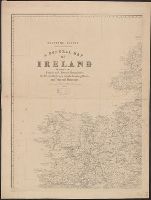
- Creator:
- Ordnance Survey of Ireland
- Published / Created:
- [188-]
- Call Number:
- 327 1875
- Container / Volume:
- BRBL_00073
- Image Count:
- 4
- Resource Type:
- Maps, Atlases & Globes
- Found in:
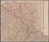
- Beinecke Rare Book and Manuscript Library > A general map of Ireland : showing the county and barony boundaries, the rivers, railways, canals, leading roads and principal demesnes ... (New Edition).
- Published / Created:
- 1808
- Call Number:
- 89cea 1808
- Container / Volume:
- BRBL_00658
- Image Count:
- 4
- Resource Type:
- Maps, Atlases & Globes
- Found in:
- Beinecke Rare Book and Manuscript Library > A General Chart of the West Indies and Gulf of Mexico, describing the Gulf and Winward Passages, Coasts of Florida, Louisiana and Mexico, Bay of Honduras and Musquito Shore ... Drawn from the surveys taken by Mr. Geo Gaulo ... by Foss Dessiou.
- Published / Created:
- 1905
- Call Number:
- 771 Ad47 1905
- Container / Volume:
- BRBL_00480
- Image Count:
- 4
- Resource Type:
- Maps, Atlases & Globes
- Found in:
- Beinecke Rare Book and Manuscript Library > Map of the Adirondack Forest and adjoining territory / compiled from the official maps and field notes on file in the state departments at Albany, N.Y. ; by authority of the Forest, Fish, and Game Commission.
- Creator:
- American Geographical Society of New York
- Published / Created:
- 1918
- Call Number:
- 44cbd 1918
- Container / Volume:
- BRBL_00256
- Image Count:
- 4
- Resource Type:
- Maps, Atlases & Globes
- Found in:
- Beinecke Rare Book and Manuscript Library > Block diagram showing terrain of the Balkan Peninsula [cartographic material].
- Creator:
- Beers, S. N
- Published / Created:
- 1859
- Call Number:
- 771 On8 1859
- Container / Volume:
- BRBL_00490
- Image Count:
- 4
- Resource Type:
- Maps, Atlases & Globes
- Found in:
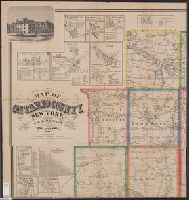
- Beinecke Rare Book and Manuscript Library > Map of Ontario County, New York : from actual surveys / by S.N. Beers, assisted by D.G. Beers.
- Creator:
- Maury, Matthew Fontaine, 1806-1873
- Published / Created:
- 1852
- Call Number:
- 11cfk 1850F
- Container / Volume:
- BRBL_00774
- Image Count:
- 4
- Resource Type:
- Maps, Atlases & Globes
- Found in:
- Beinecke Rare Book and Manuscript Library > Whale chart of the world [cartographic material] / by M.F. Maury, L.L.D. Lieut. U.S. Navy, superin'dt. of U.S.N. Observatory ; compiled from materials in the Bureau of Ordnance and Hydrography by P.M. A.C. Jackson.
- Creator:
- Pownall, Thomas, 1722-1805
- Published / Created:
- March 25th, 1776.
- Call Number:
- 71 1776N
- Container / Volume:
- BRBL_00726
- Image Count:
- 4
- Resource Type:
- Maps, Atlases & Globes
- Found in:
- Beinecke Rare Book and Manuscript Library > A map of the middle British colonies in North America [cartographic material] : First published by Lewis Evans, of Philadelphia, in 1755 ; and since corrected and improved, as also extended, with the addition of New England, and bordering parts of Canada
- Creator:
- Beer, Wilhelm, 1797-1850
- Published / Created:
- 1834
- Call Number:
- 4 1835
- Container / Volume:
- BRBL_00196
- Image Count:
- 4
- Resource Type:
- Maps, Atlases & Globes
- Found in:
- Beinecke Rare Book and Manuscript Library > Mappa selenographica [cartographic material] : totam lunae hemisphaeram visibilem complectens observationibus propriis : quatuor sectionibus constructa et delineata / Suae Majestati Friderico Sexto, regi daniae illustrissimo summa veneratione dedicata ; a
- Published / Created:
- 1913
- Call Number:
- 428 Ot9 1913
- Container / Volume:
- BRBL_00249
- Image Count:
- 4
- Resource Type:
- Maps, Atlases & Globes
- Found in:
- Beinecke Rare Book and Manuscript Library > Oetzthal & Stubai.
- Creator:
- Walling, Henry Francis, 1825-1888
- Published / Created:
- 1858
- Call Number:
- 764 B45 1858
- Container / Volume:
- BRBL_00454
- Image Count:
- 6
- Resource Type:
- Maps, Atlases & Globes
- Found in:
- Beinecke Rare Book and Manuscript Library > Map of the county of Berkshire, Massachusetts : based upon the trigonometrical survey of the state / the details from actual surveys under the direction of Henry F. Walling, supt. of the state map.