Search
You Searched For
Search Results
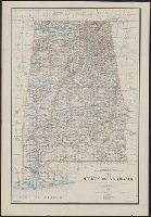
- Creator:
- King, Harry
- Published / Created:
- 1895
- Call Number:
- 793 1895
- Container / Volume:
- BRBL_00520
- Image Count:
- 1
- Resource Type:
- Maps, Atlases & Globes
- Alternative Title:
- Department of the Interior General Land
- Publisher:
- Department of the Interior, General
- Found in:
- Beinecke Rare Book and Manuscript Library > Map of the state of Alabama : compiled from the official records of the General Land Office and other sources / under the direction of Harry King, C.E. Chief of Drafting Division G.L.O.; compiled by Rob[t] H. Morton; revised and drawn by Daniel O'Hare.
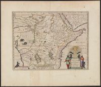
- Creator:
- Blaeu, Joan, 1596-1673
- Published / Created:
- 1672]
- Call Number:
- 63 1662
- Container / Volume:
- BRBL_00334
- Image Count:
- 2
- Resource Type:
- Maps, Atlases & Globes
- Alternative Title:
- Aethiopia superior vel interior, vulgo
- Found in:
- Beinecke Rare Book and Manuscript Library > Aethiopia svperior vel interior, vulgo Abissinorvm sive Presbiteri Ioannis imperivm.
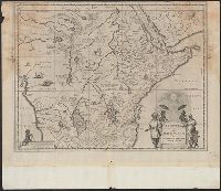
- Creator:
- Blaeu, Joan, 1596-1673
- Published / Created:
- 1670?]
- Call Number:
- 63 1670
- Container / Volume:
- BRBL_00334
- Image Count:
- 1
- Resource Type:
- Maps, Atlases & Globes
- Alternative Title:
- Aethiopia superior vel interior, vulgo
- Found in:
- Beinecke Rare Book and Manuscript Library > Aethiopia svperior vel interior, vulgo Abissinorvm sive Presbiteri Ioannis imperivm.
- Creator:
- Canada. Dominion Water Power Branch
- Published / Created:
- [1912]
- Call Number:
- 737CBF 1912
- Container / Volume:
- BRBL_00386
- Image Count:
- 1
- Resource Type:
- Maps, Atlases & Globes
- Publisher:
- Dept. of the Interior Water Power
- Found in:
- Beinecke Rare Book and Manuscript Library > Contour map of Bow River Basin above Calgary [Alberta] : to accompany report on power and storage investigation / by M.C. Hendry.
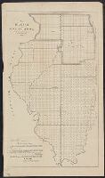
- Published / Created:
- 1848
- Call Number:
- 806fcm 1848
- Container / Volume:
- BRBL_00549
- Image Count:
- 1
- Resource Type:
- Maps, Atlases & Globes
- Publisher:
- [U.S. Dept. of Interior, General Land
- Found in:
- Beinecke Rare Book and Manuscript Library > Diagram of the State of Illinois, accompanying the report of the 20th of October,1848; [by] F.R. Conway.
- Creator:
- Canada. Railway Lands Branch
- Published / Created:
- 1916
- Call Number:
- 736FCM 1916
- Container / Volume:
- BRBL_00383
- Image Count:
- 1
- Resource Type:
- Maps, Atlases & Globes
- Publisher:
- Dept. of the Interior, Railway Lands
- Found in:
- Beinecke Rare Book and Manuscript Library > Map of Manitoba, Saskatchewan and Alberta : showing the number of quarter sections available for homestead entry in each township, also the pre-emption and purchased homestead area as defined by the Dominion Lands Act 1908 / prepared in the Railway Lands
- Published / Created:
- 1881
- Call Number:
- 736FCM 1881
- Container / Volume:
- BRBL_00383
- Image Count:
- 1
- Resource Type:
- Maps, Atlases & Globes
- Publisher:
- the Interior,
- Found in:
- Beinecke Rare Book and Manuscript Library > Map of Part of the Province of Manitoba, shewing Dominion lands surveyed and lands disposed of.
- Creator:
- United States. General Land Office
- Published / Created:
- 1866
- Call Number:
- 844fcm 1866
- Container / Volume:
- BRBL_00615
- Image Count:
- 1
- Resource Type:
- Maps, Atlases & Globes
- Publisher:
- Department of the Interior, General
- Found in:
- Beinecke Rare Book and Manuscript Library > Map of public surveys in California & Nevada : to accompany report of Commissioner of the General Land Office, 1866.
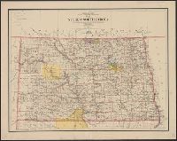
- Creator:
- United States. General Land Office
- Published / Created:
- 1903
- Call Number:
- 822 1903
- Container / Volume:
- BRBL_00567
- Image Count:
- 1
- Resource Type:
- Maps, Atlases & Globes
- Publisher:
- Dept. of the Interior, General Land
- Found in:
- Beinecke Rare Book and Manuscript Library > Map of the state of North Dakota / compiled from the official records of the General Land Office and other sources under the direction of Frank Bond ; compiled and drawn by M. Hendges ; lettered by Wm. Bauman, Jr.
- Creator:
- Geological Survey (U.S.)
- Published / Created:
- 1917
- Call Number:
- BrSides Elephant Folio 2018 24
- Image Count:
- 2
- Resource Type:
- Maps, Atlases & Globes
- Publisher:
- Dept. of the Interior, U.S. Geological
- Found in:
- Beinecke Rare Book and Manuscript Library > Topographic map of the Island of Oahu [cartographic material] : city and county of Honolulu / surveyed 1909-1913 by the Engineer Troops, U.S. Army ; control by U.S. Coast and Geodetic Survey and Hawaiian Territorial Survey ; assembled and drawn by the U.S