Skip to search
Skip to main content
Skip to first result
Search
You Searched For
"Interiors"
Format
cartographic
New Search
Search Results
Creator:
Published / Created:
1895
Call Number:
793 1895
Container / Volume:
BRBL_00520
Image Count:
1
Resource Type:
Maps, Atlases & Globes
Alternative Title:
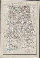
Department of the Interior General Land
Description:
Covers also part of Tennessee, Georgia, Florida, and Mississippi., Prime meridians: Greenwich and Washington, D.C., and Relief shown by shading.
Publisher:
Department of the Interior , General
Subject (Geographic):
Alabama--Maps
Subject (Name):
Morton, Robert H, O'Hare, Daniel, and United States. General Land Office
Found in:
Beinecke Rare Book and Manuscript Library > Map of the state of Alabama : compiled from the official records of the General Land Office and other sources / under the direction of Harry King, C.E. Chief of Drafting Division G.L.O.; compiled by Rob[t] H. Morton; revised and drawn by Daniel O'Hare.
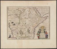
Creator:
Published / Created:
1672]
Call Number:
63 1662
Container / Volume:
BRBL_00334
Image Count:
2
Resource Type:
Maps, Atlases & Globes
Alternative Title:
Aethiopia superior vel interior , vulgo
Description:
From the author's Atlas major. 1662., Includes ill. of animals and ornamental cartouche., Relief shown pictorially., and Verso: text with running title "Abyssinorvm Imperivm," page numbers "86", "85"; signature "Bb".
Publisher:
J. Blaeu,
Subject (Geographic):
Africa, Central--Maps--Early works to 1800 and Africa, Eastern--Maps--Early works to 1800
Subject (Name):
Blaeu, Joan, 1596-1673. Atlas maior
Found in:
Beinecke Rare Book and Manuscript Library > Aethiopia svperior vel interior, vulgo Abissinorvm sive Presbiteri Ioannis imperivm.
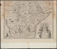
Creator:
Published / Created:
1670?]
Call Number:
63 1670
Container / Volume:
BRBL_00334
Image Count:
1
Resource Type:
Maps, Atlases & Globes
Alternative Title:
Aethiopia superior vel interior , vulgo
Description:
Appears in the author's Atlas major., Includes ill. of animals and ornamental cartouche., Relief shown pictorially., and Sheet measures 42.6 x 56.1 cm. Blank sheet (6.8 x 56 cm.) pasted to bottom.
Publisher:
J. Blaeu,
Subject (Geographic):
Africa, Central--Maps--Early works to 1800 and Africa, Eastern--Maps--Early works to 1800
Subject (Name):
Blaeu, Joan, 1596-1673. Atlas maior
Found in:
Beinecke Rare Book and Manuscript Library > Aethiopia svperior vel interior, vulgo Abissinorvm sive Presbiteri Ioannis imperivm.
Creator:
Published / Created:
[1912]
Call Number:
737CBF 1912
Container / Volume:
BRBL_00386
Image Count:
1
Resource Type:
Maps, Atlases & Globes
Alternative Title:
Bow River Basin above Calgary
Description:
Relief shown by contours and spot heights.
Publisher:
Dept. of the Interior Water Power
Subject (Geographic):
Bow River Region (Alta.)--Maps
Subject (Name):
Hendry, M. C
Subject (Topic):
Watersheds--Alberta--Maps
Found in:
Beinecke Rare Book and Manuscript Library > Contour map of Bow River Basin above Calgary [Alberta] : to accompany report on power and storage investigation / by M.C. Hendry.
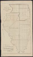
Published / Created:
1848
Call Number:
806fcm 1848
Container / Volume:
BRBL_00549
Image Count:
1
Resource Type:
Maps, Atlases & Globes
Description:
map shows detailed data concerning land districts (townships). For publisher compare Phillips, Lists of Maps, vol.II, page 328, item 5. and Preliminary record.
Publisher:
[U.S. Dept. of Interior , General Land
Subject (Geographic):
Illinois--Maps
Found in:
Beinecke Rare Book and Manuscript Library > Diagram of the State of Illinois, accompanying the report of the 20th of October,1848; [by] F.R. Conway.
Creator:
Published / Created:
1916
Call Number:
736FCM 1916
Container / Volume:
BRBL_00383
Image Count:
1
Resource Type:
Maps, Atlases & Globes
Description:
"Corrected to July 1916.", Relief shown by hachures., and Shows surveyed township sections and railway routes.
Publisher:
Dept. of the Interior , Railway Lands
Subject (Geographic):
Prairie Provinces--Surveys--Maps
Subject (Name):
Lynch, F. C. C. (Francis Christopher Chisholm), 1884-
Subject (Topic):
Homestead law--Prairie Provinces--Maps
Found in:
Beinecke Rare Book and Manuscript Library > Map of Manitoba, Saskatchewan and Alberta : showing the number of quarter sections available for homestead entry in each township, also the pre-emption and purchased homestead area as defined by the Dominion Lands Act 1908 / prepared in the Railway Lands
Published / Created:
1881
Call Number:
736FCM 1881
Container / Volume:
BRBL_00383
Image Count:
1
Resource Type:
Maps, Atlases & Globes
Description:
"Electoral Districts marked by RED LINES."
Publisher:
the Interior ,
Subject (Geographic):
Manitoba--Maps
Found in:
Beinecke Rare Book and Manuscript Library > Map of Part of the Province of Manitoba, shewing Dominion lands surveyed and lands disposed of.
Creator:
Published / Created:
1866
Call Number:
844fcm 1866
Container / Volume:
BRBL_00615
Image Count:
1
Resource Type:
Maps, Atlases & Globes
Alternative Title:
House executive document (United States. Congress. House) ; 38th Congress, 1st session, no. 1.
Description:
"House R. Ex. Doc. No. 1, 38th Cong., 1st Sess.", Includes "List of private grants finally surveyed.", Relief shown by hachures., and Shows drainage, townships, railroads, mines, oil springs, land grants, etc.
Publisher:
Department of the Interior , General
Subject (Geographic):
California--Maps and California--Surveys--Maps
Subject (Name):
Bien, Julius, 1826-1909
Subject (Topic):
Land grants--California--Maps and Mines and mineral resources--California--Maps
Found in:
Beinecke Rare Book and Manuscript Library > Map of public surveys in California & Nevada : to accompany report of Commissioner of the General Land Office, 1866.
Creator:
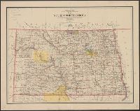
Published / Created:
1903
Call Number:
822 1903
Container / Volume:
BRBL_00567
Image Count:
1
Resource Type:
Maps, Atlases & Globes
Description:
Relief shown by shading.
Publisher:
Dept. of the Interior , General Land
Subject (Geographic):
North Dakota--Maps
Subject (Name):
Bauman, Wm. (William), Bond, Frank, 1856-1940, and Hendges, M
Found in:
Beinecke Rare Book and Manuscript Library > Map of the state of North Dakota / compiled from the official records of the General Land Office and other sources under the direction of Frank Bond ; compiled and drawn by M. Hendges ; lettered by Wm. Bauman, Jr.
Creator:
Published / Created:
1917
Call Number:
BrSides Elephant Folio 2018 24
Image Count:
2
Resource Type:
Maps, Atlases & Globes
Description:
In two sheets., Includes inset of The Hawaiian Islands., and Relief shown by contours and spot heights; contour interval 40 ft.
Publisher:
Dept. of the Interior , U.S. Geological
Subject (Geographic):
Hawaii--Oahu and Oahu (Hawaii)--Maps
Subject (Name):
Birdseye, C. H. (Claude Hale), 1878-1941, Davis, Geo. R. (George R.), Fowler, A. T, Hawaii. Territorial Survey., Marshall, R. B. (Robert Bradford), 1867-1949, and U.S. Coast and Geodetic Survey
Found in:
Beinecke Rare Book and Manuscript Library > Topographic map of the Island of Oahu [cartographic material] : city and county of Honolulu / surveyed 1909-1913 by the Engineer Troops, U.S. Army ; control by U.S. Coast and Geodetic Survey and Hawaiian Territorial Survey ; assembled and drawn by the U.S
Branch:v1.61.8 ,Deployed:2024-06-20T11:14:55-04:00