Skip to search
Skip to main content
Skip to first result
Search
You Searched For
Format
cartographic
New Search
Search Results
Creator:
Published / Created:
undated
Call Number:
WA MSS 303
Collection Title:
Lewis and Clark Expedition maps and receipt, ca. 1803-1810
Container / Volume:
Box 1 | Folder 3r
Image Count:
1
Subject (Topic):
Lewis and Clark Expedition (1804-1806) and West (U.S.)
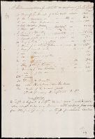
Found in:
Beinecke Rare Book and Manuscript Library > "A Memorandum of Articles in readiness for the Voyage," manuscript list
Creator:
Published / Created:
1943
Call Number:
36gma 1943
Container / Volume:
BRBL_00130
Image Count:
1
Resource Type:
Maps, Atlases & Globes
Description:
"Map no. 1994, 25 August 1943." and 1. Northwestern waterways -- 2. Berlin -- 3. Magdeburg.
Publisher:
Lithographed in the Reproduction Branch, OSS,
Subject (Geographic):
Europe, Central--Maps and Germany--Maps
Subject (Topic):
Inland navigation--Europe, Central--Maps and Inland navigation--Germany--Maps
Found in:
Beinecke Rare Book and Manuscript Library > "Greater Germany" inland waterways.
Creator:
Published / Created:
1945
Call Number:
36cb 1945
Container / Volume:
BRBL_00127
Image Count:
1
Resource Type:
Maps, Atlases & Globes
Description:
"No. 6339." and Shows cave regions within the "Greater" German boundary of 1944.
Publisher:
OSS,
Subject (Geographic):
Europe, Central--Maps
Subject (Topic):
Caves--Europe, Central--Maps
Found in:
Beinecke Rare Book and Manuscript Library > "Greater" Germany caves and cave regions.
Creator:
Published / Created:
1945
Call Number:
36eb 1945B
Container / Volume:
BRBL_00127
Image Count:
1
Resource Type:
Maps, Atlases & Globes
Description:
"No. 6381-R & A, OSS, 28 April 1945.", "Population data compiled in the Department of State, Division of Geography and Cartography.", and Inset: [Düsseldorf-Münster area].
Publisher:
R & A, OSS,
Subject (Geographic):
Europe, Central--Population--Maps and Germany--Population--Maps
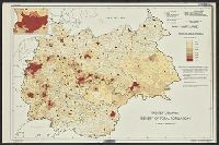
Found in:
Beinecke Rare Book and Manuscript Library > "Greater" Germany, density of total population by Kreise or similar units excluding cities 10,000 and over.
Creator:
Published / Created:
1945
Call Number:
36eb 1945C
Container / Volume:
BRBL_00127
Image Count:
1
Resource Type:
Maps, Atlases & Globes
Description:
"No. 6380 - R & A, OSS, 28 April 1945." and Includes sources.
Publisher:
R & A, OSS,
Subject (Geographic):
Europe, Central--Population--Maps and Germany--Population--Maps
Found in:
Beinecke Rare Book and Manuscript Library > "Greater" Germany, density of total population by Kreise or similar units.
Creator:
Published / Created:
1945
Call Number:
36eb 1939A
Container / Volume:
BRBL_00127
Image Count:
1
Resource Type:
Maps, Atlases & Globes
Description:
"No. 6356, R.A., OSS, 10 April 1945." and Inset: [Düsseldorf-Münster area]
Publisher:
R & A, OSS,
Subject (Geographic):
Europe, Central--Maps and Germany--Maps
Subject (Topic):
Working class--Europe, Central--Maps and Working class--Germany--Maps
Found in:
Beinecke Rare Book and Manuscript Library > "Greater" Germany, population dependent upon commercial and service occupations (by Kreise 1939).
Creator:
Published / Created:
1945
Call Number:
36eb 1945A
Container / Volume:
BRBL_00127
Image Count:
1
Resource Type:
Maps, Atlases & Globes
Description:
"No. 7113--R & A, IRIS 31 October 1945." and Includes notes and 1 inset.
Publisher:
The Branch,
Subject (Geographic):
Germany--Maps and Germany--Population--Maps
Found in:
Beinecke Rare Book and Manuscript Library > "Greater" Germany. : population change by Kreise, circa 1933-1939.
Creator:
Published / Created:
1945
Call Number:
36eb 1939
Container / Volume:
BRBL_00127
Image Count:
1
Resource Type:
Maps, Atlases & Globes
Description:
"No. 6357 - R & A, OSS, 10 April 1945.", "Population data compiled in the Department of State, Division of Geography and Cartography.", and Inset: [Düsseldorf-Münster area]
Publisher:
R & A, OSS,
Subject (Geographic):
Europe, Central--Population--Maps and Germany--Population--Maps
Found in:
Beinecke Rare Book and Manuscript Library > "Greater" Germany; population dependent upon agriculture (by kreise, 1939)
Published / Created:
[1944?]
Call Number:
307hc 1944
Container / Volume:
BRBL_00036A
Image Count:
1
Resource Type:
Maps, Atlases & Globes
Description:
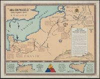
Inset: North African and Sicilian campaigns.
Publisher:
G-2 Section, 2nd A.D.,
Subject (Geographic):
Europe, Western--Maps
Found in:
Beinecke Rare Book and Manuscript Library > "Hell on Wheels" 1942-1943-1944.
Published / Created:
[1874?]
Call Number:
796gme 1874
Container / Volume:
BRBL_00531
Image Count:
2
Resource Type:
Maps, Atlases & Globes
Alternative Title:
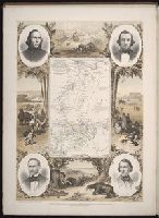
Proposed lines of the International R.R. of Mexico., Railroad map of Texas, Texas New Yorker., Texas New Yorker's map of the United States., and Travelers' and immigrants' guide, or railroad map to Texas
Description:
"Entered according to act of Congress in the year 1874 by Geo. H. Sweet in the office of the Librarian of Congress at Washington.", "Supplement to the 'Texas New Yorker' ....", From the Streeter collection., Includes text, ill., location map, and inset of "Proposed lines of the International R.R. of Mexico.", Prime meridians: Greenwich and Washington., Relief shown by hachures., and Text and "Texas New Yorker's map of the United States: showing the principal railroad routes" (scale [ca. 1:9,000,000]) on verso.
Publisher:
Geo. H. Sweet,
Subject (Name):
Streeter, Thomas W.--(Thomas Winthrop),--1883-1965--Ownership and Sweet, George H
Subject (Topic):
Railroads--Mexico--Maps, Railroads--Texas--Maps, and Railroads--United States--Maps
Found in:
Beinecke Rare Book and Manuscript Library > "Texas New Yorker's" railroad map of Texas : showing all completed and proposed routes, with principal rivers, county boundaries and county-seats, railroad stations and distances, congressional districts, United States military telegraph line, and frontie
Creator:
Call Number:
A52 030 1
Collection Title:
Ancient monuments of the Mississippi Valley: comprising the results of extensive original surveys
Image Count:
1
Description:
Facing p. 96.
Subject (Geographic):
Mississippi River Valley --Antiquities
Subject (Name):
Davis, E. H. (Edwin Hamilton), 1811-1888
Subject (Topic):
Mound-builders and Mounds --Mississippi River Valley
Collection Created:
[Washington, Smithsonian institution, 1848]
Found in:
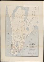
Beinecke Rare Book and Manuscript Library > "The serpent;" (Entry 1014) Adams County Ohio. Pl. XXXV [35]
Published / Created:
1817
Call Number:
766 N46 1817
Container / Volume:
BRBL_00469A
Image Count:
1
Resource Type:
Maps, Atlases & Globes
Description:
This map is mounted. It measures about 1/4" larger.
Publisher:
A. Doolittle,
Subject (Geographic):
New Haven (Conn.)--Maps
Found in:
Beinecke Rare Book and Manuscript Library > "To the mayor, aldermen & Common Council of the city of New Haven, this plan is ... dedicated by ... Amos Doolittle."
Published / Created:
[1824]
Call Number:
766 N46 1824A
Container / Volume:
BRBL_00470
Image Count:
1
Resource Type:
Maps, Atlases & Globes
Description:
This map is mounted. It measures about 1/4" larger.
Publisher:
A. Doolittle,
Subject (Geographic):
New Haven (Conn.)--Maps
Found in:
Beinecke Rare Book and Manuscript Library > "To the mayor, aldermen & Common Council of the city of New Haven, this plan is ... dedicated by ... Amos Doolittle."
Published / Created:
undated
Call Number:
WA MSS S-2962
Collection Title:
Northern Pacific Railway Company maps and drawings
Container / Volume:
Box 1 | Map 11
Image Count:
1
Resource Type:
Maps, Atlases & Globes
Subject (Geographic):
Idaho and Washington (State)
Subject (Name):
Northern Pacific Railway Company
Subject (Topic):
Railroads
Found in:
Beinecke Rare Book and Manuscript Library > (IDAHO & WASHINGTON) [Anon.] [Untitled map of northwestern Idaho and northeastern Washington].
Creator:
Published / Created:
1890
Call Number:
WA MSS S-2962
Collection Title:
Northern Pacific Railway Company maps and drawings
Container / Volume:
Box 1 | Map 10
Image Count:
2
Resource Type:
Maps, Atlases & Globes
Description:
Distance 24-1/l0 Miles.
Subject (Geographic):
Clearwater River (Idaho), Nez Perce Indian Reservation (Idaho), Palouse River Valley (Idaho and Wash.), Snake River (Idaho), and Washington (State)
Subject (Name):
Northern Pacific Railway Company and Spokane and Palouse Railway Company
Subject (Topic):
Railroads--Right of way
Found in:
Beinecke Rare Book and Manuscript Library > (IDAHO) Kendrick, J. W., Surveyor. Map Showing Definite Location of the Spokane & Palouse Ry. (Lewiston Extension). From Julietta to Lewiston Idaho Territory. Distance 24-1/lO Miles. Drawn by J. M. Gibboney. Assistant Engineer's Office, Tacoma, Washington. Scale 1 in.=2000 ft.
Published / Created:
undated
Call Number:
WA MSS S-2962
Collection Title:
Northern Pacific Railway Company maps and drawings
Container / Volume:
3 (Roll) | Map 24
Image Count:
1
Resource Type:
Maps, Atlases & Globes
Abstract:
Map depicting the the region along the Kootenai and Clark Rivers, near the Montana-Idaho border. Lake Pend Oreille, Idaho is a lower left. Routes of the Great Northern and Northern Pacific railroads are shown.
Description:
Scale 1/2=1 mile.
Subject (Geographic):
Idaho and Montana
Subject (Name):
Northern Pacific Railway Company
Subject (Topic):
Railroads
Found in:
Beinecke Rare Book and Manuscript Library > (MONTANA & IDAHO) [Anon.] [Untitled map of far northwestern Montana and a part of the Idaho panhandle.]
Creator:
Published / Created:
1891 April 6
Call Number:
WA MSS S-2962
Collection Title:
Northern Pacific Railway Company maps and drawings
Container / Volume:
Box 1 | Map 34
Image Count:
1
Resource Type:
Maps, Atlases & Globes
Abstract:
Havre, Montana, and the upper Milk River, which includes all existing railroad lines, wagon roads, telegraph lines, towns, forts, "Fort Assiniboine Military Reserve", springs, etc.
Subject (Geographic):
Milk River (Mont.) and Montana
Subject (Name):
Great Northern Railway Company (U.S.) and St. Paul, Minneapolis & Manitoba Railway Company
Subject (Topic):
Railroads
Collection Created:
1870-1966
Found in:
Beinecke Rare Book and Manuscript Library > (MONTANA) Bischoff, A. Map of North- West part of Montana...Great Northern Line St. Paul, Minneapolis & Manitoba Ry. Pacific Extension. Elbridge H. Beckler, Chief Engineer. Helena, Mont. Scale 1 in.= 2 miles.
Creator:
Published / Created:
1887 August
Call Number:
WA MSS S-2962
Collection Title:
Northern Pacific Railway Company maps and drawings
Container / Volume:
Box 1 | Map 33
Image Count:
2
Resource Type:
Maps, Atlases & Globes
Description:
Scale 12 miles to 1 inch. On verso: "Route map - St. P.M. & M.Ry. Mont. Extn. Minot to Butte ... "
Subject (Geographic):
Fort Berthold Indian Reservation (N.D.), Montana, North Dakota, and Yellowstone River (Mont.)
Subject (Name):
Northern Pacific Railway Company and St. Paul, Minneapolis & Manitoba Railway Company
Subject (Topic):
Railroads
Found in:
Beinecke Rare Book and Manuscript Library > (MONTANA) Roberts, E. J. Montana Extension. The Saint Paul, Minneapolis and Manitoba Ry. Co. Scale 12 miles to 1 inch.
Published / Created:
1886
Call Number:
WA MSS S-2962
Collection Title:
Northern Pacific Railway Company maps and drawings
Container / Volume:
Box 1 | Map 31
Image Count:
1
Resource Type:
Maps, Atlases & Globes
Description:
Scale 1"=6 miles.
Subject (Geographic):
Flathead Lake (Mont.), Missouri River, and Montana
Subject (Name):
Northern Pacific Railway Company
Subject (Topic):
Railroads
Found in:
Beinecke Rare Book and Manuscript Library > (MONTANA) [Anon.] Map of a Portion of Montana Territory.
Published / Created:
undated
Call Number:
WA MSS S-2962
Collection Title:
Northern Pacific Railway Company maps and drawings
Container / Volume:
Box 1 | Map 36
Image Count:
1
Resource Type:
Maps, Atlases & Globes
Abstract:
Map depicting the region between the Marias River and the Canadian border, marked as British Possessions. the routes of the Great Northern and then Great Falls and Canada railroads are shown, as well as topographical detail, the "Road from Fort Benton to
Subject (Geographic):
Montana
Subject (Name):
Great Northern Railway Company (U.S.)
Subject (Topic):
Railroads
Found in:
Beinecke Rare Book and Manuscript Library > (MONTANA) [Anon.] [Untitled map of a part of north central Montana.]
Creator:
Published / Created:
1915
Call Number:
11hcf 1919E-5
Container / Volume:
BRBL_00010ZA
Image Count:
1
Resource Type:
Maps, Atlases & Globes
Alternative Title:
Europe 1:1,000,000, G.S.G.S. ; no. 2758, and G.S.G.S. ; no. 2758.
Description:
Copy 2 ms. notes, hand col. spots on map. and Includes index to adjoining sheets, index to boundaries, and pronunciation glossary.
Publisher:
Ordnance Survey,
Subject (Geographic):
Austria--Maps and Europe, Eastern--Maps
Found in:
Beinecke Rare Book and Manuscript Library > (Vienna) Wien : North M 33. / compiled at the Royal Geographical Society under the direction of the Geographical Section ; drawn and printed by Ordnance Survey.
Creator:
Published / Created:
1918
Call Number:
11hcf 1919E-6
Container / Volume:
BRBL_00010ZA
Image Count:
1
Resource Type:
Maps, Atlases & Globes
Alternative Title:
Europe 1:1,000,000, G.S.G.S. ; no. 2758, and G.S.G.S. ; no. 2758.
Description:
"Minor corrections December 1918." and Includes index to adjoining sheets, index to boundaries, and pronunciation glossary.
Publisher:
Ordnance Survey,
Subject (Geographic):
Austria--Maps and Europe, Eastern--Maps
Found in:
Beinecke Rare Book and Manuscript Library > (Vienna) Wien : North M 33. / compiled at the Royal Geographical Society under the direction of the Geographical Section ; drawn and printed by Ordnance Survey.
Creator:
Published / Created:
1915
Call Number:
11hcf 1919E-5
Container / Volume:
BRBL_00010ZA
Image Count:
1
Resource Type:
Maps, Atlases & Globes
Alternative Title:
Europe 1:1,000,000, G.S.G.S. ; no. 2758, and G.S.G.S. ; no. 2758.
Description:
Includes index to adjoining sheets, index to boundaries, and pronunciation glossary.
Publisher:
Ordnance Survey,
Subject (Geographic):
Austria--Maps and Europe, Eastern--Maps
Found in:
Beinecke Rare Book and Manuscript Library > (Vienna) Wien : North M 33. / compiled at the Royal Geographical Society under the direction of the Geographical Section ; drawn and printed by Ordnance Survey.
Published / Created:
1891 September 10
Call Number:
WA MSS S-2962
Collection Title:
Northern Pacific Railway Company maps and drawings
Container / Volume:
Box 1 | Map 40
Image Count:
1
Resource Type:
Maps, Atlases & Globes
Description:
Scale 1 in. = 2780 ft. Map depicts the city of Spokane, all existing railroad lines, topographical detail, townships, smelters, etc.
Subject (Geographic):
Spokane (Wash.) and Washington (State)
Subject (Name):
Northern Pacific Railway Company
Subject (Topic):
Railroads
Found in:
Beinecke Rare Book and Manuscript Library > (WASHINGTON) [Anon.] Sketch of Country North of Spokane Wash. Helena Mont.
Creator:
Published / Created:
1915
Call Number:
11hcf 1919E-12
Image Count:
1
Resource Type:
Maps, Atlases & Globes
Alternative Title:
Europe 1:1,000,000, G.S.G.S. ; no. 2758, and GSGS (Series) ; no. 2758.
Description:
Includes index to adjoining sheets, index to boundaries, and pronunciation glossary.
Publisher:
Ordnance Survey,
Subject (Geographic):
Europe, Eastern--Maps
Subject (Topic):
World War, 1914-1918--Maps
Found in:
Beinecke Rare Book and Manuscript Library > (Warsaw) Varshava : North N. 34. / compiled at the Royal Geographical Society under the direction of the Geographical Section; drawn and printed by Ordnance Survey.
Creator:
Published / Created:
1854
Call Number:
Folio 296
Image Count:
1
Resource Type:
Books, Journals & Pamphlets
Description:
Hand colored map. and In double columns. In portfolio.
Publisher:
Published for the author by E. Stanford; [etc., etc.]
Subject (Geographic):
Africa, Central --Maps and Africa, Central--Description and travel
Subject (Name):
Overweg, Adolf,--1822-1852, Richardson, James,--1806-1851, and Vogel, Eduard,--1829-1856
Found in:
Beinecke Rare Book and Manuscript Library > ... An account of the progress of the expedition to Central Africa, performed by order of Her Majesty's Foreign office, under Messrs. Richardson, Barth, Overweg & Vogel, in the years 1850, 1851, 1852, and 1853. Consisting of maps and illustrations, with descriptive notes, constructed and comp. from official and private materials by Augustus Petermann ...
Published / Created:
[1730?]
Call Number:
894 1730
Container / Volume:
BRBL_00659
Image Count:
1
Resource Type:
Maps, Atlases & Globes
Description:
Preliminary record.
Publisher:
Willm. Mount & T. Page,
Subject (Geographic):
Honduras--Maps--Early works to 1800
Found in:
Beinecke Rare Book and Manuscript Library > ... This draught. being part of ye Spanish & Musketor Shore & the Bay of Honduras with. ye Islands adjacent; ... by ... Samuel Penthalow.
Published / Created:
1842
Call Number:
32 Ox1 1842
Container / Volume:
BRBL_00052A
Image Count:
1
Resource Type:
Maps, Atlases & Globes
Publisher:
J.R.N.,
Subject (Geographic):
Oxford (England)--Maps
Found in:
Beinecke Rare Book and Manuscript Library > 10 miles round Oxford. Printed by Day and Haghe ... London.
Published / Created:
1850
Call Number:
1976 Folio 96
Collection Title:
A new universal atlas containing maps of the various empires, kingdoms, states and republics of the
Image Count:
1
Resource Type:
Maps, Atlases & Globes
Publisher:
Thomas, Cowperthwait & Co
Subject (Geographic):
Connecticut
Collection Created:
Philadelphia, Cowperthwait, DeSilver & Butler, 1854, c1850
Found in:
Beinecke Rare Book and Manuscript Library > 10. Map of Connecticut
Creator:
Published / Created:
1886 c1882.
Call Number:
774 P53 1886
Container / Volume:
BRBL_00500
Image Count:
1
Resource Type:
Maps, Atlases & Globes
Alternative Title:
Smith's 12 miles around Philadelphia. and Twelve miles around Philadelphia.
Description:
On panel: Smith's 12 miles around Philadelphia. and Shows wards and radial distances.
Publisher:
Smith,
Subject (Geographic):
Philadelphia--Maps
Found in:
Beinecke Rare Book and Manuscript Library > 12 miles around Philadelphia.
Published / Created:
[1909?]
Call Number:
771 N49 1609
Image Count:
1
Resource Type:
Maps, Atlases & Globes
Description:
This map is based upon the early colonial surveys of ...
Publisher:
Townsend Macoon,
Subject (Geographic):
New York (N.Y.)--Maps--Early works to 1800
Found in:
Beinecke Rare Book and Manuscript Library > 1609 The Island of Manhattan (Mannahtin) at the time of its discovery ... L.L. Coates Engr'g Co., N.Y.
Creator:
Published / Created:
©1909.
Call Number:
771 N49 1664
Container / Volume:
BRBL_00483
Image Count:
1
Resource Type:
Maps, Atlases & Globes
Alternative Title:
Amsterdam in New Netherland, Early New York., and New Amsterdam 1653-1664
Description:
"The personal names are those of the more prominent citizens of that period with the location of their homes.", "The principal points of interest for this period are in red.", Includes historical notes., Relief shown by hachures., and Shows the footprints of some historic buildings and names them; roads and wharves are also named.
Publisher:
Townsend MacCoun,
Subject (Geographic):
Manhattan (New York, N.Y.)--History--Colonial period, ca. 1600-1775--Maps, New York (N.Y.)--History--Colonial period, ca. 1600-1775--Maps, and New York (N.Y.)--Maps
Subject (Name):
L.L. Poates Engr'g Co
Found in:
Beinecke Rare Book and Manuscript Library > 1653-1664 Amsterdam in New Netherland [cartographic material] : the city of the Dutch West India Company / by Townsend MacCoun ; L.L. Poates Engr'g. Co.
Creator:
Published / Created:
©1909.
Call Number:
771 N49 1730
Container / Volume:
BRBL_00484
Image Count:
1
Resource Type:
Maps, Atlases & Globes
Alternative Title:
New York 1730 and New York, the English Colonial city
Description:
"The principal points of interest for this period are in red.", Includes historical notes., Relief shown by hachures., Shows the footprints of some historic buildings and of Fort George and names them; roads and wharves are also named., and This is one map from the set titled: Early New York.
Publisher:
Townsend MacCoun,
Subject (Geographic):
Manhattan (New York, N.Y.)--History--Colonial period, ca. 1600-1775--Maps, New York (N.Y.)--History--Colonial period, ca. 1600-1775--Maps, and New York (N.Y.)--Maps
Found in:
Beinecke Rare Book and Manuscript Library > 1730 New York, the English Colonial city / by Townsend MacCoun ; L.L. Poates Engr'g. Co.
Published / Created:
[1909?]
Call Number:
771 N49 1783
Container / Volume:
BRBL_00484
Image Count:
1
Resource Type:
Maps, Atlases & Globes
Publisher:
Townsend Macoon,
Subject (Geographic):
New York (N.Y.)--Maps--Early works to 1800
Found in:
Beinecke Rare Book and Manuscript Library > 1783 Manhattan Island at the close of the Revolution showing the American City with its Landmarks ... Fortifications ... L.L. Poates Engr'g Co., N.Y.
Creator:
Published / Created:
[1878?].
Call Number:
75 1878
Container / Volume:
BRBL_00406
Image Count:
16
Resource Type:
Maps, Atlases & Globes
Alternative Title:
Centennial map of the United States and territories and Centennial map of the United States, 1879.
Description:
Imperfect: Sheet 5 wanting., In portfolio., and Relief shown by hachures.
Publisher:
J. Bien,
Subject (Geographic):
United States--Maps
Subject (Name):
Bien, Julius, 1826-1909, Roeser, C. (Charles), United States. General Land Office, and Woods, William L
Found in:
Beinecke Rare Book and Manuscript Library > 1876 Centennial map of the United States and territories : showing the extent of public surveys, indian and military reservations, land grant R.R. rail roads, canals, cities, towns & other details / compiled from the official surveys of the General Land O
Creator:
Published / Created:
c1917.
Call Number:
30 1917B
Container / Volume:
BRBL_00032A
Image Count:
1
Resource Type:
Maps, Atlases & Globes
Description:
Caricature map., Copyright: Karel Horký., and Countries are represented by animal ill. to depict international relations.
Publisher:
s.n.],
Subject (Geographic):
Europe--Maps and Europe--Politics and government--Maps
Subject (Topic):
World War, 1914-1918--Maps
Found in:
Beinecke Rare Book and Manuscript Library > 1914--1915--1916--1917--?? / drawn by J. Lenhard.
Creator:
Published / Created:
[1928]
Call Number:
844 R524 1928
Container / Volume:
BRBL_00607
Image Count:
2
Resource Type:
Maps, Atlases & Globes
Alternative Title:
Map of Riverside and New 1928 map of Riverside, California and road map of Southern California
Description:
"Copyright by Geo. C. Thomas.", "Southern California highway map" (scale [ca. 1:1,360,000]), text, and advertisements on verso., and Includes index and advertisements.
Publisher:
Thomas Bros.,
Subject (Geographic):
Riverside (Calif.)--Maps
Subject (Name):
Thomas, Geo. Coupland (George Coupland)
Subject (Topic):
Roads--California, Southern--Maps and Streets--California--Riverside--Maps
Found in:
Beinecke Rare Book and Manuscript Library > 1928 map of Riverside / compiled & published by Thomas Bros.
Creator:
Published / Created:
[1930]
Call Number:
827 1930
Container / Volume:
BRBL_00577
Image Count:
2
Resource Type:
Maps, Atlases & Globes
Alternative Title:
Aeronautical and topographical map of United States. and Oklahoma
Description:
Includes inset of the panhandle, advertisement for "The Oklahoma Farmer-Stockman," and 9 photos., Index, population info., "Aeronautical and topographical map of United States," and text of U.S. air mail service on verso., and Relief shown by hachures.
Publisher:
George F. Cram,
Subject (Geographic):
Oklahoma--Maps
Subject (Topic):
Airways--United States--Maps and Roads--Oklahoma--Maps
Found in:
Beinecke Rare Book and Manuscript Library > 1930 census map of Oklahoma / George F. Cram Company, engravers and publishers.
Creator:
Published / Created:
[1931]
Call Number:
824gmb 1931
Container / Volume:
BRBL_00572
Image Count:
2
Resource Type:
Maps, Atlases & Globes
Alternative Title:
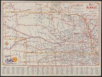
1931 road map, Nebraska, Nebraska, and Shell 1931 official road map, Nebraska
Description:
"Shell 1931 official road map, United States" (scale [ca. 1:11,750,000]), distance table, text, and col. ill. on verso. and Indexed.
Publisher:
H.M. Gousha Company,
Subject (Geographic):
Nebraska--Maps
Subject (Name):
Shell Oil Company
Subject (Topic):
Roads--Nebraska--Maps
Found in:
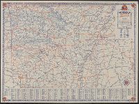
Beinecke Rare Book and Manuscript Library > 1931 official road map, Nebraska / [prepared for] Shell.
Creator:
Published / Created:
[1931]
Call Number:
822gmb 1931
Container / Volume:
BRBL_00567
Image Count:
2
Resource Type:
Maps, Atlases & Globes
Alternative Title:
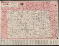
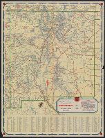
1931, North Dakota :, North Dakota, Standard Oil Company (Indiana) 1931 official road map, North Dakota, and Standard Oil Company (Indiana) 1931 official road map, United States.
Description:
"Standard Oil Company (Indiana) 1931 official road map, United States," text, and logos on verso., In lower right: E-237-J., and Indexed.
Publisher:
H.M. Gousha,
Subject (Geographic):
North Dakota--Maps
Subject (Name):
Standard Oil Company (Indiana)
Subject (Topic):
Roads--North Dakota--Maps
Found in:
Beinecke Rare Book and Manuscript Library > 1931 official road map, North Dakota / this map showing main trunk and highways is distributed with the compliments of Standard Oil Company (Indiana).
Creator:
Published / Created:
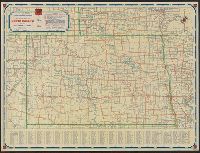
[1932]
Call Number:
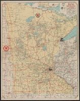
814gmb 1932
Container / Volume:
BRBL_00559
Image Count:
2
Resource Type:
Maps, Atlases & Globes
Alternative Title:
Texaco road map, Minnesota :
Description:
"Texaco road map, 1932, United States," local route maps of Minneapolis-St. Paul and Duluth, distance table, indexes, ill., and text on verso., In lower right: A4 2820., and Includes inset of northeastern Minnesota.
Publisher:
Rand McNally and Co.,
Subject (Geographic):
Minnesota--Maps
Subject (Name):
Texas Company
Subject (Topic):
Roads--Minnesota--Maps
Found in:
Beinecke Rare Book and Manuscript Library > 1932 Texaco road map, Minnesota.
Published / Created:
[1932?], c1931.
Call Number:
833gmb 1932
Container / Volume:
BRBL_00586
Image Count:
2
Resource Type:
Maps, Atlases & Globes
Alternative Title:
Highway map of the state of Wyoming and Wyoming worth knowing.
Description:
Includes ill. and text., Relief shown by hachures and spot heights., Text, photos, and highway map of United States on verso., and Verso caption: Wyoming worth knowing.
Publisher:
Wyoming State Dept. of Commerce and Industry, in cooperation Wyoming State Highway Dept.,
Subject (Geographic):
Wyoming--Maps
Subject (Name):
Wyoming. Dept. of Commerce and Industry and Wyoming. State Highway Dept
Subject (Topic):
Roads--Wyoming--Maps
Found in:
Beinecke Rare Book and Manuscript Library > 1932 highway map of the state of Wyoming.
Creator:
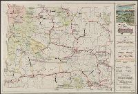
Published / Created:
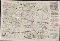
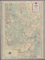
[1933]
Call Number:
833gmb 1933
Container / Volume:
BRBL_00586
Image Count:
2
Resource Type:
Maps, Atlases & Globes
Alternative Title:
Highway map of the state of Wyoming and Wyoming worth knowing.
Description:
Also shows air routes, national forests, game refuges, national parks and monuments, Indian reservations, military reservations, and historic trails., Includes ill. and text., and Photos, text, distance table, and map of western states (scale [ca. 1:12,500,000]
Publisher:
Wyoming State Dept. of Commerce and Industry,
Subject (Geographic):
Wyoming--Maps
Subject (Name):
Wyoming. Dept. of Commerce and Industry
Subject (Topic):
Roads--Wyoming--Maps
Found in:
Beinecke Rare Book and Manuscript Library > 1933 highway map of the state of Wyoming / Wyoming State Highway Department.
Creator:
Published / Created:
[1934]
Call Number:
818gmb 1934
Container / Volume:
BRBL_00565
Image Count:
2
Resource Type:
Maps, Atlases & Globes
Alternative Title:
1934 road map, Arkansas and Arkansas
Description:
In lower right: P.3., Indexed., Relief shown by hachures., and Text, distance table, and ill. on verso.
Publisher:
Rand McNally,
Subject (Geographic):
Arkansas--Maps
Subject (Name):
Gulf Refining Company
Subject (Topic):
Roads--Arkansas--Maps
Found in:
Beinecke Rare Book and Manuscript Library > 1934 official road map, Arkansas / [prepared for] Gulf Refining Co.
Creator:
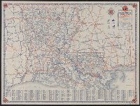
Published / Created:
[1934]
Call Number:
795gmb 1934
Container / Volume:
BRBL_00523
Image Count:
2
Resource Type:
Maps, Atlases & Globes
Alternative Title:
1934 road map, Louisiana and Louisiana
Description:
"P.15.", Indexed., and Text, distance table, and ill. on verso.
Publisher:
Rand McNally,
Subject (Geographic):
Louisiana--Maps
Subject (Name):
Gulf Refining Company
Subject (Topic):
Roads--Louisiana--Maps
Found in:
Beinecke Rare Book and Manuscript Library > 1934 official road map, Louisiana / [prepared for] Gulf Refining Co.
Creator:
Published / Created:
[1934]
Call Number:
841gmb 1934
Container / Volume:
BRBL_00597
Image Count:
2
Resource Type:
Maps, Atlases & Globes
Alternative Title:
1934 official road map, United States., Highway map of New Mexico, New Mexico, Official road map, New Mexico, Official road map, United States., Road map, New Mexico, Road map, United States., and United States.
Description:
Copyright: 1934, H.M. Gousha Company., Ill., index to points of interest, text of "Interesting places in New Mexico," and "1934 official road map, United States" (scale [ca. 1:10,800,000]) on verso., In lower right: 2H 245 J.C., Indexed., and Relief shown by shading and spot heights.
Publisher:
H.M. Gousha,
Subject (Geographic):
New Mexico--Maps
Subject (Name):
Phillips Petroleum Company
Subject (Topic):
Express highways--United States--Maps and Roads--New Mexico--Maps
Found in:
Beinecke Rare Book and Manuscript Library > 1934 official road map, New Mexico / [prepared for] Phillips Petroleum Company.
Creator:
Published / Created:
[1934]
Call Number:
822gmb 1934
Container / Volume:
BRBL_00567
Image Count:
2
Resource Type:
Maps, Atlases & Globes
Alternative Title:
Highway map of North Dakota, North Dakota, Phillips Petroleum Company 1934 official road map, North Dakota, and Phillips Petroleum Company 1934 official road map, United States.
Description:
"Phillips Petroleum Company 1934 official road map, United States," text, and ill. on verso., In lower right: H-237-J.C., Indexed., and Relief shown by hachures.
Publisher:
H.M. Gousha,
Subject (Geographic):
North Dakota--Maps
Subject (Name):
Phillips Petroleum Company
Subject (Topic):
Roads--North Dakota--Maps
Found in:
Beinecke Rare Book and Manuscript Library > 1934 official road map, North Dakota / compliments of Phillips Petroleum Company.
Creator:
Published / Created:
1937
Call Number:
832gmb 1937
Container / Volume:
BRBL_00583
Image Count:
2
Resource Type:
Maps, Atlases & Globes
Alternative Title:
Idaho, Idaho, Standard stations road map, and Standard stations road map, Idaho
Description:
"Prepared exclusively for Standard Oil Company of California., In lower right: 10-K., Indexed., Mileage chart, 3 insets and ancillary U.S. map on verso., and Relief shown by hachures and spot heights.
Publisher:
H.M. Gousha,
Subject (Geographic):
Idaho--Maps
Subject (Topic):
Roads--Idaho--Maps
Found in:
Beinecke Rare Book and Manuscript Library > 1937 road map, Idaho.
Creator:
Published / Created:
1938
Call Number:
796gmb 1938
Container / Volume:
BRBL_00531
Image Count:
2
Resource Type:
Maps, Atlases & Globes
Alternative Title:
Texas highway map
Description:
"Corrected to April 1, 1938"., Ill. on verso., Includes local route maps, index, and ill., and Relief shown pictorially and by spot heights.
Publisher:
Texas Highway Dept.],
Subject (Geographic):
Roads--Texas--Maps and Texas--Maps
Subject (Name):
Texas. Highway Dept
Found in:
Beinecke Rare Book and Manuscript Library > 1938 Texas highway map / compiled and drawn by R.M. Stene.
Branch:v1.62.5 ,Deployed:2024-07-17T14:11:01-04:00