Search
You Searched For
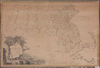
Search Results
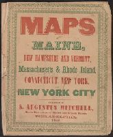
- Published / Created:
- 1846
- Call Number:
- 76 1846A
- Container / Volume:
- BRBL_00445
- Image Count:
- 7
- Resource Type:
- Maps, Atlases & Globes
- Found in:
- Beinecke Rare Book and Manuscript Library > Maps of Maine, New Hampshire and Vermont, Massachusetts & Rhode Island, Connecticut, New York and New York City.
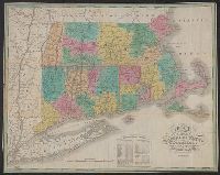
- Published / Created:
- 1825
- Call Number:
- 76 1825A
- Container / Volume:
- BRBL_00444
- Image Count:
- 1
- Resource Type:
- Maps, Atlases & Globes
- Abstract:
- Massachusetts, Connecticut and Rhode Island, divided
- Alternative Title:
- Massachusetts Connecticut & Rhode
- Description:
- Cover title: Massachusetts Connecticut
- Subject (Geographic):
- Massachusetts--Maps.
- Found in:
- Beinecke Rare Book and Manuscript Library > Map of Massachusetts Connecticut and Rhode Island [cartographic material] : constructed from the latest authorities. 1825. / Drawn by D.H. Vance. Engraved by J.H. Young.
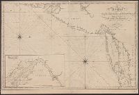
- Published / Created:
- [1815].
- Call Number:
- 755cea 1815
- Container / Volume:
- BRBL_00442
- Image Count:
- 1
- Resource Type:
- Maps, Atlases & Globes
- Found in:
- Beinecke Rare Book and Manuscript Library > A new chart of the coast of Connecticut. New York, New Jersey and the Delaware ... by Samuel Lambert, Salem. Wightman Sculpsit.
- Creator:
- Dorman, Moses, author.
- Published / Created:
- 1830
- Call Number:
- 764 An23 1830
- Image Count:
- 1
- Resource Type:
- Maps, Atlases & Globes
- Description:
- portion of the City of Lawrence, Massachusetts.
- Subject (Topic):
- Landowners--Massachusetts--Andover
- Found in:
- Beinecke Rare Book and Manuscript Library > A plan of Andover taken for the town / by Moses Dorman, Jr.
- Creator:
- Dearborn, Benjamin, 1754-1838
- Published / Created:
- [1814]
- Call Number:
- 764 B65 1814A
- Container / Volume:
- BRBL_00455
- Image Count:
- 2
- Resource Type:
- Maps, Atlases & Globes
- Description:
- Removed from Massachusetts House
- Subject (Topic):
- Drainage--Massachusetts--Boston
- Found in:
- Beinecke Rare Book and Manuscript Library > A plan of those parts of Boston and the towns in its vicinity : with the waters and flats adjacent which are immediately or remotely connected with the contemplated design of erecting perpetual tide-mills.
- Published / Created:
- [1833?]
- Call Number:
- 764CA 1833
- Container / Volume:
- BRBL_00460
- Image Count:
- 1
- Resource Type:
- Maps, Atlases & Globes
- Subject (Geographic):
- Massachusetts--Maps
- Found in:
- Beinecke Rare Book and Manuscript Library > Geological map of Massachusetts By Edw. D. Hitchcock 1833 ...
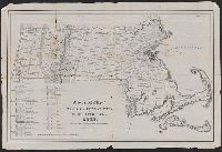
- Published / Created:
- 1801
- Call Number:
- 764FB 1801
- Container / Volume:
- BRBL_00462
- Image Count:
- 1
- Resource Type:
- Maps, Atlases & Globes
- Subject (Geographic):
- Massachusetts--Maps
- Found in:
- Beinecke Rare Book and Manuscript Library > Map of Massachusetts proper compiled from actual surveys made by Order of the General Court. And under the inspection of Agents of their Appointment. By Osgood Carleton.
- Published / Created:
- 1837
- Call Number:
- 764gme 1837
- Container / Volume:
- BRBL_00462
- Image Count:
- 2
- Resource Type:
- Maps, Atlases & Globes
- Subject (Geographic):
- Massachusetts--Maps
- Found in:
- Beinecke Rare Book and Manuscript Library > Route of the Western Rail Road ... Enlarged from the Map of the State.
- Published / Created:
- 1848
- Call Number:
- 76 1848
- Container / Volume:
- BRBL_00445
- Image Count:
- 1
- Resource Type:
- Maps, Atlases & Globes
- Found in:
- Beinecke Rare Book and Manuscript Library > Map of Massachusetts, Rhode Island and Connecticut.
- Published / Created:
- 1835
- Call Number:
- 764 B65 1835
- Container / Volume:
- BRBL_00455
- Image Count:
- 1
- Resource Type:
- Maps, Atlases & Globes
- Subject (Topic):
- City planning--Massachusetts--Boston
- Found in:
- Beinecke Rare Book and Manuscript Library > The South Cove territory, comprising every part which is coloured on this map.