Search
You Searched For
Search Results
- Published / Created:
- 1755]
- Call Number:
- 755 1755A
- Container / Volume:
- BRBL_00690
- Image Count:
- 1
- Resource Type:
- Maps, Atlases & Globes
- Found in:
- Beinecke Rare Book and Manuscript Library > A map of the British & French Plantations in North America.
- Creator:
- Kitchin, Thomas, 1718-1784
- Published / Created:
- 1756
- Call Number:
- 755 1765A
- Container / Volume:
- BRBL_00690
- Image Count:
- 1
- Resource Type:
- Maps, Atlases & Globes
- Found in:
- Beinecke Rare Book and Manuscript Library > A map of the eastern part of the Province of New York : with part of New Jersey &c. / drawn from the best authorities by T. Kitchin geogr.
- Published / Created:
- [1754]
- Call Number:
- 755 1754
- Container / Volume:
- BRBL_00728
- Image Count:
- 1
- Resource Type:
- Maps, Atlases & Globes
- Found in:
- Beinecke Rare Book and Manuscript Library > An accurate map of the English colonies in North America, bordering on the river Ohio.
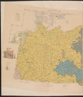
- Creator:
- Great Britain. War Office. General Staff. Geographical Section
- Published / Created:
- 1918
- Call Number:
- 36ed 1918
- Container / Volume:
- BRBL_00127
- Image Count:
- 2
- Resource Type:
- Maps, Atlases & Globes
- Found in:
- Beinecke Rare Book and Manuscript Library > Ethnographical map [cartographic material].
- Published / Created:
- 1918?]
- Call Number:
- 38hc 1918A Sep. folder
- Container / Volume:
- BRBL_00172
- Image Count:
- 1
- Resource Type:
- Maps, Atlases & Globes
- Found in:
- Beinecke Rare Book and Manuscript Library > Fernsprechleitungen der Schaltstellen.
- Creator:
- Raspe, Gabriel Nicolaus, 1712-1785
- Published / Created:
- [1777]
- Call Number:
- 771 1777C
- Container / Volume:
- BRBL_00729
- Image Count:
- 1
- Resource Type:
- Maps, Atlases & Globes
- Found in:
- Beinecke Rare Book and Manuscript Library > Grundriss des nördlichen Theils der Neujorks Insel : nebst den am 16. Novbr. 1776 eroberten Fort Washington, nun das Fort Knijphausen genannt, und dem Fort Lee.
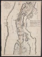
- Published / Created:
- [1900?]
- Call Number:
- 796 St44 1900
- Container / Volume:
- BRBL_00528
- Image Count:
- 1
- Resource Type:
- Maps, Atlases & Globes
- Found in:
- Beinecke Rare Book and Manuscript Library > Map of Stephens County, Texas / lithographed by August Gast & Co.
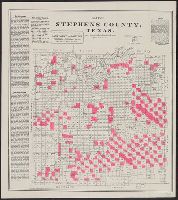
- Published / Created:
- [1859?] and [between 1880 and 1889?]
- Call Number:
- BrSides Folio 2018 138
- Image Count:
- 1
- Resource Type:
- Maps, Atlases & Globes
- Found in:
- Beinecke Rare Book and Manuscript Library > Map of a portion of Point Keweenaw, L.S. : showing the lands &c. of the Pennsylvania & Delaware Mining Co's.
- Creator:
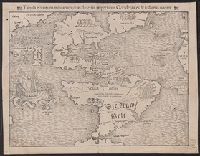
- Münster, Sebastian, 1489-1552
- Published / Created:
- 1559?]
- Call Number:
- 70 1559
- Container / Volume:
- BRBL_00685
- Image Count:
- 2
- Resource Type:
- Maps, Atlases & Globes
- Found in:
- Beinecke Rare Book and Manuscript Library > Tabula nouarum insularum, quas diuersis respectibus Occidentales & Indianas uocant.
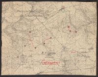
- Published / Created:
- 1918
- Call Number:
- 38hc 1918 Sep. folder
- Container / Volume:
- BRBL_00172
- Image Count:
- 1
- Resource Type:
- Maps, Atlases & Globes
- Found in:
- Beinecke Rare Book and Manuscript Library > Verdun-Point-à-Mousson.