Search
You Searched For
Search Results
- Creator:
- Pownall, Thomas, 1722-1805
- Published / Created:
- March 25th, 1776.
- Call Number:
- 71 1776N
- Container / Volume:
- BRBL_00726
- Image Count:
- 4
- Resource Type:
- Maps, Atlases & Globes
- Found in:
- Beinecke Rare Book and Manuscript Library > A map of the middle British colonies in North America [cartographic material] : First published by Lewis Evans, of Philadelphia, in 1755 ; and since corrected and improved, as also extended, with the addition of New England, and bordering parts of Canada
- Creator:
- Pownall, Thomas, 1722-1805
- Published / Created:
- March 25th, 1776.
- Call Number:
- 755 1776P
- Container / Volume:
- BRBL_00430
- Image Count:
- 1
- Resource Type:
- Maps, Atlases & Globes
- Found in:
- Beinecke Rare Book and Manuscript Library > A map of the middle British colonies in North America [cartographic material] : First published by Lewis Evans, of Philadelphia, in 1755 ; and since corrected and improved, as also extended, with the addition of New England, and bordering parts of Canada
- Creator:
- Pownall, Thomas, 1722-1805
- Published / Created:
- March 25th, 1776.
- Call Number:
- 71 1776N
- Container / Volume:
- BRBL_00726
- Image Count:
- 1
- Resource Type:
- Maps, Atlases & Globes
- Found in:
- Beinecke Rare Book and Manuscript Library > A map of the middle British colonies in North America [cartographic material] : First published by Lewis Evans, of Philadelphia, in 1755 ; and since corrected and improved, as also extended, with the addition of New England, and bordering parts of Canada
- Creator:
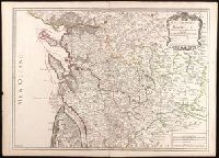
- Jaillot, Alexis Hubert, 1632?-1712
- Published / Created:
- 1722
- Call Number:
- BrSides Double Folio 2019 86
- Image Count:
- 1
- Resource Type:
- Maps, Atlases & Globes
- Found in:
- Beinecke Rare Book and Manuscript Library > Generalité de La Rochelle divisée en cinq elections : sçavoir La Rochelle dans le pays d'Aunis, St. Jean d'Angely, Saintes, Marennes en Saintonge, Cognac en Angoumois : dressée sur les memoires les plus nouveaux / par le Sr. Jaillot ; Delahaye sculpsit.
- Creator:
- Dodsley, Robert, 1703-1764.
- Published / Created:
- [1761]
- Call Number:
- 32 L84 1761
- Image Count:
- 1
- Resource Type:
- Maps, Atlases & Globes
- Found in:
- Beinecke Rare Book and Manuscript Library > A new and correct plan of London, Westminster and Southwark [cartographic material] : with several additional improvements not in any former survey.
- Creator:
- De Witt, Simeon, 1756-1834
- Published / Created:
- [1793?]
- Call Number:
- 771 1793
- Container / Volume:
- BRBL_00477
- Image Count:
- 1
- Resource Type:
- Maps, Atlases & Globes
- Found in:
- Beinecke Rare Book and Manuscript Library > 1st sheet of De Witt's state-map of New-York / C. Tiebout sculp. NYork.
- Creator:
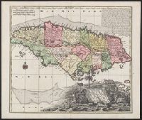
- Seutter, Matthaeus, 1678-1756, cartographer
- Published / Created:
- 1740?]
- Call Number:
- 8555 1740
- Container / Volume:
- BRBL_00642
- Image Count:
- 1
- Resource Type:
- Maps, Atlases & Globes
- Found in:
- Beinecke Rare Book and Manuscript Library > Nova designatio Insulae Jamaicae [cartographic material] : ex Antillanis Americae Septentrion. non postremae / secundum gubernationes suas accuratas aeri incisa et publici juris facta a Matthaeo Seuttero, Sac. Caes. et Reg. Cathol. Maj. Geogr.
- Creator:
- Robert Sayer and John Bennett (Firm)
- Published / Created:
- 1776
- Call Number:
- 755 1776
- Container / Volume:
- BRBL_00430
- Image Count:
- 1
- Resource Type:
- Maps, Atlases & Globes
- Found in:
- Beinecke Rare Book and Manuscript Library > A general map of the middle British colonies, in America [cartographic material] : Containing Virginia, Maryland, the Delaware counties, Pennsylvania and New Jersey. With the addition of New York, and the greatest part of New England, as also of the borde
- Creator:
- Bellin, Jacques Nicolas, 1703-1772, cartographer
- Published / Created:
- 1744
- Call Number:
- 85 1744
- Collection Title:
- Histoire et description generale de la Nouvelle France
- Container / Volume:
- BRBL_00731
- Image Count:
- 1
- Resource Type:
- Maps, Atlases & Globes
- Found in:
- Beinecke Rare Book and Manuscript Library > Partie de la coste de la Louisiane et de la Floride [cartographic material] : depuis le Mississipi jusqua S[t]. Marc d'Apalache / dressée sur les manuscrits du depost des plans de la Marine par N.B. Ing[r] du Roy et de la Marine.
- Published / Created:
- [1754]
- Call Number:
- 755 1754
- Container / Volume:
- BRBL_00728
- Image Count:
- 1
- Resource Type:
- Maps, Atlases & Globes
- Found in:
- Beinecke Rare Book and Manuscript Library > An accurate map of the English colonies in North America, bordering on the river Ohio.
- Creator:
- Seutter, Matthaeus, 1678-1756
- Published / Created:
- [1740?]
- Call Number:
- BrSides Double Folio 2019 40
- Image Count:
- 1
- Resource Type:
- Maps, Atlases & Globes
- Found in:
- Beinecke Rare Book and Manuscript Library > Provincia Gallis la Provence dicta : determinata in omnes suas praefecturas cum terris confinibus et alluentib. Maris Mediterranei partibus / cura et caelo Matthaei Seutteri, S.C.M. Geogr. Augustani ; Gottfr. Rogg inv. et delin.
- Creator:
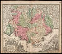
- Bellin, Jacques Nicolas, 1703-1772
- Published / Created:
- 1757
- Call Number:
- BrSides 2018 139
- Image Count:
- 1
- Resource Type:
- Maps, Atlases & Globes
- Found in:
- Beinecke Rare Book and Manuscript Library > Carte de la Nouvelle Angleterre, Nouvelle Yorck, et Pensilvanie / pour servir à l'Histoire générale des voyages. Par M.B., ing. de la mare.
- Creator:
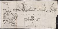
- Ross, John, active 1762-1789
- Published / Created:
- 1 June 1775.
- Call Number:
- BrSides Folio 2018 122
- Image Count:
- 1
- Resource Type:
- Maps, Atlases & Globes
- Found in:
- Beinecke Rare Book and Manuscript Library > Course of the river Mississipi [sic] from the Balise to Fort Chartres [cartographic material] ; taken on an expedition to the Illinois, in the latter end of the year 1765. / By Lieut. Ross of the 34th Regiment: Improved from the surveys of the river made
- Published / Created:
- 1st June 1776.
- Call Number:
- 771cea N49 1776
- Container / Volume:
- BRBL_00493
- Image Count:
- 1
- Resource Type:
- Maps, Atlases & Globes
- Found in:
- Beinecke Rare Book and Manuscript Library > Chart of the entrance of Hudson's River, from Sandy Hook to New York [cartographic material] : with the banks, depths of water, sailing-marks, & ca.
- Creator:
- Endasian, Elia, cartographer
- Published / Created:
- [1787]
- Call Number:
- 11 1847A 1
- Image Count:
- 1
- Resource Type:
- Maps, Atlases & Globes
- Found in:
- Beinecke Rare Book and Manuscript Library > Amerika, ěst nor ashkharhagrakan znnutʻeantsʻ [cartographic material] : pʻoragreal i Vēnētik i Vans Srboyn Ghazaru i tʻuis merum 1236, 1787.
- Creator:
- Anville, Jean Baptiste Bourguignon d', 1697-1782
- Published / Created:
- 1779
- Call Number:
- 90 1779
- Container / Volume:
- BRBL_00661
- Image Count:
- 2
- Resource Type:
- Maps, Atlases & Globes
- Found in:
- Beinecke Rare Book and Manuscript Library > A map of South America containing Tierra-Firma, Guayana, New Granada, Amazonia, Brasil, Peru, Paraguay, Chaco, Tucuman, Chili and Patagonia [cartographic material] : from Mr. d'Anville, with several improvements and additions, and the newest discoveries /
- Creator:
- Anville, Jean Baptiste Bourguignon d', 1697-1782, cartographer
- Published / Created:
- [1767]
- Call Number:
- 50 1767
- Container / Volume:
- BRBL_00271
- Image Count:
- 1
- Resource Type:
- Maps, Atlases & Globes
- Found in:
- Beinecke Rare Book and Manuscript Library > Partie Orientale de la carte des anciennes monarchies [cartographic material] : omnis anima potestatibus sublimioribus subdita sit : non est enim potestas nisi à Deo : quae autem sunt, à Deo ordinatae sunt Aux Romains, ch. XIII. v.I / gravé par Le Tell
- Creator:
- Jansson, Jan, 1588-1664, cartographer
- Published / Created:
- 1652?]
- Call Number:
- 60 1652
- Container / Volume:
- BRBL_00321
- Image Count:
- 1
- Resource Type:
- Maps, Atlases & Globes
- Found in:
- Beinecke Rare Book and Manuscript Library > Africae propriae tabvla [cartographic material] : in qua Punica regna vides, Tyrios et Agenoris urbem.
- Creator:
- Homann, Johann Baptist, 1663-1724
- Published / Created:
- 1730?]
- Call Number:
- 60 1730B
- Container / Volume:
- BRBL_00323
- Image Count:
- 1
- Resource Type:
- Maps, Atlases & Globes
- Found in:
- Beinecke Rare Book and Manuscript Library > Totius Africae nova repraesentatio, qua praeter diversos in ea status et regiones, etiam origo Nili ex veris rr. pp. missionariorum relationibus ostenditur / â Io. Baptista Homanno ... Norimbergae.
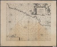
- Creator:
- Keulen, Johannes van, 1654-1715, cartographer
- Published / Created:
- [1681?]
- Call Number:
- 6549 1681
- Container / Volume:
- BRBL_00344
- Image Count:
- 1
- Resource Type:
- Maps, Atlases & Globes
- Found in:
- Beinecke Rare Book and Manuscript Library > Paskaart van de kuste van, Gualate en Arguyn [cartographic material] : beginnende van C. Bajador tor C. Blanco : seer nau-keurigh op-gestelt.