Search
You Searched For
Search Results
- Creator:
- Cassini, Cesar-Francois, 1714-1784
Mayer, Tobias, 1723-1762
Snellius, Willebrord, 1580-1626
- Published / Created:
- 1747
- Call Number:
- 1983 Folio 23
- Collection Title:
- [Atlas factice of 50 maps, primarily by Johann Baptist Homann and/or issued by the Homann Erben
- Image Count:
- 1
- Found in:
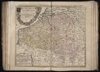
- Beinecke Rare Book and Manuscript Library > Belgivm Catholicvm seu decem provinciae Germaniae inferioris : cum confiniis Germaniae svp. et Franciae legitime omnia delineata et ad ductum observationum astronomicarum, nec non geometricarum operationum a Cassinio Snellio Muschenbrokio aliisqve rite ha
- Creator:
- Cassini, Cesar-Francois, 1714-1784
Mayer, Tobias, 1723-1762
Snellius, Willebrord, 1580-1626
- Published / Created:
- 1747
- Call Number:
- 1975 Folio 31
- Collection Title:
- [Atlas factice of 42 maps, produced by the Homann Erben firm]
- Image Count:
- 1
- Resource Type:
- Maps, Atlases & Globes
- Found in:
- Beinecke Rare Book and Manuscript Library > Belgivm Catholicvm seu decem provinciae Germaniae inferioris : cum confiniis Germaniae svp. et Franciae legitime omnia delineata et ad ductum observationum astronomicarum, nec non geometricarum operationum a Cassinio Snellio Muschenbrokio aliisqve rite ha
- Creator:
- Cassini, Cesar-Francois, 1714-1784
Homann Erben (Firm)
Mayer, Tobias, 1723-1762
Snellius, Willebrord, 1580-1626
- Call Number:
- 1973 Folio 30
- Collection Title:
- [Atlas factice of 32 maps and 1 distance table, produced by the Homann Erben firm]
- Image Count:
- 2
- Found in:
- Beinecke Rare Book and Manuscript Library > Belgivm Catholicvm seu decem provinciae Germaniae inferioris : cum confiniis Germaniae svp. et Franciae legitime omnia delineata et ad ductum observationum astronomicarum, nec non geometricarum operationum a Cassinio Snellio Muschenbrokio aliisqve rite ha
- Creator:
- Homann Erben (Firm)
Muller, J. C. (Johann Christoph), 1673-1721
- Published / Created:
- ca. 1730?
- Call Number:
- 1975 Folio 31
- Collection Title:
- [Atlas factice of 42 maps, produced by the Homann Erben firm]
- Image Count:
- 2
- Found in:
- Beinecke Rare Book and Manuscript Library > Bohemiae Regnum in XII Circulos divisum [cartographic material] : cum Com. Glac. et Distr. Egerano ceterisq[ue] circumjacentibiis terris / ex Muellerianis aliisq[ue] chorographicis subsidys delineatum nunc noviter revisum et emendatius per Homannianos Her
- Creator:
- Anville, Jean Baptiste Bourguignon d', 1697-1782
Haye, G. de la
- Published / Created:
- Novembre 1755
- Call Number:
- 2003 Folio 85
- Image Count:
- 1
- Found in:
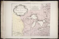
- Beinecke Rare Book and Manuscript Library > Canada, Louisiane et terres angloises
- Creator:
- Bellin, Jacques Nicolas, 1703-1772, creator
France, Depot des cartes et plans de la marine
- Published / Created:
- 1763
- Call Number:
- 2003 Folio 85
- Image Count:
- 1
- Found in:
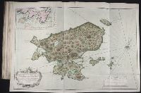
- Beinecke Rare Book and Manuscript Library > Carte de l'Isle Saint Pierre: dressee au Depost des Cartes et Plans de la marine pour le service des vaisseaux du roy par ordre de M. Le Duc de Choiseul colonel-general des Suisses et Grisons, ministre de la guerre et de la marine
- Creator:
- Frezier, Amedee Francois, 1682-1773
Robert de Vaugondy, Gilles, 1688-1766, creator
- Published / Created:
- avec privilege 1749
- Call Number:
- 2003 Folio 85
- Image Count:
- 1
- Found in:
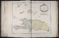
- Beinecke Rare Book and Manuscript Library > Carte de l'isle de Saint-Domingue: dressee d'apres la carte originale de Mr. Frezier
- Creator:
- Bellin, Jacques Nicolas, 1703-1772, creator
France, Depot des cartes et plans de la marine
Rameau, P.
- Published / Created:
- 1763
- Call Number:
- 2003 Folio 85
- Image Count:
- 1
- Found in:
- Beinecke Rare Book and Manuscript Library > Carte de l'isle de Sainte Lucie
- Creator:
- Bellin, Jacques Nicolas, 1703-1772, creator
France, DeÌpot des cartes et plans de la marine
- Published / Created:
- 1760
- Call Number:
- 2003 Folio 85
- Image Count:
- 1
- Found in:
- Beinecke Rare Book and Manuscript Library > Carte de l'isle de la Grenade
- Creator:
- Bellin, Jacques Nicolas, 1703-1772, creator
Croisey, P.
France, Depot des cartes et plans de la marine
- Published / Created:
- 1763
- Call Number:
- 2003 Folio 85
- Image Count:
- 1
- Found in:
- Beinecke Rare Book and Manuscript Library > Carte de la Guyane francoise et l'isle de Cayenne