Search
You Searched For
Search Results
- Published / Created:
- [1800?]
- Call Number:
- 402 1800
- Container / Volume:
- BRBL_00705
- Image Count:
- 12
- Resource Type:
- Maps, Atlases & Globes
- Found in:
- Beinecke Rare Book and Manuscript Library > [Manuscript map of Lombardy]. Fratelli Bordiga inc.
- Creator:
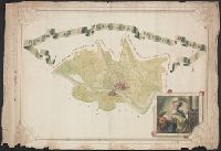
- Pissina, Giuseppe Antonio
- Published / Created:
- [1786]
- Call Number:
- BrSides Double Folio 2018 103
- Image Count:
- 11
- Resource Type:
- Maps, Atlases & Globes
- Found in:
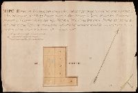
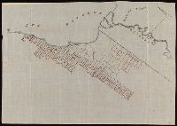
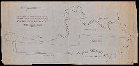
- Beinecke Rare Book and Manuscript Library > Tipo dimostrativo delle acque, cavi, edificij, e fondi cadenti rapporto alle loro colature sotto il contratto di transazione sequito fra l'illmo. Sig. Marchese Cusani Livellario delle acque di Lunico, ed uniti della misericordia unitamente a ssri. Carpane
- Published / Created:
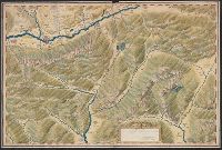
- [1920?]
- Call Number:
- 515 1920
- Container / Volume:
- BRBL_00707
- Image Count:
- 13
- Resource Type:
- Maps, Atlases & Globes
- Found in:
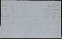
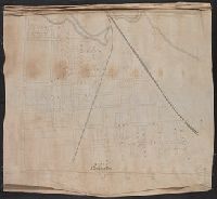
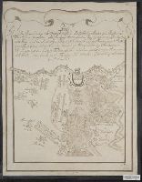
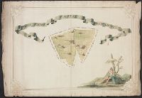
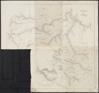
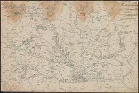
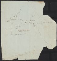
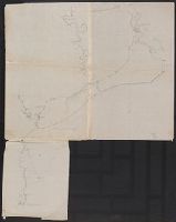
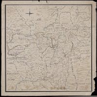
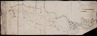
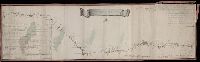
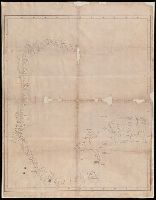
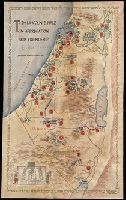
- Beinecke Rare Book and Manuscript Library > [Manuscript maps showing ruin sites etc. in the Transjordan and adjacent areas].
- Published / Created:
- [1790]
- Call Number:
- 352 K125 1790
- Container / Volume:
- BRBL_00702
- Image Count:
- 4
- Resource Type:
- Maps, Atlases & Globes
- Found in:
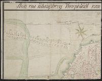
- Beinecke Rare Book and Manuscript Library > Plan von Königsberg Hauptstadt vom Königreich Preussen.
- Published / Created:
- [1870?]
- Call Number:
- 766 N46 1870H
- Container / Volume:
- BRBL_00712
- Image Count:
- 4
- Resource Type:
- Maps, Atlases & Globes
- Found in:
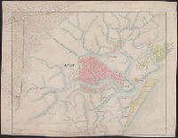
- Beinecke Rare Book and Manuscript Library > Manuscript maps of New Haven.
- Published / Created:
- 1823
- Call Number:
- 32 L9431 1823
- Container / Volume:
- BRBL_00701
- Image Count:
- 5
- Resource Type:
- Maps, Atlases & Globes
- Found in:
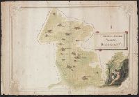
- Beinecke Rare Book and Manuscript Library > [Manuscript map of Lovell Hill, Berkshire].
- Creator:
- Bruner, L. D.
- Published / Created:
- [1867?]
- Call Number:
- BrSides Elephant Folio 2018 14
- Image Count:
- 7
- Resource Type:
- Maps, Atlases & Globes
- Found in:
- Beinecke Rare Book and Manuscript Library > [Collection of five manuscript nautical charts of the World, the South Atlantic, and the East Indies with "Course indicator of U.S.S. 'Idaho'" drawn by L.D. Bruner].
- Creator:
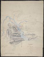
- De Lacy, W. W. (Walter Washington), 1819-1892
- Call Number:
- WA MSS 443
- Collection Title:
- Isaac Ingalls Stevens papers
- Container / Volume:
- Box 1 | Folder 29
- Image Count:
- 1
- Resource Type:
- Maps, Atlases & Globes
- Found in:
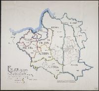
- Beinecke Rare Book and Manuscript Library > Plan of the battle of Grande Ronde fought Jul 17, 1856.
- Published / Created:
- 1939
- Call Number:
- 356fd 1939C
- Container / Volume:
- BRBL_00702
- Image Count:
- 1
- Resource Type:
- Maps, Atlases & Globes
- Found in:
- Beinecke Rare Book and Manuscript Library > Poland, showing the Eighteenth Century Partitions; at its greatest extent, 1772: before the second partition of 1793: before the third partition of 1795.
- Published / Created:
- 1745
- Call Number:
- 36 P471 1745
- Container / Volume:
- BRBL_00702
- Image Count:
- 1
- Resource Type:
- Maps, Atlases & Globes
- Found in:
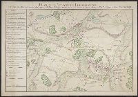
- Beinecke Rare Book and Manuscript Library > Plan de L'Attaque de Pfaffenhoffen. Faite par Mr. de Batiany ... 1745.
- Published / Created:
- 1612
- Call Number:
- 38 H453 1612
- Container / Volume:
- BRBL_00703
- Image Count:
- 1
- Resource Type:
- Maps, Atlases & Globes
- Found in:
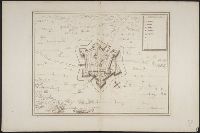
- Beinecke Rare Book and Manuscript Library > La Ville de Hesdin.
- Published / Created:
- [1780?]
- Call Number:
- 40 N36 1780
- Container / Volume:
- BRBL_00705
- Image Count:
- 1
- Resource Type:
- Maps, Atlases & Globes
- Found in:
- Beinecke Rare Book and Manuscript Library > Dipartimento del Serio. Tipografico del Distretto della Nesa.
- Published / Created:
- 1726
- Call Number:
- 303cea 1726
- Container / Volume:
- BRBL_00701
- Image Count:
- 1
- Resource Type:
- Maps, Atlases & Globes
- Found in:
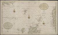
- Beinecke Rare Book and Manuscript Library > Het Nooderdeel van De Noord Zee seer Dienstig voor de Oost Indische Knuysors.
- Published / Created:
- 1826
- Call Number:
- 352 M85 1826
- Container / Volume:
- BRBL_00702
- Image Count:
- 1
- Resource Type:
- Maps, Atlases & Globes
- Found in:
- Beinecke Rare Book and Manuscript Library > Nouveau Plan de Moscou. Dressé par la Commission des bâtiments pour servir au Guide du Voyageur G.L. de Laveau.
- Published / Created:
- 1837
- Call Number:
- 39hc Sa54 1837
- Container / Volume:
- BRBL_00703
- Image Count:
- 1
- Resource Type:
- Maps, Atlases & Globes
- Found in:
- Beinecke Rare Book and Manuscript Library > Plan of the Operations in Spain between the 10th and 16th of March 1837.
- Published / Created:
- [1800?]
- Call Number:
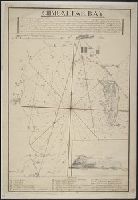
- 399 1800
- Container / Volume:
- BRBL_00704
- Image Count:
- 1
- Resource Type:
- Maps, Atlases & Globes
- Found in:
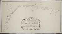
- Beinecke Rare Book and Manuscript Library > Gibraltar Bay.
- Published / Created:
- [1740?]
- Call Number:
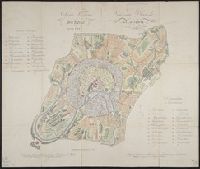
- 40 B45 1740
- Container / Volume:
- BRBL_00705
- Image Count:
- 1
- Resource Type:
- Maps, Atlases & Globes
- Found in:
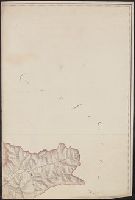
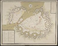
- Beinecke Rare Book and Manuscript Library > [Manuscript map of Bergamo].
- Published / Created:
- 1779
- Call Number:
- 3331gmg H788 1749
- Container / Volume:
- BRBL_00701
- Image Count:
- 1
- Resource Type:
- Maps, Atlases & Globes
- Found in:
- Beinecke Rare Book and Manuscript Library > Kaarte van de lengte en breete der Zand - Plaat genaamd De Horst ...
- Published / Created:
- 1759
- Call Number:
- 36hc M66 1759A
- Container / Volume:
- BRBL_00703
- Image Count:
- 1
- Resource Type:
- Maps, Atlases & Globes
- Found in:
- Beinecke Rare Book and Manuscript Library > [Manuscript map of a battle in the vicinity of Minden].
- Published / Created:
- 1643
- Call Number:
- 11 1643
- Container / Volume:
- BRBL_00700
- Image Count:
- 1
- Resource Type:
- Maps, Atlases & Globes
- Found in:
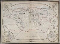
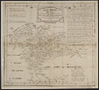
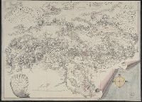
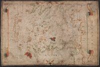
- Beinecke Rare Book and Manuscript Library > [Portolan chart of the World].
- Published / Created:
- 1619?]
- Call Number:
- 21cea 1619
- Container / Volume:
- BRBL_00700
- Image Count:
- 1
- Resource Type:
- Maps, Atlases & Globes
- Found in:
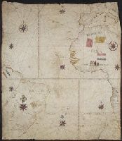
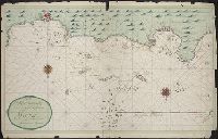
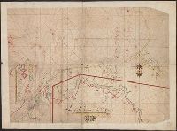
- Beinecke Rare Book and Manuscript Library > [Anonymous ms. Portugese portolano of the Atlantic Ocean.]
- Published / Created:
- [1683?]
- Call Number:
- 23 1683
- Container / Volume:
- BRBL_00700
- Image Count:
- 1
- Resource Type:
- Maps, Atlases & Globes
- Found in:
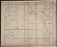
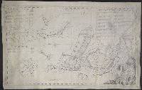
- Beinecke Rare Book and Manuscript Library > Wassende graadt kaert vande Groote Zud Zee.
- Published / Created:
- 1684
- Call Number:
- 18 1684
- Container / Volume:
- BRBL_00700
- Image Count:
- 1
- Resource Type:
- Maps, Atlases & Globes
- Found in:
- Beinecke Rare Book and Manuscript Library > The Northern part of ye World projected upon the Plaine of the Equator. By Anthony Payne ... A. AE 15 1/2. 1684.
- Published / Created:
- 1798
- Call Number:
- 27cea 1798
- Container / Volume:
- BRBL_00700
- Image Count:
- 1
- Resource Type:
- Maps, Atlases & Globes
- Found in:
- Beinecke Rare Book and Manuscript Library > A New Chart of the Eastern Straits or the Straits of the East of Java, with a part of the Banda Sea; corrected and improved chiefly from the observation of Captn. - Williams.
- Published / Created:
- [1810?]
- Call Number:
- 28cea M314 1810
- Container / Volume:
- BRBL_00700
- Image Count:
- 1
- Resource Type:
- Maps, Atlases & Globes
- Found in:
- Beinecke Rare Book and Manuscript Library > [Manuscript map of Manila Harbor and Bay Lake].
- Published / Created:
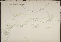
- c1640]
- Call Number:
- 3365 1640
- Container / Volume:
- BRBL_00701
- Image Count:
- 1
- Resource Type:
- Maps, Atlases & Globes
- Found in:
- Beinecke Rare Book and Manuscript Library > T'fort aende Warande [cartographic material].
- Published / Created:
- [Between 1721 and 1724]
- Call Number:
- 352am Sa25 1721
- Container / Volume:
- BRBL_00702
- Image Count:
- 1
- Resource Type:
- Maps, Atlases & Globes
- Found in:
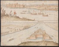
- Beinecke Rare Book and Manuscript Library > The E.S.E. prospective of St. Peterboug [sic] up the Goulff of Fienlad [sic] with part of the River Neva.
- Published / Created:
- [1700?]
- Call Number:
- 428 In7 1700
- Container / Volume:
- BRBL_00706
- Image Count:
- 1
- Resource Type:
- Maps, Atlases & Globes
- Found in:
- Beinecke Rare Book and Manuscript Library > [Manuscript map of Environs North & West of Insprugg].
- Published / Created:
- [approximately 1780?]
- Call Number:
- 39 M29 1795
- Container / Volume:
- BRBL_00703
- Image Count:
- 1
- Resource Type:
- Maps, Atlases & Globes
- Found in:
- Beinecke Rare Book and Manuscript Library > Plano Dela Plaza y Puerto de Malaga.
- Published / Created:
- [1780?]
- Call Number:
- 40 C862 1780
- Container / Volume:
- BRBL_00705
- Image Count:
- 1
- Resource Type:
- Maps, Atlases & Globes
- Found in:
- Beinecke Rare Book and Manuscript Library > Descrittíone del Territorio Cremasco con Confíní.
- Published / Created:
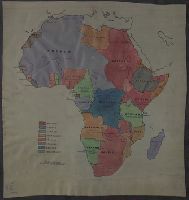
- [1915?]
- Call Number:
- 60fd 1915
- Container / Volume:
- BRBL_00707
- Image Count:
- 1
- Resource Type:
- Maps, Atlases & Globes
- Found in:
- Beinecke Rare Book and Manuscript Library > [Manuscript map of Colonial Africa].
- Published / Created:
- 1788
- Call Number:
- 390 No. 9
- Container / Volume:
- BRBL_00703
- Image Count:
- 1
- Resource Type:
- Maps, Atlases & Globes
- Found in:
- Beinecke Rare Book and Manuscript Library > Mapa que comprehende la provincia antiqua de la Bética, dividida en quartro conventos jurídicos segun Plinio, y en el mismo número de gentes ó regiones segun Ptolemeo. Por D. Jaun Lopez.
- Published / Created:
- [1576]
- Call Number:
- 491 Is7 1576
- Container / Volume:
- BRBL_00707
- Image Count:
- 1
- Resource Type:
- Maps, Atlases & Globes
- Found in:
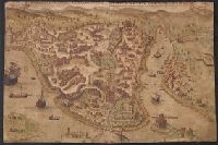
- Beinecke Rare Book and Manuscript Library > Questa e la famosisima citta di Costantinopoli. [View of Constantinople]. .
- Published / Created:
- [1720]
- Call Number:
- 3748 1720
- Container / Volume:
- BRBL_00703
- Image Count:
- 1
- Resource Type:
- Maps, Atlases & Globes
- Found in:
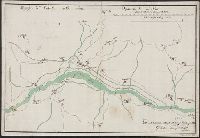
- Beinecke Rare Book and Manuscript Library > Die Orthographische und Ichnographische Vorstellung der neüen Landstrassen so durch die Solloturnerische Landschafft, vom Schloss Falckenstein durch das Thal biss an Mimlisweil ... [Soloturn to Basel].
- Published / Created:
- [1740?]
- Call Number:
- 275 1740
- Container / Volume:
- BRBL_00700
- Image Count:
- 1
- Resource Type:
- Maps, Atlases & Globes
- Found in:
- Beinecke Rare Book and Manuscript Library > Nieurve Afteekeningh Van de Noord Küst = Van Java. Vertoonende de Reede Van Batavia en Bantan.
- Creator:
- Taylor, J
- Published / Created:
- [1773]
- Call Number:
- 3254 1773
- Container / Volume:
- BRBL_00701
- Image Count:
- 1
- Resource Type:
- Maps, Atlases & Globes
- Found in:
- Beinecke Rare Book and Manuscript Library > The Kites Nest, Broadway Court, and the Home Farms belonging to Geo. Savage Esqr., in the parish of Broadway, and county of Worcester, 1773 / J. Taylor delint.
- Published / Created:
- [1780?]
- Call Number:
- 40 1780D
- Container / Volume:
- BRBL_00704
- Image Count:
- 1
- Resource Type:
- Maps, Atlases & Globes
- Found in:
- Beinecke Rare Book and Manuscript Library > Roggia Braschetta detta Oronella.
- Published / Created:
- 1774
- Call Number:
- 3331gmg H876 1774
- Container / Volume:
- BRBL_00701
- Image Count:
- 1
- Resource Type:
- Maps, Atlases & Globes
- Found in:
- Beinecke Rare Book and Manuscript Library > Kaart van den tegenwoordigen Zee-Dyk liggende voor de Landen van Muisduinen en de Helder, strekkende van het Nieuwe-Diep tot aan Kykduin, mitsgaders de diepte voor dezelve gepeild, van twee tot twee Roeden naar Zee, met Hoog-Water in Amsterd. Voeten door
- Published / Created:
- [1780]
- Call Number:
- 29cea 1780
- Container / Volume:
- BRBL_00701
- Image Count:
- 1
- Resource Type:
- Maps, Atlases & Globes
- Found in:
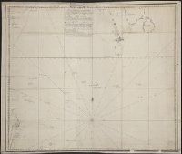
- Beinecke Rare Book and Manuscript Library > A Plane Chart of several Islands Bank Shoals & Soundings ...
- Published / Created:
- [1780?]
- Call Number:
- 40 P28 1780C
- Container / Volume:
- BRBL_00705
- Image Count:
- 1
- Resource Type:
- Maps, Atlases & Globes
- Found in:
- Beinecke Rare Book and Manuscript Library > Parco Vecchio Pavise Delegazione XII.
- Published / Created:
- [1870?]
- Call Number:
- 556 1870
- Container / Volume:
- BRBL_00707
- Image Count:
- 1
- Resource Type:
- Maps, Atlases & Globes
- Found in:
- Beinecke Rare Book and Manuscript Library > [Manuscript map of Asia and Australia.]
- Published / Created:
- 18--]
- Call Number:
- 40 V55 1830
- Container / Volume:
- BRBL_00705
- Image Count:
- 1
- Resource Type:
- Maps, Atlases & Globes
- Found in:
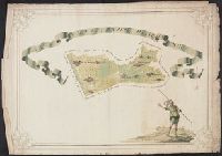
- Beinecke Rare Book and Manuscript Library > [An unfinished manuscript map of the area around Venice, including Fusina, Marghera, Murano, S. Erasmo, Le Vignole, Lazzaretto and S. Spirito.]
- Published / Created:
- [1810]
- Call Number:
- 36hc D625 1810
- Container / Volume:
- BRBL_00703
- Image Count:
- 1
- Resource Type:
- Maps, Atlases & Globes
- Found in:
- Beinecke Rare Book and Manuscript Library > Plan der Position de Corps d'Armee bey Dippoldiswalda [Saxony] unter Comando Sr. Excell. des Herrn Gen: Feld- Zeug- Meister Grafen v. Wied. Desineé par J.C. v. John et Ingen.
- Published / Created:
- [1720]
- Call Number:
- 529 1720
- Container / Volume:
- BRBL_00707
- Image Count:
- 1
- Resource Type:
- Maps, Atlases & Globes
- Found in:
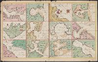
- Beinecke Rare Book and Manuscript Library > [Manuscript map by Gerard van Keulen showing 12 sections of the Red Sea].
- Published / Created:
- [1710]
- Call Number:
- 39hc V68 1710
- Container / Volume:
- BRBL_00703
- Image Count:
- 1
- Resource Type:
- Maps, Atlases & Globes
- Found in:
- Beinecke Rare Book and Manuscript Library > Plan des Isles de Bayonne et de la riviere de Vigue.
- Published / Created:
- [ca. 1750]
- Call Number:
- 733 B384 1750
- Container / Volume:
- BRBL_00709
- Image Count:
- 1
- Resource Type:
- Maps, Atlases & Globes
- Found in:
- Beinecke Rare Book and Manuscript Library > [Manuscript map of Fort Beauséjour, Acadia].
- Published / Created:
- [1830]
- Call Number:
- 42 Sa39 1830
- Container / Volume:
- BRBL_00706
- Image Count:
- 1
- Resource Type:
- Maps, Atlases & Globes
- Found in:
- Beinecke Rare Book and Manuscript Library > [Manuscript map showing part of the province of Salzburg]. Gezeichnet Franz Weys.
- Published / Created:
- [1690?]
- Call Number:
- 521 J565 1690
- Container / Volume:
- BRBL_00707
- Image Count:
- 1
- Resource Type:
- Maps, Atlases & Globes
- Found in:
- Beinecke Rare Book and Manuscript Library > [Manuscript map of the Red Sea around the town of Jiddah (or Jedda.)].
- Published / Created:
- [1780?]
- Call Number:
- 399 1780A
- Container / Volume:
- BRBL_00704
- Image Count:
- 1
- Resource Type:
- Maps, Atlases & Globes
- Found in:
- Beinecke Rare Book and Manuscript Library > Gibraltar.
- Published / Created:
- [1790?]
- Call Number:
- 426 1790
- Container / Volume:
- BRBL_00706
- Image Count:
- 1
- Resource Type:
- Maps, Atlases & Globes
- Found in:
- Beinecke Rare Book and Manuscript Library > Ducato di Stiria.
- Published / Created:
- [1780?]
- Call Number:
- 40 P28 1780A
- Container / Volume:
- BRBL_00705
- Image Count:
- 1
- Resource Type:
- Maps, Atlases & Globes
- Found in:
- Beinecke Rare Book and Manuscript Library > Campagna Sottana Pavese Delegazione VI.
- Published / Created:
- 1595
- Call Number:
- 434 K83 1595
- Container / Volume:
- BRBL_00706
- Image Count:
- 1
- Resource Type:
- Maps, Atlases & Globes
- Found in:
- Beinecke Rare Book and Manuscript Library > Comorra [Komarno, Czechoslovakia]. Communicavit G. Houf [nagel].
- Published / Created:
- [1830]
- Call Number:
- 466 Sa51 1830
- Container / Volume:
- BRBL_00706
- Image Count:
- 1
- Resource Type:
- Maps, Atlases & Globes
- Found in:
- Beinecke Rare Book and Manuscript Library > Sn. Bernardino Provincia di Crema.
- Published / Created:
- [1800?]
- Call Number:
- 399cea 1800
- Container / Volume:
- BRBL_00704
- Image Count:
- 1
- Resource Type:
- Maps, Atlases & Globes
- Found in:
- Beinecke Rare Book and Manuscript Library > Plan of Gibraltar Bay.
- Published / Created:
- [1715?]
- Call Number:
- 53 1700
- Container / Volume:
- BRBL_00707
- Image Count:
- 1
- Resource Type:
- Maps, Atlases & Globes
- Found in:
- Beinecke Rare Book and Manuscript Library > A large draught of the Red Sea from Mount Felix to Judda.
- Published / Created:
- [1840?]
- Call Number:
- 41hc 1840
- Container / Volume:
- BRBL_00706
- Image Count:
- 1
- Resource Type:
- Maps, Atlases & Globes
- Found in:
- Beinecke Rare Book and Manuscript Library > Théatre de la Guerre Dédié A.S.A.R. Monseigneule Duc D'Aoste. Par son tris humble tris obeissantet tris fidelle Servilees Lelhevgure Victor De Roubin, Italie.
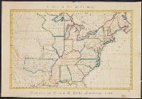
- Published / Created:
- 1828
- Call Number:
- 75 1828D
- Container / Volume:
- BRBL_00709
- Image Count:
- 1
- Resource Type:
- Maps, Atlases & Globes
- Found in:
- Beinecke Rare Book and Manuscript Library > A Map of the United States. Projected by Nancy Gibbs, Livermore, 1828.
- Published / Created:
- 1597
- Call Number:
- 43 G99 1597
- Container / Volume:
- BRBL_00706
- Image Count:
- 1
- Resource Type:
- Maps, Atlases & Globes
- Found in:
- Beinecke Rare Book and Manuscript Library > Iaverinum, vulgo Rab [Gyor, Hungary] Iaverinum olim anno MDLXVI à Nicolao Aginelli Italo acuratissime delineatum ex manisculo in minorem tabullam traductum Amicis Agrippensibus id requiventib. amice communicat Georius Houfnaglius MDXCVII.
- Published / Created:
- [1837]
- Call Number:
- 394hc 1837
- Container / Volume:
- BRBL_00703
- Image Count:
- 1
- Resource Type:
- Maps, Atlases & Globes
- Found in:
- Beinecke Rare Book and Manuscript Library > [Manuscript map of Passages, Spain].
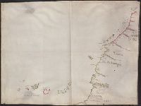
- Published / Created:
- [1750]
- Call Number:
- 655gmg 1750
- Container / Volume:
- BRBL_00708
- Image Count:
- 1
- Resource Type:
- Maps, Atlases & Globes
- Found in:
- Beinecke Rare Book and Manuscript Library > [Manuscript map of the coastline of Western Africa].
- Published / Created:
- [1929?]
- Call Number:
- 632 K129 1929
- Container / Volume:
- BRBL_00708
- Image Count:
- 1
- Resource Type:
- Maps, Atlases & Globes
- Found in:
- Beinecke Rare Book and Manuscript Library > Map of Kampala showing collecting stations of water ...
- Published / Created:
- [1780?]
- Call Number:
- 40 P28 1780B
- Container / Volume:
- BRBL_00705
- Image Count:
- 1
- Resource Type:
- Maps, Atlases & Globes
- Found in:
- Beinecke Rare Book and Manuscript Library > Del e Gazione Prima del Principato di Pavia.
- Published / Created:
- [1770?]
- Call Number:
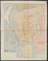
- 37 G28 1770
- Container / Volume:
- BRBL_00703
- Image Count:
- 1
- Resource Type:
- Maps, Atlases & Globes
- Found in:
- Beinecke Rare Book and Manuscript Library > Plan de la ville de Geneve.
- Published / Created:
- [1780?]
- Call Number:
- 40 P28 1780
- Container / Volume:
- BRBL_00705
- Image Count:
- 1
- Resource Type:
- Maps, Atlases & Globes
- Found in:
- Beinecke Rare Book and Manuscript Library > Parco Nuovo Pavese delegazione XIII.
- Published / Created:
- [1830?]
- Call Number:
- 40 M841 1830
- Container / Volume:
- BRBL_00705
- Image Count:
- 1
- Resource Type:
- Maps, Atlases & Globes
- Found in:
- Beinecke Rare Book and Manuscript Library > Pianta della Citta di Mortara.
- Published / Created:
- [ca. 1725]
- Call Number:
- 6555cea 1725
- Container / Volume:
- BRBL_00708
- Image Count:
- 1
- Resource Type:
- Maps, Atlases & Globes
- Found in:
- Beinecke Rare Book and Manuscript Library > Goud Kust.
- Published / Created:
- [1780?]
- Call Number:
- 40 P28 1780D
- Container / Volume:
- BRBL_00705
- Image Count:
- 1
- Resource Type:
- Maps, Atlases & Globes
- Found in:
- Beinecke Rare Book and Manuscript Library > Campagna Soprana Pavese Delegazione V.
- Published / Created:
- [1846?]
- Call Number:
- 54635 K836 1846
- Container / Volume:
- BRBL_00707
- Image Count:
- 1
- Resource Type:
- Maps, Atlases & Globes
- Found in:
- Beinecke Rare Book and Manuscript Library > [Manuscript map showing part of the Bering Island or Komandor Islands and the position of the wreck of the ship "Baltic" out of New Bedford].
- Published / Created:
- 1738
- Call Number:
- 583 1738
- Container / Volume:
- BRBL_00707
- Image Count:
- 1
- Resource Type:
- Maps, Atlases & Globes
- Found in:
- Beinecke Rare Book and Manuscript Library > Part of Malaya. Part of Tanasary.
- Published / Created:
- [1550?]
- Call Number:
- 488 1550
- Container / Volume:
- BRBL_00706
- Image Count:
- 1
- Resource Type:
- Maps, Atlases & Globes
- Found in:
- Beinecke Rare Book and Manuscript Library > [Portolan chart of the Aegean Sea].
- Published / Created:
- [187-?]
- Call Number:
- 582 B22 187X
- Container / Volume:
- BRBL_00707
- Image Count:
- 1
- Resource Type:
- Maps, Atlases & Globes
- Found in:
- Beinecke Rare Book and Manuscript Library > [Thailand, from Bangkok west to Phet Buri].
- Published / Created:
- 1755
- Call Number:
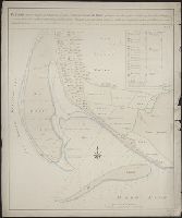
- 59cea H762 1755
- Container / Volume:
- BRBL_00707
- Image Count:
- 1
- Resource Type:
- Maps, Atlases & Globes
- Found in:
- Beinecke Rare Book and Manuscript Library > [Manuscript chart showing the mouth of the Hoogly River from the Bay of Bengal towards Calcutta]. Johannus van Bergen.
- Published / Created:
- [1845?]
- Call Number:
- 40gcf 1845
- Container / Volume:
- BRBL_00705
- Image Count:
- 1
- Resource Type:
- Maps, Atlases & Globes
- Found in:
- Beinecke Rare Book and Manuscript Library > Linea di livellazione per il redefosso dal fundo del ponte al dazio di p. v. sino alla vecchiabbia di sotto de tre molini di S. Maria della Traversera.
- Published / Created:
- 1717
- Call Number:
- 461 B41 1717
- Container / Volume:
- BRBL_00706
- Image Count:
- 1
- Resource Type:
- Maps, Atlases & Globes
- Found in:
- Beinecke Rare Book and Manuscript Library > Pianta ... gran piazza de Belgrado ...
- Published / Created:
- 1785
- Call Number:
- 648cea Sa23 1785
- Container / Volume:
- BRBL_00708
- Image Count:
- 1
- Resource Type:
- Maps, Atlases & Globes
- Found in:
- Beinecke Rare Book and Manuscript Library > A chart of a bay [St. Francis Bay?] on the SE coast of Africa ... 1785 ... in Lat. 34°09'S, Long 26°10'E.
- Published / Created:
- [1798]
- Call Number:
- 734 B797 1798
- Container / Volume:
- BRBL_00709
- Image Count:
- 1
- Resource Type:
- Maps, Atlases & Globes
- Found in:
- Beinecke Rare Book and Manuscript Library > Plan of the Township of Broughton surveyed by Order of Samuel Holland Esq. Surveyor General of Lower and Upper Canada. By Christopher S. Bailley, Dept. Provinl. Surr.
- Published / Created:
- [1700?]
- Call Number:
- 761 1700
- Container / Volume:
- BRBL_00709
- Image Count:
- 1
- Resource Type:
- Maps, Atlases & Globes
- Found in:
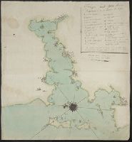
- Beinecke Rare Book and Manuscript Library > [Manuscript map of the Maine Coastline].
- Creator:
- Mellin, Ludwig August, Graf, 1754-1831
- Published / Created:
- Au mois de Dec. 1774.
- Call Number:
- BrSides Folio 2019 58
- Image Count:
- 1
- Resource Type:
- Maps, Atlases & Globes
- Found in:
- Beinecke Rare Book and Manuscript Library > Karte von der Merenge zwischen dem Schwarzen und Assowschen Meere, wie auch von dem Stücke der Krim so Russland gehoeret. Anno 1774 / L. A. Colo. Mellin, Lieutenant de L'Etat Major de l'armee, fec.
- Creator:
- Maas, Abraham
- Published / Created:
- [1729]
- Call Number:
- BrSides Double Folio 2019 81
- Image Count:
- 1
- Resource Type:
- Maps, Atlases & Globes
- Found in:
- Beinecke Rare Book and Manuscript Library > Nieuwe kaarte van't canaal welke gegraven werd von Sleutelburg na nieu Ladoga / naukeurig opgesteld en getekend door Abraham Maas tot Sint Petersburg op d'oude Schans ter Ny 1729.
- Creator:
- Loginov, Matveĭ
Логинов, Матвей
- Published / Created:
- [between 1750 and 1800?]
- Call Number:
- BrSides Double Folio 2019 79
- Image Count:
- 1
- Resource Type:
- Maps, Atlases & Globes
- Found in:
- Beinecke Rare Book and Manuscript Library > [Map of the Central and Southern Ural Mountains].
- Creator:
- Bersenev, Ivan Mikhaĭlovich, -1789
Берсенев, Иван Михайлович, -1789
- Published / Created:
- [1785?]
- Call Number:
- BrSides Double Folio 2019 76
- Image Count:
- 1
- Resource Type:
- Maps, Atlases & Globes
- Found in:
- Beinecke Rare Book and Manuscript Library > Karta reki Dniepra ivsego Limana otʺ Khersona do mysa A., Kinburnskoi beregʺ / opisi flota kapitana vtorogo ranga Berseneva 1785 goda. Ochagovskoi beregʺ nalozhenʺ sprezhdnikhʺ kartʺ, glubina naznachena vʺ futakhʺ.
- Published / Created:
- [1780?]
- Call Number:
- BrSides Double Folio 2019 75
- Image Count:
- 1
- Resource Type:
- Maps, Atlases & Globes
- Found in:
- Beinecke Rare Book and Manuscript Library > [Map showing a part of the Ukraine and Moldova].
- Creator:
- Petin, Andreĭ
Петин, Андрей
- Published / Created:
- [between 1762 and 1796]
- Call Number:
- BrSides Double Folio 2019 77
- Image Count:
- 1
- Resource Type:
- Maps, Atlases & Globes
- Found in:
- Beinecke Rare Book and Manuscript Library > Karta bolʹshoĭ Sanktpeterburgskoĭ doroge lezhasheĭ chrezʺ Tverskui︠u︡ gubernīi︠u︡ / gubernskiĭ zemlemerʺ Andreĭ Petin.
- Published / Created:
- [between 1800 and 1810?]
- Call Number:
- BrSides Double Folio 2018 83
- Image Count:
- 1
- Resource Type:
- Maps, Atlases & Globes
- Found in:
- Beinecke Rare Book and Manuscript Library > [Manuscript map of the coastline of the Gulf of Mexico from the border of Louisiana and Texas to the Yucatán Peninsula].
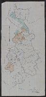
- Creator:
- Paucker, Fred
- Published / Created:
- 1957
- Call Number:
- 51 1957
- Image Count:
- 1
- Resource Type:
- Maps, Atlases & Globes
- Found in:
- Beinecke Rare Book and Manuscript Library > [Map of Israel] / Fred Paucker.
- Creator:
- Johnson, Thomas H., Cartographer
- Published / Created:
- 2nd Feby. 1877.
- Call Number:
- BrSides Double Folio 2018 97
- Image Count:
- 1
- Resource Type:
- Maps, Atlases & Globes
- Found in:
- Beinecke Rare Book and Manuscript Library > McIntyre / Thos. H. Johnson, Assistant Commissioner.
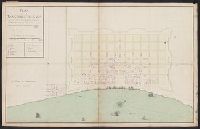
- Published / Created:
- 1721
- Call Number:
- 795 N47 1721
- Container / Volume:
- BRBL_00716
- Image Count:
- 1
- Resource Type:
- Maps, Atlases & Globes
- Found in:
- Beinecke Rare Book and Manuscript Library > Plan de la Nouvelle Orleans Scituée sur le Fleuve St. Louis ... 1721.
- Creator:
- Heyrick, J. C., creator
- Published / Created:
- 1912
- Call Number:
- 802gbc P429 1912
- Container / Volume:
- BRBL_00717
- Image Count:
- 1
- Resource Type:
- Maps, Atlases & Globes
- Found in:
- Beinecke Rare Book and Manuscript Library > Map of Riverside Coal & Timber Co. : lands on Little Leatherwood C'r, Perry Co., Kentucky / J.C. Heydrick.
- Creator:
- Heart, Jonathan, 1748-1791
- Published / Created:
- 1787
- Call Number:
- 774 F854 1787A
- Container / Volume:
- BRBL_00730
- Image Count:
- 1
- Resource Type:
- Maps, Atlases & Globes
- Found in:
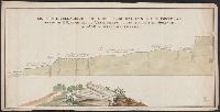
- Beinecke Rare Book and Manuscript Library > Profile of the works on French Creek [cartographic material].
- Creator:
- Heart, Jonathan, 1748-1791
- Published / Created:
- 1787
- Call Number:
- 774 F854 1787
- Container / Volume:
- BRBL_00730
- Image Count:
- 1
- Resource Type:
- Maps, Atlases & Globes
- Found in:
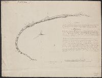
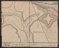
- Beinecke Rare Book and Manuscript Library > Map of the country adjacent to Fort [Franklin] on French Creek / by Jona. Heart ...
- Published / Created:
- [between 1840 and 1849?]
- Call Number:
- BrSides Double Folio 2018 104
- Image Count:
- 1
- Resource Type:
- Maps, Atlases & Globes
- Found in:
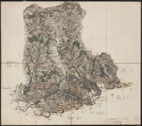
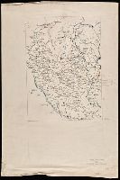
- Beinecke Rare Book and Manuscript Library > Carta geographia della provincia di Milano.
- Published / Created:
- [between 1875 and 1900?]
- Call Number:
- BrSides 2018 155
- Image Count:
- 1
- Resource Type:
- Maps, Atlases & Globes
- Found in:
- Beinecke Rare Book and Manuscript Library > [Manuscript map of mine locations in Michigan].
- Published / Created:
- [between 1840 and 1849?]
- Call Number:
- BrSides 2018 158
- Image Count:
- 1
- Resource Type:
- Maps, Atlases & Globes
- Found in:
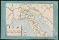
- Beinecke Rare Book and Manuscript Library > Lo e Alpi in Italia.
- Published / Created:
- [between 1850 and 1859?]
- Call Number:
- BrSides 2018 156
- Image Count:
- 1
- Resource Type:
- Maps, Atlases & Globes
- Found in:
- Beinecke Rare Book and Manuscript Library > Map showing copper lands in Virginia.
- Published / Created:
- [between 1875 and 1900?]
- Call Number:
- BrSides Folio 2018 133
- Image Count:
- 1
- Resource Type:
- Maps, Atlases & Globes
- Found in:
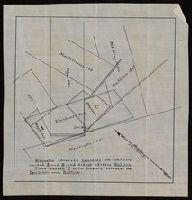
- Beinecke Rare Book and Manuscript Library > [Manuscript map of delineations of unknown property owned by Richard H. Rickard].
- Published / Created:
- [1872?]
- Call Number:
- BrSides Folio 2018 139
- Image Count:
- 1
- Resource Type:
- Maps, Atlases & Globes
- Found in:
- Beinecke Rare Book and Manuscript Library > [Map of Thunder Bay District, Canada, showing silver lands owned by Peter Mitchell & others, Sept. 7th, 1872].
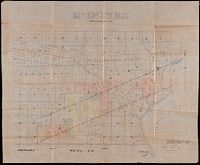
- Creator:
- Denton, D. S., Jr., cartographer.
- Published / Created:
- [1907]
- Call Number:
- BrSides Double Folio 2018 88
- Image Count:
- 1
- Resource Type:
- Maps, Atlases & Globes
- Found in:
- Beinecke Rare Book and Manuscript Library > Map of Meadow Land at Ocean side in the town of Hempstead Nassau County, N.Y. belonging to the estate of Lewis Davison Dec'd and the estate of Tredwell Davison dec'd / surveyed in March 1907, by DS Denton, Jr.
- Published / Created:
- [1810?]
- Call Number:
- BrSides Double Folio 2018 105
- Image Count:
- 1
- Resource Type:
- Maps, Atlases & Globes
- Found in:
- Beinecke Rare Book and Manuscript Library > Estratto della mappa di nuovo censo del comune di Dresano mandamento di Paullo provincia di Milano.
- Published / Created:
- [between 1875 and 1900?]
- Call Number:
- BrSides Box 2018 74
- Image Count:
- 1
- Resource Type:
- Maps, Atlases & Globes
- Found in:
- Beinecke Rare Book and Manuscript Library > [Manuscript map of mine locations in the vicinity of Mass City, Michigan].