Search
You Searched For
Search Results
- Published / Created:
- 1590
- Call Number:
- 49cea 1590
- Image Count:
- 2
- Resource Type:
- Maps, Atlases & Globes
- Found in:
- Beinecke Rare Book and Manuscript Library > [Portolan chart of the Mediterranean Sea and Europe].
- Call Number:
- 32cea 1550
- Container / Volume:
- BRBL_00701
- Image Count:
- 2
- Resource Type:
- Maps, Atlases & Globes
- Found in:
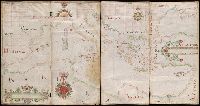
- Beinecke Rare Book and Manuscript Library > [Section of a portolan chart spanning Great Britain in the west to the Adriatic Sea in the east.]
- Published / Created:
- 1619?]
- Call Number:
- 21cea 1619
- Container / Volume:
- BRBL_00700
- Image Count:
- 1
- Resource Type:
- Maps, Atlases & Globes
- Description:
- chart from Auktion XXXVIII, p. 72, published
- Found in:
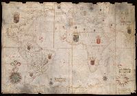
- Beinecke Rare Book and Manuscript Library > [Anonymous ms. Portugese portolano of the Atlantic Ocean.]
- Published / Created:
- [approximately 1600?]
- Call Number:
- Art Storage 986
- Image Count:
- 2
- Resource Type:
- Maps, Atlases & Globes
- Description:
- Portolan chart with seaport names given
- Subject (Topic):
- Nautical charts--Mediterranean Sea
- Found in:
- Beinecke Rare Book and Manuscript Library > Portolan chart of the Mediterranean Sea.
- Published / Created:
- [ca. 1760]
- Call Number:
- 85cea 1760
- Container / Volume:
- BRBL_00719
- Image Count:
- 2
- Resource Type:
- Maps, Atlases & Globes
- Description:
- Spanish manuscript portolan chart on
- Found in:
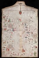
- Beinecke Rare Book and Manuscript Library > [Manuscript map of the West Indies].
- Creator:
- Oliva, Joan, fl. 1580-1615
- Call Number:
- Art Storage 30cea 1555
- Image Count:
- 2
- Resource Type:
- Maps, Atlases & Globes
- Description:
- Portolan chart with seaport names given
- Found in:
- Beinecke Rare Book and Manuscript Library > [Portolan chart of the Mediterranean Sea, the North Atlantic Ocean, the Baltic Sea, and the northwestern African coast].
- Creator:
- Comberford, Nicholas, -1673, cartographer.
- Published / Created:
- [1647]
- Call Number:
- 49 1647
- Image Count:
- 2
- Resource Type:
- Maps, Atlases & Globes
- Description:
- Portolan chart with seaport names given
- Subject (Topic):
- Nautical charts--Black Sea--Early works
- Found in:
- Beinecke Rare Book and Manuscript Library > Portolan chart of the Mediterranean Sea, the Black Sea, and the northern coast of Africa.
- Creator:
- Albernaz, João Teixeira, active 1665-1681
- Published / Created:
- [1665]
- Call Number:
- 11 1665
- Image Count:
- 2
- Resource Type:
- Maps, Atlases & Globes
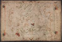
- Description:
- Portolan chart with seaport names given
- Subject (Topic):
- Nautical charts--Atlantic Ocean--Early
- Found in:
- Beinecke Rare Book and Manuscript Library > Portolan chart of the Atlantic, the western half of the Indian Ocean, and the extreme southeast of the Pacific.
- Published / Created:
- 1643
- Call Number:
- 11 1643
- Container / Volume:
- BRBL_00700
- Image Count:
- 1
- Resource Type:
- Maps, Atlases & Globes
- Found in:
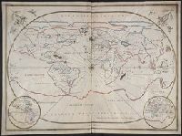
- Beinecke Rare Book and Manuscript Library > [Portolan chart of the World].
- Published / Created:
- [1550?]
- Call Number:
- 488 1550
- Container / Volume:
- BRBL_00706
- Image Count:
- 1
- Resource Type:
- Maps, Atlases & Globes
- Found in:
- Beinecke Rare Book and Manuscript Library > [Portolan chart of the Aegean Sea].