Skip to search
Skip to main content
Skip to first result
Search
You Searched For
Genre
Maps
Genre
Hand coloring
Language
French
New Search
Search Results
Creator:
Published / Created:
173-?]
Call Number:
11 1670
Container / Volume:
BRBL_00680
Image Count:
1
Resource Type:
Maps, Atlases & Globes
Found in:
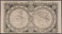
Beinecke Rare Book and Manuscript Library > Mappe-monde celeste, terrestre et historique [cartographic material].
Creator:
Published / Created:
ca. 1730-ca. 1800]
Call Number:
1973 Folio 71
Image Count:
1
Resource Type:
Maps, Atlases & Globes
Found in:
Beinecke Rare Book and Manuscript Library > [Atlas nouveau contenant toutes les parties du monde ou sont exactement marqués les empires, monarchies, royaumes, états, republiques &c. Le tout recueilli par les meilleurs geógraphes.]
Creator:
Call Number:
Zm Sp79
Collection Title:
Allgemeines historisches Taschenbuch, oder, Abriss der merkwurdigsten neuen Welt-Begebenheiten
Image Count:
1
Found in:
Beinecke Rare Book and Manuscript Library > Die Vereinigten Staaten von Nord America. nach der von Wm Faden 1783
Creator:
Published / Created:
1773
Call Number:
1983 Folio 23
Collection Title:
[Atlas factice of 50 maps, primarily by Johann Baptist Homann and/or issued by the Homann Erben
Image Count:
1
Found in:
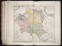
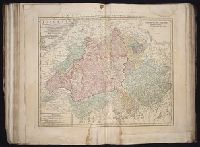
Beinecke Rare Book and Manuscript Library > Mappa geographica Regni Poloniae [cartographic material] : ex novissimis quotquot sunt mappis specialibus composita et ad L.L. stereographicae projectionis / revocata a Tob. Mayero, S.C.S.
Creator:
Published / Created:
[1743?]
Call Number:
1983 Folio 23
Collection Title:
[Atlas factice of 50 maps, primarily by Johann Baptist Homann and/or issued by the Homann Erben
Image Count:
1
Found in:
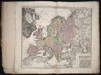
Beinecke Rare Book and Manuscript Library > Europa, secundum legitimas projectionis stereographicae regulas [cartographic material] : et juxta recentissimas observationes aeque ac relationes adhibitis quoq[ue] veterum monumentorum subsidiis / descripta et in partes suas methodicas X divisa a Ioh. M
Creator:
Published / Created:
1747
Call Number:
1983 Folio 23
Collection Title:
[Atlas factice of 50 maps, primarily by Johann Baptist Homann and/or issued by the Homann Erben
Image Count:
1
Found in:
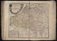
Beinecke Rare Book and Manuscript Library > Belgivm Catholicvm seu decem provinciae Germaniae inferioris : cum confiniis Germaniae svp. et Franciae legitime omnia delineata et ad ductum observationum astronomicarum, nec non geometricarum operationum a Cassinio Snellio Muschenbrokio aliisqve rite ha
Creator:
Published / Created:
1748
Call Number:
1983 Folio 23
Collection Title:
[Atlas factice of 50 maps, primarily by Johann Baptist Homann and/or issued by the Homann Erben
Image Count:
1
Found in:
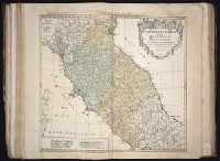
Beinecke Rare Book and Manuscript Library > Statvs Ecclesiastici nec non Magni Ducatvs Toscanae nova tabula geographica [cartographic material] / secundum prinicipia legitimae delineationis descripta a Tob. Majero, Societ. Geogr. Sodali.
Creator:
Published / Created:
1747
Call Number:
1983 Folio 23
Collection Title:
[Atlas factice of 50 maps, primarily by Johann Baptist Homann and/or issued by the Homann Erben
Image Count:
1
Found in:
Beinecke Rare Book and Manuscript Library > S.R.I. circulus Austriacus [cartographic material] : quem componunt archid. Austriae, ducatus Stiriae, Carinthiae, Carnioliae, comit. Tyrolensis, ditionesque Sueviae austriacae, cum suis confiniis / a Tobia Majero ; curantibus Homannianis Heridibus = Le C
Creator:
Published / Created:
1744
Call Number:
1983 Folio 23
Collection Title:
[Atlas factice of 50 maps, primarily by Johann Baptist Homann and/or issued by the Homann Erben
Image Count:
1
Found in:
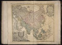
Beinecke Rare Book and Manuscript Library > Asia secundum legitimas projectionis stereographicae regulas et juxta recentissimas observationes [cartographic material] : et relationes explosis aliorum fabulosis designationibus et narrationibus, adhibitis quoque veterum monumentis et recentiorum itine
Creator:
Published / Created:
ca. 1751
Call Number:
1983 Folio 23
Collection Title:
[Atlas factice of 50 maps, primarily by Johann Baptist Homann and/or issued by the Homann Erben
Image Count:
1
Found in:
Beinecke Rare Book and Manuscript Library > Helvetia tredecim statibvs liberis, quos cantones vocant composita: una cum foederatis & subjectis provinciis, ex probatissimis subsidiis
Creator:
Published / Created:
1744
Call Number:
1983 Folio 23
Collection Title:
[Atlas factice of 50 maps, primarily by Johann Baptist Homann and/or issued by the Homann Erben
Image Count:
1
Found in:
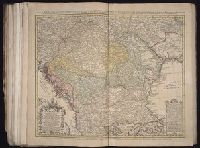
Beinecke Rare Book and Manuscript Library > Hvngariae ampliori significatu et veteris vel methodicae, complexae regna: Hvngariae Propriae, Croatiae, Dalmatiae, Bosniae, Serviae, Bvlgariae, Cvmaniae, principatvm: Transylvaniae, despotatvs: Walachiae, Moldaviae (exclusis ab eadem alienatis Galitia et
Creator:
Published / Created:
1786
Call Number:
1983 Folio 23
Collection Title:
[Atlas factice of 50 maps, primarily by Johann Baptist Homann and/or issued by the Homann Erben
Image Count:
1
Found in:
Beinecke Rare Book and Manuscript Library > Charte das Russische Reich, und die von den Tatarn bewohnte Laender in Europa und Asien enthaltend [cartographic material] / entworfen von F.L. Guessefeld = Carte de l'Empire de Russie et de la Grande Tatarie / dressee avec soin par F.L. Guessefeld
Creator:
Published / Created:
1766
Call Number:
1983 Folio 23
Collection Title:
[Atlas factice of 50 maps, primarily by Johann Baptist Homann and/or issued by the Homann Erben
Image Count:
1
Found in:
Beinecke Rare Book and Manuscript Library > Totius Danubii cum adjacentibus regnis nec non totius Graeciae et archipelagi [cartographic material] : novissima tabula ex recentissimis subsidiis concinnata et ad leges projectionis stereographicae legitimae / reducta ab Augusto Gottlob Boehmio ...
Creator:
Published / Created:
1764
Call Number:
1983 Folio 23
Collection Title:
[Atlas factice of 50 maps, primarily by Johann Baptist Homann and/or issued by the Homann Erben
Image Count:
1
Found in:
Beinecke Rare Book and Manuscript Library > Tres nouvelle Carte du Royaume de France [cartographic material] : divise en toutes les Provinces et Gouvernements dressee sur une nouvelle observation astronomique faite aux environ du Globe, assujetie aux memoires du feu M. Cassini de Thury, dans toute
Creator:
Published / Created:
1782
Call Number:
1983 Folio 23
Collection Title:
[Atlas factice of 50 maps, primarily by Johann Baptist Homann and/or issued by the Homann Erben
Image Count:
1
Found in:
Beinecke Rare Book and Manuscript Library > Der Fraenkische Kreis / [cartographic material] / von F.L. Guessefeld = Charte geographique du Cercle de Franconie / dressee nouvellement par F.L. Guessefeld
Creator:
Published / Created:
MDCCLXXXIV [1784]
Call Number:
1983 Folio 23
Collection Title:
[Atlas factice of 50 maps, primarily by Johann Baptist Homann and/or issued by the Homann Erben
Image Count:
1
Found in:
Beinecke Rare Book and Manuscript Library > Repraesentationem hancce Circuli Saxonici Inferioris [cartographic material] : ad mentem domini D. Buesching, et ex novissimis ac praestantissimis observationibus delineavit F. L. Guessefeld
Creator:
Published / Created:
ca. 1750
Call Number:
1983 Folio 23
Collection Title:
[Atlas factice of 50 maps, primarily by Johann Baptist Homann and/or issued by the Homann Erben
Image Count:
1
Found in:
Beinecke Rare Book and Manuscript Library > Palaestina in XII tribus divisa cum terris adiacentibus / [cartographic material] / denuo revisa & copiosior reddita studio Iohannis Christoph Harenbergh, Praep. S. Laur. Schening
Creator:
Published / Created:
A. MDCCXXXIII [1733]
Call Number:
1975 Folio 31
Collection Title:
[Atlas factice of 42 maps, produced by the Homann Erben firm]
Image Count:
1
Found in:
Beinecke Rare Book and Manuscript Library > Typus geographicus [cartographic material] : Chili a Paraguay freti Magellanici &c., ex. PPbg. Alfonso d'Ovalle & Nicol. Techo nec non de Brouwer, Narbouroug, de Beauchesne &c., a Guiliel de l'Islio descripta, insuperque secundum recentiores du Frezier re
Creator:
Published / Created:
A. MDCCXXXXIII [1743]
Call Number:
1975 Folio 31
Collection Title:
[Atlas factice of 42 maps, produced by the Homann Erben firm]
Image Count:
1
Found in:
Beinecke Rare Book and Manuscript Library > Europa, secundum legitimas projectionis stereographicae regulas : et juxta recentissimas observationes aeque ac relationes adhibitis quoq[ue] veterum monumentorum subsidiis / descripta et in partes suas methodicas X divisa a Ioh. Matth. Hasio, Math. P.P.O
Creator:
Published / Created:
1741
Call Number:
1975 Folio 31
Collection Title:
[Atlas factice of 42 maps, produced by the Homann Erben firm]
Image Count:
1
Found in:
Beinecke Rare Book and Manuscript Library > Regni Galliae seu Franciae et Navarrae [cartographic material] : tabula geographica in usum elementorum geographiae schazianorum accom[m]odata / per Homannianos Heredes
Creator:
Published / Created:
1742?
Call Number:
1975 Folio 31
Collection Title:
[Atlas factice of 42 maps, produced by the Homann Erben firm]
Image Count:
1
Found in:
Beinecke Rare Book and Manuscript Library > Praefectura Generalis & Comitatus Provinciae una cum Terris adjacentibus in suas Dioeceses & Praeturas subdivisus ad prototypum del Islianum / [cartographic material] / excusus studion Homannianorum Heredum
Creator:
Published / Created:
1747 [i.e. 1748?]
Call Number:
1975 Folio 31
Collection Title:
[Atlas factice of 42 maps, produced by the Homann Erben firm]
Image Count:
1
Found in:
Beinecke Rare Book and Manuscript Library > Belgii universi seu inferioris Germaniae quam XVII provinciae Austriaco Gallico et Batavo sceptro parentes constituunt nova tabula geographica / [cartographic material] / a Tobia Majero, Math. Cult. ad leges legitimae delineationis revocata
Creator:
Published / Created:
1747
Call Number:
1975 Folio 31
Collection Title:
[Atlas factice of 42 maps, produced by the Homann Erben firm]
Image Count:
1
Resource Type:
Maps, Atlases & Globes
Found in:
Beinecke Rare Book and Manuscript Library > Belgivm Catholicvm seu decem provinciae Germaniae inferioris : cum confiniis Germaniae svp. et Franciae legitime omnia delineata et ad ductum observationum astronomicarum, nec non geometricarum operationum a Cassinio Snellio Muschenbrokio aliisqve rite ha
Creator:
Published / Created:
1748
Call Number:
1975 Folio 31
Collection Title:
[Atlas factice of 42 maps, produced by the Homann Erben firm]
Image Count:
1
Found in:
Beinecke Rare Book and Manuscript Library > Statvs Ecclesiastici nec non Magni Ducatvs Toscanae nova tabula geographica [cartographic material] / secundum prinicipia legitimae delineationis descripta a Tob. Majero, Societ. Geogr. Sodali
Creator:
Published / Created:
ca. 1741
Call Number:
1975 Folio 31
Collection Title:
[Atlas factice of 42 maps, produced by the Homann Erben firm]
Image Count:
2
Found in:
Beinecke Rare Book and Manuscript Library > Imperii Romano Germanici in svos statvs et circvlos divisi tabvla generalis in ufus iuventutis erundiendae accommodata / a Ioh Bapt Homanno, S.C.M. Geographo, Reg. Boruss. Societ. Scient. Sodali
Creator:
Published / Created:
ca. 1730?
Call Number:
1975 Folio 31
Collection Title:
[Atlas factice of 42 maps, produced by the Homann Erben firm]
Image Count:
2
Found in:
Beinecke Rare Book and Manuscript Library > Bohemiae Regnum in XII Circulos divisum [cartographic material] : cum Com. Glac. et Distr. Egerano ceterisq[ue] circumjacentibiis terris / ex Muellerianis aliisq[ue] chorographicis subsidys delineatum nunc noviter revisum et emendatius per Homannianos Her
Creator:
Published / Created:
1745
Call Number:
1975 Folio 31
Collection Title:
[Atlas factice of 42 maps, produced by the Homann Erben firm]
Image Count:
1
Found in:
Beinecke Rare Book and Manuscript Library > Dvcatvs Silesiae tabvla geographica prima inferiorem eivs partem, seu novem principatvs, quorum insignia hic adjecta sunt, secundum statum recentissimium complectens / [cartographic material] / ad mentem Hasiani avtographi majoris legitime delineata et ed
Creator:
Published / Created:
1746
Call Number:
1975 Folio 31
Collection Title:
[Atlas factice of 42 maps, produced by the Homann Erben firm]
Image Count:
1
Found in:
Beinecke Rare Book and Manuscript Library > Planiglobii terrestris mappa universalis utrumq[ue] hemisphaerium orient. et occidentale repraesentans, ex IV. mappis generalibus, Hasianis composita et adjectis ceteris hemisphaeriis / [cartographic material] / designata a G.M. Lowizio ; excudentibus Hom
Creator:
Published / Created:
1746
Call Number:
1975 Folio 31
Collection Title:
[Atlas factice of 42 maps, produced by the Homann Erben firm]
Image Count:
1
Found in:
Beinecke Rare Book and Manuscript Library > Dvcatvs Silesiae tabvla altera svperiorem Silesiam exhibens / [cartographic material] / ex mappa Hasiana majore desumta & excusa per Homan[n]ianos Heredes
Creator:
Published / Created:
1747
Call Number:
1975 Folio 31
Collection Title:
[Atlas factice of 42 maps, produced by the Homann Erben firm]
Image Count:
1
Found in:
Beinecke Rare Book and Manuscript Library > S.R.I. circulus Austriacus [cartographic material] : quem componunt archid. Austriae, ducatus Stiriae, Carinthiae, Carnioliae, comit. Tyrolensis, ditionesque Sueviae austriacae, cum suis confiniis / a Tobia Majero ; curantibus Homannianis Heridibus, C.P.S
Creator:
Published / Created:
1744
Call Number:
1975 Folio 31
Collection Title:
[Atlas factice of 42 maps, produced by the Homann Erben firm]
Image Count:
1
Found in:
Beinecke Rare Book and Manuscript Library > Asia secundvm legitimas projectionis stereographicae regvlas et jvxta recentissimas observationes [cartographic material] : et relationes explosis aliorum fabulosis designationibus et narrationibus, adhibitis quoque veterum monumentis et recentiorum itine
Creator:
Published / Created:
1744
Call Number:
1975 Folio 31
Collection Title:
[Atlas factice of 42 maps, produced by the Homann Erben firm]
Image Count:
1
Found in:
Beinecke Rare Book and Manuscript Library > Palaestina seu terra olim sancta tum duodecim tribubus distributa tum a Davide et Salomone ... / [cartographic material] / delineavit I.C. Harenberg
Creator:
Published / Created:
[1692?]
Call Number:
Folio 469
Collection Title:
[Atlas factice of 13 maps by Nicolaes Visscher I, Nicolaes Visscher II, Guillaume Sanson, and
Image Count:
1
Found in:
Beinecke Rare Book and Manuscript Library > Le Royaume de France distingue suivant l’estenduee de toutes ses provinces et ses acquisitions [cartographic material] : dans l’Espagne, dans l’Italie, dans l’Allemagne, et dans la Flandre, l’Artois, le Haynaut, le Namur, et le Luxembourg, Provinces des P
Creator:
Published / Created:
1691
Call Number:
Folio 469
Collection Title:
[Atlas factice of 13 maps by Nicolaes Visscher I, Nicolaes Visscher II, Guillaume Sanson, and
Image Count:
1
Found in:
Beinecke Rare Book and Manuscript Library > Les Provinces des Pays-Bas catholiques [cartographic material] : distinguees suivant qu’elles sont presentement partagees entre le Roy de France, le Roy d’Espagne et les Estats Generaux des Provinces-Unies / presentees au Roy par ... Guillaume Sanson Geog
Creator:
Published / Created:
A. MDCCXXXXIII [1743]
Call Number:
1973 Folio 30
Collection Title:
[Atlas factice of 32 maps and 1 distance table, produced by the Homann Erben firm]
Image Count:
1
Found in:
Beinecke Rare Book and Manuscript Library > Europa, secundum legitimas projectionis stereographicae regulas [cartographic material] : et juxta recentissimas observationes aeque ac relationes adhibitis quoq[ue] veterum monumentorum subsidiis / descripta et in partes suas methodicas X divisa a Ioh. M
Creator:
Published / Created:
1744
Call Number:
1973 Folio 30
Collection Title:
[Atlas factice of 32 maps and 1 distance table, produced by the Homann Erben firm]
Image Count:
2
Found in:
Beinecke Rare Book and Manuscript Library > Asia secundum legitimas projectionis stereographicae regulas et juxta recentissimas observation [cartographic material] : et relationes explosis aliorum fabulosis designationibus et narrationibus, adhibitis quoque veterum monumentis et recentiorum itinera
Creator:
Published / Created:
a. 1751
Call Number:
1973 Folio 30
Collection Title:
[Atlas factice of 32 maps and 1 distance table, produced by the Homann Erben firm]
Image Count:
2
Found in:
Beinecke Rare Book and Manuscript Library > Helvetia tredecim statibvs liberis, qvos cantones vocant composita [cartographic material] : una cum foederatis & subjectis provinciis, ex probatissimis subsidiis / geographice delineata per Dm. Tobiam Mayerum, Professorem Matth., Goettingensem
Creator:
Published / Created:
1750
Call Number:
1973 Folio 30
Collection Title:
[Atlas factice of 32 maps and 1 distance table, produced by the Homann Erben firm]
Image Count:
2
Found in:
Beinecke Rare Book and Manuscript Library > Mappa geographica Regni Poloniae [cartographic material] : ex novissimis quotquot sunt mappis specialibus composita et ad L.L. stereographicae projectionis / revocata a Tob. Mayero, S.C.S.
Creator:
Published / Created:
1744
Call Number:
1973 Folio 30
Collection Title:
[Atlas factice of 32 maps and 1 distance table, produced by the Homann Erben firm]
Image Count:
2
Found in:
Beinecke Rare Book and Manuscript Library > Hvngariae ampliori significatu et veteris vel methodicae, complexae regna: Hvngariae Propriae, Croatiae, Dalmatiae, Bosniae, Serviae, Bvlgariae, Cvmaniae, principatvm: Transylvaniae, despotatvs: Walachiae, Moldaviae (exclusis ab eadem alienatis Galitia et
Creator:
Published / Created:
1746
Call Number:
1973 Folio 30
Collection Title:
[Atlas factice of 32 maps and 1 distance table, produced by the Homann Erben firm]
Image Count:
1
Found in:
Beinecke Rare Book and Manuscript Library > Planiglobii terrestris mappa universalis utrumq[ue] hemisphaerium orient. et occidentale repraesentans, ex IV. mappis generalibus, Hasianis composita et adjectis ceteris hemisphaeriis / [cartographic material] / designata a G.M. Lowizio ; excudentibus Hom
Creator:
Published / Created:
1741
Call Number:
1973 Folio 30
Collection Title:
[Atlas factice of 32 maps and 1 distance table, produced by the Homann Erben firm]
Image Count:
2
Found in:
Beinecke Rare Book and Manuscript Library > Regni Galliae seu Franciae et Navarrae [cartographic material] : tabula geographica in usum elementorum geographiae schazianorum accom[m]odata / per Homannianos Heredes
Creator:
Published / Created:
1748
Call Number:
1973 Folio 30
Collection Title:
[Atlas factice of 32 maps and 1 distance table, produced by the Homann Erben firm]
Image Count:
2
Found in:
Beinecke Rare Book and Manuscript Library > Belgii universi seu inferioris Germaniae quam XVII provinciae Austriaco Gallico et Batavo sceptro parentes constituunt nova tabula geographica / [cartographic material] / a Tobia Majero, Math. Cult. ad leges legitimae delineationis revocata
Creator:
Call Number:
1973 Folio 30
Collection Title:
[Atlas factice of 32 maps and 1 distance table, produced by the Homann Erben firm]
Image Count:
2
Found in:
Beinecke Rare Book and Manuscript Library > Belgivm Catholicvm seu decem provinciae Germaniae inferioris : cum confiniis Germaniae svp. et Franciae legitime omnia delineata et ad ductum observationum astronomicarum, nec non geometricarum operationum a Cassinio Snellio Muschenbrokio aliisqve rite ha
Creator:
Published / Created:
[1746?]
Call Number:
1973 Folio 30
Collection Title:
[Atlas factice of 32 maps and 1 distance table, produced by the Homann Erben firm]
Image Count:
2
Found in:
Beinecke Rare Book and Manuscript Library > Imperii Romano Germanici in svos statvs et circvlos divisi tabvla generalis in ufus iuventutis erundiendae accommodata / [cartographic material] / a Ioh Bapt Homanno, S.C.M. Geographo, Reg. Boruss. Societ. Scient. Sodali
Published / Created:
[1618]
Call Number:
Taylor 275
Collection Title:
Journal ou relation exacte du voyage de Guill Schouten
Image Count:
1
Found in:
Beinecke Rare Book and Manuscript Library > [Double hemisphere map of the world showing track of Schouten’s voyage in 1615-1617]
Published / Created:
[1618]
Call Number:
Taylor 275
Collection Title:
Journal ou relation exacte du voyage de Guill Schouten
Image Count:
1
Found in:
Beinecke Rare Book and Manuscript Library > Description du nouveau pasage vers le zud du destroit de Magellan ...
Published / Created:
1756
Call Number:
1973 Folio 119
Collection Title:
Atlas universel, par M. Robert ... et par M. Robert de Vaugondy son fils ...
Image Count:
1
Resource Type:
Maps, Atlases & Globes
Found in:
Beinecke Rare Book and Manuscript Library > Carte de la Lorraine et Du Barrois dans laquelle se trouvent la generalite de metz et autres enclaves; dresseepour la lecture du memoire de M. Durival l'aine, et dediee au Roy de Pologne Duc de Lorraine et de bar par le Sr. Robert de Vaugondy ...
Published / Created:
1753
Call Number:
1973 Folio 119
Collection Title:
Atlas universel, par M. Robert ... et par M. Robert de Vaugondy son fils ...
Image Count:
1
Resource Type:
Maps, Atlases & Globes
Found in:
Beinecke Rare Book and Manuscript Library > Carte de la l'Egypte ancienne et moderne, dressee sur celle du R.P. Sicard et autres, assujielles aux observations astronomiques par le Sr. Robert de Vaugondy ...
Creator:
Published / Created:
1755
Call Number:
2003 Folio 85
Image Count:
1
Found in:
Beinecke Rare Book and Manuscript Library > Partie de l'Amerique septentrionale: qui comprend le cours de l'Ohio, la Nlle. Angleterre, la Nlle York, le New Jersey, la Pensylvanie, le Maryland, la Virginie, la Caroline
Creator:
Published / Created:
1755
Call Number:
2003 Folio 85
Image Count:
1
Found in:
Beinecke Rare Book and Manuscript Library > Partie de l'Amerique septent? qui comprend la Nouvelle France ou le Canada
Creator:
Published / Created:
1750
Call Number:
2003 Folio 85
Image Count:
1
Found in:
Beinecke Rare Book and Manuscript Library > Partie de la mer du Nord: ouse trouvent les grandes et petites isles Antilles, et les isles Lucayes
Creator:
Published / Created:
avec privilege 1749
Call Number:
2003 Folio 85
Image Count:
1
Found in:
Beinecke Rare Book and Manuscript Library > Carte de l'isle de Saint-Domingue: dressee d'apres la carte originale de Mr. Frezier
Creator:
Published / Created:
1755
Call Number:
2003 Folio 85
Image Count:
1
Found in:
Beinecke Rare Book and Manuscript Library > Carte de la Virginie et du Maryland
Creator:
Published / Created:
avec privilege 1750
Call Number:
2003 Folio 85
Image Count:
1
Found in:
Beinecke Rare Book and Manuscript Library > Amerique meridionale: dresee sur les memoires les plus recents et assujetie aux observations astronomique
Creator:
Published / Created:
1759
Call Number:
2003 Folio 85
Image Count:
1
Found in:
Beinecke Rare Book and Manuscript Library > Carte reduite des isles de la Guadeloupe, Marie Galante, et les Saintes
Creator:
Published / Created:
1760
Call Number:
2003 Folio 85
Image Count:
1
Found in:
Beinecke Rare Book and Manuscript Library > Carte reduite des costes de la Guyane: depuis la riviere d'Orenoque jusqu'au Cap de Nord a l'entree de la riviere des Amazones
Creator:
Published / Created:
1758
Call Number:
2003 Folio 85
Image Count:
1
Found in:
Beinecke Rare Book and Manuscript Library > Carte reduite de l'isle de Saint Christophe: dressee des cartes, plans et journaux de la marine : pour le service des vaisseaux du roy : par ordre de M. le Marquis de Massiac, lieutenant general des Armees navales, Secretaire d'Etat aiant le Departement d
Creator:
Published / Created:
1758
Call Number:
2003 Folio 85
Image Count:
1
Found in:
Beinecke Rare Book and Manuscript Library > Carte reduite de l'isle de la Martinique
Creator:
Published / Created:
1762?
Call Number:
2003 Folio 85
Image Count:
1
Found in:
Beinecke Rare Book and Manuscript Library > Carte reduite de l'isle de Cube
Creator:
Published / Created:
1758
Call Number:
2003 Folio 85
Image Count:
1
Found in:
Beinecke Rare Book and Manuscript Library > Carte reduite de l'isle d'Antigue: dressee au Depost des cartes, plans et journaux de la marine : pour le service des vaisseaux du roy : par ordre de M. le Marquis de Massiac, lieutenant general des Armees navales, Secretaire d'Etat aiant le Departement d
Creator:
Published / Created:
1762?
Call Number:
2003 Folio 85
Image Count:
1
Found in:
Beinecke Rare Book and Manuscript Library > Carte hydrographique de la baye de la Havane: avec le plan de la ville et de ses forts pour joindre a la Carte de l'isle de Cube
Creator:
Published / Created:
1791
Call Number:
2003 Folio 85
Image Count:
1
Found in:
Beinecke Rare Book and Manuscript Library > Carte du cours du fleuve de Saint Laurent depuis Quebec jusqu'a la mer en deux feuilles: 1re. feuille depuis Quebec jusqu'a Matane et Rivere des Outardes, 1761
Creator:
Published / Created:
ca. 1763
Call Number:
2003 Folio 85
Image Count:
1
Found in:
Beinecke Rare Book and Manuscript Library > Carte des isles de Saint Pierre et Miquelon: levee par ordre de M. Le Duc du Choiseul, Colonel General des Suisses et Grisons Ministre de la Guerre et de la Marine, 1763 : reduite et assujetie au ciel par le service des vaisseaux du Roy
Creator:
Published / Created:
1763
Call Number:
2003 Folio 85
Image Count:
1
Found in:
Beinecke Rare Book and Manuscript Library > Carte de l'Isle Saint Pierre: dressee au Depost des Cartes et Plans de la marine pour le service des vaisseaux du roy par ordre de M. Le Duc de Choiseul colonel-general des Suisses et Grisons, ministre de la guerre et de la marine
Creator:
Published / Created:
1763
Call Number:
2003 Folio 85
Image Count:
1
Found in:
Beinecke Rare Book and Manuscript Library > Carte de l'isle de Sainte Lucie
Creator:
Published / Created:
1760
Call Number:
2003 Folio 85
Image Count:
1
Found in:
Beinecke Rare Book and Manuscript Library > Carte de l'isle de la Grenade
Creator:
Published / Created:
1755?
Call Number:
2003 Folio 85
Image Count:
1
Found in:
Beinecke Rare Book and Manuscript Library > Carte de la Louisiane et des pays voisins: dediee a M. Rouille, secretaire d'Etat, ayant le Departement de la marine
Creator:
Published / Created:
1763
Call Number:
2003 Folio 85
Image Count:
1
Found in:
Beinecke Rare Book and Manuscript Library > Carte de la Guyane francoise et l'isle de Cayenne
Creator:
Published / Created:
[1752]
Call Number:
2003 Folio 85
Image Count:
1
Found in:
Beinecke Rare Book and Manuscript Library > Carte de la Louisiane
Creator:
Published / Created:
Novembre 1755
Call Number:
2003 Folio 85
Image Count:
1
Found in:
Beinecke Rare Book and Manuscript Library > Canada, Louisiane et terres angloises
Creator:
Published / Created:
1746
Call Number:
2003 Folio 85
Image Count:
1
Found in:
Beinecke Rare Book and Manuscript Library > Amerique Septentrionale: publiee sous les auspices de Monseigneur le Duc d'Orleans preÌÎåmier prince du sang / par le Sr. D'Anville
Published / Created:
ca. 1755
Call Number:
2003 Folio 85
Image Count:
1
Found in:
Beinecke Rare Book and Manuscript Library > Le fleuve Saint-Laurent: represente plus en detail que dans l'etendue de la carte
Published / Created:
1754
Call Number:
2003 Folio 85
Image Count:
1
Found in:
Beinecke Rare Book and Manuscript Library > Carte reduite du golphe du St. Laurent: contenant l'isle de Terre-Neuve et partie de la coste des Esquimaux, l'isle Royale, l'isle St. Jean et celle d'Anticosti &ca
Creator:
Published / Created:
avec privilege 1748
Call Number:
2003 Folio 85
Image Count:
1
Found in:
Beinecke Rare Book and Manuscript Library > Amerique meridionale : publiee sous les auspices de Monseigneur le Duc d'Orleans preå«mier prince du sang / par le Sr. D'Anville
Creator:
Published / Created:
1635
Call Number:
1988 Folio 13
Collection Title:
Theatrum orbis terrarum. French
Image Count:
3
Found in:
Beinecke Rare Book and Manuscript Library > La Nouvelle Belgique & la Nouvelle Angleterre
Creator:
Published / Created:
1635
Call Number:
1988 Folio 13
Collection Title:
Theatrum orbis terrarum. French
Image Count:
3
Found in:
Beinecke Rare Book and Manuscript Library > Les isles de Reí & D'Oleíron
Creator:
Published / Created:
1635
Call Number:
1988 Folio 13
Collection Title:
Theatrum orbis terrarum. French
Image Count:
3
Found in:
Beinecke Rare Book and Manuscript Library > La Verginie
Creator:
Published / Created:
1743
Call Number:
1982 Folio 10
Image Count:
2
Found in:
Beinecke Rare Book and Manuscript Library > L'Italie : publiee sous les auspices de Monseigneur le Duc d'Orleans, Premier Prince du Sang
Creator:
Published / Created:
1783 February 24
Call Number:
1982 Folio 10
Image Count:
1
Found in:
Beinecke Rare Book and Manuscript Library > Carte generale des etats du roi de Sardaigne
Creator:
Published / Created:
1778
Call Number:
1982 Folio 10
Image Count:
1
Found in:
Beinecke Rare Book and Manuscript Library > Nouvelle carte de la Suisse : dans laquelle sont exactement distingues les treize cantons, leurs allies, et leurs sujets : dressee sur les memoires les plus corrects et assujettie aux observations astronomiques
Creator:
Published / Created:
[ca. 1700]
Call Number:
1973 Folio 10
Image Count:
1
Resource Type:
Maps, Atlases & Globes
Found in:
Beinecke Rare Book and Manuscript Library > Gouvernement General de Languedoc: divise en ses vint deux Diocesez
Creator:
Published / Created:
1693
Call Number:
1973 Folio 10
Image Count:
1
Resource Type:
Maps, Atlases & Globes
Found in:
Beinecke Rare Book and Manuscript Library > La Suisse divisee en ses treze cantons, ses alliez [et] ses sujets
Creator:
Published / Created:
1696
Call Number:
1973 Folio 10
Image Count:
1
Resource Type:
Maps, Atlases & Globes
Found in:
Beinecke Rare Book and Manuscript Library > Le cercle de Franconie : subdivise en tous les estats qui le composent
Creator:
Published / Created:
1783
Call Number:
GEN MSS 499
Collection Title:
Henri Crublier d'Opterre journal and maps, [1776]-1783.
Container / Volume:
Bsd folder 10
Image Count:
3
Found in:
Beinecke Rare Book and Manuscript Library > Unidentified. 'Amérique Septentrionale, 1783. Plan de la Ville et du Port de Ports-mouth, dans le newhampshire.'
Branch:v1.60.98 ,Deployed:2024-04-24T10:14:36-04:00