Imray, James F. (James Frederick), 1829?-1891, author James Imray and Son, publisher
Call Number:
23cea 1884
Container / Volume:
BRBL_00021
Image Count:
2
Resource Type:
Maps, Atlases & Globes
Alternative Title:
Cape Northumberland to Cape Howe and Chart no. 2, Cape Northumberland to Cape Howe
Description:
Imperfect: sheet torn in half, edges chipped, with some loss of text. Backed with paper. Manuscript annotations on map. Some locations highlighted in yellow. Label on verso: Chart and In lower left margin: Cor. VII, 83, XII, 83, 84, VII, VIII, IX.
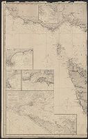
Vidal, A. T. E. (Alexander Thomas Emeric), 1792-1863, author
Call Number:
655 1827
Container / Volume:
BRBL_00345
Image Count:
1
Resource Type:
Maps, Atlases & Globes
Description:
Depths shown by isolines and soundings., Manuscript annotations on verso. Manuscript number in upper left corner: 666., Prime meridian: Greenwich., and Relief shown by hachures and spot heights.
Subject (Geographic):
Atlantic Coast (Africa)--Maps and South Atlantic Ocean--Navigation
Subject (Name):
Great Britain. Hydrographic Office, publisher, J. & C. Walker (Firm), engraver, Mudge, William, 1762-1820, and Owen, W. F. W., 1774-1857
Imray, James F. (James Frederick), 1829?-1891, cartographer James Imray and Son, issuing body
Call Number:
23cea 1886
Container / Volume:
BRBL_00021
Image Count:
2
Resource Type:
Maps, Atlases & Globes
Alternative Title:
Western Pacific, sheet no. 4
Description:
Hydrographic chart of the western Pacific Ocean, including eastern Australia, Papua New Guinea, the Solomon Islands, New Hebrides, New Caledonia, and the northwest of New Zealand., Mellish Reef., and Relief shown by hachures and spot heights. Depth shown by iso
Subject (Geographic):
Melanesia--Maps and Pacific Ocean--Maps
Subject (Topic):
Nautical charts--Melanesia and Nautical charts--Pacific Ocean
Bookseller's labels: Landbergs; G. Hedberg ... Stockholm. Bookplate of Alarik Waghtmeister. Manuscript annotations on front paste-down endpaper of cover; title on cover "Johan Monssons Karta öfver Östersjön.", Coordinates not present on map and are approximated., Depths shown by soundings., Includes dedication from "Johan Mansson.", North oriented towards the bottom., Title devised by cataloger., and Watermark.