Skip to search
Skip to main content
Skip to first result
Search
You Searched For
"Michigan"
Repository
Beinecke Rare Book and Manuscript Library
Genre
Maps
Language
English
New Search
Search Results
Creator:
Published / Created:
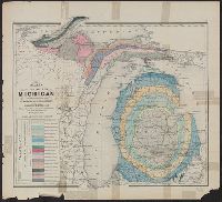
1911
Call Number:
811 1911
Container / Volume:
BRBL_00552
Image Count:
2
Resource Type:
Maps, Atlases & Globes
Alternative Title:
New business atlas map of Michigan .
Description:
new business atlas map of Michigan ; Rand
Publisher:
Rand McNally & Co.,
Subject (Geographic):
Michigan --Maps
Subject (Name):
Rand McNally and Company. Michigan
Subject (Topic):
Railroads--Michigan --Maps
Found in:
Beinecke Rare Book and Manuscript Library > Michigan, Southern Peninsula ; Michigan, Northern Peninsula.
Published / Created:
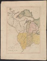
[1831?]
Call Number:
811 1831
Container / Volume:
BRBL_00552
Image Count:
1
Resource Type:
Maps, Atlases & Globes
Publisher:
Published by David H. Burr,
Subject (Geographic):
Michigan --Maps
Found in:
Beinecke Rare Book and Manuscript Library > Michigan.
Creator:
Published / Created:
1888
Call Number:
812 Oc5 1888
Container / Volume:
BRBL_00555A
Image Count:
1
Resource Type:
Maps, Atlases & Globes
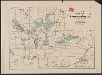
Alternative Title:
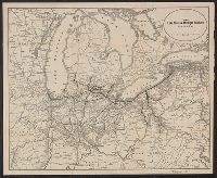
Lakes & drives in the vicinity of Oconomowoc & Waukesha, Waukesha County, Wisconsin
Description:
above Lake Michigan ."
Publisher:
Milwaukee Litho. & Engr. Co.,
Subject (Geographic):
Oconomowoc (Wis.)--Maps and Waukesha County (Wis.)--Maps
Subject (Name):
Chicago, Milwaukee, and St. Paul Railway Company
Subject (Topic):
Lakes--Wisconsin--Oconomowoc--Maps and Lakes--Wisconsin--Waukesha County--Maps
Found in:
Beinecke Rare Book and Manuscript Library > Map of the lakes & drives in the vicinity of Oconomowoc & Waukesha, Waukesha County, Wisconsin / drawn by Chas. Lapham.
Creator:
Published / Created:
[1866]
Call Number:
812 1866
Container / Volume:
BRBL_00555
Image Count:
2
Resource Type:
Maps, Atlases & Globes
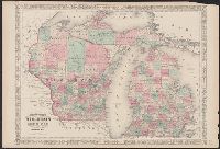
Alternative Title:
Wisconsin and Michigan
Description:
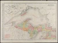
"Entered according to Act of Congress in the Year 1864, by A.J. Johnson in the Clerks Office of the District Court of the United States for the Southern District of New York.", In upper margins: 56, 57., and Includes notes on elevation, water depths, and area in square miles in selected parts of map.
Publisher:
A.J. Johnson,
Subject (Geographic):
Michigan --Maps
Subject (Topic):
Counties--Michigan --Maps
Found in:
Beinecke Rare Book and Manuscript Library > Johnson's Wisconsin and Michigan.
Branch:v1.61.8 ,Deployed:2024-06-20T11:15:04-04:00