
Search


Limit your search
- Public✖[remove]70
- English✖[remove]70
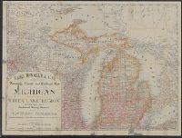
- Railroads--Michigan--Maps4
- Copper mines and mining2
- Copper mines and mining--Michigan--Houghton County--Maps2
- Copper mines and mining--Michigan--Keweenaw County--Maps.2
- Counties--Michigan--Maps2
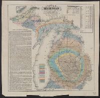
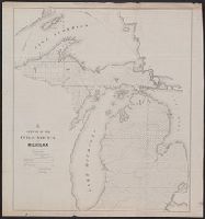
- Geology--Michigan--Maps2
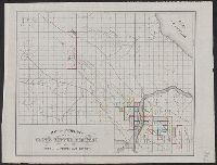
- Landowners--Michigan--Houghton County--Maps2
- Railroads--Middle West--Maps2
- Railroads--Northwestern States--Maps2
- Real property--Michigan--Houghton County--Maps2
- G.W. & C.B. Colton & Co3
- Rickard, Richard H.,---1885--Ownership.3
- De La Vergne, Earl W. pro2
- George B. Cadwell & Co. Atlas of Lenawee County, Michigan2
- Globe Copper Company2
- Globe Copper Company--Maps2
- Graham, C. B. (Curtis B.)2
- Northern Pacific Railroad Company--Maps2
- Alton and Sangamon Rail Road Company1
- Arrowsmith, John, 1790-18731
Current results range from 1754 to 1915