Search
You Searched For
Search Results
- Creator:
- Beckit, Robert, engraver
- Published / Created:
- 1598
- Call Number:
- Taylor 216A
- Collection Title:
- John Huighen van Linschoten, his Discours of Voyages into ye Easte & West Indies
- Image Count:
- 1
- Subject (Geographic):
- Africa --Maps --Early works to 1800
- Found in:
- Beinecke Rare Book and Manuscript Library > Delineatio orarum maritimarum, terrae vulgo indigitatae terra do Natal item Sofalae, Mozambicae & Melindae, insulaeq[ue] sancti Laurentij ...
- Call Number:
- 1976 1233
- Collection Title:
- Forty-two new maps of Asia, Africa, and America ... : all engrav’d, according to the latest
- Image Count:
- 1
- Subject (Geographic):
- Africa --Maps --Early works to 1800
- Found in:
- Beinecke Rare Book and Manuscript Library > The east part of Barbary containing Tunis, Tripoli, Barca, Egypt, Nubia, part of Biledulgerid and Zaara or desart
- Creator:
- Rogers, William, b. ca. 1545, engraver
- Published / Created:
- Undated
- Call Number:
- Taylor 216A
- Collection Title:
- Iohn Huighen van Linschoten, his Discours of Voyages into ye Easte & West Indies : deuided into
- Image Count:
- 1
- Subject (Geographic):
- Africa --Maps --Early works to 1800
- Found in:
- Beinecke Rare Book and Manuscript Library > [Map of southern Africa and Madagascar]
- Creator:
- Jefferys, Thomas, d. 1771
- Published / Created:
- August 12th, 1768.
- Call Number:
- 655 1768
- Container / Volume:
- BRBL_00345
- Image Count:
- 1
- Resource Type:
- Maps, Atlases & Globes
- Subject (Geographic):
- Africa, West--Maps--Early works to 1800
- Found in:
- Beinecke Rare Book and Manuscript Library > The western coast of Africa, from Cape Blanco to Cape Virga, exhibiting Senegambia proper / by T. Jefferys.
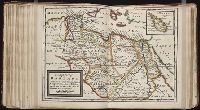
- Creator:
- L'Isle, Guillaume de, 1675-1726
- Published / Created:
- 1711
- Call Number:
- 53 1711
- Container / Volume:
- BRBL_00684
- Image Count:
- 1
- Resource Type:
- Maps, Atlases & Globes
- Subject (Geographic):
- Africa--Maps--Early works to 1800
- Found in:
- Beinecke Rare Book and Manuscript Library > A map of Turky [sic] Arabia & Persia : corrected from the latest travels and from the observations of the Royal Societys of London and Paris / by G. De L'Isle.
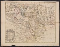
- Published / Created:
- [1751]
- Call Number:
- BrSides 2019 106
- Image Count:
- 1
- Resource Type:
- Maps, Atlases & Globes
- Subject (Geographic):
- Africa, Eastern--Maps--Early works to
- Found in:
- Beinecke Rare Book and Manuscript Library > Riget Monomotapa og de hosligende Stater af de l'Isle og andre Jordbeskrivere.
- Creator:
- Delarochette, L. (Louis), 1731-1802, creator
- Published / Created:
- 1780 June 28
- Call Number:
- 1982 Folio 10
- Image Count:
- 1
- Subject (Topic):
- Coasts --Africa, North --Maps --Early
- Found in:
- Beinecke Rare Book and Manuscript Library > A chart of the coasts of Spain and Portugal, with the Balearic Islands, and part of the coast of Barbary
- Call Number:
- 1974 Folio 72
- Collection Title:
- The English pilot: describing the West-India navigation, from Hudson's-Bay to the river Amazones
- Image Count:
- 1
- Subject (Geographic):
- Africa --Maps --Early works to 1800
- Found in:
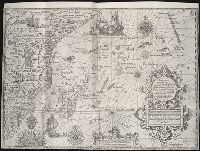
- Beinecke Rare Book and Manuscript Library > A new and correct chart of the western and southern oceans
- Creator:
- Harris, I., d. 1739
- Call Number:
- 1978 Folio 10
- Collection Title:
- The English pilot: describing the West-India navigation, from Hudson's-Bay to the river Amazones
- Image Count:
- 1
- Subject (Geographic):
- Africa --Maps --Early works to 1800
- Found in:
- Beinecke Rare Book and Manuscript Library > A new and correct chart shewing the variations of the compass in the western & southern oceans
- Call Number:
- 1973 Folio 114
- Collection Title:
- The English pilot: describing the West-India navigation, from Hudson's-Bay to the river Amazones
- Image Count:
- 1
- Resource Type:
- Maps, Atlases & Globes
- Subject (Geographic):
- Africa --Maps --Early works to 1800
- Found in:
- Beinecke Rare Book and Manuscript Library > A new and correct chart of the western and southern oceans ...