Skip to search
Skip to main content
Skip to first result
Search
You Searched For
Genre
Maps
Language
French
New Search
Search Results
Creator:
Published / Created:
1744
Call Number:
1973 Folio 30
Collection Title:
[Atlas factice of 32 maps and 1 distance table, produced by the Homann Erben firm]
Image Count:
2
Found in:
Beinecke Rare Book and Manuscript Library > Asia secundum legitimas projectionis stereographicae regulas et juxta recentissimas observation [cartographic material] : et relationes explosis aliorum fabulosis designationibus et narrationibus, adhibitis quoque veterum monumentis et recentiorum itinera
Creator:
Published / Created:
a. 1751
Call Number:
1973 Folio 30
Collection Title:
[Atlas factice of 32 maps and 1 distance table, produced by the Homann Erben firm]
Image Count:
2
Found in:
Beinecke Rare Book and Manuscript Library > Helvetia tredecim statibvs liberis, qvos cantones vocant composita [cartographic material] : una cum foederatis & subjectis provinciis, ex probatissimis subsidiis / geographice delineata per Dm. Tobiam Mayerum, Professorem Matth., Goettingensem
Creator:
Published / Created:
1750
Call Number:
1973 Folio 30
Collection Title:
[Atlas factice of 32 maps and 1 distance table, produced by the Homann Erben firm]
Image Count:
2
Found in:
Beinecke Rare Book and Manuscript Library > Mappa geographica Regni Poloniae [cartographic material] : ex novissimis quotquot sunt mappis specialibus composita et ad L.L. stereographicae projectionis / revocata a Tob. Mayero, S.C.S.
Creator:
Published / Created:
1744
Call Number:
1973 Folio 30
Collection Title:
[Atlas factice of 32 maps and 1 distance table, produced by the Homann Erben firm]
Image Count:
2
Found in:
Beinecke Rare Book and Manuscript Library > Hvngariae ampliori significatu et veteris vel methodicae, complexae regna: Hvngariae Propriae, Croatiae, Dalmatiae, Bosniae, Serviae, Bvlgariae, Cvmaniae, principatvm: Transylvaniae, despotatvs: Walachiae, Moldaviae (exclusis ab eadem alienatis Galitia et
Creator:
Published / Created:
1746
Call Number:
1973 Folio 30
Collection Title:
[Atlas factice of 32 maps and 1 distance table, produced by the Homann Erben firm]
Image Count:
1
Found in:
Beinecke Rare Book and Manuscript Library > Planiglobii terrestris mappa universalis utrumq[ue] hemisphaerium orient. et occidentale repraesentans, ex IV. mappis generalibus, Hasianis composita et adjectis ceteris hemisphaeriis / [cartographic material] / designata a G.M. Lowizio ; excudentibus Hom
Creator:
Published / Created:
1741
Call Number:
1973 Folio 30
Collection Title:
[Atlas factice of 32 maps and 1 distance table, produced by the Homann Erben firm]
Image Count:
2
Found in:
Beinecke Rare Book and Manuscript Library > Regni Galliae seu Franciae et Navarrae [cartographic material] : tabula geographica in usum elementorum geographiae schazianorum accom[m]odata / per Homannianos Heredes
Creator:
Published / Created:
1748
Call Number:
1973 Folio 30
Collection Title:
[Atlas factice of 32 maps and 1 distance table, produced by the Homann Erben firm]
Image Count:
2
Found in:
Beinecke Rare Book and Manuscript Library > Belgii universi seu inferioris Germaniae quam XVII provinciae Austriaco Gallico et Batavo sceptro parentes constituunt nova tabula geographica / [cartographic material] / a Tobia Majero, Math. Cult. ad leges legitimae delineationis revocata
Creator:
Call Number:
1973 Folio 30
Collection Title:
[Atlas factice of 32 maps and 1 distance table, produced by the Homann Erben firm]
Image Count:
2
Found in:
Beinecke Rare Book and Manuscript Library > Belgivm Catholicvm seu decem provinciae Germaniae inferioris : cum confiniis Germaniae svp. et Franciae legitime omnia delineata et ad ductum observationum astronomicarum, nec non geometricarum operationum a Cassinio Snellio Muschenbrokio aliisqve rite ha
Creator:
Published / Created:
[1746?]
Call Number:
1973 Folio 30
Collection Title:
[Atlas factice of 32 maps and 1 distance table, produced by the Homann Erben firm]
Image Count:
2
Found in:
Beinecke Rare Book and Manuscript Library > Imperii Romano Germanici in svos statvs et circvlos divisi tabvla generalis in ufus iuventutis erundiendae accommodata / [cartographic material] / a Ioh Bapt Homanno, S.C.M. Geographo, Reg. Boruss. Societ. Scient. Sodali
Creator:
Published / Created:
1681
Call Number:
2007 1436
Image Count:
221
Found in:
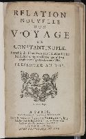
Beinecke Rare Book and Manuscript Library > Relation nouvelle d’un voyage de Constantinople. Enrichie de plans levez par l’auteur sur les lieux, et des figures de tout ce qu’il y a de plus remarquable dans cette ville. Presentee au roy
Creator:
Published / Created:
[1819]
Call Number:
1995 Folio 11
Image Count:
40
Resource Type:
Books, Journals & Pamphlets
Found in:
Beinecke Rare Book and Manuscript Library > Voyage pittoresque de Constantinople et des rives du Bosphore / d'apr es les dessins de M. Melling, architecte de l'Empereur Seå«lim III et dessinateur de la Sultane Hadidge sa soeur ; publie par MM Treuttel et Wurtz
Call Number:
Taylor 257
Collection Title:
Les voyages dv sievr de Champlain Xaintongeois, capitaine ordinaire pour le Roy, en la marine
Image Count:
1
Found in:
Beinecke Rare Book and Manuscript Library > Isle de sainte Croix
Call Number:
Taylor 257
Collection Title:
Les voyages dv sievr de Champlain Xaintongeois, capitaine ordinaire pour le Roy, en la marine
Image Count:
1
Found in:
Beinecke Rare Book and Manuscript Library > Malle Barre
Call Number:
Taylor 257
Collection Title:
Les voyages dv sievr de Champlain Xaintongeois, capitaine ordinaire pour le Roy, en la marine
Image Count:
1
Found in:
Beinecke Rare Book and Manuscript Library > Le Beau port
Call Number:
Taylor 257
Collection Title:
Les voyages dv sievr de Champlain Xaintongeois, capitaine ordinaire pour le Roy, en la marine
Image Count:
1
Found in:
Beinecke Rare Book and Manuscript Library > Port Fortune
Published / Created:
[1618]
Call Number:
Taylor 275
Collection Title:
Journal ou relation exacte du voyage de Guill Schouten
Image Count:
1
Found in:
Beinecke Rare Book and Manuscript Library > [Double hemisphere map of the world showing track of Schouten’s voyage in 1615-1617]
Published / Created:
[1618]
Call Number:
Taylor 275
Collection Title:
Journal ou relation exacte du voyage de Guill Schouten
Image Count:
1
Found in:
Beinecke Rare Book and Manuscript Library > Description du nouveau pasage vers le zud du destroit de Magellan ...
Published / Created:
[1618]
Call Number:
Taylor 275
Collection Title:
Journal ou relation exacte du voyage de Guill Schouten
Image Count:
1
Found in:
Beinecke Rare Book and Manuscript Library > Description de la grande mer du Sud monstrant par quel chemin Guillaume Schouten a nauige ...
Published / Created:
[1618]
Call Number:
Taylor 275
Collection Title:
Journal ou relation exacte du voyage de Guill Schouten
Image Count:
1
Found in:
Beinecke Rare Book and Manuscript Library > Description de la coste septentrionale de Noua Guinea ...
Published / Created:
Undated
Call Number:
1975 2757
Collection Title:
El atlas abreviado, o, El nuevo compendio de la geografia universal, politica, historica, i curiosa
Image Count:
1
Resource Type:
Maps, Atlases & Globes
Found in:
Beinecke Rare Book and Manuscript Library > Isles Britanniques ou sont les royaumes d'Angleterre d'Escosse et d'Irlande
Published / Created:
1756
Call Number:
1973 Folio 119
Collection Title:
Atlas universel, par M. Robert ... et par M. Robert de Vaugondy son fils ...
Image Count:
1
Resource Type:
Maps, Atlases & Globes
Found in:
Beinecke Rare Book and Manuscript Library > Carte de la Lorraine et Du Barrois dans laquelle se trouvent la generalite de metz et autres enclaves; dresseepour la lecture du memoire de M. Durival l'aine, et dediee au Roy de Pologne Duc de Lorraine et de bar par le Sr. Robert de Vaugondy ...
Published / Created:
1753
Call Number:
1973 Folio 119
Collection Title:
Atlas universel, par M. Robert ... et par M. Robert de Vaugondy son fils ...
Image Count:
1
Resource Type:
Maps, Atlases & Globes
Found in:
Beinecke Rare Book and Manuscript Library > Carte de la l'Egypte ancienne et moderne, dressee sur celle du R.P. Sicard et autres, assujielles aux observations astronomiques par le Sr. Robert de Vaugondy ...
Creator:
Published / Created:
1755
Call Number:
2003 Folio 85
Image Count:
1
Found in:
Beinecke Rare Book and Manuscript Library > Partie de l'Amerique septentrionale: qui comprend le cours de l'Ohio, la Nlle. Angleterre, la Nlle York, le New Jersey, la Pensylvanie, le Maryland, la Virginie, la Caroline
Creator:
Published / Created:
1755
Call Number:
2003 Folio 85
Image Count:
1
Found in:
Beinecke Rare Book and Manuscript Library > Partie de l'Amerique septent? qui comprend la Nouvelle France ou le Canada
Creator:
Published / Created:
1750
Call Number:
2003 Folio 85
Image Count:
1
Found in:
Beinecke Rare Book and Manuscript Library > Partie de la mer du Nord: ouse trouvent les grandes et petites isles Antilles, et les isles Lucayes
Creator:
Published / Created:
avec privilege 1749
Call Number:
2003 Folio 85
Image Count:
1
Found in:
Beinecke Rare Book and Manuscript Library > Carte de l'isle de Saint-Domingue: dressee d'apres la carte originale de Mr. Frezier
Creator:
Published / Created:
1755
Call Number:
2003 Folio 85
Image Count:
1
Found in:
Beinecke Rare Book and Manuscript Library > Carte de la Virginie et du Maryland
Creator:
Published / Created:
avec privilege 1750
Call Number:
2003 Folio 85
Image Count:
1
Found in:
Beinecke Rare Book and Manuscript Library > Amerique meridionale: dresee sur les memoires les plus recents et assujetie aux observations astronomique
Creator:
Published / Created:
1759
Call Number:
2003 Folio 85
Image Count:
1
Found in:
Beinecke Rare Book and Manuscript Library > Carte reduite des isles de la Guadeloupe, Marie Galante, et les Saintes
Creator:
Published / Created:
1760
Call Number:
2003 Folio 85
Image Count:
1
Found in:
Beinecke Rare Book and Manuscript Library > Carte reduite des costes de la Guyane: depuis la riviere d'Orenoque jusqu'au Cap de Nord a l'entree de la riviere des Amazones
Creator:
Published / Created:
1758
Call Number:
2003 Folio 85
Image Count:
1
Found in:
Beinecke Rare Book and Manuscript Library > Carte reduite de l'isle de Saint Christophe: dressee des cartes, plans et journaux de la marine : pour le service des vaisseaux du roy : par ordre de M. le Marquis de Massiac, lieutenant general des Armees navales, Secretaire d'Etat aiant le Departement d
Creator:
Published / Created:
1758
Call Number:
2003 Folio 85
Image Count:
1
Found in:
Beinecke Rare Book and Manuscript Library > Carte reduite de l'isle de la Martinique
Creator:
Published / Created:
1762?
Call Number:
2003 Folio 85
Image Count:
1
Found in:
Beinecke Rare Book and Manuscript Library > Carte reduite de l'isle de Cube
Creator:
Published / Created:
1758
Call Number:
2003 Folio 85
Image Count:
1
Found in:
Beinecke Rare Book and Manuscript Library > Carte reduite de l'isle d'Antigue: dressee au Depost des cartes, plans et journaux de la marine : pour le service des vaisseaux du roy : par ordre de M. le Marquis de Massiac, lieutenant general des Armees navales, Secretaire d'Etat aiant le Departement d
Creator:
Published / Created:
1762?
Call Number:
2003 Folio 85
Image Count:
1
Found in:
Beinecke Rare Book and Manuscript Library > Carte hydrographique de la baye de la Havane: avec le plan de la ville et de ses forts pour joindre a la Carte de l'isle de Cube
Creator:
Published / Created:
1791
Call Number:
2003 Folio 85
Image Count:
1
Found in:
Beinecke Rare Book and Manuscript Library > Carte du cours du fleuve de Saint Laurent depuis Quebec jusqu'a la mer en deux feuilles: 1re. feuille depuis Quebec jusqu'a Matane et Rivere des Outardes, 1761
Creator:
Published / Created:
ca. 1763
Call Number:
2003 Folio 85
Image Count:
1
Found in:
Beinecke Rare Book and Manuscript Library > Carte des isles de Saint Pierre et Miquelon: levee par ordre de M. Le Duc du Choiseul, Colonel General des Suisses et Grisons Ministre de la Guerre et de la Marine, 1763 : reduite et assujetie au ciel par le service des vaisseaux du Roy
Creator:
Published / Created:
1763
Call Number:
2003 Folio 85
Image Count:
1
Found in:
Beinecke Rare Book and Manuscript Library > Carte de l'Isle Saint Pierre: dressee au Depost des Cartes et Plans de la marine pour le service des vaisseaux du roy par ordre de M. Le Duc de Choiseul colonel-general des Suisses et Grisons, ministre de la guerre et de la marine
Creator:
Published / Created:
1763
Call Number:
2003 Folio 85
Image Count:
1
Found in:
Beinecke Rare Book and Manuscript Library > Carte de l'isle de Sainte Lucie
Creator:
Published / Created:
1760
Call Number:
2003 Folio 85
Image Count:
1
Found in:
Beinecke Rare Book and Manuscript Library > Carte de l'isle de la Grenade
Creator:
Published / Created:
1755?
Call Number:
2003 Folio 85
Image Count:
1
Found in:
Beinecke Rare Book and Manuscript Library > Carte de la Louisiane et des pays voisins: dediee a M. Rouille, secretaire d'Etat, ayant le Departement de la marine
Creator:
Published / Created:
1763
Call Number:
2003 Folio 85
Image Count:
1
Found in:
Beinecke Rare Book and Manuscript Library > Carte de la Guyane francoise et l'isle de Cayenne
Creator:
Published / Created:
[1752]
Call Number:
2003 Folio 85
Image Count:
1
Found in:
Beinecke Rare Book and Manuscript Library > Carte de la Louisiane
Creator:
Published / Created:
Novembre 1755
Call Number:
2003 Folio 85
Image Count:
1
Found in:
Beinecke Rare Book and Manuscript Library > Canada, Louisiane et terres angloises
Creator:
Published / Created:
1746
Call Number:
2003 Folio 85
Image Count:
1
Found in:
Beinecke Rare Book and Manuscript Library > Amerique Septentrionale: publiee sous les auspices de Monseigneur le Duc d'Orleans preÌÎåmier prince du sang / par le Sr. D'Anville
Published / Created:
ca. 1755
Call Number:
2003 Folio 85
Image Count:
1
Found in:
Beinecke Rare Book and Manuscript Library > Le fleuve Saint-Laurent: represente plus en detail que dans l'etendue de la carte
Published / Created:
1754
Call Number:
2003 Folio 85
Image Count:
1
Found in:
Beinecke Rare Book and Manuscript Library > Carte reduite du golphe du St. Laurent: contenant l'isle de Terre-Neuve et partie de la coste des Esquimaux, l'isle Royale, l'isle St. Jean et celle d'Anticosti &ca
Creator:
Published / Created:
avec privilege 1748
Call Number:
2003 Folio 85
Image Count:
1
Found in:
Beinecke Rare Book and Manuscript Library > Amerique meridionale : publiee sous les auspices de Monseigneur le Duc d'Orleans preå«mier prince du sang / par le Sr. D'Anville
Published / Created:
Undated
Call Number:
Taylor 232
Collection Title:
Mecometrie de leymant, cest a dire La maniere de mesvrer les longitudes par le moyen de l’eymant
Image Count:
1
Found in:
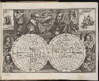
Beinecke Rare Book and Manuscript Library > Orbis terrae compendiosa descriptio ex peritis simorum totius orbis gaeographorum tabulis et novissimis observationibus desumpta
Creator:
Call Number:
Z6 12
Collection Title:
Histoire de la Novvelle France
Image Count:
1
Found in:
Beinecke Rare Book and Manuscript Library > Figure et descrition de la terre reconue et habitee par les Francois en la Floride et audeca, gisante par los 30-31- et 32- degrez
Published / Created:
1609
Call Number:
Z6 12
Collection Title:
Histoire de la Novvelle France
Image Count:
1
Found in:
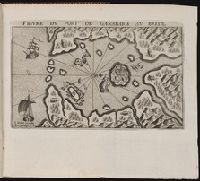
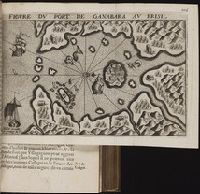
Beinecke Rare Book and Manuscript Library > Figure du port de Ganabara au Brisil / I. Millot excudit. Auec priuilege du Roy
Published / Created:
[1609]
Call Number:
Z6 12
Collection Title:
Histoire de la Novvelle France
Image Count:
1
Found in:
Beinecke Rare Book and Manuscript Library > Figure de la terre neuue, grande riuiere de Canada, et cotes de l’ocean en la Nouuelle France / Ian Swelinc fecit ; I. Millot excudit ; Marcus Lescarbot nunc primum delineauit, publicauit, donauit. Auec priuilege du Roy
Creator:
Published / Created:
1609
Call Number:
Z6 12
Collection Title:
Histoire de la Novvelle France
Image Count:
1
Found in:
Beinecke Rare Book and Manuscript Library > Figure du Port Royal en la Nouuelle France / par Marc Lescarbot ; Jan Swelinck sculp. ; I. Millot excudit
Published / Created:
[1609]
Call Number:
Taylor 245
Collection Title:
Histoire de la Novvelle France
Image Count:
1
Found in:
Beinecke Rare Book and Manuscript Library > Figure du port de Ganabara au Brisil / I. Millot excudit. Auec priuilege du Roy
Published / Created:
[1609]
Call Number:
Pequot L56
Collection Title:
Histoire de la Nouvelle-France : contenant les navigations, decouvertes, & habitations faites par
Image Count:
1
Found in:
Beinecke Rare Book and Manuscript Library > Figure du port de Ganabara au Brisil / I. Millot excudit. Auec priuilege du Roy
Creator:
Published / Created:
[1609]
Call Number:
Pequot L56
Collection Title:
Histoire de la Nouvelle France : contenant les navigations, decouvertes, & habitations faites par
Image Count:
1
Found in:
Beinecke Rare Book and Manuscript Library > Figure de la terre neuue, grande riuiere de Canada, et cotes de l’ocean en la Nouuelle France / Ian Swelinc fecit ; I. Millot excudit ; Marcus Lescarbot nunc primum delineauit, publicauit, donauit. Auec priuilege du Roy
Creator:
Published / Created:
1609
Call Number:
Pequot L56
Collection Title:
Histoire de la Nouvelle-France : contenant les navigations, decouvertes, & habitations faites par
Image Count:
1
Found in:
Beinecke Rare Book and Manuscript Library > Figure du Port Royal en la Nouuelle France / par Marc Lescarbot ; Jan Swelinck sculp. ; I. Millot excudit
Published / Created:
1618?
Call Number:
Taylor 278
Collection Title:
Jovrnal ou Description dv merveillevx voyage de Gvillavme Schovten, hollandois natif de Hoorn
Image Count:
1
Found in:
Beinecke Rare Book and Manuscript Library > [Map of the world in two hemispheres]
Published / Created:
1618?
Call Number:
Taylor 278
Collection Title:
Jovrnal ou Description dv merveillevx voyage de Gvillavme Schovten, hollandois natif de Hoorn
Image Count:
1
Found in:
Beinecke Rare Book and Manuscript Library > Description de nouveau passage vers le zud du destroict de Magellan ...
Published / Created:
1618?
Call Number:
Taylor 278
Collection Title:
Jovrnal ou Description dv merveillevx voyage de Gvillavme Schovten, hollandois natif de Hoorn
Image Count:
1
Found in:
Beinecke Rare Book and Manuscript Library > Description de la grande Mer de Sud ...
Published / Created:
1618?
Call Number:
Taylor 278
Collection Title:
Jovrnal ou Description dv merveillevx voyage de Gvillavme Schovten, hollandois natif de Hoorn
Image Count:
1
Found in:
Beinecke Rare Book and Manuscript Library > [Map of Nova Guinea]
Published / Created:
1612
Call Number:
Pequot G325
Collection Title:
Descriptio ac delineatio geographica detectionis freti, sive, transitus ad occasum supra terras
Image Count:
1
Found in:
Beinecke Rare Book and Manuscript Library > Tabula nautica ...
Published / Created:
Undated
Call Number:
CF2221 F74
Collection Title:
Relation du voyage de la Mer du Sud aux cotes du Chily et du Perou : fait pendant les annees 1712
Image Count:
1
Resource Type:
Books, Journals & Pamphlets
Found in:
Beinecke Rare Book and Manuscript Library > Carte redvite, pour l'intelligence du Voyage de la Mer du Sud ...
Creator:
Published / Created:
[1783?]
Call Number:
1977 Folio 177
Image Count:
4
Resource Type:
Maps, Atlases & Globes
Found in:
Beinecke Rare Book and Manuscript Library > England and Ireland : containing all the cities, boroughs, markettowns & principal villages : with the coast of France from Calais to Brest delineated and engraved from actual surveys / by Richard William Seale.
Creator:
Published / Created:
1635
Call Number:
1988 Folio 13
Collection Title:
Theatrum orbis terrarum. French
Image Count:
3
Found in:
Beinecke Rare Book and Manuscript Library > La Nouvelle Belgique & la Nouvelle Angleterre
Creator:
Published / Created:
1635
Call Number:
1988 Folio 13
Collection Title:
Theatrum orbis terrarum. French
Image Count:
3
Found in:
Beinecke Rare Book and Manuscript Library > Les isles de Reí & D'Oleíron
Creator:
Published / Created:
1635
Call Number:
1988 Folio 13
Collection Title:
Theatrum orbis terrarum. French
Image Count:
3
Found in:
Beinecke Rare Book and Manuscript Library > La Verginie
Published / Created:
1731
Call Number:
Ehdc 725
Collection Title:
Voyage du chevalier Des Marchais en Guinee, isles voisines, et a Cayenne, fait en 1725, 1726 & 1727
Image Count:
1
Resource Type:
Maps, Atlases & Globes
Found in:
Beinecke Rare Book and Manuscript Library > Carte particuliere du Royaume de Juda
Creator:
Call Number:
1977 Folio 114
Collection Title:
L’atlas curieux ou Le monde represente dans des cartes generales et particulieres du ciel et de la
Image Count:
1
Resource Type:
Maps, Atlases & Globes
Found in:
Beinecke Rare Book and Manuscript Library > Bourg, chateau, et iardins de Fontaine-bleau
Creator:
Published / Created:
1743
Call Number:
1982 Folio 10
Image Count:
2
Found in:
Beinecke Rare Book and Manuscript Library > L'Italie : publiee sous les auspices de Monseigneur le Duc d'Orleans, Premier Prince du Sang
Creator:
Published / Created:
1783 February 24
Call Number:
1982 Folio 10
Image Count:
1
Found in:
Beinecke Rare Book and Manuscript Library > Carte generale des etats du roi de Sardaigne
Creator:
Published / Created:
1778
Call Number:
1982 Folio 10
Image Count:
1
Found in:
Beinecke Rare Book and Manuscript Library > Nouvelle carte de la Suisse : dans laquelle sont exactement distingues les treize cantons, leurs allies, et leurs sujets : dressee sur les memoires les plus corrects et assujettie aux observations astronomiques
Creator:
Published / Created:
[168-?]
Call Number:
1973 Folio 10
Image Count:
1
Resource Type:
Maps, Atlases & Globes
Found in:
Beinecke Rare Book and Manuscript Library > Lutetiae Parisiorum universae Galliae metropolis novissima [et] accuratissima
Creator:
Published / Created:
[ca. 1700]
Call Number:
1973 Folio 10
Image Count:
1
Resource Type:
Maps, Atlases & Globes
Found in:
Beinecke Rare Book and Manuscript Library > Gouvernement General de Languedoc: divise en ses vint deux Diocesez
Creator:
Published / Created:
1693
Call Number:
1973 Folio 10
Image Count:
1
Resource Type:
Maps, Atlases & Globes
Found in:
Beinecke Rare Book and Manuscript Library > La Suisse divisee en ses treze cantons, ses alliez [et] ses sujets
Creator:
Published / Created:
1696
Call Number:
1973 Folio 10
Image Count:
1
Resource Type:
Maps, Atlases & Globes
Found in:
Beinecke Rare Book and Manuscript Library > Le cercle de Franconie : subdivise en tous les estats qui le composent
Creator:
Published / Created:
[1710]
Call Number:
1973 Folio 10
Image Count:
1
Resource Type:
Maps, Atlases & Globes
Found in:
Beinecke Rare Book and Manuscript Library > Teatre de la guerre en Flandre [et] Brabant, les pays conquis et le Bas-Rhein etc
Call Number:
1973 Folio 67
Collection Title:
The West-India pilot: containing piloting directions for Port Royal and Kingston harbours in
Image Count:
1
Found in:
Beinecke Rare Book and Manuscript Library > Plan de la Rade du Port Paix
Call Number:
1973 Folio 67
Collection Title:
The West-India pilot: containing piloting directions for Port Royal and Kingston harbours in
Image Count:
1
Found in:
Beinecke Rare Book and Manuscript Library > Plan du Cap Francois
Call Number:
1973 Folio 67
Collection Title:
The West-India pilot: containing piloting directions for Port Royal and Kingston harbours in
Image Count:
1
Found in:
Beinecke Rare Book and Manuscript Library > Plan du cul de sac de Leogane ou le Port au Prince
Published / Created:
1612
Call Number:
Taylor 258
Collection Title:
Descriptio ac delineatio geographica detectionis freti, sive, transitus ad occasum supra terras
Image Count:
1
Found in:
Beinecke Rare Book and Manuscript Library > Tabula nautica, qua repraesentantur orae maritimae, meatus, ac freta, noviter a H. Hudsono Anglo ad Caurum supra Novam Franciam
Published / Created:
1632
Call Number:
BrSides Folio 2008 15
Collection Title:
Les voyages de la Novvelle France occidentale, dicte Canada / faits par le Sr. de Champlain
Image Count:
1
Found in:
Beinecke Rare Book and Manuscript Library > Carte de la Nouuelle France, augmentee depuis la derniere, seruant a la nauigation faicte en son vray Meridien, par le Sr. de Champlain pour le Roy en la Marine; lequel depuis l'an 1603 jusques en l'année 1629; a descouuert plusieurs costes, terres, lacs, ruineres, et Nations de Sauuages, par cy deuant incognuës, comme il se voit en ses relations quil a faict Imprimer en 1632, ou il se uoit cette marque [image of a flag] ce sont habitations qu'ont faict les françois. Faicte l'an 1632 par le sieur de Champlain. Scale [ca. 1:1,000,000].
Creator:
Published / Created:
1728
Call Number:
Efd 728L
Image Count:
6
Found in:
Beinecke Rare Book and Manuscript Library > Nouvelle relation de l'Afrique occidentale: contenant une description exacte du Senegal & des païs situés entre le Cap-Blanc & la riviere de Serrelionne, jusqu'à plus de 300. lieuës en avant dans les terres. L'histoire naturelle de ces païs, les differentes nations qui y sont répanduës, leurs religions & leurs mœurs. Avec l'etat ancien et present des compagnies qui y font le commerce. Ouvrage enrichi de quantite' de cartes, de plans, & de figures en taille-douce. Par le pere Jean-Baptiste Labat ...
Creator:
Published / Created:
1783
Call Number:
GEN MSS 499
Collection Title:
Henri Crublier d'Opterre journal and maps, [1776]-1783.
Container / Volume:
Bsd folder 10
Image Count:
3
Found in:
Beinecke Rare Book and Manuscript Library > Unidentified. 'Amérique Septentrionale, 1783. Plan de la Ville et du Port de Ports-mouth, dans le newhampshire.'
Branch:v1.60.98 ,Deployed:2024-04-24T10:14:35-04:00