Search
You Searched For
Search Results
- Published / Created:
- [between 1829 and 1835]
- Call Number:
- 796ad 1830
- Container / Volume:
- BRBL_00716
- Image Count:
- 1
- Resource Type:
- Maps, Atlases & Globes
- Found in:
- Beinecke Rare Book and Manuscript Library > [Dominguez Grant]
- Creator:
- Jefferys, Thomas, d. 1771
- Published / Created:
- 1794
- Call Number:
- 795cea 1794
- Container / Volume:
- BRBL_00523
- Image Count:
- 1
- Resource Type:
- Maps, Atlases & Globes
- Found in:
- Beinecke Rare Book and Manuscript Library > The western coast of Louisiana and the coast of New Leon / by Thos. Jefferys, geographer to His Majesty.
- Creator:
- J.H. Colton & Co
- Published / Created:
- [1855?]
- Call Number:
- 796 1855
- Container / Volume:
- BRBL_00525
- Image Count:
- 1
- Resource Type:
- Maps, Atlases & Globes
- Found in:
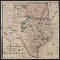
- Beinecke Rare Book and Manuscript Library > Texas.
- Published / Created:
- 1837?]
- Call Number:
- 796 H37 1837
- Container / Volume:
- BRBL_00527A
- Image Count:
- 1
- Resource Type:
- Maps, Atlases & Globes
- Found in:
- Beinecke Rare Book and Manuscript Library > Survey of 5 leagues of land belonging to Wm P. Harris & others / lith. of P. Snell.
- Published / Created:
- 1814?]
- Call Number:
- 88 1814
- Container / Volume:
- BRBL_00644
- Image Count:
- 1
- Resource Type:
- Maps, Atlases & Globes
- Found in:
- Beinecke Rare Book and Manuscript Library > Spanish North America.
- Creator:
- Hewitt, N. R
- Published / Created:
- 1821?]
- Call Number:
- 88 1821
- Container / Volume:
- BRBL_00644
- Image Count:
- 1
- Resource Type:
- Maps, Atlases & Globes
- Found in:
- Beinecke Rare Book and Manuscript Library > Spanish North America / Hewitt sculp.
- Creator:
- Lee, Thomas Jefferson, 1808-1891
- Published / Created:
- 1842?]
- Call Number:
- 796fab Sa13 1842J
- Container / Volume:
- BRBL_00530
- Image Count:
- 1
- Resource Type:
- Maps, Atlases & Globes
- Found in:
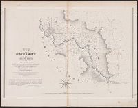
- Beinecke Rare Book and Manuscript Library > Sabine Pass and mouth of the river Sabine in the sea / surveyed under the direction of Major J.D. Graham, U.S. Top.l Engineers ; by Lieut. T.J. Lee, U.S. Top.l Engineers and Cap.t P.J. Pillans, Texan Army, attached to the Joint Commission for marking the
- Creator:
- Rand McNally and Company
- Published / Created:
- [1877?]
- Call Number:
- 796gme 1877
- Container / Volume:
- BRBL_00531
- Image Count:
- 2
- Resource Type:
- Maps, Atlases & Globes
- Found in:
- Beinecke Rare Book and Manuscript Library > Revised map of the state of Texas / Rand McNally & Co., map engravers.
- Creator:
- Nicholson, W. L
- Published / Created:
- [1879?]
- Call Number:
- 796gmd 1879
- Container / Volume:
- BRBL_00531
- Image Count:
- 2
- Resource Type:
- Maps, Atlases & Globes
- Found in:
- Beinecke Rare Book and Manuscript Library > Post route map of the state of Texas : with adjacent parts of Louisiana, Arkansas, Indian Territory, and of the Republic of Mexico / designed and constructed under the orders of Postmaster General D.M. Key by W.L. Nicholson.
- Creator:
- Sandusky, William H
- Published / Created:
- 1845
- Call Number:
- 796 G139 1845B
- Container / Volume:
- BRBL_00527A
- Image Count:
- 1
- Resource Type:
- Maps, Atlases & Globes
- Found in:
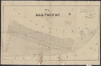
- Beinecke Rare Book and Manuscript Library > Plan of the city of Galveston, Texas / by William H. Sandusky ; lith. by Wagner and McGuigan.
- Creator:
- Blake, Jacob Edmund, 1811 or 12-1846
- Published / Created:
- 1842?]
- Call Number:
- 796fab Sa13 1842F
- Container / Volume:
- BRBL_00530
- Image Count:
- 1
- Resource Type:
- Maps, Atlases & Globes
- Found in:
- Beinecke Rare Book and Manuscript Library > Part of the boundary between the United States and Texas, north of the Sabine River from the 72nd mile mound to Red River / drawn from the notes of survey and copied for the use of the commissioners under the Convention of 25th April, 1838 by J. Edm.d Bla
- Creator:
- Blake, Jacob Edmund, 1811 or 12-1846
- Published / Created:
- 1842?]
- Call Number:
- 796fab Sa13 1842E
- Container / Volume:
- BRBL_00530
- Image Count:
- 1
- Resource Type:
- Maps, Atlases & Globes
- Found in:
- Beinecke Rare Book and Manuscript Library > Part of the boundary between the United States and Texas, north of Sabine River from the 39th [i.e. 36th] to the 72nd mile mound / drawn from the notes of survey and copied for the use of the commissioners under the Convention of 25th April 1838 by J. Edm
- Creator:
- Blake, Jacob Edmund, 1811 or 12-1846
- Published / Created:
- 1842?]
- Call Number:
- 796fab Sa13 1842D
- Container / Volume:
- BRBL_00530
- Image Count:
- 1
- Resource Type:
- Maps, Atlases & Globes
- Found in:
- Beinecke Rare Book and Manuscript Library > Part of the boundary between the United States and Texas, from Sabine River northward to the 36th mile mound / drawn from the notes of survey and copied for the use of the commissioners under the Convention of 25th April 1838, by J. Edm.d Blake 1st Lieut.
- Creator:
- Hall, Sidney
- Published / Created:
- March, 1828.
- Call Number:
- 88 1828A
- Container / Volume:
- BRBL_00644
- Image Count:
- 1
- Resource Type:
- Maps, Atlases & Globes
- Found in:
- Beinecke Rare Book and Manuscript Library > Mexico and Guatimala : corrected from original information communicated by Simon A.G. Bourne, Esq. / by Sidney Hall.
- Creator:
- Arrowsmith, John, 1790-1873
- Published / Created:
- 1842
- Call Number:
- 88 1842
- Container / Volume:
- BRBL_00645
- Image Count:
- 1
- Resource Type:
- Maps, Atlases & Globes
- Found in:
- Beinecke Rare Book and Manuscript Library > Mexico / by J. Arrowsmith.
- Creator:
- Arrowsmith, John, 1790-1873
- Published / Created:
- 1834 February 15
- Call Number:
- 88 1834
- Container / Volume:
- BRBL_00644
- Image Count:
- 1
- Resource Type:
- Maps, Atlases & Globes
- Found in:
- Beinecke Rare Book and Manuscript Library > Mexico / by J. Arrowsmith.
- Creator:
- Arrowsmith, John, 1790-1873
- Published / Created:
- 1832 February 15
- Call Number:
- 88 1832
- Container / Volume:
- BRBL_00644
- Image Count:
- 1
- Resource Type:
- Maps, Atlases & Globes
- Found in:
- Beinecke Rare Book and Manuscript Library > Mexico / by J. Arrowsmith.
- Creator:
- Gray, A. B. (Andrew Belcher), 1820-1862
- Published / Created:
- 1842?]
- Call Number:
- 796fab Sa13 1842I
- Container / Volume:
- BRBL_00530
- Image Count:
- 1
- Resource Type:
- Maps, Atlases & Globes
- Found in:
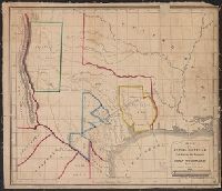
- Beinecke Rare Book and Manuscript Library > Map of the river Sabine from Logan's Ferry to 32nd degree of north latitude : shewing the boundary between the United States of America and the Republic of Texas between said points, as marked and laid down by survey in 1841, under the direction of the Jo
- Creator:
- Groesbeck, Jno. D. (John D.)
- Published / Created:
- 1854]
- Call Number:
- 796 G139 1838
- Container / Volume:
- BRBL_00527
- Image Count:
- 1
- Resource Type:
- Maps, Atlases & Globes
- Found in:
- Beinecke Rare Book and Manuscript Library > Map of the city of Galveston : situated on the east end of Galveston Island, Texas / surveyed and drawn by Jno. D. Groesbeck, civil engineer ; L.H. Bradford & Co.'s lith.
- Creator:
- Croskey, Joseph Rodney
- Published / Created:
- 1842
- Call Number:
- 796ad 1842
- Container / Volume:
- BRBL_00529
- Image Count:
- 1
- Resource Type:
- Maps, Atlases & Globes
- Found in:
- Beinecke Rare Book and Manuscript Library > Map of the Republic of Texas, exhibiting the property of John Woodward / drawn by Joseph Rodney Croskey.