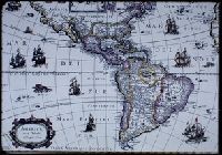
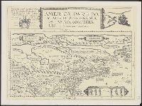
The description of this slide reflects the way that Erdoes organized 35mm slides. Erdoes arranged his slides in labeled containers that were sub-divided into labeled sections. The title for this image has been transcribed from its sub-section label; images of other slides from the same sub-section share the container title. The date listed here reflects a span of known dates associated the sub-section. In some cases, titles have been expanded to note particular individuals who appear frequently and who were identified by Erdoes in captions. Individual slide captions have not been transcribed or captured during digitization.
Subject (Geographic):
North America--Maps--Early works to 1800 and South America--Maps--Early works to 1800
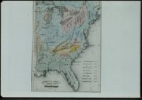
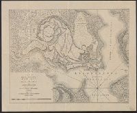
The description of this slide reflects the way that Erdoes organized 35mm slides. Erdoes arranged his slides in labeled containers that were sub-divided into labeled sections. The title for this image has been transcribed from its sub-section label; images of other slides from the same sub-section share the container title. The date listed here reflects a span of known dates associated the sub-section. In some cases, titles have been expanded to note particular individuals who appear frequently and who were identified by Erdoes in captions. Individual slide captions have not been transcribed or captured during digitization.
Subject (Geographic):
West (U.S.)--Maps
Subject (Topic):
Indian reservations--Maps and Indians--Languages--Maps
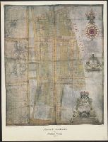
Publication (London Topographical Society) ; no. 128., Publication ; no. 128, and Suruey of Hatton-Garden belonging to ye Right Hon'b. Christopher, Lord Viscount Hatton of Gretton, Barron Hatton of Kirby.
Description:
Accompanied by text: The survey of Hatton Garden in 1694 by Abraham Arlidge / PS Hunting ([1] leaf ; 27 x 21 cm.)., Facsim. of ms. cadastral map showing buildings, lot numbers, and householders' names., and Includes indexes of householders' names and coat of arms.
Publisher:
London Topographical Society,
Subject (Geographic):
Hatton Garden (London, England)--Maps--Early works to 1800
Subject (Topic):
Early maps--Facsimiles and Real property--England--Hatton Garden (London)--Maps--Early works to 1800
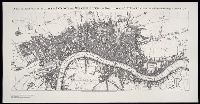
Hernlund, Patricia. Johnson's London, 1754-56 Johnsonians (Society) Seale, Richard William, engraver Stinehour Press Stow, John, 1525?-1605. Survey of the cities of London and Westminster and the borough of Southwark
Published / Created:
[United States : and 1989]
Call Number:
BrSides Folio 2005 20
Image Count:
1
Resource Type:
Maps, Atlases & Globes
Description:
"Limited to 280 copies to mark the 280th birthday of Doctor Samuel Johnson.", "Printed by Meriden-Stinehour Press for the Johnsonians on the occasion of their annual dinner held at Anderson House ... Washington ... 16 September 1989.", Accompanied by: Hernlund, Patricia. Johnson's London, 1754-56., Facsimile reproduction of the frontispiece map in: J. Stow, Survey of the cities of London and Westminster and the borough of Southwark, 6th ed., London, 1754-1755., Map signed: R.W. Seale sculp., and The map is described in: Hernlund, P. Johnson's London, 1754-56.
Publisher:
s.n.,
Subject (Geographic):
London (England)--Maps--Early works to 1800--Facsimiles
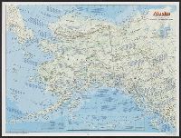
National Geographic Society (U.S.). Cartographic Division
Published / Created:
1983
Call Number:
848 1983
Container / Volume:
BRBL_00631
Image Count:
2
Resource Type:
Maps, Atlases & Globes
Alternative Title:
The making of America: Alaska.
Description:
"Supplement to the National Geographic, January 1984, page 50A, vol. 165, no. 1.", Inset: Continuation of the Aleutian Islands on same scale as main map., Relief shown by shading and spot heights., Text, maps, ill. on verso., and Title when folded: The making of America: Alaska.