Search
You Searched For
Search Results
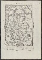
- Creator:
- Silvani, Bernardo
- Published / Created:
- Anno Domini 1511]
- Call Number:
- 11 1511A
- Container / Volume:
- BRBL_00732
- Image Count:
- 1
- Resource Type:
- Maps, Atlases & Globes
- Description:
- The author's name is often given as
- Found in:
- Beinecke Rare Book and Manuscript Library > [World map].
- Creator:
- Ramusio, Giovanni Battista, 1485-1557
- Published / Created:
- 155-?]
- Call Number:
- 60 155X
- Container / Volume:
- BRBL_00321
- Image Count:
- 2
- Resource Type:
- Maps, Atlases & Globes
- Description:
- Appears in the author's Delle
- Found in:
- Beinecke Rare Book and Manuscript Library > [Map of Africa].
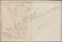
- Creator:
- Des Barres, Joseph F. W. (Joseph Frederick Wallet), 1722-1824
- Published / Created:
- 177-?]
- Call Number:
- 733cea G76 1776
- Container / Volume:
- BRBL_00379
- Image Count:
- 2
- Resource Type:
- Maps, Atlases & Globes
- Description:
- From the author's Atlantic Neptune.
- Found in:
- Beinecke Rare Book and Manuscript Library > [Chart of Passamaquoddy Bay and Grand Manan island, New Brunswick].
- Creator:
- Des Barres, Joseph F. W. (Joseph Frederick Wallet), 1722-1824
- Published / Created:
- Augt. 1st, 1781.
- Call Number:
- 734 S46 1781
- Container / Volume:
- BRBL_00380
- Image Count:
- 1
- Resource Type:
- Maps, Atlases & Globes
- Description:
- Appears in the author's Atlantic
- Found in:
- Beinecke Rare Book and Manuscript Library > [Bay of Seven Islands, Québec].
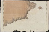
- Creator:
- Des Barres, Joseph F. W. (Joseph Frederick Wallet), 1722-1824
- Published / Created:
- Septr. 1 1781.
- Call Number:
- 733cea M67 1781
- Container / Volume:
- BRBL_00379
- Image Count:
- 1
- Resource Type:
- Maps, Atlases & Globes
- Description:
- From the author's Atlantic Neptune.
- Found in:
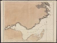
- Beinecke Rare Book and Manuscript Library > [A chart of the bay and river of Miramichy / surveyed by Samuel Holland].
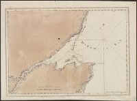
- Creator:
- Des Barres, Joseph F. W. (Joseph Frederick Wallet), 1722-1824
- Published / Created:
- Aug. 1 1781.
- Call Number:
- 734cea G214 1781
- Container / Volume:
- BRBL_00380
- Image Count:
- 2
- Resource Type:
- Maps, Atlases & Globes
- Description:
- From the author's Atlantic Neptune.
- Found in:
- Beinecke Rare Book and Manuscript Library > [A chart of the Bay of Gaspey &c. / surveyed by Samuel Holland].
- Creator:
- Des Barres, Joseph F. W. (Joseph Frederick Wallet), 1722-1824
- Published / Created:
- Aug. 1 1781.
- Call Number:
- 734cea C35 1781
- Container / Volume:
- BRBL_00380
- Image Count:
- 1
- Resource Type:
- Maps, Atlases & Globes
- Description:
- From the author's Atlantic Neptune.
- Found in:
- Beinecke Rare Book and Manuscript Library > [A chart of Chaleurs Bay / surveyed by Samuel Holland].
- Call Number:
- 1977 +392
- Collection Title:
- ... augmented by the author, and afterwards by A.M., H.D., and
- Image Count:
- 1
- Resource Type:
- Maps, Atlases & Globes
- Found in:
- Beinecke Rare Book and Manuscript Library > Walbrook Ward and Dow Gate Ward with its division into parishes taken from the last surveys
- Creator:
- Chatelain, Henri Abraham, author
- Call Number:
- 653 L71 1719
- Container / Volume:
- BRBL_00343
- Image Count:
- 1
- Resource Type:
- Maps, Atlases & Globes
- Found in:
- Beinecke Rare Book and Manuscript Library > Vue & description de la ville de Lovango dans le royaume de Congo avec plusieurs : particularitez curieuses touchant les moeurs & les habillemens des indiens du pais.
- Creator:
- Linschoten, Jan Huygen van, 1563-1611
- Published / Created:
- 1596]
- Call Number:
- 64 1596
- Container / Volume:
- BRBL_00337
- Image Count:
- 1
- Resource Type:
- Maps, Atlases & Globes
- Description:
- Appears in the author's
- Found in:
- Beinecke Rare Book and Manuscript Library > Typus orarum maritimarum Guineae, Manicongo, & Angôlae ultra promontorium Bonae Spei ... [cartographic material] = Afheeldinghe der custen des landts Guinea, Manicongo, ende Angôla, ende voorts tot voorby de C. de boa esperança ... / Arnoldus F. á Lan