Skip to search
Skip to main content
Skip to first result
Yale University Library
Ask Yale Library
Reserve Rooms
Places to Study
Research
Quicksearch
Search Library Catalog (Orbis)
Search Law Library Catalog (MORRIS)
Search Borrow Direct
Search WorldCat
Search Articles+
Search Digital Collections
Search Archives at Yale
Research Guides
Find Databases by Title
Find eJournals by Title
Guide to Using Special Collections
Services
Your Personal Librarian
Subject Specialists
Research Support and Workshops
Citation Tools
OverDrive: Popular Audio and eBooks
Get It @ Yale (Borrow Direct, Interlibrary Loan, Scan & Deliver)
Course Reserves
Off-Campus Access
EliScholar
OverDrive: Popular Audio and eBooks
Bass Media Equipment
Libraries & Collections
Arts Library
Bass Library
Beinecke Library
Classics Library
Divinity Library
Film Study Center
Fortunoff Archive
Humanities Collections
International Collections
Law Library
Lewis Walpole Library
Library Collection Services
Manuscripts & Archives
Map Collection
Marx Science & Social Science Library
Medical Library
Music Library
Sterling Library
Yale Center for British Art
Information & Policies
Library Hours
Departments & Staff
Borrowing & Circulation
Services for Persons with Disabilities
Copyright Basics
Scanning, Printing & Copying
Computers & Wireless
Library Policies
About the Library
Giving to the Library
Purchase Request
Working at the Library
Terms Governing Use of Materials
Search in
All Fields
Creator
Title
Call Number
Date
Subject
Orbis ID
Full Text
Description
Full text
search for
Search
Search
Advanced Search
Digital Collections
Search
You Searched For
Access
Public
Genre
Maps
Resource Type
cartographic image
New Search
1
-
31
of
31
Sort
by Year (descending)
relevance
Creator (A --> Z)
Creator (Z --> A)
Title (A --> Z)
Title (Z --> A)
Year (ascending)
Year (descending)
Number of results to display per page
100
per page
9
per page
30
per page
60
per page
99
per page
View results as:
List
List
Gallery
Gallery
Search Results
[Portolan chart of the Mediterranean Sea, the North Atlantic Ocean, the Black Sea, and the
A night-club map of Harlem : the stars indicate the places that are open all night, the only
Cragmont
Sectionized map of Cheyenne River and Standing Rock Indian Reservation opened by act of May 29
Portolan chart of western Europe and the Mediterranean Sea
Map of India : shewing the British territories, subdivided into collectorates and including British
Montana Territory
Bird's eye view of Lawrence, Kansas, 1880 [cartographic material]
Manuscript map of New Haven Green to Edgewood by Donald G. Mitchell
Montana Territory
Map of the Baltimore, Chesapeake & Delaware Bay Railroad
Map of Horse Railroad, Westville, & part of New Haven : enlarged four-fold from the county survey
Map of a portion of Westville & New Haven
Plan of the New Haven City burial ground
Map of the city of New Haven, Connecticut
An explanation of the original location and general plan or draught of the lands and lots of
Map of the peninsula of India, comprising the whole of the Madras Presidency, and portions of the
Map of a survey of the Mokelumne Hill Canal and a reconnoissance of the adjoining country
Islas Filipinas [cartographic material]
Oxforde
Huang chao yi tong yu di quan tu
A map exhibiting all the new discoveries in the interior parts of North America : inscribed by
Visualized map of all the countries
Scotland : drawn and engrav'd from a series of angles and astronomical observations
Mappa geographica regionem Mexicanam et Floridam terrasque adjacentes, ut et anteriores Americae
Paskaerte van de Oosterse en Noordse Schipvaert van Nederlandt tot Nova Zembla
[Jiangxi Yuanzhou Fu tu].
[Portolan chart of the Mediterranean Sea].
Tabula itineraria ex illustri Peutingerorum Bibliotheca quae Augustae Vindel est beneficio Marci
Limit your search
Extent of Digitization
Completely digitized
31
Access
Public
✖
[remove]
31
Repository
Beinecke Rare Book and Manuscript Library
30
Lewis Walpole Library
1
Genre
Maps
✖
[remove]
31
Early works to 1800
8
Manuscript maps
8
Cadastral maps
3
Early works
3
Portolan charts
3
Aerial views
2
Annotations (Provenance) 19th century
2
Chinese rare maps
2
Forgeries
2
more
Genre
»
Resource Type
cartographic image
✖
[remove]
31
Language
English
20
Latin
4
Chinese
2
Italian
2
Dutch
1
Japanese
1
Spanish
1
Creator
Mitchell, Donald Grant, 1822-1908, cartographer
3
Lotter, Tobias Conrad, 1717-1777, cartographer
2
Morse, D. D., artist
2
United States. War Department. Corps of Engineers, cartographer, publisher
2
Ainslie, John (Surveyor)
1
Arrowsmith, Aaron, 1750-1823, cartographer
1
Blaeu, Joan, 1596-1673, cartographer
1
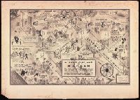
Campbell, E. Simms (Elmer Simms), 1906-1971, creator
1
Dong, Fangli, active 19th century, cartographer
1
Goddard, George H. (George Henry), 1817-1906, cartographer
1
more
Creator
»
Subject (Topic)
Maps
3
Nautical charts
3
Real property
2
Administrative and political divisions
1
African American neighborhoods
1
Boundaries
1
Canals
1
Cemeteries
1
Description and travel
1
Geography
1
more
Subject (Topic)
»
Subject (Name)
Baltimore, Chesapeake and Delaware Bay Railroad Company.
1
Bentley, Gladys
1
Calloway, Cab, 1907-1994
1
Club Hot-Cha (New York, N.Y.)
1
Connie’s Inn (New York, N.Y.)
1
Cotton Club.
1
Grove Street Cemetery (New Haven, Conn.)
1
Lafayette Theater (New York, N.Y. : 132nd Street)
1
Radium Club (New York, N.Y.)
1
Robinson, Bill, 1878-1949
1
more
Subject (Name)
»
Publication Place
Connecticut?
3
England London
3
United States Connecticut
3
United States Washington (D.C.)
3
Augustae Vindel. [Augsburg]
2
Chicago
2
China
2
Germany Augsburg
2
London
2
United States Illinois Chicago
2
more
Publication Place
»
Date Created
View distribution
Current results range from
1598
to
1960
Date Created range begin
Date Created range end
View larger »
Full Text Available
None
2