Search
You Searched For
Search Results
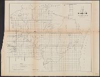
- Creator:
- Surveyor General of Iowa, Wisconsin, and Minnesota
- Published / Created:
- 1855
- Call Number:
- 812 1855C
- Container / Volume:
- BRBL_00555
- Image Count:
- 1
- Resource Type:
- Maps, Atlases & Globes
- Alternative Title:
- Wisconsin and territory of Minnesota.
- Subject (Geographic):
- Wisconsin--Maps
- Found in:
- Beinecke Rare Book and Manuscript Library > Sketch of the public surveys in Wisconsin and territory of Minnesota.
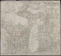
- Creator:
- Burr, David H., 1803-1875
- Published / Created:
- [1839?]
- Call Number:
- 811 1839A
- Container / Volume:
- BRBL_00552
- Image Count:
- 4
- Resource Type:
- Maps, Atlases & Globes
- Alternative Title:
- Map of Michigan and part of Wisconsin
- Subject (Geographic):
- Wisconsin--Maps
- Found in:
- Beinecke Rare Book and Manuscript Library > Map of Michigan & part of Wisconsin Territory : exhibiting the post offices, post roads, canals, rail roads, &c. / by David H. Burr.
- Published / Created:
- 1915
- Call Number:
- 812ag 1915
- Container / Volume:
- BRBL_00556
- Image Count:
- 2
- Resource Type:
- Maps, Atlases & Globes
- Alternative Title:
- northwestern Wisconsin
- Description:
- northern Wisconsin and Michigan, reached by the
- Subject (Geographic):
- Wisconsin--Maps
- Found in:
- Beinecke Rare Book and Manuscript Library > Hunting and fishing resorts of northern Wisconsin and Michigan : reached by the Chicago and North Western Railway.
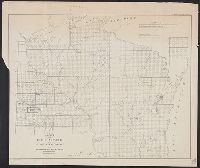
- Creator:
- United States. Surveyor General
- Published / Created:
- 1860
- Call Number:
- 812fcm 1860
- Container / Volume:
- BRBL_00556
- Image Count:
- 1
- Resource Type:
- Maps, Atlases & Globes
- Alternative Title:
- Wisconsin and territory of Minnesota.
- Subject (Geographic):
- Wisconsin--Maps
- Found in:
- Beinecke Rare Book and Manuscript Library > Sketch of the public surveys in the state of Wisconsin and territory of Minnesota.
- Creator:
- Farmer, John, 1798-1859
- Published / Created:
- 1857
- Call Number:
- 754 1857
- Container / Volume:
- BRBL_00416
- Image Count:
- 1
- Resource Type:
- Maps, Atlases & Globes
- Alternative Title:
- Township map of Michigan and Wisconsin.
- Subject (Geographic):
- Wisconsin--Maps
- Found in:
- Beinecke Rare Book and Manuscript Library > Farmer's township map of Michigan and Wisconsin : embracing part of Iowa Illinois and Minnesota, with a chart of the lakes / prepared engraved and published by the author at Detroit.
- Published / Created:
- [1860?]
- Call Number:
- 812 M265 1860
- Container / Volume:
- BRBL_00555A
- Image Count:
- 1
- Resource Type:
- Maps, Atlases & Globes
- Found in:
- Beinecke Rare Book and Manuscript Library > Madison, the capitol of Wisconsin.
- Published / Created:
- 1852?]
- Call Number:
- 811gme 1852
- Container / Volume:
- BRBL_00554
- Image Count:
- 1
- Resource Type:
- Maps, Atlases & Globes
- Description:
- , Wisconsin, Michigan, New York; and parts of
- Found in:
- Beinecke Rare Book and Manuscript Library > Map of Michigan Southern, Northern Indiana and Chicago and Rock Island railroads : with their connections from Council Bluffs to New York / lith. by F. Michelin & Geo. Leefe.
- Creator:
- Owen, David Dale, 1807-1860
- Published / Created:
- between 1844 and 1899?]
- Call Number:
- 815ca 1890
- Container / Volume:
- BRBL_00561
- Image Count:
- 1
- Resource Type:
- Maps, Atlases & Globes
- Subject (Topic):
- Geology--Wisconsin--Maps
- Found in:
- Beinecke Rare Book and Manuscript Library > Geological chart of part of Iowa, Wisconsin, and Illinois / by D.D. Owen.
- Published / Created:
- 1887
- Call Number:
- 812 As31 1887
- Container / Volume:
- BRBL_00555A
- Image Count:
- 1
- Resource Type:
- Maps, Atlases & Globes
- Found in:
- Beinecke Rare Book and Manuscript Library > Map of Ashland county Wisconsin : Corrected to February 1887.
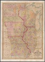
- Creator:
- Drake, Ira S
- Published / Created:
- 1850, c1849.
- Call Number:
- 754 1850
- Container / Volume:
- BRBL_00416
- Image Count:
- 1
- Resource Type:
- Maps, Atlases & Globes
- Alternative Title:
- , Iowa, and Wisconsin
- Found in:
- Beinecke Rare Book and Manuscript Library > Map of the states of Missouri, Illinois, Iowa and Wisconsin : the territory of Minnesota, and the mineral lands of Lake Superior / compiled by I.S. Drake ; engraved by Ira S. Drake and J.L. Hazzard.