Search
You Searched For
Search Results
- Published / Created:
- 1878
- Call Number:
- 75gme 1878
- Container / Volume:
- BRBL_00412
- Image Count:
- 1
- Resource Type:
- Maps, Atlases & Globes
- Subject (Geographic):
- United States--Maps
- Subject (Topic):
- Land grants--United States--Maps
- Found in:
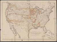
- Beinecke Rare Book and Manuscript Library > Map of the United States : exhibiting the grants of lands made by the General government to aid the construction of railroads and wagon roads / Dept. of the Interior. U.S. Geographical and Geological Survey of the Rocky Mountain Region J.W. Powell, in Cha
- Creator:
- Freyhold, Edward
- Published / Created:
- 1870
- Call Number:
- 75 1870A
- Container / Volume:
- BRBL_00404
- Image Count:
- 4
- Resource Type:
- Maps, Atlases & Globes
- Subject (Geographic):
- United States--Maps
- Subject (Topic):
- Military bases--United States--Maps
- Found in:
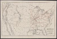
- Beinecke Rare Book and Manuscript Library > Military map of the United States / compiled and drawn by E. Freyhold.
- Creator:
- Perkins, Frederic B. (Frederic Beecher), 1828-1899
- Published / Created:
- 1880
- Call Number:
- 75FCB 1880G
- Container / Volume:
- BRBL_00410
- Image Count:
- 1
- Resource Type:
- Maps, Atlases & Globes
- Subject (Topic):
- Political parties--United States--Maps
- Found in:
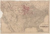
- Beinecke Rare Book and Manuscript Library > Congressional district vote map of the United States / designed by Fred B. Perkins ; drawn by Whitman & Breck.
- Creator:
- Hutawa, Julius
- Published / Created:
- 1854?]
- Call Number:
- 75 1854A
- Container / Volume:
- BRBL_00401
- Image Count:
- 1
- Resource Type:
- Maps, Atlases & Globes
- Subject (Topic):
- Inland navigation--United States--Maps
- Found in:
- Beinecke Rare Book and Manuscript Library > Map of the United States, shewing the principal steamboat routes and projected railroads connecting with St. Louis / Juls. Hutawa, lithr.
- Creator:
- Geological Survey (U.S.)
- Published / Created:
- [1897]
- Call Number:
- 75BH 1897
- Container / Volume:
- BRBL_00407A
- Image Count:
- 1
- Resource Type:
- Maps, Atlases & Globes
- Subject (Geographic):
- United States--Surveys--Maps
- Subject (Topic):
- Stream-gaging stations--United States
- Found in:
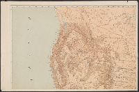
- Beinecke Rare Book and Manuscript Library > Map showing condition and progress of topographic surveys and location of gaging stations for the fiscal year 1896-1897.
- Creator:
- Rand McNally and Company
- Published / Created:
- 1888
- Call Number:
- 75gme 1888
- Container / Volume:
- BRBL_00414
- Image Count:
- 1
- Resource Type:
- Maps, Atlases & Globes
- Subject (Geographic):
- United States--Maps
- Subject (Topic):
- Railroads--United States--Maps
- Found in:
- Beinecke Rare Book and Manuscript Library > The Duluth daily news map of the Duluth railway system : Showing lines completed, under construction, and projected, Jan. 1st, 1888.
- Creator:
- Burr, Henry A
- Published / Created:
- 1853
- Call Number:
- 75GM 1853
- Container / Volume:
- BRBL_00410
- Image Count:
- 1
- Resource Type:
- Maps, Atlases & Globes
- Subject (Geographic):
- United States--Maps
- Subject (Topic):
- Railroads--United States--Maps
- Found in:
- Beinecke Rare Book and Manuscript Library > Disturnell's new map of the United States and Canada : showing all the canals, rail roads, telegraph lines and principal stage routes / Drawn by Henry A. Burr.
- Creator:
- Poole Brothers
- Published / Created:
- [1927], c1911.
- Call Number:
- 73gme 1927
- Container / Volume:
- BRBL_00376
- Image Count:
- 1
- Resource Type:
- Maps, Atlases & Globes
- Subject (Geographic):
- United States--Maps
- Subject (Topic):
- Railroads--United States--Maps
- Found in:
- Beinecke Rare Book and Manuscript Library > Map of the Canadian Pacific Railway, the Minneapolis, St. Paul & Sault Ste. Marie Railway, the Duluth, South Shore & Atlantic Railway, the Spokane International Railway and connections / Poole Bros, Chicago.
- Creator:
- Poole Brothers
- Published / Created:
- [1901?], c1893.
- Call Number:
- 73eu 1901
- Container / Volume:
- BRBL_00375B
- Image Count:
- 1
- Resource Type:
- Maps, Atlases & Globes
- Subject (Geographic):
- United States--Maps
- Subject (Topic):
- Railroads--United States--Maps
- Found in:
- Beinecke Rare Book and Manuscript Library > Map of the Canadian Pacific Railway, the Minneapolis, St. Paul and Sault Ste. Marie Railway, the Duluth, South Shore and Atlantic Railway and connections / Poole Bros, engravers.
- Creator:
- United States. General Land Office
- Published / Created:
- 1866
- Call Number:
- 75 1866
- Container / Volume:
- BRBL_00403
- Image Count:
- 1
- Resource Type:
- Maps, Atlases & Globes
- Subject (Geographic):
- United States--Surveys--Maps
- Subject (Topic):
- States--Maps
- Found in:
- Beinecke Rare Book and Manuscript Library > Map of the United States and territories : shewing the extent of public surveys and other details / constructed from the plats and official sources of the General Land Office, under the direction of Hon. Jos. S. Wilson, Commissioner, by Theodore Franks, d