Search
You Searched For
Search Results
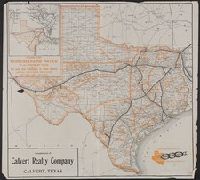
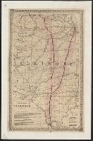
- Creator:
- Poole Brothers
- Published / Created:
- c1909.
- Call Number:
- 796gme 1909
- Container / Volume:
- BRBL_00531
- Image Count:
- 1
- Resource Type:
- Maps, Atlases & Globes
- Found in:
- Beinecke Rare Book and Manuscript Library > Iron mountain route to all parts of Texas : the way to Texas.
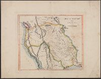
- Creator:
- Carey, Mathew, 1760-1839
- Published / Created:
- 1814]
- Call Number:
- 80 1814D
- Container / Volume:
- BRBL_00532
- Image Count:
- 1
- Resource Type:
- Maps, Atlases & Globes
- Found in:
- Beinecke Rare Book and Manuscript Library > Missouri Territory formerly Louisiana / Lewis, del. ; Bower, sc.
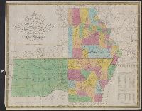
- Creator:
- Mitchell, S. Augustus (Samuel Augustus), 1792-1868
- Published / Created:
- 1833
- Call Number:
- 80 1833
- Container / Volume:
- BRBL_00532
- Image Count:
- 1
- Resource Type:
- Maps, Atlases & Globes
- Found in:
- Beinecke Rare Book and Manuscript Library > Map of the state of Missouri and territory of Arkansas / compiled from the latest authorities ; J.H. Young, sc.
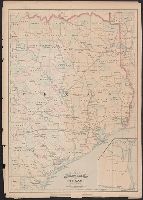
- Creator:
- Haberer, B. M
- Published / Created:
- c1916
- Call Number:
- 796ad C817 1916
- Container / Volume:
- BRBL_00529
- Image Count:
- 1
- Resource Type:
- Maps, Atlases & Globes
- Found in:
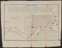
- Beinecke Rare Book and Manuscript Library > Map of the city of Corpus Christi and its environs / compiled from actual surveys and data in office of B.M. Haberer, civil engineer and land surveyor.
- Creator:
- Hood, Washington
- Published / Created:
- 1834]
- Call Number:
- 80 1834
- Container / Volume:
- BRBL_00532
- Image Count:
- 1
- Resource Type:
- Maps, Atlases & Globes
- Found in:
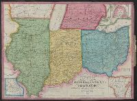
- Beinecke Rare Book and Manuscript Library > Map of the Western Territory &c.
- Creator:
- Blake, Jacob Edmund, 1811 or 12-1846
- Published / Created:
- 1842?]
- Call Number:
- 796fab Sa13 1842D
- Container / Volume:
- BRBL_00530
- Image Count:
- 1
- Resource Type:
- Maps, Atlases & Globes
- Found in:
- Beinecke Rare Book and Manuscript Library > Part of the boundary between the United States and Texas, from Sabine River northward to the 36th mile mound / drawn from the notes of survey and copied for the use of the commissioners under the Convention of 25th April 1838, by J. Edm.d Blake 1st Lieut.
- Published / Created:
- c1879.
- Call Number:
- 796 W35 1879
- Container / Volume:
- BRBL_00528
- Image Count:
- 1
- Resource Type:
- Maps, Atlases & Globes
- Found in:
- Beinecke Rare Book and Manuscript Library > Waller County, Texas / lithographed by August Gast & Co's new process.
- Published / Created:
- 1860?]
- Call Number:
- 796gme 1860
- Container / Volume:
- BRBL_00531
- Image Count:
- 1
- Resource Type:
- Maps, Atlases & Globes
- Found in:
- Beinecke Rare Book and Manuscript Library > A geographically correct map of the Red River, Sabine & Western Railway (under construction) and connections : showing distribution of pine forests (compiled from maps of U.S. government), also location of coal, iron, and oil deposits.
- Creator:
- Lewis, Samuel, 1753 or 1754-1822
- Published / Created:
- 1814
- Call Number:
- 80 1814
- Container / Volume:
- BRBL_00532
- Image Count:
- 1
- Resource Type:
- Maps, Atlases & Globes
- Found in:
- Beinecke Rare Book and Manuscript Library > A map of Lewis and Clark's track across the western portion of North America, from the Mississippi to the Pacific Ocean : by order of the executive of the United States in 1804, 5 & 6 / copied by Samuel Lewis from the original drawing of Wm. Clark ; Neele
- Creator:
- Asher & Adams
- Published / Created:
- [1878?]
- Call Number:
- 796fb 1878A
- Container / Volume:
- BRBL_00530
- Image Count:
- 1
- Resource Type:
- Maps, Atlases & Globes
- Found in:
- Beinecke Rare Book and Manuscript Library > Asher & Adams' Texas : eastern portion.
- Published / Created:
- March 22, 1837.
- Call Number:
- 796 V541 1837
- Container / Volume:
- BRBL_00528
- Image Count:
- 1
- Resource Type:
- Maps, Atlases & Globes
- Found in:
- Beinecke Rare Book and Manuscript Library > The city of Velasco.
- Published / Created:
- 1860
- Call Number:
- 806gme 1860
- Container / Volume:
- BRBL_00549
- Image Count:
- 1
- Resource Type:
- Maps, Atlases & Globes
- Found in:
- Beinecke Rare Book and Manuscript Library > Map of the Warsaw and Rockford R.R. and its connections.
- Creator:
- Ross, Lieut
- Published / Created:
- 1 June 1775.
- Call Number:
- 807 1775
- Container / Volume:
- BRBL_00550
- Image Count:
- 1
- Resource Type:
- Maps, Atlases & Globes
- Found in:
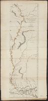
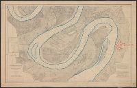
- Beinecke Rare Book and Manuscript Library > Course of the river Mississippi from the Balise to Fort Chartres : taken on an expedition to the Illinois, in the latter end of the year 1765 / by Lieut. Ross of the 34th Regiment ; improved from the surveys of the river made by the French.
- Published / Created:
- 1860]
- Call Number:
- 806gme 1860A
- Container / Volume:
- BRBL_00549
- Image Count:
- 1
- Resource Type:
- Maps, Atlases & Globes
- Found in:
- Beinecke Rare Book and Manuscript Library > Map of the Jacksonville & Carrollton Rail Road : showing its connection with St. Louis & Alton and with Iowa, Wisconsin & the northern parts of Illinois and Missouri / drawn & compiled by F.L. Hillebrand, Civ. Engineer.
- Creator:
- George B. Cadwell & Co
- Published / Created:
- 1892
- Call Number:
- 811 H867 1892
- Container / Volume:
- BRBL_00553
- Image Count:
- 1
- Resource Type:
- Maps, Atlases & Globes
- Found in:
- Beinecke Rare Book and Manuscript Library > Map of Hudson : compiled expressly for the Lenawee Co. atlas.
- Published / Created:
- [1810]
- Call Number:
- 807 1810
- Container / Volume:
- BRBL_00550
- Image Count:
- 1
- Resource Type:
- Maps, Atlases & Globes
- Found in:
- Beinecke Rare Book and Manuscript Library > Map of the Mississippi River from its Source to the Mouth of the Missouri ... from the notes of the Lieut. Z.M.Pike by Antoni Nau. Reduced and corrected by ... Mr Thompson at its source and of Capt. M. Lewis ...
- Published / Created:
- 1853
- Call Number:
- 811 1853
- Container / Volume:
- BRBL_00552
- Image Count:
- 1
- Resource Type:
- Maps, Atlases & Globes
- Found in:
- Beinecke Rare Book and Manuscript Library > Neueste Karte von Michigan : nach den bessten Quellen bearbeitet.
- Creator:
- George B. Cadwell & Co
- Published / Created:
- 1893
- Call Number:
- 811 M815 1893
- Container / Volume:
- BRBL_00553
- Image Count:
- 1
- Resource Type:
- Maps, Atlases & Globes
- Found in:
- Beinecke Rare Book and Manuscript Library > Morenci : compiled & drawn expressly for the Lenawee County atlas.
- Creator:
- United States. Mississippi River Commission
- Published / Created:
- 1879-
- Call Number:
- BrSides Double Folio 2018 85
- Image Count:
- 1
- Resource Type:
- Maps, Atlases & Globes
- Found in:
- Beinecke Rare Book and Manuscript Library > Survey of the Mississippi River / made under the direction of the Mississippi River Commission.
- Published / Created:
- 1843
- Call Number:
- 811 1843
- Container / Volume:
- BRBL_00552
- Image Count:
- 1
- Resource Type:
- Maps, Atlases & Globes
- Found in:
- Beinecke Rare Book and Manuscript Library > Traveller's map of Michigan, Indiana & Ohio.
- Creator:
- Roser, C
- Published / Created:
- 1878
- Call Number:
- 811 1878
- Container / Volume:
- BRBL_00552
- Image Count:
- 1
- Resource Type:
- Maps, Atlases & Globes
- Found in:
- Beinecke Rare Book and Manuscript Library > State of Michigan / compiled from the official records of the General Land Office and other sources by C. Roser, principal draughtsman G.L.O.
- Creator:
- J.O. Seymour & Co
- Published / Created:
- [ca. 1870]
- Call Number:
- 811gfc P831 1870
- Container / Volume:
- BRBL_00554
- Image Count:
- 1
- Resource Type:
- Maps, Atlases & Globes
- Found in:
- Beinecke Rare Book and Manuscript Library > Map of property of the Globe Copper Company and mines in the Portage Lake District.
- Published / Created:
- 1852
- Call Number:
- 8075gme 1852
- Container / Volume:
- BRBL_00551
- Image Count:
- 1
- Resource Type:
- Maps, Atlases & Globes
- Found in:
- Beinecke Rare Book and Manuscript Library > Map showing the several lines of R.R. : leading from the Lakes to the MIssissippi River together with the route surveyed by the St. C. & L.S. R.R. Co.
- Creator:
- Benton Harbor Improvement Association
- Published / Created:
- 1892?]
- Call Number:
- 811 B44 1892
- Container / Volume:
- BRBL_00553
- Image Count:
- 1
- Resource Type:
- Maps, Atlases & Globes
- Found in:
- Beinecke Rare Book and Manuscript Library > Benton Harbor : already a manufacturing, railroad and business center, is destined to speedily become one of the great cities of Michigan.
- Published / Created:
- 1837
- Call Number:
- 811 1837
- Container / Volume:
- BRBL_00552
- Image Count:
- 1
- Resource Type:
- Maps, Atlases & Globes
- Found in:
- Beinecke Rare Book and Manuscript Library > The Surveyed Part of Michigan by John Farmer.
- Published / Created:
- 1837
- Call Number:
- 811 Al53 1837
- Container / Volume:
- BRBL_00553
- Image Count:
- 1
- Resource Type:
- Maps, Atlases & Globes
- Found in:
- Beinecke Rare Book and Manuscript Library > Plan of Allegan, Allegan County, Michigan. By F.J. Littlejohn.
- Creator:
- Medary, Samuel A
- Published / Created:
- 1858
- Call Number:
- 8101 1858
- Container / Volume:
- BRBL_00552
- Image Count:
- 1
- Resource Type:
- Maps, Atlases & Globes
- Found in:
- Beinecke Rare Book and Manuscript Library > Map of the Fort Ridgely & South Pass road / by Samuel A. Medary ; drawn by John R. Key.
- Creator:
- United States. Army. Corps of Topographical Engineers
- Published / Created:
- [1858]
- Call Number:
- 811 Sa22 1858
- Container / Volume:
- BRBL_00553
- Image Count:
- 1
- Resource Type:
- Maps, Atlases & Globes
- Found in:
- Beinecke Rare Book and Manuscript Library > Chart of St. Clair Flats showing the positions of light house & beacon : now in course of erection and the channel excavated in 1857 & 1858 under the direction of Capt. A.W. Whipple, Corps of Topl. Engineers : the new channel was surveyed on the 6th & 7th
- Published / Created:
- 1899
- Call Number:
- 807gmb 1899
- Container / Volume:
- BRBL_00551
- Image Count:
- 1
- Resource Type:
- Maps, Atlases & Globes
- Found in:
- Beinecke Rare Book and Manuscript Library > Illinois Central Railroad : and Yazoo & Mississippi Valley Railroad.
- Creator:
- Winchell, Alexander, 1824-1891
- Published / Created:
- 1865
- Call Number:
- 811 1865
- Container / Volume:
- BRBL_00552
- Image Count:
- 1
- Resource Type:
- Maps, Atlases & Globes
- Found in:
- Beinecke Rare Book and Manuscript Library > Map of the Grand Traverse region : to accompany a report on its geological & industrial resources / by Alexander Winchell ; drawn by H.G. Rothwell.
- Creator:
- Haas, P
- Published / Created:
- 1841]
- Call Number:
- 811fcm 1840
- Container / Volume:
- BRBL_00554
- Image Count:
- 1
- Resource Type:
- Maps, Atlases & Globes
- Found in:
- Beinecke Rare Book and Manuscript Library > Sketch of the public surveys in the north part of Michigan / lith. of P. Haas.
- Published / Created:
- 1887
- Call Number:
- 806 C43 1887
- Container / Volume:
- BRBL_00548
- Image Count:
- 1
- Resource Type:
- Maps, Atlases & Globes
- Found in:
- Beinecke Rare Book and Manuscript Library > Blanchard's map of Chicago and environs.
- Creator:
- Blanchard, Rufus, 1821-1904
- Published / Created:
- 1900
- Call Number:
- 806 C43 1900
- Container / Volume:
- BRBL_00548
- Image Count:
- 1
- Resource Type:
- Maps, Atlases & Globes
- Found in:
- Beinecke Rare Book and Manuscript Library > Map of the business center of Chicago.
- Published / Created:
- 1884
- Call Number:
- 806 C43 1884
- Container / Volume:
- BRBL_00548
- Image Count:
- 1
- Resource Type:
- Maps, Atlases & Globes
- Found in:
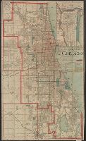
- Beinecke Rare Book and Manuscript Library > Map showing the boulevards and park system : and twelve miles of lake frontage of the City of Chicago.
- Creator:
- Ross, Lieut
- Published / Created:
- 1 June 1775.
- Call Number:
- 807 1775A
- Container / Volume:
- BRBL_00550
- Image Count:
- 1
- Resource Type:
- Maps, Atlases & Globes
- Found in:
- Beinecke Rare Book and Manuscript Library > Course of the river Mississippi from the Balise to Fort Chartres : taken on an expedition to the Illinois, in the latter end of the year 1765 / by Lieut. Ross of the 34th Regiment ; improved from the surveys of the river made by the French.
- Published / Created:
- 1852
- Call Number:
- 806cfp G562 1852
- Container / Volume:
- BRBL_00549
- Image Count:
- 1
- Resource Type:
- Maps, Atlases & Globes
- Found in:
- Beinecke Rare Book and Manuscript Library > Map of the track of the tornado of April 30th 1852. : from Golconda Illinois, to Wabash River across Indiana & the Ohio River to Georgetown Kentucky, U.S. / by John Chapplesmith.
- Published / Created:
- 1889
- Call Number:
- 806 C43 1889
- Container / Volume:
- BRBL_00548
- Image Count:
- 1
- Resource Type:
- Maps, Atlases & Globes
- Found in:
- Beinecke Rare Book and Manuscript Library > Rand, McNally and Co.'s Standard Map of Chicago No. 3.
- Creator:
- Ross, Lieut
- Published / Created:
- 1 June 1775.
- Call Number:
- 807 1775A
- Container / Volume:
- BRBL_00550
- Image Count:
- 1
- Resource Type:
- Maps, Atlases & Globes
- Found in:
- Beinecke Rare Book and Manuscript Library > Course of the river Mississippi from the Balise to Fort Chartres : taken on an expedition to the Illinois, in the latter end of the year 1765 / by Lieut. Ross of the 34th Regiment ; improved from the surveys of the river made by the French.
- Published / Created:
- 1887
- Call Number:
- 806 C772 1887
- Container / Volume:
- BRBL_00548
- Image Count:
- 1
- Resource Type:
- Maps, Atlases & Globes
- Found in:
- Beinecke Rare Book and Manuscript Library > Map of Cook and DuPage Counties, Illinois : with part of Lake County, Indiana.
- Published / Created:
- 1848
- Call Number:
- 806fcm 1848
- Container / Volume:
- BRBL_00549
- Image Count:
- 1
- Resource Type:
- Maps, Atlases & Globes
- Found in:
- Beinecke Rare Book and Manuscript Library > Diagram of the State of Illinois, accompanying the report of the 20th of October,1848; [by] F.R. Conway.
- Published / Created:
- 1893
- Call Number:
- 806gmb C43 1893
- Container / Volume:
- BRBL_00549
- Image Count:
- 1
- Resource Type:
- Maps, Atlases & Globes
- Found in:
- Beinecke Rare Book and Manuscript Library > Chicago.
- Published / Created:
- 1890
- Call Number:
- 806gmb C43 1890
- Container / Volume:
- BRBL_00549
- Image Count:
- 1
- Resource Type:
- Maps, Atlases & Globes
- Found in:
- Beinecke Rare Book and Manuscript Library > A.N. Marquis & Co's official map of Chicago / engraved by Matthews, Northrup & Co.
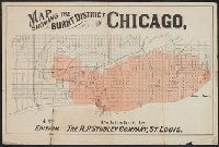
- Creator:
- R.P. Studley Co
- Published / Created:
- [1871?]
- Call Number:
- 806ae C43 1871A
- Container / Volume:
- BRBL_00549
- Image Count:
- 1
- Resource Type:
- Maps, Atlases & Globes
- Found in:
- Beinecke Rare Book and Manuscript Library > Map showing the burnt district in Chicago / published by the R.P. Studley Company, St. Louis.
- Published / Created:
- 1860
- Call Number:
- 806gme 1860B
- Container / Volume:
- BRBL_00549
- Image Count:
- 1
- Resource Type:
- Maps, Atlases & Globes
- Found in:
- Beinecke Rare Book and Manuscript Library > Map of the Illinois River Railroad / W.G. Wheaton, civil engineer.
- Creator:
- Union News Company (Boston, Mass.)
- Published / Created:
- 1893]
- Call Number:
- 806 C43 1893
- Container / Volume:
- BRBL_00548
- Image Count:
- 1
- Resource Type:
- Maps, Atlases & Globes
- Found in:
- Beinecke Rare Book and Manuscript Library > The Union News Company's indexed map of the Worlds Columbian exposition at Chicago, 1893 [cartographic material].
- Published / Created:
- 1853
- Call Number:
- 806gme G132 1853A
- Container / Volume:
- BRBL_00549
- Image Count:
- 1
- Resource Type:
- Maps, Atlases & Globes
- Found in:
- Beinecke Rare Book and Manuscript Library > Map showing the Galena & Chicago Union Railroad and its connections.
- Creator:
- United States. General Land Office
- Published / Created:
- 1866
- Call Number:
- 806gbc 1866
- Container / Volume:
- BRBL_00549
- Image Count:
- 1
- Resource Type:
- Maps, Atlases & Globes
- Found in:
- Beinecke Rare Book and Manuscript Library > Map of the state of Illinois [cartographic material].
- Published / Created:
- 1855
- Call Number:
- 811ca 1855
- Container / Volume:
- BRBL_00554
- Image Count:
- 1
- Resource Type:
- Maps, Atlases & Globes
- Found in:
- Beinecke Rare Book and Manuscript Library > [Western part of upper peninsula, Michigan].
- Creator:
- Colton, G. Woolworth (George Woolworth), 1827-1901
- Published / Created:
- 1861
- Call Number:
- 806gme 1861
- Container / Volume:
- BRBL_00549
- Image Count:
- 1
- Resource Type:
- Maps, Atlases & Globes
- Found in:
- Beinecke Rare Book and Manuscript Library > G. Woolworth Colton's railroad map of Illinois.
- Published / Created:
- 1887
- Call Number:
- 806gme C43 1887
- Container / Volume:
- BRBL_00549
- Image Count:
- 1
- Resource Type:
- Maps, Atlases & Globes
- Found in:
- Beinecke Rare Book and Manuscript Library > Map showing location of the Chicago and Calumet terminal railway : around Chicago, Illinois 1887 / Office of chief engineer, C. & C.T. Ry. Co. Hammond Ind.