
Search


Limit your search
- Public187
- United States. General Land Office27
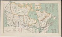
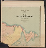
- Canada. Dept. of the Interior23
- Canada. Department of the Interior8
- Canada. Natural Resources Intelligence Branch7
- Geological Survey (U.S.)7
- Geological and Geographical Survey of the Territories (U.S.)6
- White, James, 1863-19285
- Canada. Dept. of the Interior. Railway Lands Branch4
- Canada. Topographical Survey4
- Geographical and Geological Survey of the Rocky Mountain Region (U.S.)4
- Real property--Prairie Provinces--Maps6
- Railroads--Canada--Maps5
- Explorers--United States--Maps3
- Geology--Utah--Maps3
- Land grants--California--Maps3
- Public lands--Prairie Provinces--Maps3
- Discoveries in geography2
- Homestead law--Prairie Provinces--Maps2
- Land grants--United States--Maps2
- Land tenure--British Columbia--Maps2
- United States. General Land Office13
- Canada. Dept. of the Interior12
- Bien, Julius, 1826-190911
- Roeser, C. (Charles)11
- Hayden, F. V. (Ferdinand Vandeveer), 1829-18877
- Lynch, F. C. C. (Francis Christopher Chisholm), 1884-7
- White, James, 1863-19286
- Julius Bien & Co5
- Bond, Frank, 1856-19404
- Bowman, Amos, d. 18944