English text on verso entitled: The description of the kingdom of Tartary, p. 39-40 (signature: V)., Illustrations on left border: A. Samoged -- Tartar genteel woman -- A Tartar -- Tartar country woman., Illustrations on right border: Samoged woman -- Tartar gentleman -- Tartar woman -- Tartar country man., Illustrations on top border: Astrakhan -- Samarkand -- Cambalu -- The House in Nova Zemla., Map folio 39 from: The theatre of the Empire of Great Britaine ... as also a prospect of the most famous parts of the world / John Speed. London : Thomas Bassett & Richard Chiswell, 1676., Map of Tartary [i.e. Mongolia] to the north of China controlled by marauding Mongols in the 13th-14th centuries. The map shows its provinces and cities stretching north from the Himalayas, west to eastern Europe and north of Chinae Regni Pars [i.e. China] and Corea Isle [i.e. Korea]. One feature is the Great Wall of China along the Chinese border on the lower right side of the map. There are many decorative features including along the top of the map pictorial scenes of the cities of Astrakhan, Samarkand and Cambalu, as well as an illustration of a "house in Nova Zemla". Left and right borders eight colourful illustrations of ethnic costumes from some of the peoples of Tartary., Relief shown pictorially., Text at top centre of map reviewing the discovery of Nova Zembla [i.e. the archipelago Novaya Zemlya] by the Dutch explorer William Hollander in 1594-96., and Watermark.
Map of the Northern Pacific Railroad, showing the intercontinental routes, oceanic currents and steamboat lines around the world. and Profiles of the Northern Pacific and the Central and Union Pacific Railroads, showing the difference in configuration of the country along the respective routes.
Description:
Imperfect: chipped along folds, with some loss of text. Backed with paper., Includes inset of "Map of the Northern Pacific Railroad, showing the intercontinental routes, oceanic currents and steamboat lines around the world," text, and "Profiles of the Northern Pacific and the Central and Union Pacific Railroads, showing the difference in configuration of the country along the respective routes.", Prime meridians: Greenwich and Washington., and Relief shown by hachures and spot heights.
Subject (Geographic):
North America--Maps.
Subject (Name):
Northern Pacific Railroad Company--Maps.
Subject (Topic):
Railroads--Canada--Maps. and Railroads--United States--Maps.
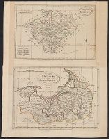
"Engrav'd for Jackson's Edition of Payne's new System of Universal Geography"--Bottom margin., Bar scales given in “English miles 69 to a degree” and "German miles 15 to a degree.”, From John Payne's Universal geography formed into a new and entire system (Dublin: Zachariah Jackson, 1792-1794), or later edition., Includes index., No. 1 of 2 maps mounted on same sheet., Prime meridian: London. Coordinates converted by cataloger to express longitude as measured from the Greenwich meridian., and Relief shown pictorially.
Subject (Geographic):
Bohemia (Czech Republic)--Maps--Early works to 1800.
Subject (Name):
Ferguson (Engraver), engraver., Jackson, Zachariah, printer., and Payne, John, active 1800. Universal geography formed into a new and entire system.
2nd edition, 1st state, with entirely new plate from 1st edition that now shows all of Florida peninsula with title in cartouche., Below map is letterpress entitled: A compendious account of the British colonies in North America., Lower right corner of map includes Evan's polymetric table of America, with distances, and Thomas Templeman's survey of the size and area of the individual colonies., and Watermark.
Subject (Geographic):
North America--Maps--Early works to 1800 and United States--History--Revolution, 1775-1783--Maps
Subject (Name):
Jefferys, Thomas, -1771. and Robert Sayer and John Bennett (Firm)