Search
You Searched For
Search Results
- Published / Created:
- 1942?]
- Call Number:
- 352cbf 1942
- Container / Volume:
- BRBL_00109
- Image Count:
- 1
- Resource Type:
- Maps, Atlases & Globes
- Found in:
- Beinecke Rare Book and Manuscript Library > [Map of the Soviet Union].
- Published / Created:
- [1903?]
- Call Number:
- 771 N49 1903
- Image Count:
- 1
- Resource Type:
- Maps, Atlases & Globes
- Found in:
- Beinecke Rare Book and Manuscript Library > [Map of the city of New York showing transportation routes].
- Published / Created:
- [between 1790 and 1799?]
- Call Number:
- BrSides Folio 2017 123
- Image Count:
- 1
- Resource Type:
- Maps, Atlases & Globes
- Found in:
- Beinecke Rare Book and Manuscript Library > [Map of the confluence of Saint Marys and Amelia Rivers on the border between Georgia and Florida].
- Published / Created:
- 191-.
- Call Number:
- 11hcf 1919E-1
- Image Count:
- 1
- Resource Type:
- Maps, Atlases & Globes
- Found in:
- Beinecke Rare Book and Manuscript Library > [Map of the countries around the Western Mediterranean.]
- Published / Created:
- between 1868 and 1889?]
- Call Number:
- 80 1900
- Container / Volume:
- BRBL_00536
- Image Count:
- 2
- Resource Type:
- Maps, Atlases & Globes
- Found in:
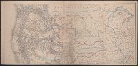
- Beinecke Rare Book and Manuscript Library > [Map of western United States showing military departments].
- Published / Created:
- [1827?]
- Call Number:
- 755 1827
- Container / Volume:
- BRBL_00439
- Image Count:
- 1
- Resource Type:
- Maps, Atlases & Globes
- Found in:
- Beinecke Rare Book and Manuscript Library > [Map showing disputed boundary between U.S. and Canada] Printed at the lithographic Establishment Quarter Master General's Office Horse Guards. Drawn by L. Herbert.
- Published / Created:
- [1898]
- Call Number:
- 855hc 1898H
- Container / Volume:
- BRBL_00765
- Image Count:
- 1
- Resource Type:
- Maps, Atlases & Globes
- Found in:
- Beinecke Rare Book and Manuscript Library > [Map showing fortifications around the mouth of the San Juan River, Cuba during the War of 1898.]
- Published / Created:
- [1870?]
- Call Number:
- 594 1870
- Container / Volume:
- BRBL_00319
- Image Count:
- 1
- Resource Type:
- Maps, Atlases & Globes
- Found in:
- Beinecke Rare Book and Manuscript Library > [Maps of the Island of Ceylon, Burmah, Siam, and Anam.]
- Published / Created:
- [1886?].
- Call Number:
- 764gme 1886
- Container / Volume:
- BRBL_00462
- Image Count:
- 2
- Resource Type:
- Maps, Atlases & Globes
- Found in:
- Beinecke Rare Book and Manuscript Library > [Maps of the locations of the Providence, Webster, and Springfield Railroad Company within Massachusetts].
- Published / Created:
- 1863
- Call Number:
- 783 C899 1863
- Container / Volume:
- BRBL_00510
- Image Count:
- 1
- Resource Type:
- Maps, Atlases & Globes
- Found in:
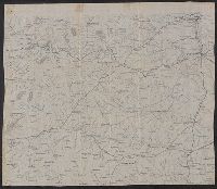
- Beinecke Rare Book and Manuscript Library > [Military and topographic map of region about Culpepper Courthouse, Va.].
- Published / Created:
- [1864]
- Call Number:
- 783hc 1864B
- Container / Volume:
- BRBL_00714
- Image Count:
- 1
- Resource Type:
- Maps, Atlases & Globes
- Found in:
- Beinecke Rare Book and Manuscript Library > [Military manuscript map of Virginia, Richmond to Lynchburg and south to the North Carolina border].
- Published / Created:
- 1864
- Call Number:
- 785hc 1864
- Container / Volume:
- BRBL_00514
- Image Count:
- 1
- Resource Type:
- Maps, Atlases & Globes
- Found in:
- Beinecke Rare Book and Manuscript Library > [Military map of North Carolina : between Raleigh and Greensboro ca. 1864].
- Published / Created:
- 1864
- Call Number:
- 783hc R41 1863
- Container / Volume:
- BRBL_00512
- Image Count:
- 1
- Resource Type:
- Maps, Atlases & Globes
- Found in:
- Beinecke Rare Book and Manuscript Library > [Military map of Richmond and vicinity].
- Published / Created:
- 1863
- Call Number:
- 783 W25 1863E
- Container / Volume:
- BRBL_00510
- Image Count:
- 1
- Resource Type:
- Maps, Atlases & Globes
- Found in:
- Beinecke Rare Book and Manuscript Library > [Military topographical map of country east and about Warrenton, VA].
- Published / Created:
- 1863
- Call Number:
- 783 W25 1863
- Container / Volume:
- BRBL_00510
- Image Count:
- 1
- Resource Type:
- Maps, Atlases & Globes
- Found in:
- Beinecke Rare Book and Manuscript Library > [Military topographical map of showing country just to the west of Warrenton, VA].
- Published / Created:
- [ca. 1905]
- Call Number:
- 771 N49 1905R
- Image Count:
- 1
- Resource Type:
- Maps, Atlases & Globes
- Found in:
- Beinecke Rare Book and Manuscript Library > [New York City real estate].
- Published / Created:
- 1884
- Call Number:
- 771 N49 1884
- Container / Volume:
- BRBL_00488
- Image Count:
- 1
- Resource Type:
- Maps, Atlases & Globes
- Found in:
- Beinecke Rare Book and Manuscript Library > [New York City].
- Published / Created:
- [1908?]
- Call Number:
- 771 N49 1908
- Image Count:
- 1
- Resource Type:
- Maps, Atlases & Globes
- Found in:
- Beinecke Rare Book and Manuscript Library > [New York City].
- Published / Created:
- [1750?]
- Call Number:
- 38cea 1750
- Container / Volume:
- BRBL_00169
- Image Count:
- 17
- Resource Type:
- Maps, Atlases & Globes
- Found in:
- Beinecke Rare Book and Manuscript Library > [North and East Coast of France].
- Creator:
- Bache, A. D. (Alexander Dallas), 1806-1867
- Published / Created:
- 1865
- Call Number:
- 754 1865
- Container / Volume:
- BRBL_00417
- Image Count:
- 1
- Resource Type:
- Maps, Atlases & Globes
- Found in:
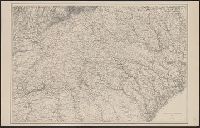
- Beinecke Rare Book and Manuscript Library > [Northern Georgia and part of South Carolina].
- Creator:
- Bache, A. D. (Alexander Dallas), 1806-1867
- Published / Created:
- 1865
- Call Number:
- 754 1865B
- Container / Volume:
- BRBL_00417
- Image Count:
- 1
- Resource Type:
- Maps, Atlases & Globes
- Found in:
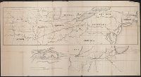
- Beinecke Rare Book and Manuscript Library > [Northern Mississippi, Alabama, and a small part of southern Tennessee] / U.S. Coast Survey, A.D. Bache, supdt.; drawn by A. Lindenkohl; H. Lindenkohl & Chas. G. Krebs, lith.
- Published / Created:
- [1847]
- Call Number:
- 844 1847
- Container / Volume:
- BRBL_00601
- Image Count:
- 1
- Resource Type:
- Maps, Atlases & Globes
- Found in:
- Beinecke Rare Book and Manuscript Library > [Occupation of California map : disposal of U.S. Army, June 19th, 1847].
- Creator:
- Great Britain. Ordnance Survey
- Published / Created:
- Novr. 9th, 1843 [i.e. ca. 1853-1874?]
- Call Number:
- 32 1873
- Container / Volume:
- BRBL_00744
- Image Count:
- 8
- Resource Type:
- Maps, Atlases & Globes
- Found in:
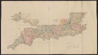
- Beinecke Rare Book and Manuscript Library > [Old series Ordnance Survey maps of England and Wales] / engraved at the Ordnance Map Office, Southampton ...
- Creator:
- Great Britain. Ordnance Survey
- Published / Created:
- Novr. 9th, 1843 [i.e. ca. 1853-1874?]
- Call Number:
- 32 1873
- Container / Volume:
- BRBL_00743
- Image Count:
- 35
- Resource Type:
- Maps, Atlases & Globes
- Found in:
- Beinecke Rare Book and Manuscript Library > [Old series Ordnance Survey maps of England and Wales] / engraved at the Ordnance Map Office, Southampton ...
- Published / Created:
- 1920
- Call Number:
- 75ak 1920
- Container / Volume:
- BRBL_00407A
- Image Count:
- 1
- Resource Type:
- Maps, Atlases & Globes
- Found in:
- Beinecke Rare Book and Manuscript Library > [Outline Map of the United States] / engraved and printed by the U.S. Geological Survey.
- Published / Created:
- 191-.
- Call Number:
- 11hcf 1919E-2
- Container / Volume:
- BRBL_00010ZA
- Image Count:
- 1
- Resource Type:
- Maps, Atlases & Globes
- Found in:
- Beinecke Rare Book and Manuscript Library > [Outline map of Dalmatia and surrounding area.]
- Published / Created:
- 191-.
- Call Number:
- 11hcf 1919-3
- Container / Volume:
- BRBL_00010K
- Image Count:
- 1
- Resource Type:
- Maps, Atlases & Globes
- Found in:
- Beinecke Rare Book and Manuscript Library > [Outline map of Eastern Europe showing exisiting and proposed frontiers.]
- Published / Created:
- 191-.
- Call Number:
- 11hcf 1919E-4
- Container / Volume:
- BRBL_00010ZA
- Image Count:
- 1
- Resource Type:
- Maps, Atlases & Globes
- Found in:
- Beinecke Rare Book and Manuscript Library > [Outline map of the Adriatic Sea and environs.]
- Published / Created:
- 1864
- Call Number:
- 787hc 1864B
- Container / Volume:
- BRBL_00517A
- Image Count:
- 1
- Resource Type:
- Maps, Atlases & Globes
- Found in:
- Beinecke Rare Book and Manuscript Library > [Part of eastern Georgia].
- Published / Created:
- 1864
- Call Number:
- 787hc 1864B
- Container / Volume:
- BRBL_00517A
- Image Count:
- 1
- Resource Type:
- Maps, Atlases & Globes
- Found in:
- Beinecke Rare Book and Manuscript Library > [Part of eastern Georgia].
- Published / Created:
- [1800?]
- Call Number:
- 755cea 1800
- Container / Volume:
- BRBL_00441
- Image Count:
- 1
- Resource Type:
- Maps, Atlases & Globes
- Found in:
- Beinecke Rare Book and Manuscript Library > [Part of the shore line of Florida, Georgia, & South Carolina and a portion of the Bahama Bank].
- Published / Created:
- [approximately 1900?]
- Call Number:
- BrSides Double Folio 2018 102
- Image Count:
- 1
- Resource Type:
- Maps, Atlases & Globes
- Found in:
- Beinecke Rare Book and Manuscript Library > [Partial cadastral map of the Province of Ontario in Canada].
- Call Number:
- 11ba 1915
- Container / Volume:
- BRBL_00010A
- Image Count:
- 1
- Resource Type:
- Maps, Atlases & Globes
- Found in:
- Beinecke Rare Book and Manuscript Library > [Philips' 12 inch terrestrial globe.]
- Published / Created:
- 1915
- Call Number:
- 11ba 1915A
- Container / Volume:
- BRBL_00010A
- Image Count:
- 1
- Resource Type:
- Maps, Atlases & Globes
- Found in:
- Beinecke Rare Book and Manuscript Library > [Philips' 4 inch graphic globe.]
- Published / Created:
- [1749]
- Call Number:
- BrSides Box 2019 18
- Image Count:
- 1
- Resource Type:
- Maps, Atlases & Globes
- Found in:
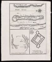
- Beinecke Rare Book and Manuscript Library > [Plan of the island of St. Louis, Senegal] ; Egnen fra fortet St. Joseph til Galam ; Grundridsning of fortet St. Joseph.
- Creator:
- Trudeau, Charles Laveau, ca. 1750-1816
- Published / Created:
- 1808]
- Call Number:
- BrSide4o Zc22 808thha
- Image Count:
- 4
- Resource Type:
- Maps, Atlases & Globes
- Found in:
- Beinecke Rare Book and Manuscript Library > [Plans of New Orleans to accompany J.B.S. Thierry's Examen des droits des Etats Unis et des pretentions de Mr. Edouard Livingston sur la batture de Mr. Edouard Livingston sur la batture en face du faubourg Ste. Marie].
- Creator:
- Bradshaw (Publisher)
- Published / Created:
- 1891]
- Call Number:
- 38 P21 1898
- Container / Volume:
- BRBL_00164
- Image Count:
- 1
- Resource Type:
- Maps, Atlases & Globes
- Found in:
- Beinecke Rare Book and Manuscript Library > [Plans of the major cities and towns of continental Europe] [cartographic material].
- Creator:
- Bradshaw (Publisher)
- Published / Created:
- 1891]
- Call Number:
- 38 M35 1898
- Container / Volume:
- BRBL_00158
- Image Count:
- 1
- Resource Type:
- Maps, Atlases & Globes
- Found in:
- Beinecke Rare Book and Manuscript Library > [Plans of the major cities and towns of continental Europe] [cartographic material].
- Published / Created:
- 1915]
- Call Number:
- 811gfc P831 1915
- Container / Volume:
- BRBL_00554
- Image Count:
- 1
- Resource Type:
- Maps, Atlases & Globes
- Found in:
- Beinecke Rare Book and Manuscript Library > [Portage Lake Mines].
- Creator:
- Pownall, Thomas, 1722-1805
- Published / Created:
- between 1783 and 1799?]
- Call Number:
- 71 1785C
- Container / Volume:
- BRBL_00366
- Image Count:
- 2
- Resource Type:
- Maps, Atlases & Globes
- Found in:
- Beinecke Rare Book and Manuscript Library > [Pownall's map of North America and the West Indies].
- Published / Created:
- 1780?]
- Call Number:
- 786 C38 1780
- Container / Volume:
- BRBL_00516
- Image Count:
- 1
- Resource Type:
- Maps, Atlases & Globes
- Found in:
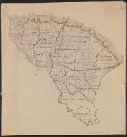
- Beinecke Rare Book and Manuscript Library > [Proof copy of a map of Charleston, South Carolina].
- Published / Created:
- 1850
- Call Number:
- 754gme 1850
- Container / Volume:
- BRBL_00419
- Image Count:
- 1
- Resource Type:
- Maps, Atlases & Globes
- Found in:
- Beinecke Rare Book and Manuscript Library > [Railroads of the Lake States, from Great Lakes to Ohio River]
- Published / Created:
- 186-]
- Call Number:
- 754gme 1860B
- Container / Volume:
- BRBL_00420
- Image Count:
- 1
- Resource Type:
- Maps, Atlases & Globes
- Found in:
- Beinecke Rare Book and Manuscript Library > [Railroads of the Northern United States from Iowa to Boston, Massachusetts]
- Published / Created:
- 1908
- Call Number:
- 319gm 1908
- Container / Volume:
- BRBL_00042
- Image Count:
- 1
- Resource Type:
- Maps, Atlases & Globes
- Found in:
- Beinecke Rare Book and Manuscript Library > [Railway, steamship and highway routes in the British Isles].
- Creator:
- Western Australia. Department of Lands and Surveys
- Published / Created:
- 1921
- Call Number:
- 2651 R197 1921
- Container / Volume:
- BRBL_00023
- Image Count:
- 1
- Resource Type:
- Maps, Atlases & Globes
- Found in:
- Beinecke Rare Book and Manuscript Library > [Ravensthorpe].
- Published / Created:
- 191-.
- Call Number:
- 11hcf 1919D-36
- Container / Volume:
- BRBL_00010X
- Image Count:
- 1
- Resource Type:
- Maps, Atlases & Globes
- Found in:
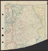
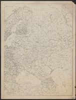
- Beinecke Rare Book and Manuscript Library > [Russia.]
- Published / Created:
- 1880?]
- Call Number:
- 824 1880
- Container / Volume:
- BRBL_00570
- Image Count:
- 1
- Resource Type:
- Maps, Atlases & Globes
- Found in:
- Beinecke Rare Book and Manuscript Library > [Sectional land map of the B. & M.R.R. lands for sale in eastern Nebraska].
- Published / Created:
- 1940?]
- Call Number:
- 836gcg Sa585 1940
- Container / Volume:
- BRBL_00593
- Image Count:
- 1
- Resource Type:
- Maps, Atlases & Globes
- Found in:
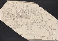
- Beinecke Rare Book and Manuscript Library > [Shows proposed range management plan for a 194,000 acre area (unit 11B) of San Rafael Grazing District].
- Published / Created:
- 185-?]
- Call Number:
- 846hc 1850
- Container / Volume:
- BRBL_00624
- Image Count:
- 1
- Resource Type:
- Maps, Atlases & Globes
- Found in:
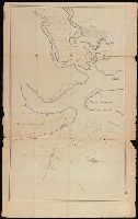
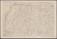
- Beinecke Rare Book and Manuscript Library > [Six route operations of a United States military company in Oregon Territory].
- Published / Created:
- [1930?]
- Call Number:
- 766 M86 1930
- Container / Volume:
- BRBL_00711
- Image Count:
- 1
- Resource Type:
- Maps, Atlases & Globes
- Found in:
- Beinecke Rare Book and Manuscript Library > [Sleeping Giant State Park, Conn.].
- Published / Created:
- [1912?].
- Call Number:
- 754 1912
- Container / Volume:
- BRBL_00417
- Image Count:
- 1
- Resource Type:
- Maps, Atlases & Globes
- Found in:
- Beinecke Rare Book and Manuscript Library > [South Atlantic States].
- Published / Created:
- 1921
- Call Number:
- 261 1921
- Container / Volume:
- BRBL_00022
- Image Count:
- 2
- Resource Type:
- Maps, Atlases & Globes
- Found in:
- Beinecke Rare Book and Manuscript Library > [Southern part of Queensland].
- Published / Created:
- 1919?]
- Call Number:
- 11hcf 1919C-4-3
- Container / Volume:
- BRBL_00010V
- Image Count:
- 1
- Resource Type:
- Maps, Atlases & Globes
- Found in:
- Beinecke Rare Book and Manuscript Library > [Southwestern portion of Map of Europe].
- Published / Created:
- 191-.
- Call Number:
- 11hcf 1919E-31
- Container / Volume:
- BRBL_00010ZA
- Image Count:
- 1
- Resource Type:
- Maps, Atlases & Globes
- Found in:
- Beinecke Rare Book and Manuscript Library > [Spalato and envrions.]
- Published / Created:
- [1890?]
- Call Number:
- 32 R119 1890
- Container / Volume:
- BRBL_00054
- Image Count:
- 1
- Resource Type:
- Maps, Atlases & Globes
- Found in:
- Beinecke Rare Book and Manuscript Library > [St. Peter's College] Radley Bounds [Berkshire].
- Published / Created:
- c1949.
- Call Number:
- 846 P837 1949A
- Container / Volume:
- BRBL_00622
- Image Count:
- 4
- Resource Type:
- Maps, Atlases & Globes
- Found in:
- Beinecke Rare Book and Manuscript Library > [Street map of Portland, Or.].
- Published / Created:
- [187-?]
- Call Number:
- 582 B22 187X
- Container / Volume:
- BRBL_00707
- Image Count:
- 1
- Resource Type:
- Maps, Atlases & Globes
- Found in:
- Beinecke Rare Book and Manuscript Library > [Thailand, from Bangkok west to Phet Buri].
- Published / Created:
- [1650?]
- Call Number:
- 18 1650
- Container / Volume:
- BRBL_00012
- Image Count:
- 1
- Resource Type:
- Maps, Atlases & Globes
- Found in:
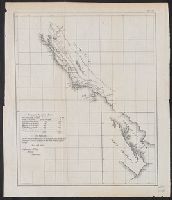
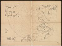
- Beinecke Rare Book and Manuscript Library > [The Arctic Regions].
- Creator:
- Des Barres, Joseph F. W. (Joseph Frederick Wallet), 1722-1824
- Published / Created:
- 1775?-1781?]
- Call Number:
- 1983 Folio 25
- Image Count:
- 3
- Resource Type:
- Maps, Atlases & Globes
- Found in:
- Beinecke Rare Book and Manuscript Library > [The Atlantic Neptune : published for the use of the Royal Navy Great Britain / by Joseph F.W. Des Barres, esq.].
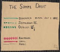
- Published / Created:
- 1916
- Call Number:
- 11hc 1916
- Container / Volume:
- BRBL_00010C
- Image Count:
- 1
- Resource Type:
- Maps, Atlases & Globes
- Found in:
- Beinecke Rare Book and Manuscript Library > [The Somme Drive.]