Search
You Searched For
Search Results
- Creator:
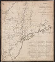
- Popple, Henry, -1743
- Published / Created:
- [ca. 1741]
- Call Number:
- 89 1733
- Container / Volume:
- BRBL_00697
- Image Count:
- 1
- Resource Type:
- Maps, Atlases & Globes
- Found in:
- Beinecke Rare Book and Manuscript Library > A map of the British Empire in America, with the French, Spanish and Hollandish settlements adjacent thereto / by Henry Popple.
- Creator:
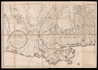
- Popple, Henry, -1743
- Published / Created:
- [ca. 1741]
- Call Number:
- 85 1760A
- Container / Volume:
- BRBL_00693
- Image Count:
- 1
- Resource Type:
- Maps, Atlases & Globes
- Found in:
- Beinecke Rare Book and Manuscript Library > A map of the British Empire in America, with the French, Spanish and Hollandish settlements adjacent thereto / by Henry Popple.
- Creator:
- Popple, Henry, -1743
- Published / Created:
- [ca. 1741]
- Call Number:
- 71 1741
- Container / Volume:
- BRBL_00687
- Image Count:
- 1
- Resource Type:
- Maps, Atlases & Globes
- Found in:
- Beinecke Rare Book and Manuscript Library > A map of the British Empire in America, with the French, Spanish and Hollandish settlements adjacent thereto / by Henry Popple.
- Creator:
- Popple, Henry, -1743
- Published / Created:
- [ca. 1741]
- Call Number:
- 85 1734
- Container / Volume:
- BRBL_00636
- Image Count:
- 1
- Resource Type:
- Maps, Atlases & Globes
- Found in:
- Beinecke Rare Book and Manuscript Library > A map of the British Empire in America, with the French, Spanish and Hollandish settlements adjacent thereto / by Henry Popple.
- Creator:
- Popple, Henry, -1743
- Published / Created:
- [ca. 1741]
- Call Number:
- 755 1734B
- Container / Volume:
- BRBL_00426
- Image Count:
- 1
- Resource Type:
- Maps, Atlases & Globes
- Found in:
- Beinecke Rare Book and Manuscript Library > A map of the British Empire in America, with the French, Spanish and Hollandish settlements adjacent thereto / by Henry Popple.
- Creator:
- Popple, Henry, -1743
- Published / Created:
- [ca. 1741]
- Call Number:
- 755 1734A
- Container / Volume:
- BRBL_00426
- Image Count:
- 1
- Resource Type:
- Maps, Atlases & Globes
- Found in:
- Beinecke Rare Book and Manuscript Library > A map of the British Empire in America, with the French, Spanish and Hollandish settlements adjacent thereto / by Henry Popple.
- Creator:
- Kip, Johannes, 1653-1722
- Published / Created:
- 1903
- Call Number:
- 32 L84 1720/1903
- Container / Volume:
- BRBL_00736
- Image Count:
- 12
- Resource Type:
- Maps, Atlases & Globes
- Found in:
- Beinecke Rare Book and Manuscript Library > A prospect of the city of London, Westminster and St. James Park = veue et perspective de la ville de Londre, Westminster et Parc St. Jacques / John Kip delineavit et sculpsit.
- Creator:
- Great Britain. War Office. General Staff. Geographical Section
- Published / Created:
- 1942
- Call Number:
- 66gmb 1942
- Container / Volume:
- BRBL_00348
- Image Count:
- 1
- Resource Type:
- Maps, Atlases & Globes
- Found in:
- Beinecke Rare Book and Manuscript Library > Africa road map 1:2,000,000 and 1:500,000, Maroc-Algerie-Tunisie.
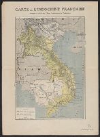
- Creator:
- Eveil Economique de l'Indochine
- Published / Created:
- 192-?]
- Call Number:
- 5816 192X
- Container / Volume:
- BRBL_00313
- Image Count:
- 2
- Resource Type:
- Maps, Atlases & Globes
- Found in:
- Beinecke Rare Book and Manuscript Library > Carte de l'Indochine Française / dressée et éditée par l'Eveil Economique de l'Indochine.
- Creator:
- La Rochefoucauld-Liancourt, François-Alexandre-Frédéric, duc de, 1747-1827
- Published / Created:
- 1799]
- Call Number:
- 755 1799C
- Container / Volume:
- BRBL_00436
- Image Count:
- 1
- Resource Type:
- Maps, Atlases & Globes
- Found in:
- Beinecke Rare Book and Manuscript Library > Carte des Etats-unis : provinces septentrionales.
- Creator:
- La Rochefoucauld-Liancourt, François-Alexandre-Frédéric, duc de, 1747-1827
- Published / Created:
- 1799]
- Call Number:
- 755 1799D
- Container / Volume:
- BRBL_00436
- Image Count:
- 1
- Resource Type:
- Maps, Atlases & Globes
- Found in:
- Beinecke Rare Book and Manuscript Library > Carte des etats-unis : provinces méridionales.
- Creator:
- Capitaine du Chesnoy, Michel, 1746-1804
- Published / Created:
- [1779]
- Call Number:
- 755 1775C
- Container / Volume:
- BRBL_00429
- Image Count:
- 1
- Resource Type:
- Maps, Atlases & Globes
- Found in:
- Beinecke Rare Book and Manuscript Library > Carte du théatre de la guerre dans l'Amerique Septentrionale pendant les années 1775, 76, 77, et 78 [cartographic material] : où se trouvent les principaux camps avec les différentes places et epoques des batailles qui se sont données pendent ces cam
- Creator:
- Capitaine, Louis, ca. 1749-ca. 1797
- Published / Created:
- 1799]
- Call Number:
- 755 1799B
- Container / Volume:
- BRBL_00436
- Image Count:
- 1
- Resource Type:
- Maps, Atlases & Globes
- Found in:
- Beinecke Rare Book and Manuscript Library > Carte génerale des Etats-Unis de l'Amérique Septentrionale : divisée en ses 17 provinces / par L. Capitaine Ier. ingenieur et Associé de la Carte géné'le. de la France en 180 fles.
- Creator:
- Lafon, Barthélémy, 1769-1820
- Published / Created:
- [1806]
- Call Number:
- 795 Or5 1806
- Container / Volume:
- BRBL_00522
- Image Count:
- 1
- Resource Type:
- Maps, Atlases & Globes
- Found in:
- Beinecke Rare Book and Manuscript Library > Carte générale du territoire d'Orléans comprenant aussi la Floride Occidentale et une portion du territoire du Mississipi : dresée d'après les observations les plus récentes / par Bmi. Lafon ... 1806.
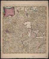
- Creator:
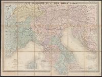
- Andriveau-Goujon, E. (Eugène), 1832-1897
- Published / Created:
- 1859
- Call Number:
- 40 1859F
- Container / Volume:
- BRBL_00201
- Image Count:
- 1
- Resource Type:
- Maps, Atlases & Globes
- Found in:
- Beinecke Rare Book and Manuscript Library > Carte strategique de L'Italie septentrionale [cartographic material] / Imp. Lemercier, Paris.
- Published / Created:
- [1917?]
- Call Number:
- 335 Y93 1917
- Container / Volume:
- BRBL_00087
- Image Count:
- 1
- Resource Type:
- Maps, Atlases & Globes
- Found in:
- Beinecke Rare Book and Manuscript Library > Champ de bataille de l'Yser = The Yser battlefield.
- Creator:
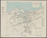
- United States. Army Map Service
- Published / Created:
- 1943
- Call Number:
- 38 C71 1943
- Container / Volume:
- BRBL_00157
- Image Count:
- 1
- Resource Type:
- Maps, Atlases & Globes
- Found in:
- Beinecke Rare Book and Manuscript Library > Colmar [cartographic material] : city plan / prepared under the direction of the Chief of Engineers, U.S. Army, 1943.
- Creator:
- Great Britain. Inter-service Topographical Dept
- Published / Created:
- 1943, 1944 printing.
- Call Number:
- 38 D742 1944
- Container / Volume:
- BRBL_00157
- Image Count:
- 1
- Resource Type:
- Maps, Atlases & Globes
- Found in:
- Beinecke Rare Book and Manuscript Library > Douarnenez-Tréboul [cartographic material] : plan of port and town / compiled and drawn by Inter-Service Topographical Dept. ; produced under the Superintendence of Vice-Admiral John Edgell, hydrographer.
- Creator:
- Great Britain. Inter-service Topographical Dept
- Published / Created:
- 1943
- Call Number:
- 38 D92 1943
- Container / Volume:
- BRBL_00157
- Image Count:
- 1
- Resource Type:
- Maps, Atlases & Globes
- Found in:
- Beinecke Rare Book and Manuscript Library > Dunkerque [cartographic material] : plan of port & town / compiled and drawn by Inter-Service Topographical Dept. ; produced under the Superintendence of Vice-Admiral John Edgell, hydrographer.
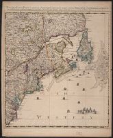
- Creator:
- Seale, Richard William
- Published / Created:
- [1783?]
- Call Number:
- 1977 Folio 177
- Image Count:
- 4
- Resource Type:
- Maps, Atlases & Globes
- Found in:
- Beinecke Rare Book and Manuscript Library > England and Ireland : containing all the cities, boroughs, markettowns & principal villages : with the coast of France from Calais to Brest delineated and engraved from actual surveys / by Richard William Seale.
- Creator:
- Great Britain. Inter-service Topographical Dept
- Published / Created:
- 1943, 1944 printing.
- Call Number:
- 38 F31 1944
- Container / Volume:
- BRBL_00157
- Image Count:
- 1
- Resource Type:
- Maps, Atlases & Globes
- Found in:
- Beinecke Rare Book and Manuscript Library > Fécamp, plan of port and town [cartographic material] / compiled and drawn by Inter-Service Topographical Dept. ; produced under the Superintendence of Vice-Admiral John Edgell, hydrographer.
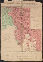
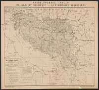
- Creator:
- Županić, Niko
- Published / Created:
- 1915
- Call Number:
- 11hcf 1919E-27
- Container / Volume:
- BRBL_00010ZA
- Image Count:
- 1
- Resource Type:
- Maps, Atlases & Globes
- Found in:
- Beinecke Rare Book and Manuscript Library > Jugoslovenska zemlja = The Jugoslav territory = Le territoire Iougoslave : Map of Jugoslav territory / by Dr. Niko Županić ; Issued for the Jugoslav community in London.
- Creator:
- Dufrénoy (Firm)
Wuhrer, L
- Published / Created:
- [1920?]
- Call Number:
- 11hcf 1919E-33
- Container / Volume:
- BRBL_00010ZA
- Image Count:
- 1
- Resource Type:
- Maps, Atlases & Globes
- Found in:
- Beinecke Rare Book and Manuscript Library > Les revendications italiennes envers l'Autriche qui a combattu pour le Pangermanisme contre l'Entente et les revendications italiennes envers les Yougoslaves qui, étant le rempart contre le Pangermanisme, sont les alliés naturels de l'Entente = the Ital
- Creator:
- Dufrénoy (Firm)
Wuhrer, L
- Published / Created:
- [1920?]
- Call Number:
- 11hcf 1919D-15
- Container / Volume:
- BRBL_00010W
- Image Count:
- 1
- Resource Type:
- Maps, Atlases & Globes
- Found in:
- Beinecke Rare Book and Manuscript Library > Les revendications italiennes envers l'Autriche qui a combattu pour le Pangermanisme contre l'Entente et les revendications italiennes envers les Yougoslaves qui, étant le rempart contre le Pangermanisme, sont les alliés naturels de l'Entente = the Ital
- Creator:
- Teleki, Pál, gróf, 1879-1941
- Published / Created:
- 1919
- Call Number:
- 11hcf 1919-51
- Container / Volume:
- BRBL_00010L
- Image Count:
- 1
- Resource Type:
- Maps, Atlases & Globes
- Found in:
- Beinecke Rare Book and Manuscript Library > Magyarország néprajzi térképe a népsürüség alapján = / szerkesztette Grof Teleki Pál = Ethnographical map of Hungary based on the density of population / by Count Paul Teleki = Carte ethnographique de la Hongrie construite en la accordance avec
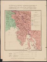
- Creator:
- Županić, Niko
- Published / Created:
- 1915
- Call Number:
- 46ed 1915
- Container / Volume:
- BRBL_00260
- Image Count:
- 1
- Resource Type:
- Maps, Atlases & Globes
- Found in:
- Beinecke Rare Book and Manuscript Library > Map of Jugoslav territory [cartographic material] / by Niko Županić.
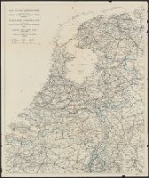
- Published / Created:
- [1946?]
- Call Number:
- 331 1946
- Container / Volume:
- BRBL_00079
- Image Count:
- 1
- Resource Type:
- Maps, Atlases & Globes
- Found in:
- Beinecke Rare Book and Manuscript Library > Map of the Netherlands = Karte der Niederlande = Carte de Pays-Bas.
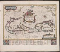
- Creator:
- Blaeu, Willem Janszoon, 1571-1638
- Published / Created:
- 1645-1650]
- Call Number:
- 217 1630
- Container / Volume:
- BRBL_00732
- Image Count:
- 2
- Resource Type:
- Maps, Atlases & Globes
- Found in:
- Beinecke Rare Book and Manuscript Library > Mappa Aestivarum insularum, alias Barmudas dictarum : ad ostia Mexicani aestuarij jacentium in latitudine graduum 32 minutorum 25 ad Anglia, Londino scilicet versus Libonotum 3300 miliaribus Anglicanis, et a Roanoack (qui locus est in Virginia) versus Eur
- Creator:
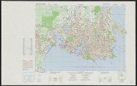
- Canada. Mapping and Charting Establishment
- Published / Created:
- c1979.
- Call Number:
- 739 V66 1976
- Container / Volume:
- BRBL_00391
- Image Count:
- 2
- Resource Type:
- Maps, Atlases & Globes
- Found in:
- Beinecke Rare Book and Manuscript Library > Military city map 1:25 000. Victoria [map] / produced by the Mapping and Charting Establishment, Department of National Defence, Canada = Carte militaire de la ville 1:25 000. Victoria / publiée par le Service de la cartographie, Ministére de la défens