Search
You Searched For
Search Results
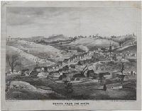
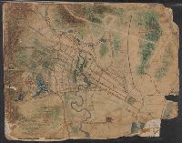
- Creator:
- Goddard, George H. (George Henry), 1817-1906, artist
- Published / Created:
- May 1853.
- Call Number:
- WA Prints 391
- Image Count:
- 1
- Resource Type:
- cartographic image
- Found in:
- Beinecke Rare Book and Manuscript Library > Sonora from the north
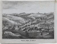
- Creator:
- Goddard, George H. (George Henry), 1817-1906, artist
- Published / Created:
- May 1853.
- Call Number:
- WA Prints 391
- Image Count:
- 1
- Resource Type:
- cartographic image
- Found in:
- Beinecke Rare Book and Manuscript Library > Sonora from the north
- Creator:
- Scott, F. H., Major, cartographer
- Published / Created:
- 1855.
- Call Number:
- Covers 59 1855
- Image Count:
- 4
- Resource Type:
- cartographic image
- Found in:
- Beinecke Rare Book and Manuscript Library > Map of the peninsula of India, comprising the whole of the Madras Presidency, and portions of the adjacent territories of Bengal and Bombay [cartographic material]
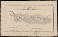
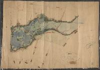
- Creator:
- Goddard, George H. (George Henry), 1817-1906, cartographer
- Published / Created:
- [1855?]
- Call Number:
- BrSides Zc72 855gn
- Image Count:
- 2
- Resource Type:
- cartographic image
- Found in:
- Beinecke Rare Book and Manuscript Library > Map of a survey of the Mokelumne Hill Canal and a reconnoissance of the adjoining country / [cartographic material]
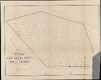
- Creator:
- Lehman, Christian, creator
- Published / Created:
- [1857]
- Call Number:
- 2018 Folio 173
- Image Count:
- 93
- Resource Type:
- cartographic image
- Found in:
- Beinecke Rare Book and Manuscript Library > An explanation of the original location and general plan or draught of the lands and lots of Germantown and Creesam Townships, copied from Matthias Zimmerman's original dated June 26th A.D. 1746, and of the several districts and divisions thereof, part extracted from original and former draughts and part done and taken from actual mensuration drawn by Christian Lehman, July 28, 1776, recopied by his grandson Joseph Lehman, January 1, 1824, from which recopy this copy was taken, August 1857, for Peter E. Keyser
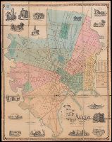
- Creator:
- Searle, S.W., cartographer
- Published / Created:
- 1859.
- Call Number:
- 766 N46 1859
- Image Count:
- 1
- Resource Type:
- cartographic image
- Found in:
- Beinecke Rare Book and Manuscript Library > Map of the city of New Haven, Connecticut
- Creator:
- Searl, S. W., cartographer
- Published / Created:
- [1863]
- Call Number:
- BrSides Folio 2014 10
- Image Count:
- 2
- Resource Type:
- cartographic image
- Found in:
- Beinecke Rare Book and Manuscript Library > Plan of the New Haven City burial ground
- Creator:
- Mitchell, Donald Grant, 1822-1908, cartographer
- Published / Created:
- Decr. 1863.
- Call Number:
- Roll Map 78
- Image Count:
- 2
- Resource Type:
- cartographic image
- Found in:
- Beinecke Rare Book and Manuscript Library > Map of a portion of Westville & New Haven
- Creator:
- Mitchell, Donald Grant, 1822-1908, cartographer
- Published / Created:
- [1870?]
- Call Number:
- Manuscript 766 N46 1870F
- Image Count:
- 1
- Resource Type:
- cartographic image
- Found in:
- Beinecke Rare Book and Manuscript Library > Map of Horse Railroad, Westville, & part of New Haven : enlarged four-fold from the county survey
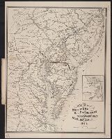
- Creator:
- J.L. Smith Co., cartographer, publisher
- Published / Created:
- 1874.
- Call Number:
- 754gme 1874
- Image Count:
- 1
- Resource Type:
- cartographic image
- Found in:
- Beinecke Rare Book and Manuscript Library > Map of the Baltimore, Chesapeake & Delaware Bay Railroad