Skip to search
Skip to main content
Skip to first result
Search
You Searched For
Repository
Beinecke Rare Book and Manuscript Library
Subject (Geographic)
Asiatic Russia--Maps
New Search
Search Results
Creator:
Published / Created:
1884
Call Number:
54 1884
Container / Volume:
BRBL_00290
Image Count:
10
Resource Type:
Maps, Atlases & Globes
Alternative Title:
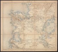
Карта Азіятской Россіи с прилегающими к ней владѣниями / составлена при Военно Топографическом отдѣлѣ Главнаго Штаба ; под редакц. генер. М. Большева.
Description:
Relief shown by hachures and spot heights.
Publisher:
Izd. Voen. Top. Otdi︠e︡la, and Изд. Воен. Топ. Отдѣла,
Subject (Geographic):
Asia--Asiatic Russia.--(OCoLC)fst01266496 and Asiatic Russia--Maps
Subject (Name):
Bolʹshev, M and Большев, М
Found in:
Beinecke Rare Book and Manuscript Library > Karta Azīi︠a︡tskoĭ Rossīi s prilegai︠u︡shchimi k neĭ vladi︠e︡nii︠a︡mi [cartographic material] / sostavlena pri Voenno Topograficheskom otdi︠e︡li︠e︡ Glavnago Shtaba ; pod redakt︠s︡. gener. M. Bolʹsheva.
Creator:
Published / Created:
1889-.
Call Number:
547 1892
Container / Volume:
BRBL_00291
Image Count:
5
Resource Type:
Maps, Atlases & Globes
Description:
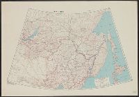
Sheets IX, X, XVIII, XIX, and XX only.
Publisher:
Izdanie Voenno-topograficheskago otdiela glavnago shtaba,
Subject (Geographic):
Asia--Maps and Asiatic Russia--Maps
Found in:
Beinecke Rare Book and Manuscript Library > Karta iuzhnoī pogranichnoī polosy Asiatskoī Rossīi. Pod redaktsieī General-Maīora Bol' sheva.
Creator:
Published / Created:
[1945?]
Call Number:
5463gm 1945
Container / Volume:
BRBL_00290
Image Count:
1
Resource Type:
Maps, Atlases & Globes
Alternative Title:
Its A.M.S. ; 5207 and Series (Standard map series designation system) ; S901.
Description:
"9-45.", "Lambert conformal conic projection.", Area covered extends from Lake Baikal to the Pacific Ocean and includes Manchuria., Elevations are shown by hachures and spot heights in meters., and Two classes of roads and five classes of railroads are shown.
Publisher:
Army Map Service,
Subject (Geographic):
Asiatic Russia--Maps, China--Maps, and Russia--Maps
Subject (Topic):
Transportation--China--Manchuria--Maps and Transportation--Russia--Maps
Found in:
Beinecke Rare Book and Manuscript Library > Russian maritime provinces [cartographic material] : special strategic map / prepared under the direction of the Chief of Engineers, U.S. Army.
Branch:v1.61.6 ,Deployed:2024-06-12T09:55:19-04:00